Pearl River, LA to Stennis Space Center, MS Tornado - April 10, 2024
|
Rating:
|
EF-1
|
|
Estimated Maximum Wind:
|
100 mph
|
|
Injuries/Fatalities:
|
None
|
|
Damage Path Length:
|
19.24 miles
|
|
Maximum Path Width:
|
550 yards
|
|
Approximate Start Point/Time:
|
1 miles S of Pearl River, LA at 1006 AM CDT
|
|
Approximate End Point/Time:
|
1 mile WNW of Kiln, MS at 1031 AM CDT
|
|
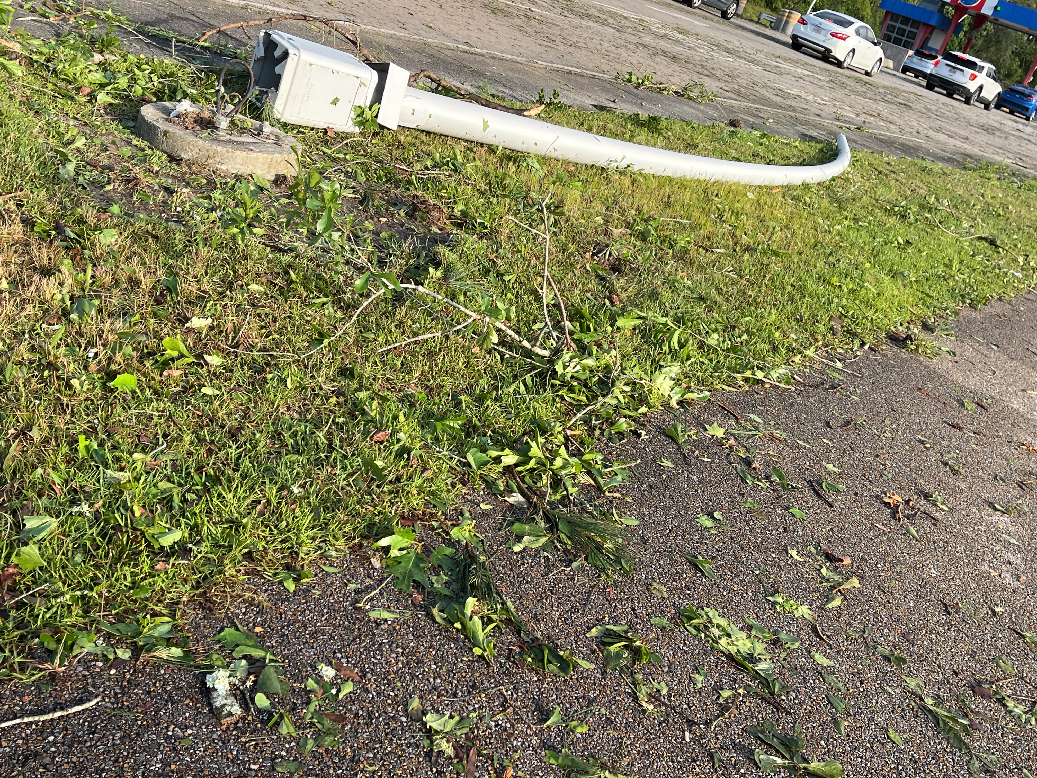
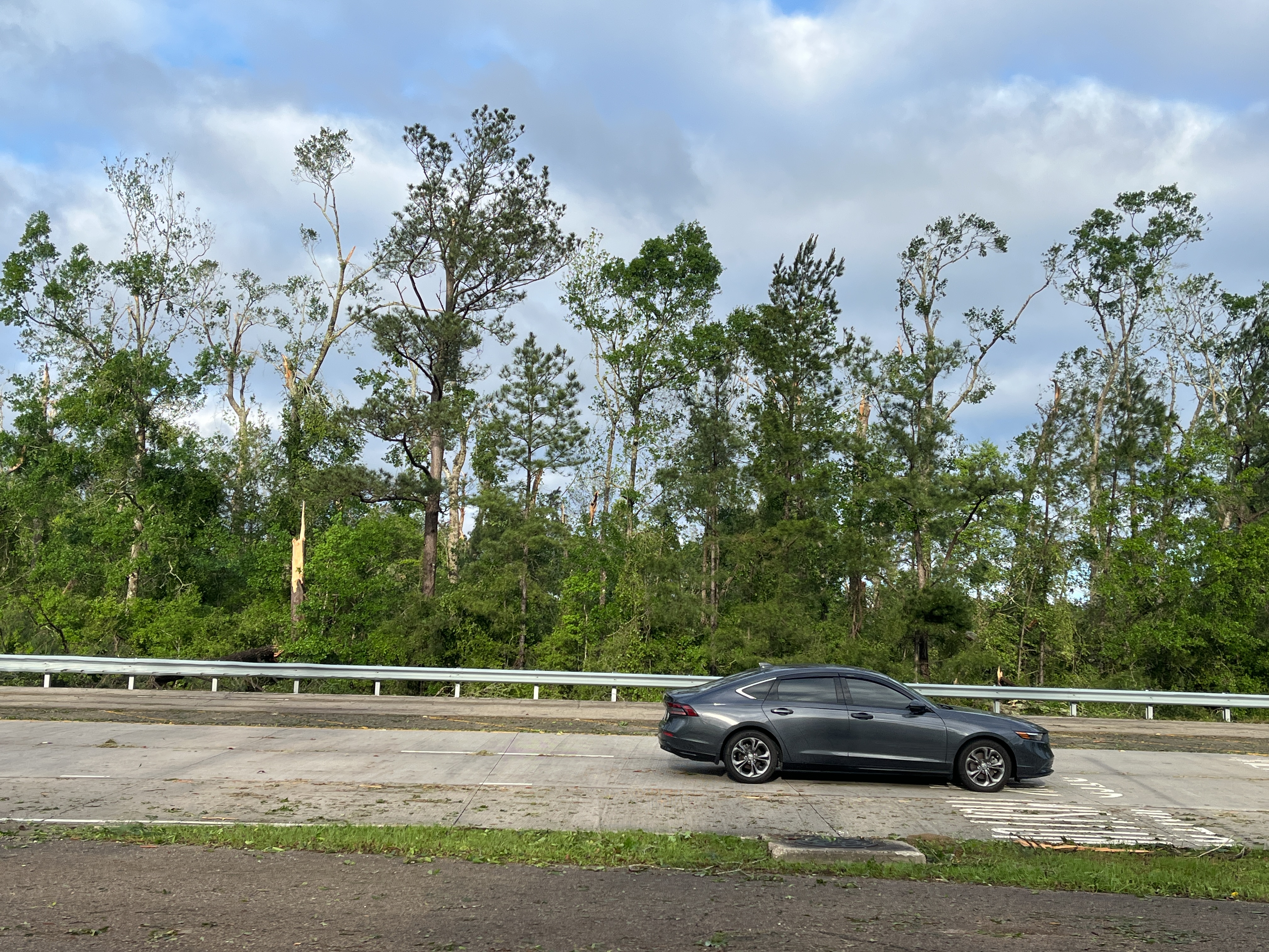
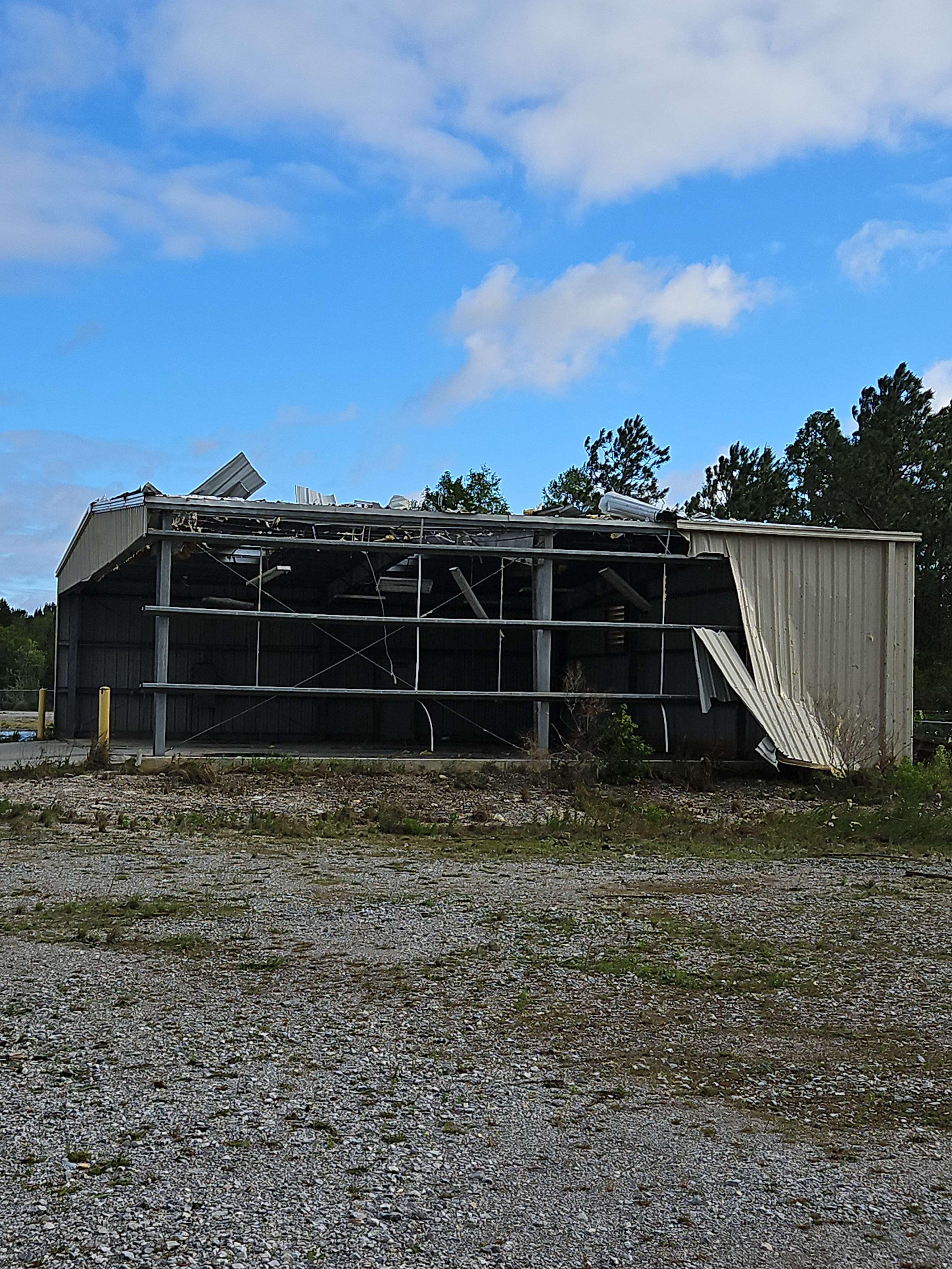
A National Weather Service Damage Assessment Team has surveyed the storm damage in Pearl River, LA and Stennis Space Center, MS. It has been determined the damage was the result of a tornado. The tornado has been rated an EF-1 on the Enhanced Fujita Scale. Damage estimates were consistent with winds of 100 mph. The beginning of a long-lived tornado developed near Pearl River, LA near the intersection of US Highway 11 and LA Highway 41 where numerous tree branches were snapped and tossed east. A combination of high resolution satellite and radar imagery analysis indicated that this tornado quickly grew in size and intensity after it crossed Interstate 59. Widespread tree damage could be seen on true color satellite imagery growing to a damage path as wide as 500 yards over the Pearl River Basin. Extensive wind damage could be seen extending outward half a mile south of the tornado path as the tornado approached the Louisiana- Mississippi border. The damage path briefly became more obscure and broad as the tornado to its south occluded into Stennis. Extensive tree damage occurred. While ground surveying was limited in and around Stennis Space Center, high resolution satellite imagery identified a swath of damage continued northeastward through Texas Flat Road. Numerous snapped softwood trees and a leaning transmission pole were observed. The damage path gradually became less obvious as the tornado occluded northeast and the end points are associated with tree damage observed west of Kiln along Kiln Picayune Road. |
|
|
|
|
||||||||||||||