Scattered severe thunderstorms capable of large hail in excess of two inches, strong tornadoes, and damaging wind gusts are likely across parts of the Upper Mississippi Valley and Midwest this evening. Heavy to excessive rainfall may bring a flooding threat to portions of the Central Plains to the Midwest through Thursday. The heatwave in the Central U.S. will begin to push South and East Thursday Read More >
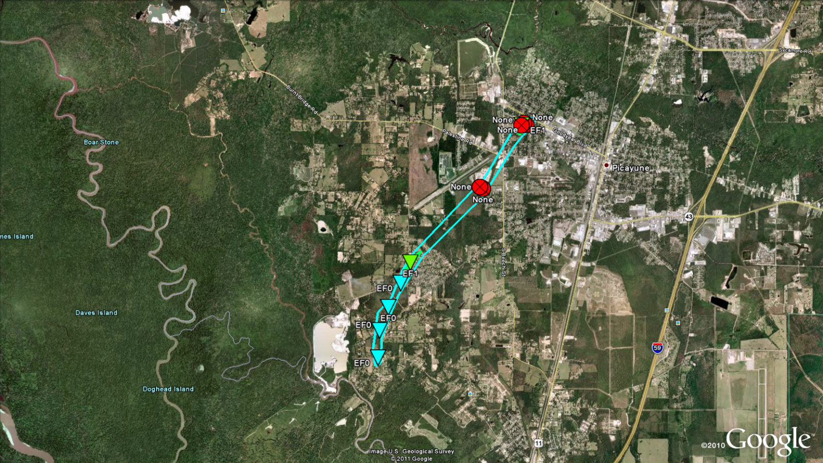
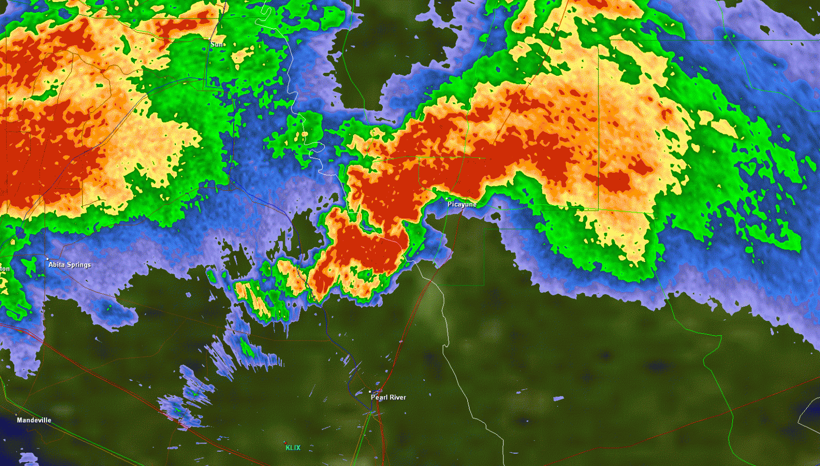
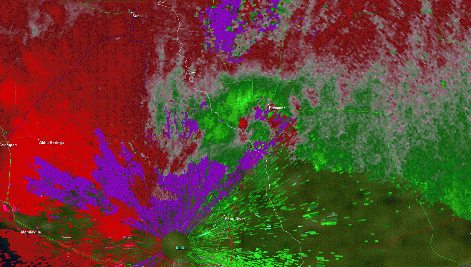
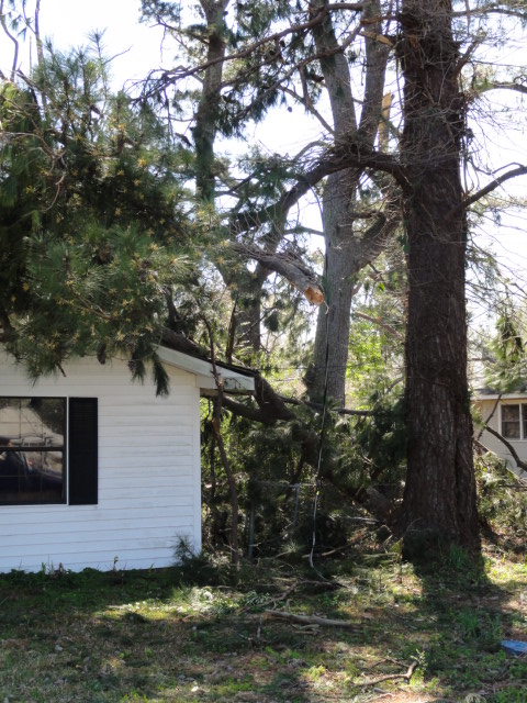
Picayune, MS Tornado - March 9, 2011
|
Rating:
|
EF-1
|
|
Estimated Maximum Wind:
|
90 mph
|
|
Injuries/Fatalities:
|
None
|
|
Damage Path Length:
|
3 miles
|
|
Maximum Path Width:
|
100 yards
|
|
Approximate Start Point/Time:
|
5 miles SW of Picayune, MS at 525 AM
|
|
Approximate End Point/Time:
|
1 miles NE of Picayune, MS at 530 AM
|
|
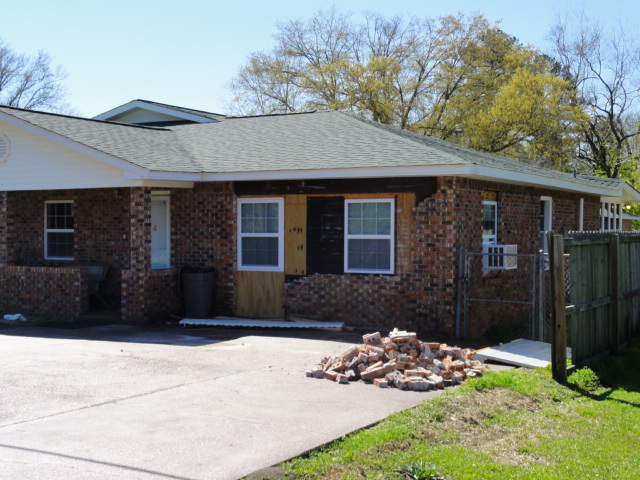
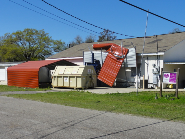
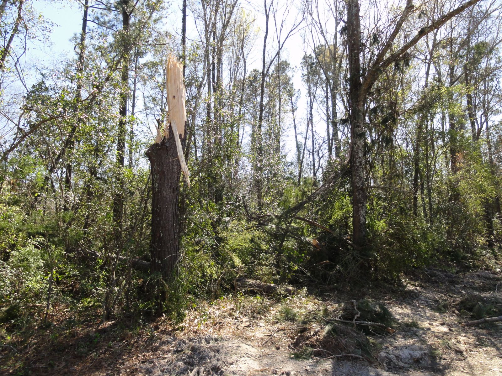
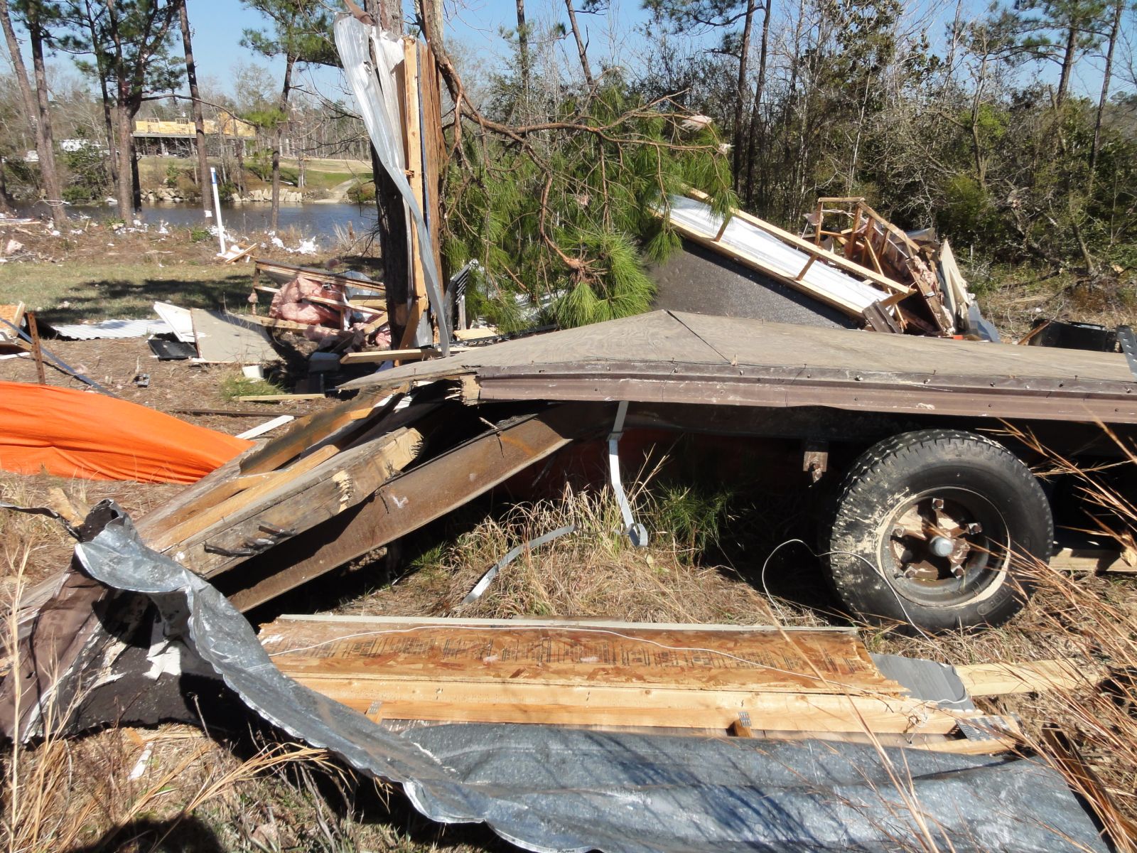
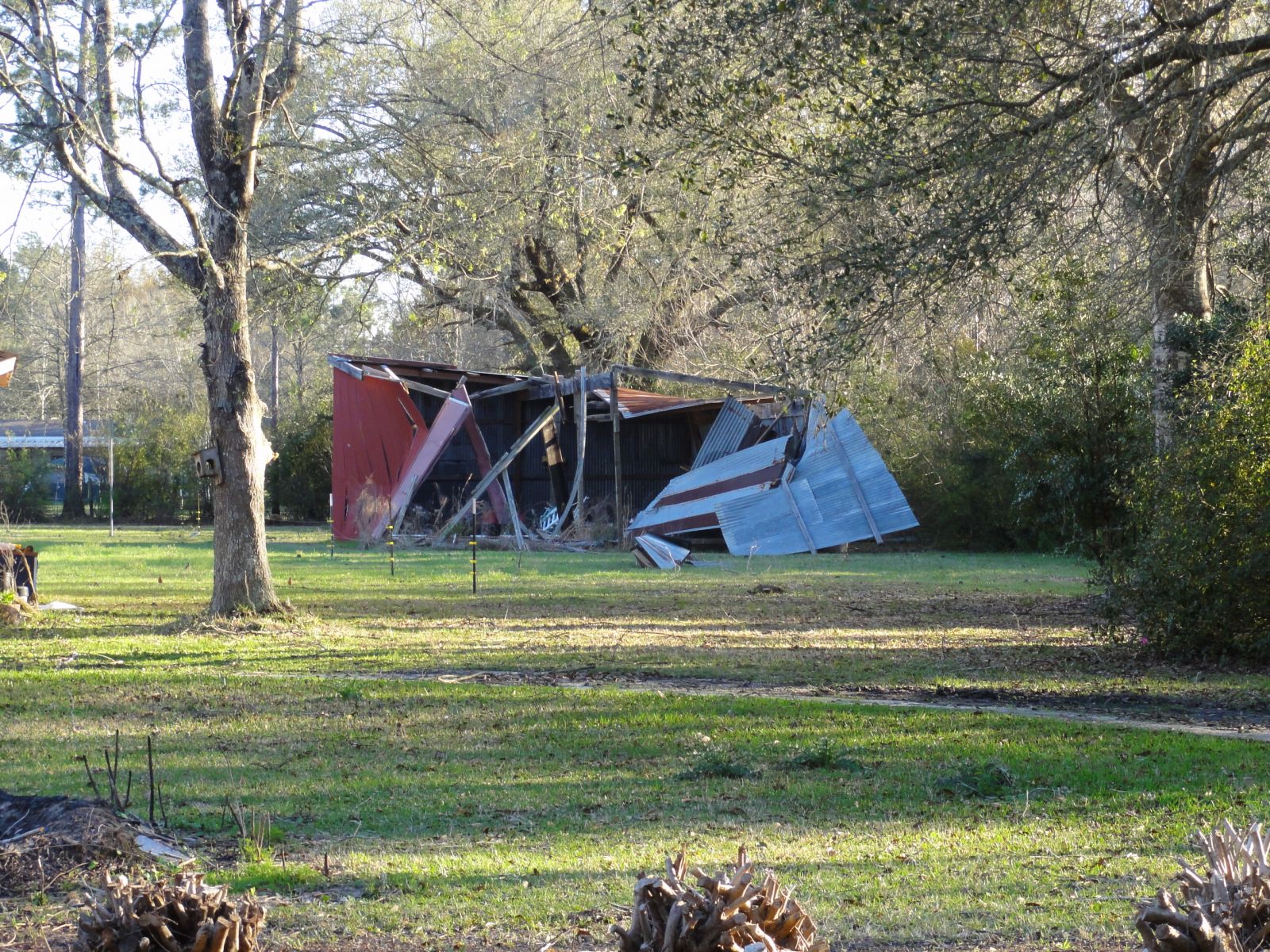
A National Weather Service Damage Assessment Team has surveyed the storm damage in Pearl River County near Picayune, MS. It has been determined the damage was the result of a tornado. The tornado has been rated an EF-1 on the Enhanced Fujita Scale. Damage estimates were consistent with winds of 90 mph. The tornado touched down 5 miles southwest of Picayune on Jackson Landing Road...and continued on an intermittent path to the northeast across South Beech Street and Goodyear Road. The tornado dissipated about 1 mile northeast of Picayune near Adcox Road and Highway 43. Damage was observed near 6th Avenue and Forest Street where a large tree snapped and fell onto a house. Additionally...the tornado may have been the same parent tornado that began near Lacombe. However it is currently recorded as a separate tornado due to the lack of damage survey data through the Bogue Chitto National Wildlife Refuge. The tornado damage path was 3 miles long and was 100 yards wide at its widest point. No injuries or deaths were reported. |
|
|
|
|
||||||||||||||