|
A National Weather Service Damage Assessment Team has surveyed the storm damage near Marrero, Gretna, Algiers, and Arabi, LA. It has been determined the damage was the result of a tornado. The tornado has been rated an EF-2 on the Enhanced Fujita Scale. Damage estimates were consistent with winds of 125 mph.
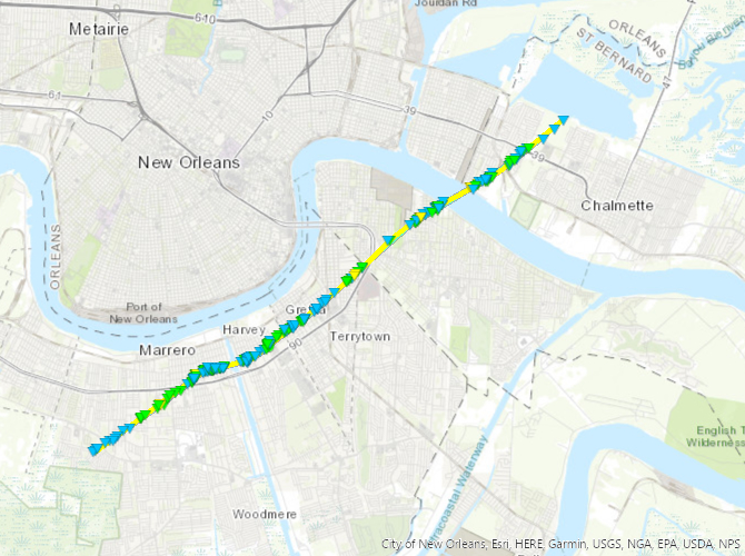
The tornado touched down just west of Luther Dr, causing roof damage to a home near the intersection with Mather Dr. It moved northeastward causing damage to trees and roofs, with significant damage to three homes near the intersection of Betty St and Deana St. Just after passing the intersection of Ames Blvd and August Ave, it pushed a large set of bleachers off its foundation at Archbishop Shaw HS. Widespread tree damage was also observed here. The tornado continued northeast into Marrero and Harvey where it caused widespread structural damage along its path. A couple homes on the west side of Harvey suffered complete loss of their roofs with multiple walls collapsed, and were also shifted from their foundations. Other homes along the path in this area suffered minor roof and wall damage. The tornado weakened as it moved east-northeast into Gretna, causing damage mostly to trees. It then strengthened again as it approached approached the Westbank Expressway in far eastern Gretna. In the vicinity of Cook St and Theard St, several homes were severely damaged, with portions of roof structure removed, and one home was completely shifted from its foundation. After crossing the Westbank Expressway and moving into Algiers, the tornado again caused significant structural damage along Tita St. One home was shifted from its foundation and began to roll over, being completely destroyed in the process. Three others suffered significant roof structure loss or partial wall collapse. A church was also shifted from its foundation and destroyed on Wiltz Ln. The tornado then crossed the river and moved into Arabi. It continued to cause damage to trees, power lines and structures as it moved northeastward. Minor fascia damage was noted to an apartment building where the tornado crossed Patricia street and moved into an inaccessible forested area. The track was extended into the the Florida Walk Canal based on high resolution satellite data indicating tree damage along the path through the forest. It may have continued into the marsh, but no damage was observable. The maximum rating of 125 mph EF-2 is based on the homes that lost all or most of their roof structure as well as suffering some wall collapse.
|
|

Surveyed damage track from Marrero to Arabi, LA

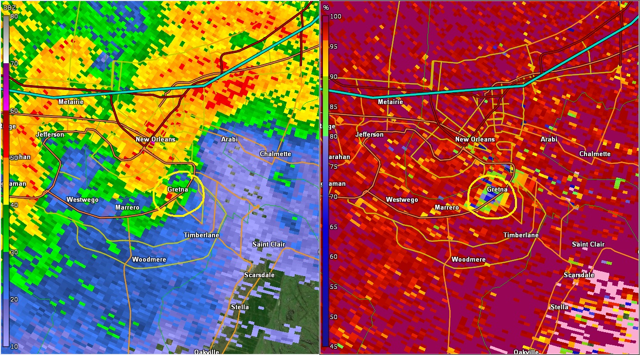
KLIX WSR-88D radar data near Gretna, LA at 357 PM CST 12/14/2022 (circled area is tornadic debris signature)

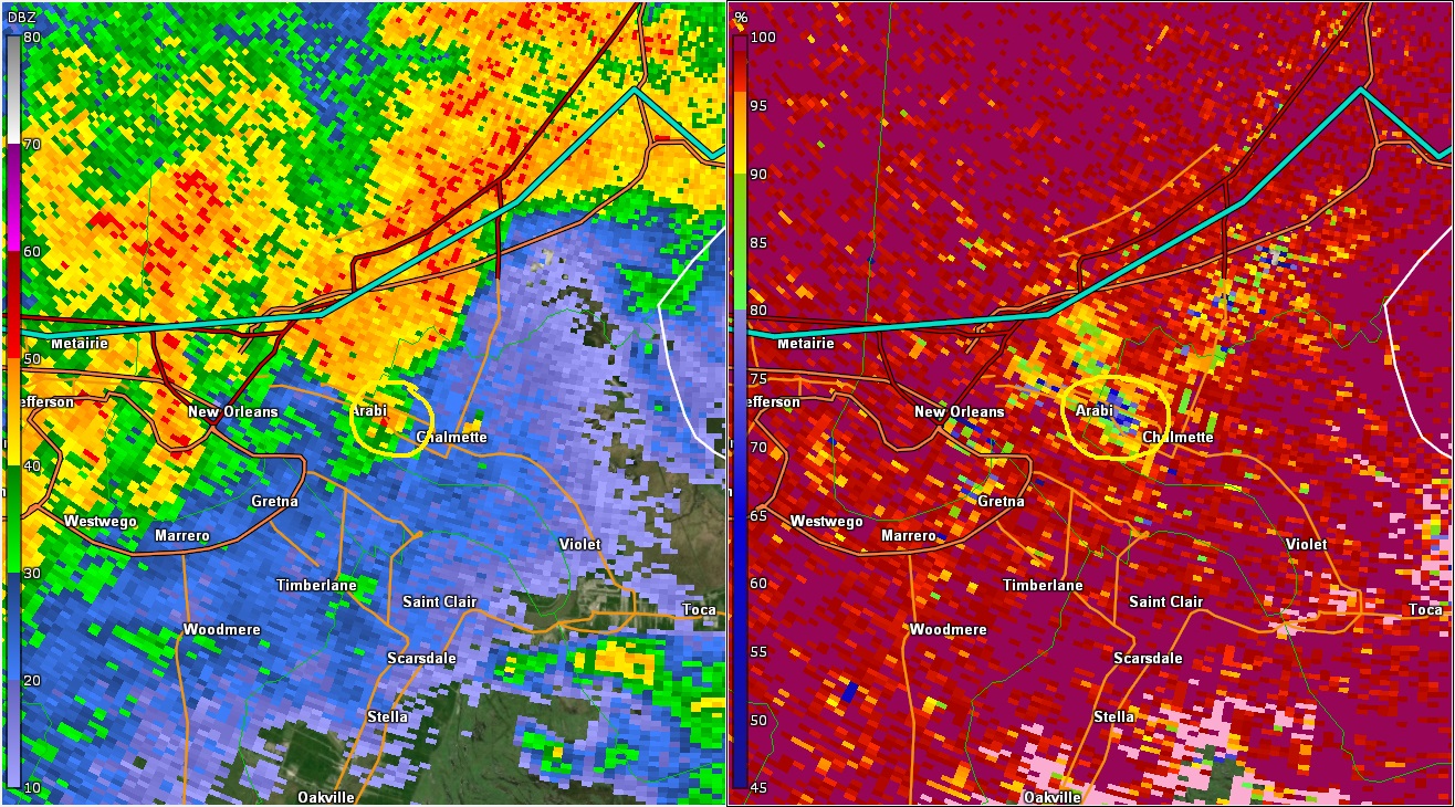
KLIX WSR-88D radar data near Arabi, LA at 406 PM CST 12/14/2022 (circled area is tornadic debris signature)
|