Life-threatening, potentially catastrophic flash flooding expected along the central Gulf Coast as the remnants of Arthur track across the area. Isolated brief tornadoes and damaging gusts remain possible overnight in the Southeast. Isolated to scattered dry thunderstorms may cause lightning-ignited fires and erratic behavior due to gusty winds across parts of the West Friday. Read More >
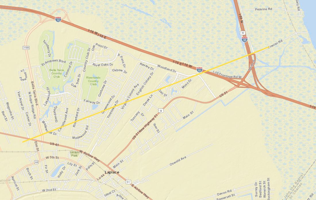
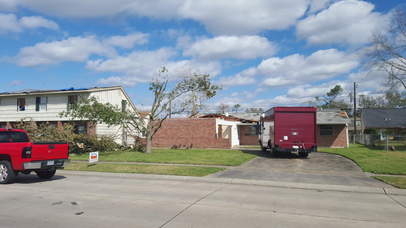
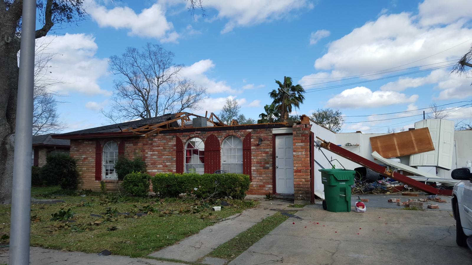
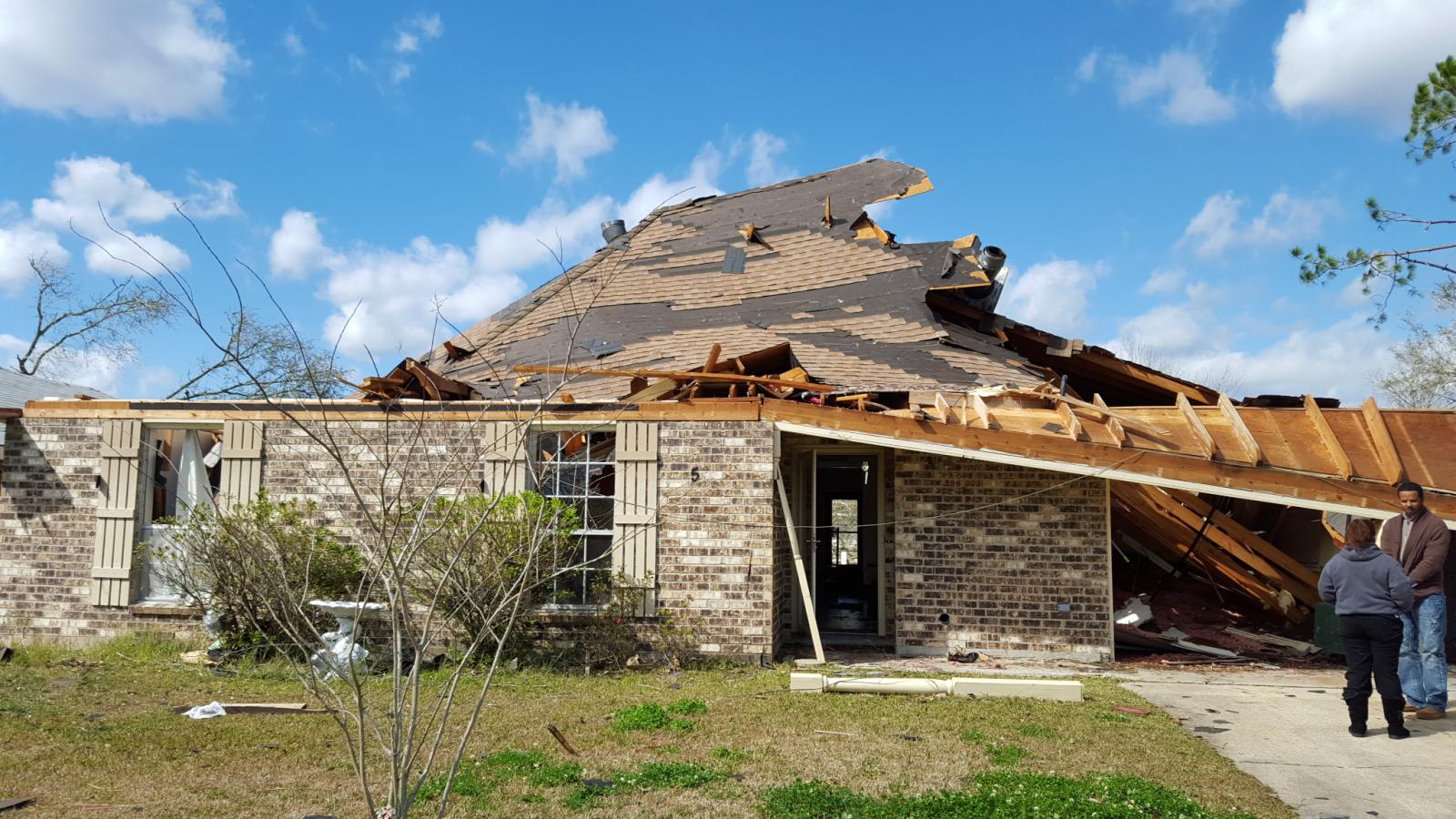
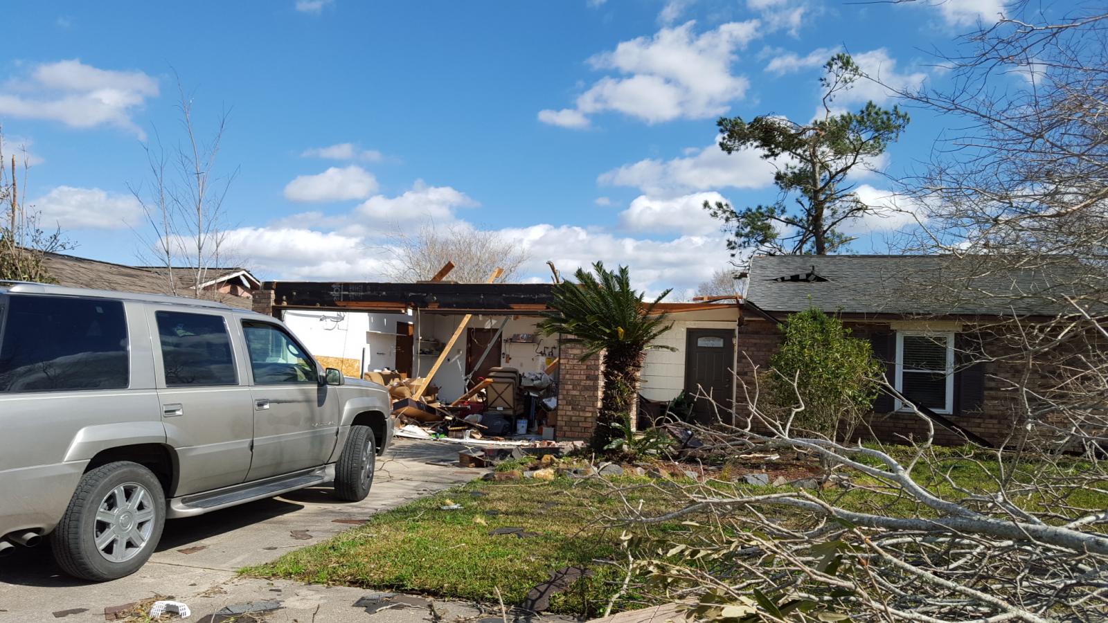
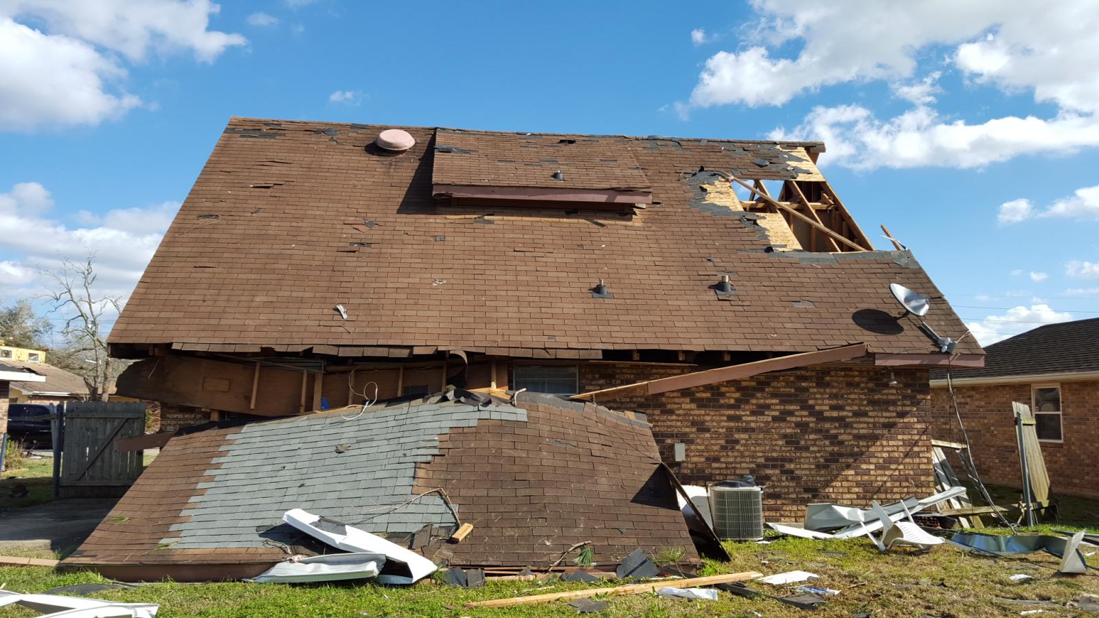
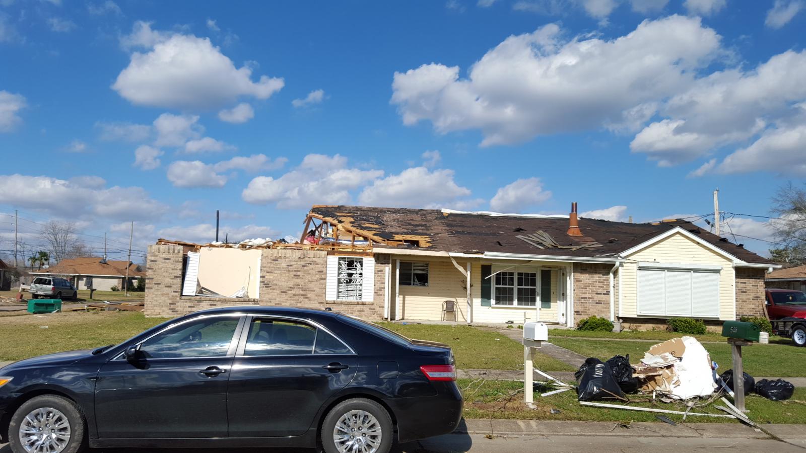
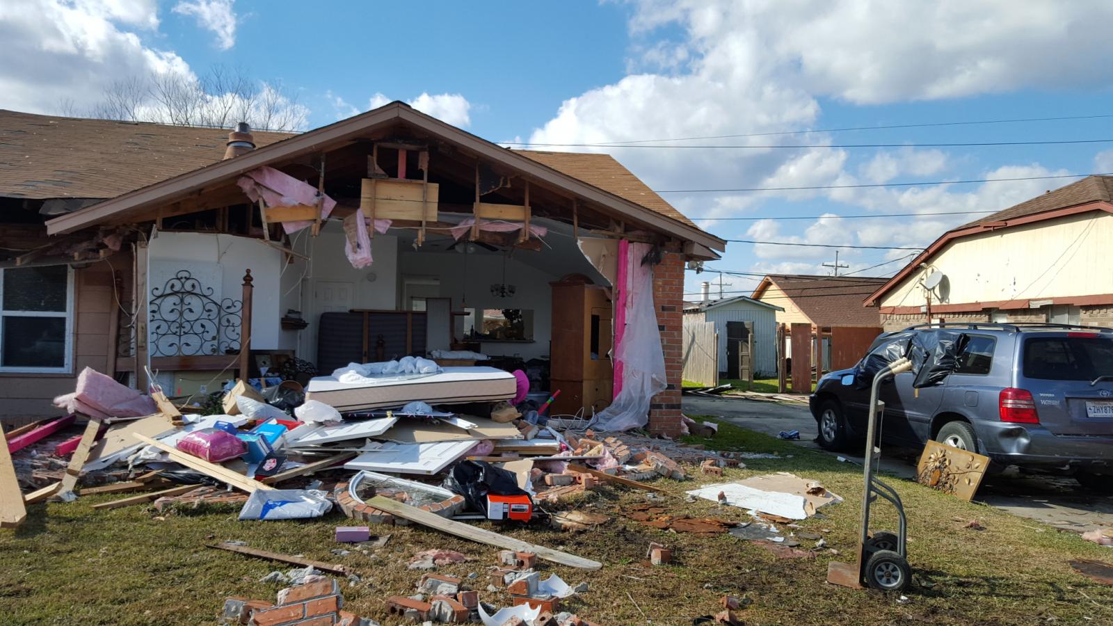
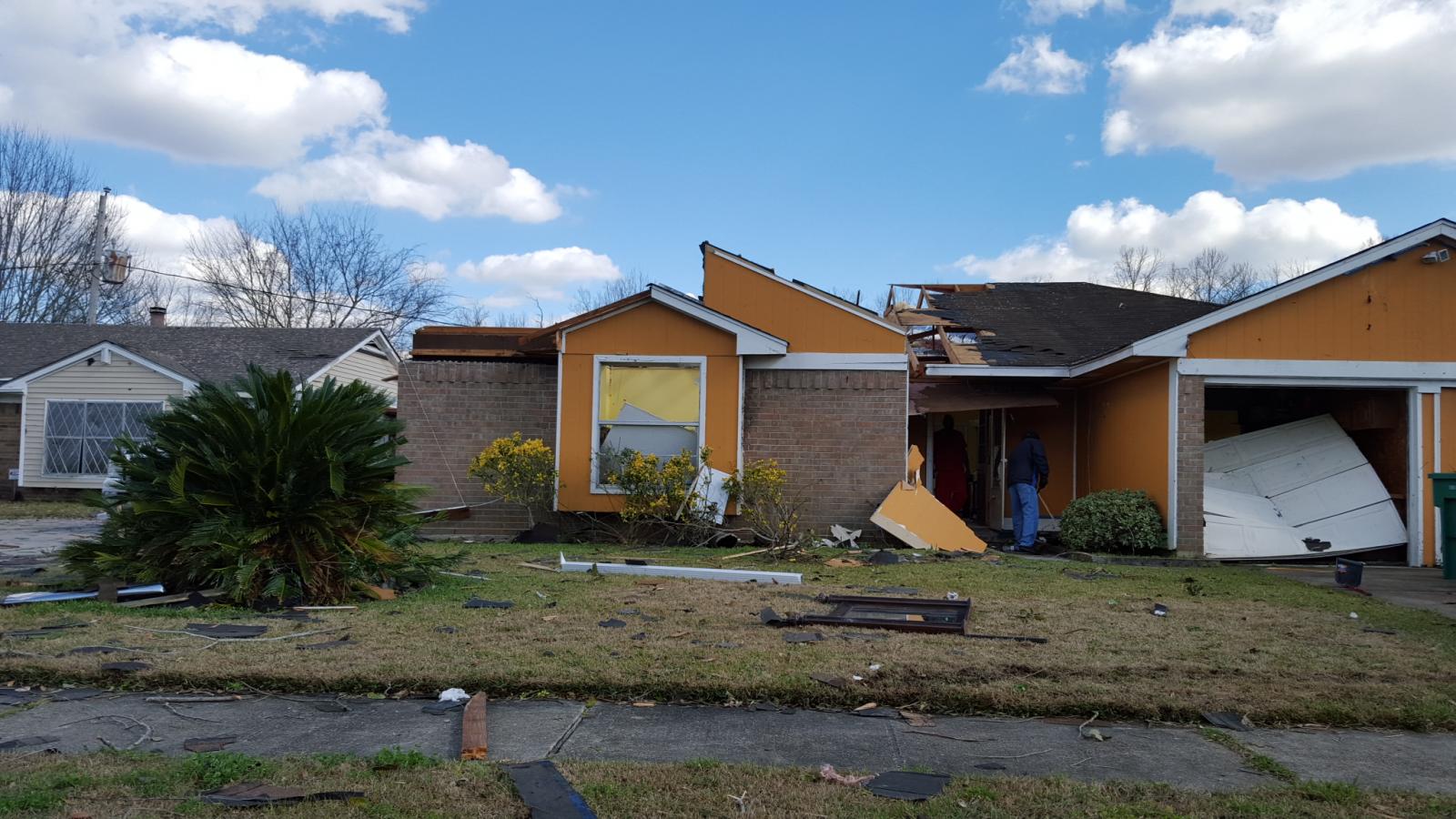
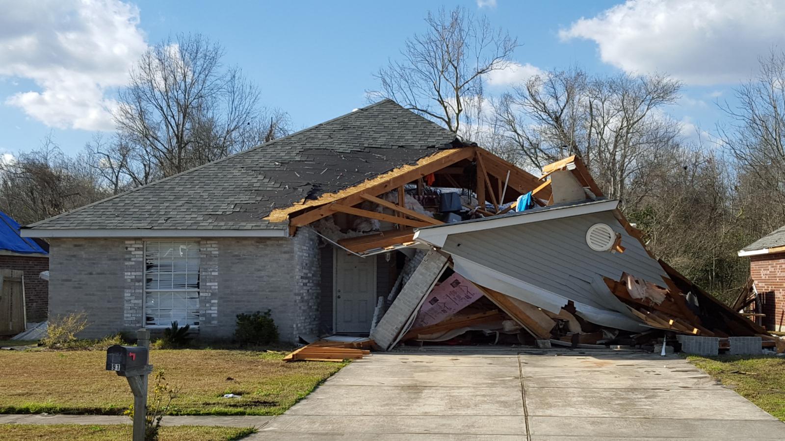
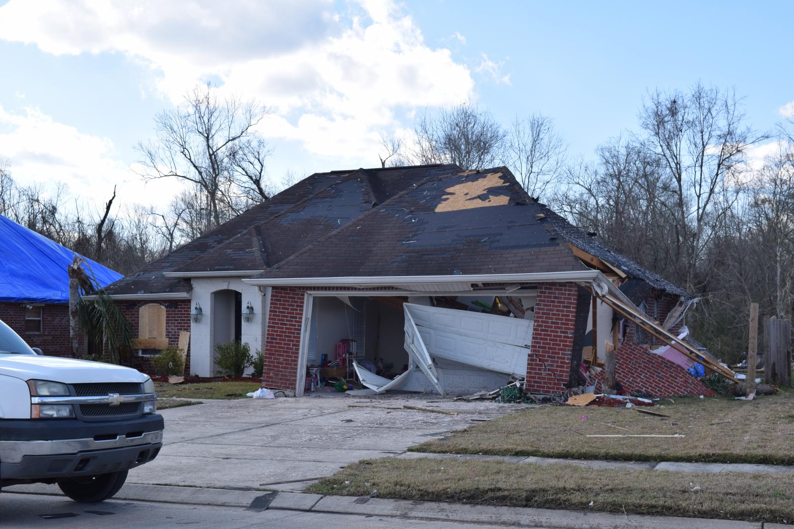
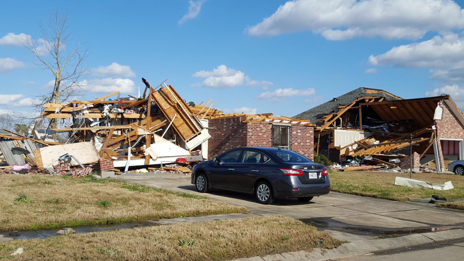
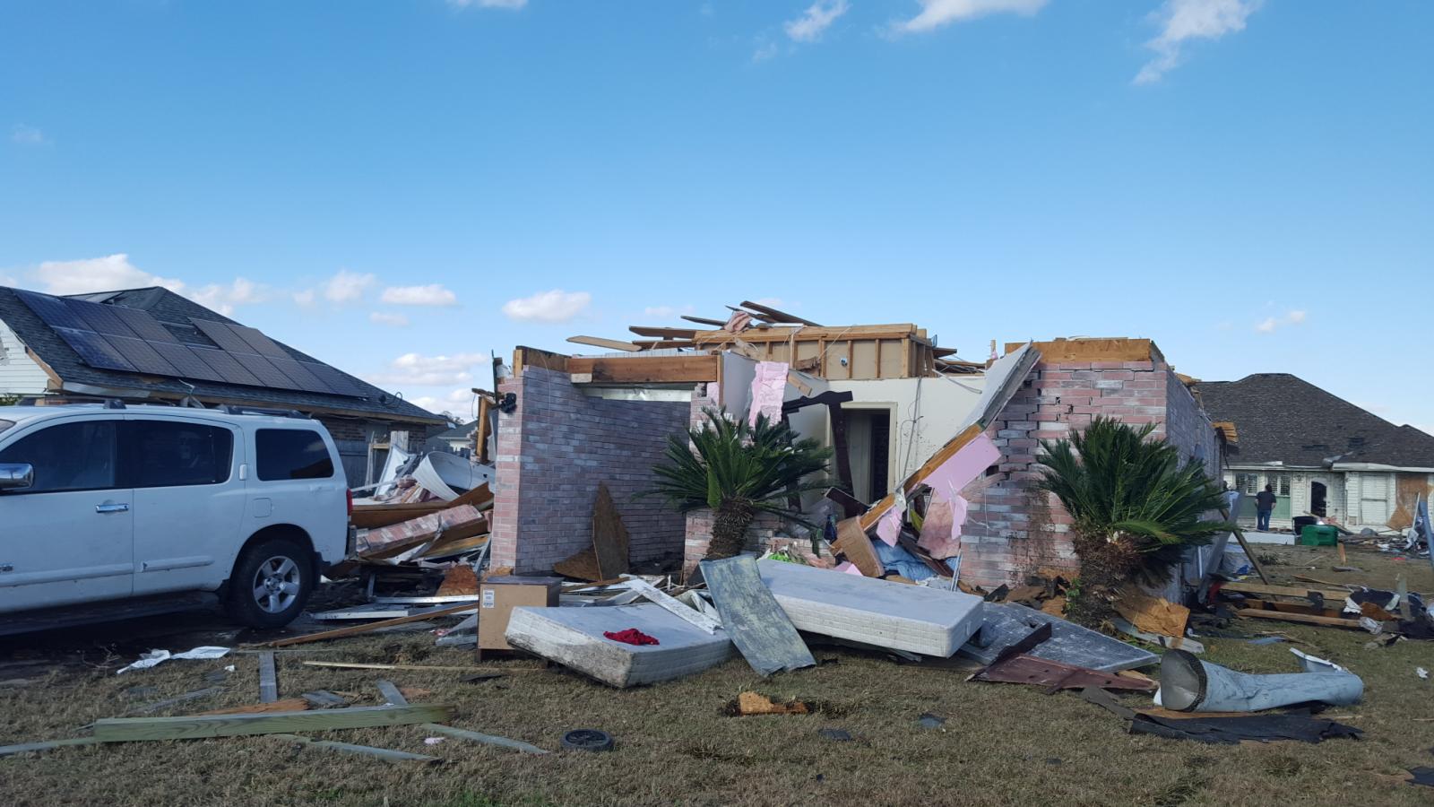
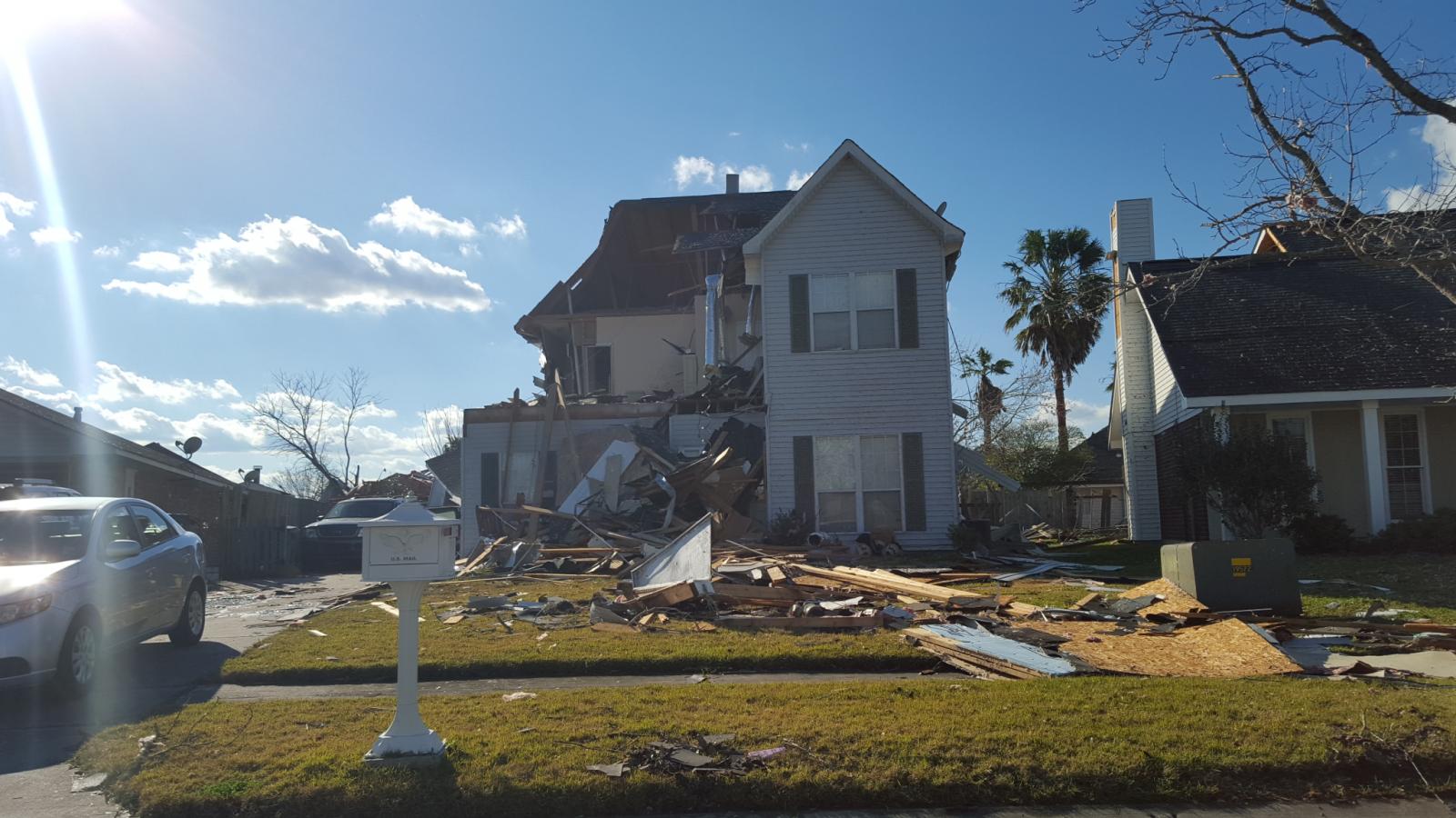
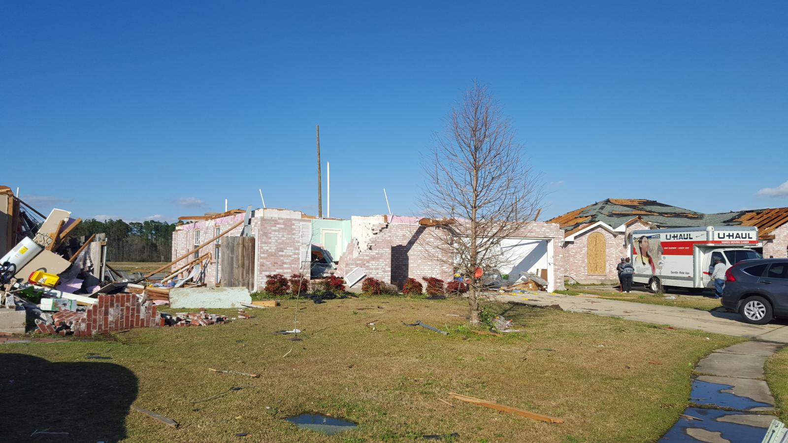
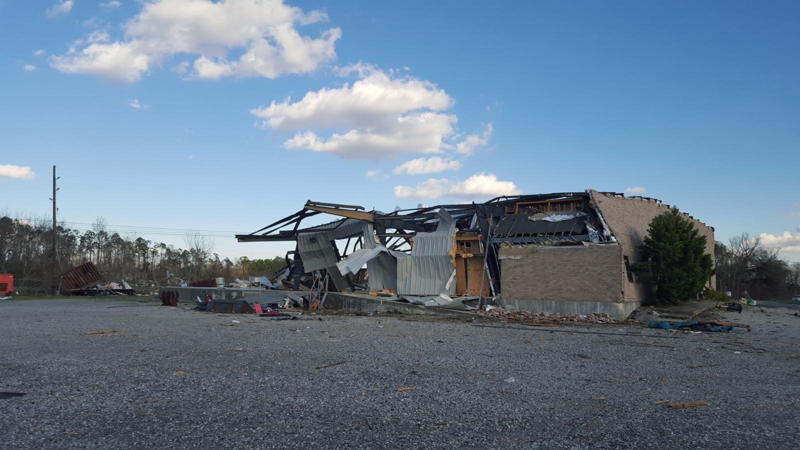
Laplace, LA Tornado - February 23, 2016
|
Rating:
|
EF-2
|
|
Estimated Maximum Wind:
|
130 mph
|
|
Injuries/Fatalities:
|
17 injuries/No fatalities
|
|
Damage Path Length:
|
4.5 miles
|
|
Maximum Path Width:
|
250 yards
|
|
Approximate Start Point/Time:
|
Laplace, LA at 432 PM
|
|
Approximate End Point/Time:
|
Laplace, LA at 444 PM
|
|
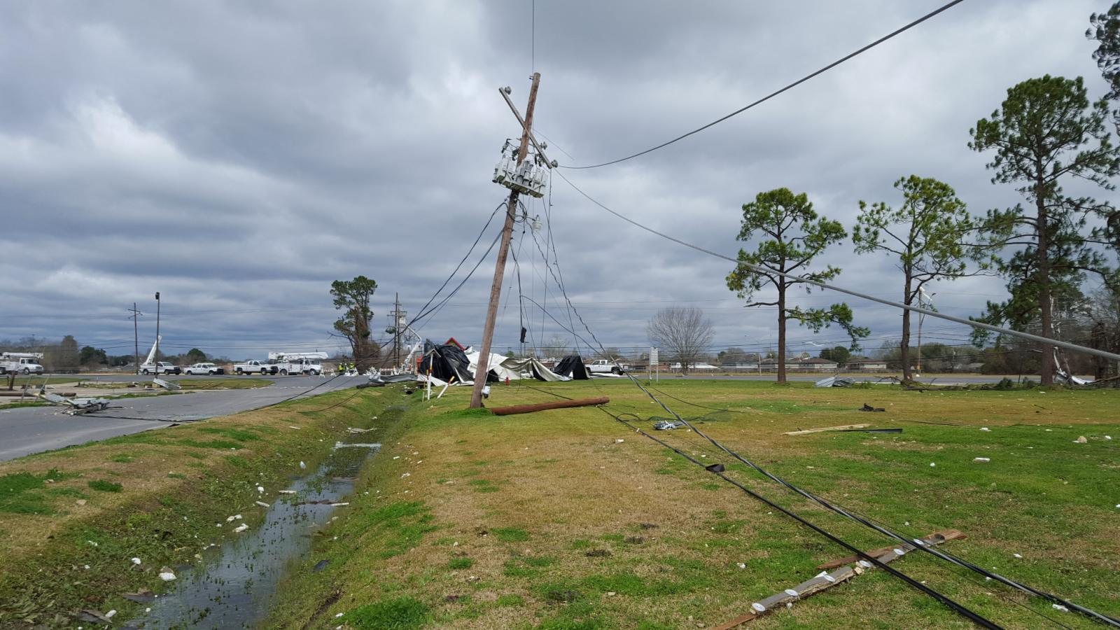
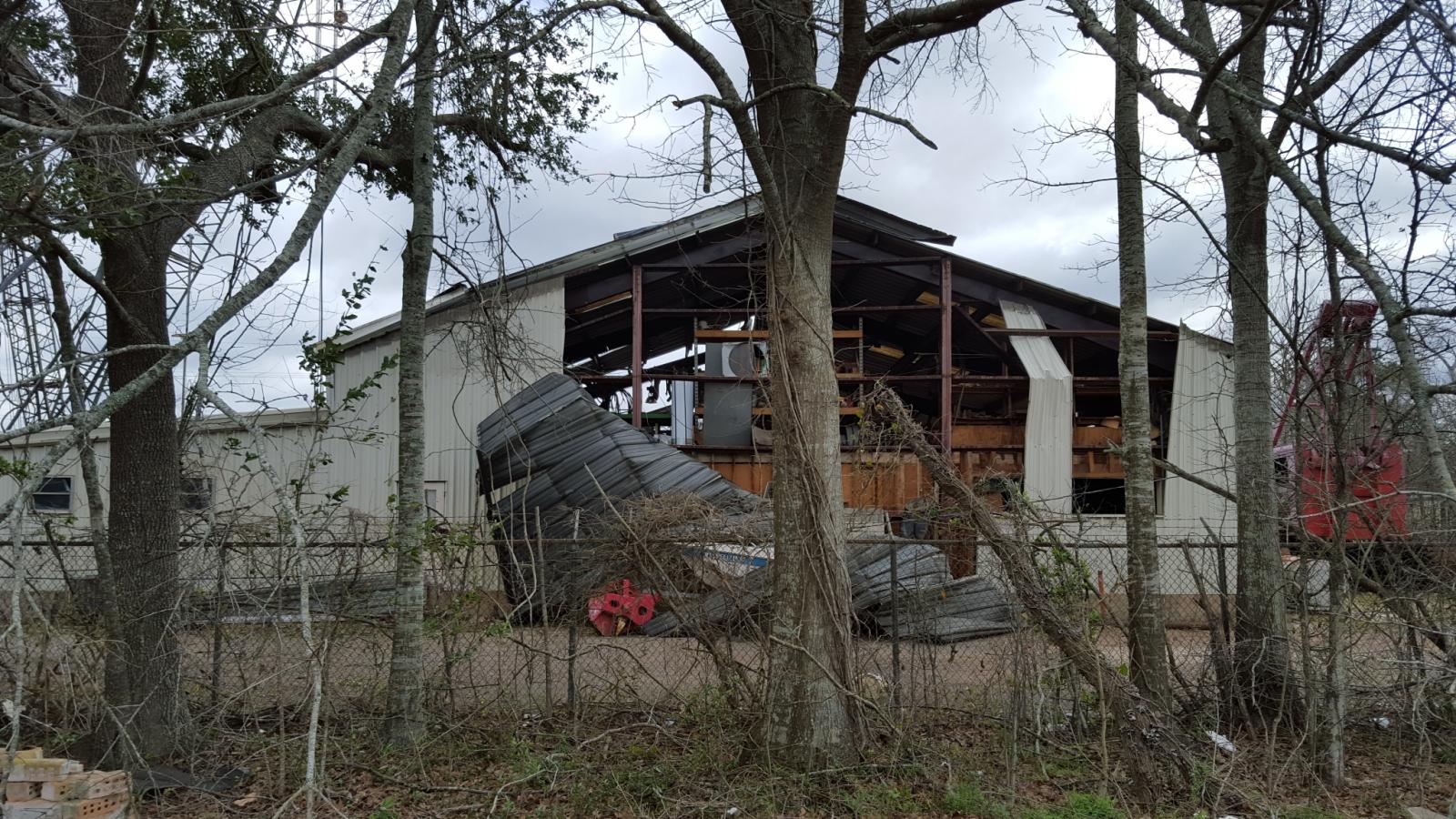
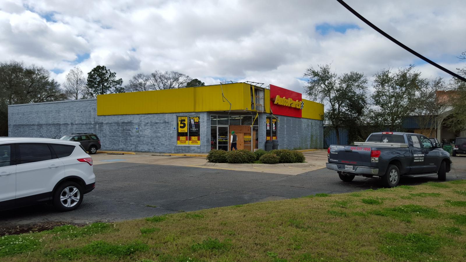
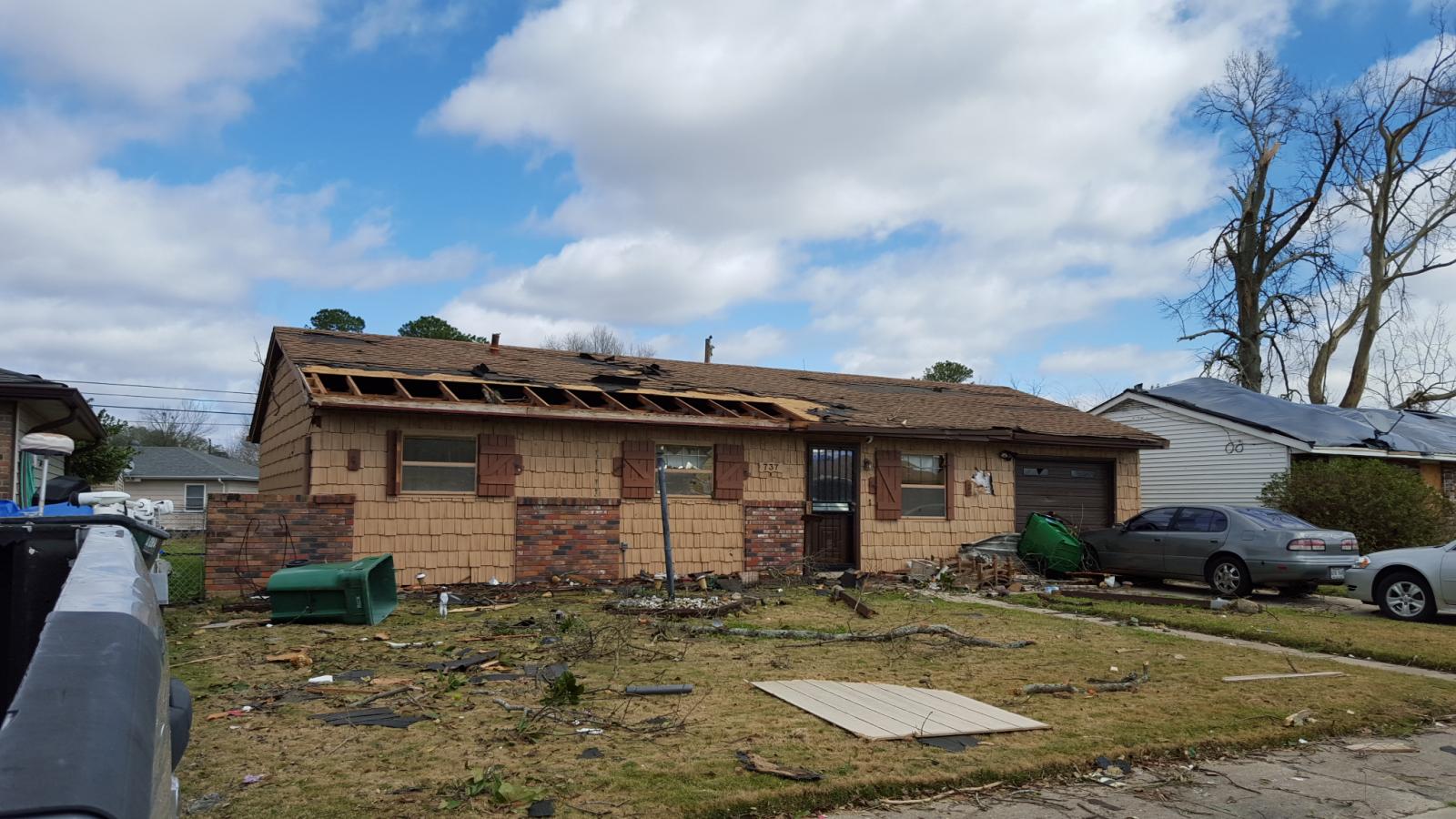
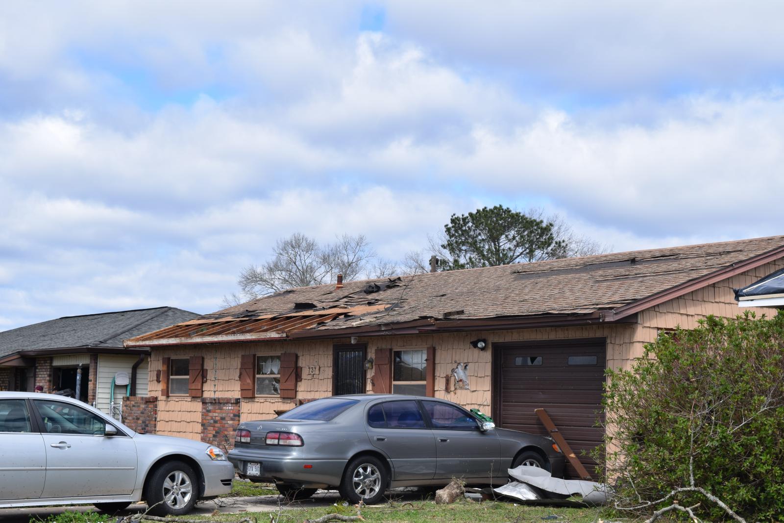
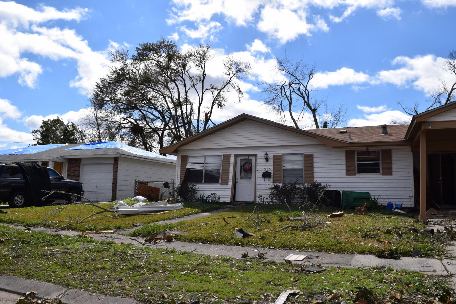
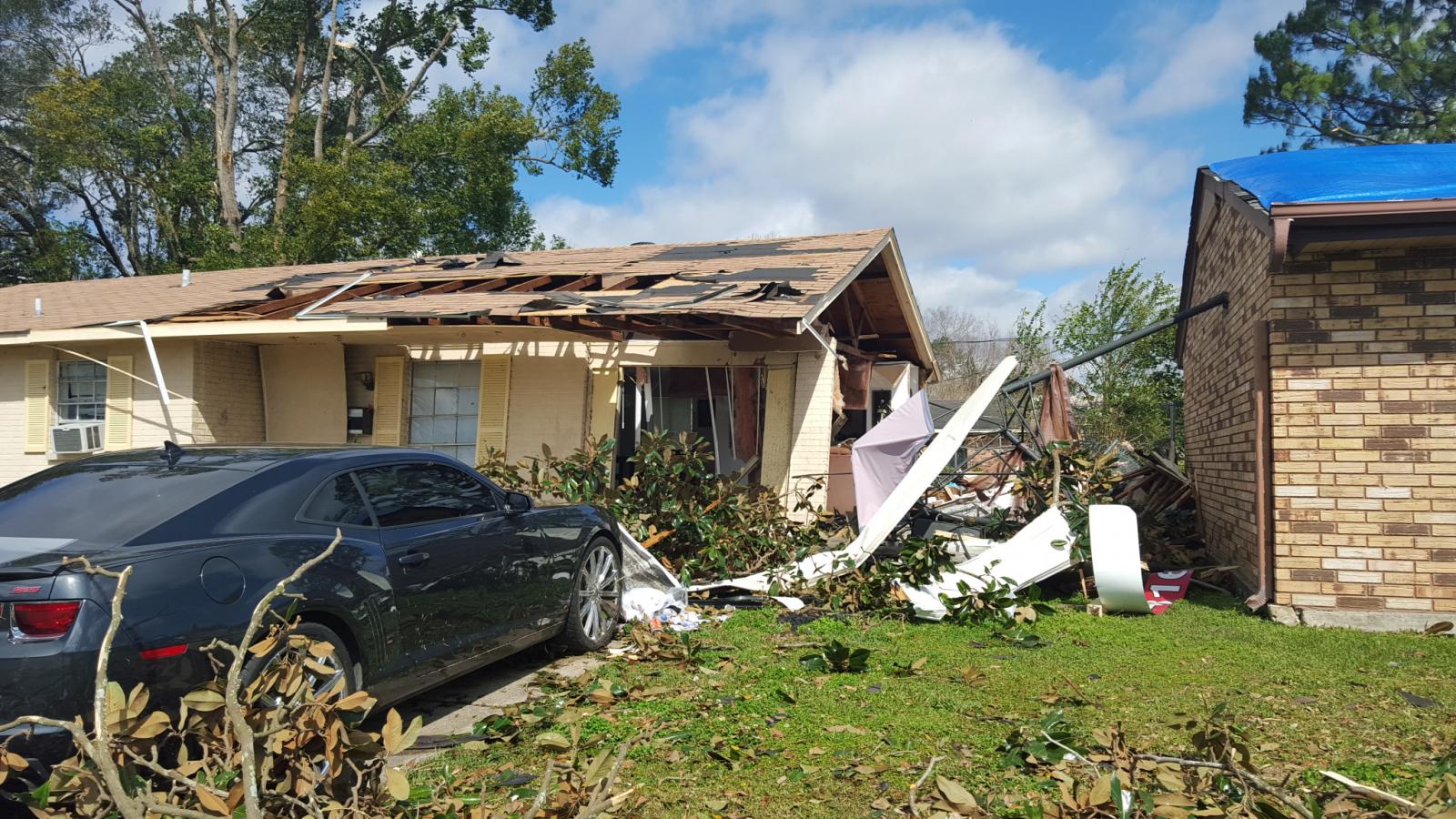
A National Weather Service Damage Assessment Team has surveyed the storm damage in Laplce, LA. It has been determined the damage was the result of a tornado. The tornado has been rated an EF-2 on the Enhanced Fujita Scale. Damage estimates were consistent with winds of 130 mph. The tornado touched down near the New Wind Fellowship Church and removed much of its roof covering. Power poles were snapped as the tornado crossed US Highway 61 (Airline Highway) and then moved into a retail area near the intersection of US Highway 61 and Belle Terre Boulevard where it blew out windows and removed roof covering and facia from several buildings. The tornado was at its widest around this time with a width of 250 yards. Damage in this area was consistent with EF-1 wind speeds. The tornado then continued northeast into the Carrollwood area causing a broad area of EF-0 and EF-1 damage. Large trees were snapped and several homes suffered roof damage. Most of the roof damage consisted of loss of shingles and some decking. The tornado then continued northeastward into the Riverland Heights subdivision. The most substantial damage in this area was along Greenwood Drive where the tornado was moving roughly parallel to the street. Many homes suffered roof damage and a few lost portions of the roof structure. 2 homes suffered the collapse of a single exterior wall, but it was noted that the damage was likely a result of garage door failures allowing the wind to lift the roof off the home from inside and push the exposed wall out. Very little damage as observed to the tops of the standing walls, despite the entire roof being blown away. The tornado had contracted to 200 yards wide as it moved through these neighborhoods. The tornado continued to the northeast and intensified as it reached the Cambridge area. In this area, a narrow stretch of EF-2 damage was seen near the intersection of Heritage Cove and Virginia Colony Avenue. A few homes and duplexes suffered partial to total loss of roof structure and decking along with partial exterior wall failures and blown out windows. This damage occurred with no apparent failures of garages. The damage in this area was consistent with peak winds of around 120 mph. The tornado continued to strengthen as it moved through a wooded area and emerged into the Palmetto and Indigo Estates Subdivisions. This is where the most significant damage along the tornado path occurred. Near the intersection of Nicole and Gail Streets, two single story houses suffered complete roof loss as well as total failure of most exterior walls. A third home lost about half of its second floor. Damage in this area was consistent with a strong EF-2 producing wind speeds of 130 mph. Two other homes on Sawgrass Drive also suffered total roof loss and partial failure of exterior walls. The tornado continued northeast and damaged some large metal warehouse buildings on Woodland Drive. The tornado began to rapidly weaken as it crossed Interstate 10 and Interstate 55. The last damage was observed near Frenier Road and US Highway 51 where a light pole was snapped and tree branches were broken. |
|
|
|
|
||||||||||||||||||||||||||||||