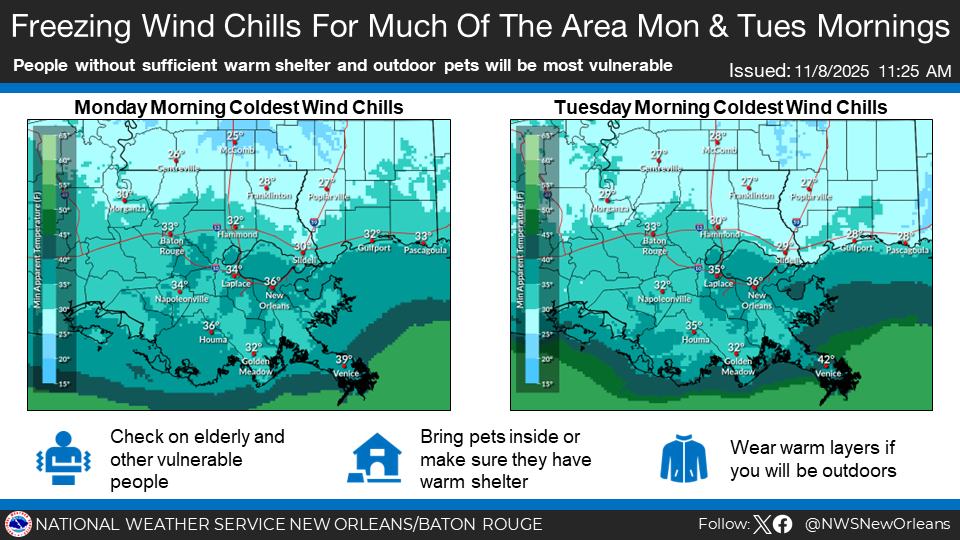
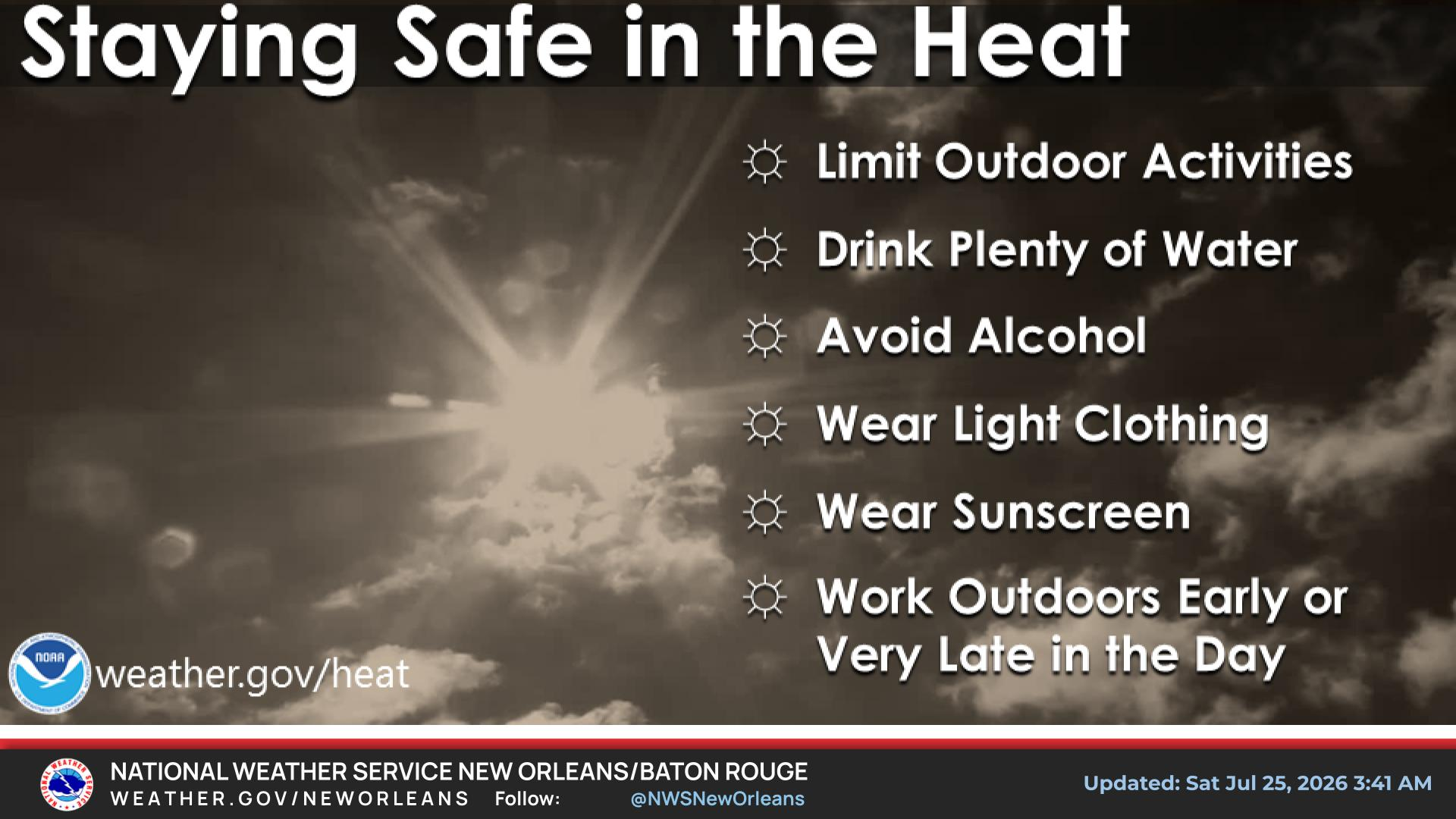
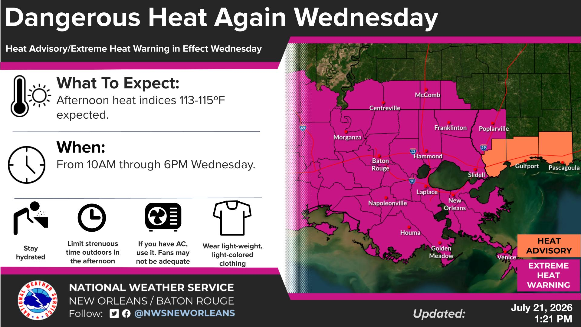
National Weather Service United States Department of Commerce
Click a location below for detailed forecast.

Last Map Update: Mon, Feb 2, 2026 at 11:40:44 pm CST

Rain returns Tuesday night into early wednesday morning! From 6PM thru midnight, A line of light to moderate showers approaches NW areas. Some embedded thunderstorms. Rain totals light from 0.10 to 0.50”, locally heavier around 0.75” isolated spots. Midnight through 6AM Wednesday, The line of showers/few storms advances southeast early Wed morning. Careful during your early morning commute due to wet roads! 6AM Wednesday through noon Wednesday: Light/moderate showers exit south/east, we dry out and cool down back into the 50’s and 60’s with breezy north winds.


CoCoRaHS
CoCoRaHS - Click for more information
Submit
Storm Report

Submit a Storm Report

River Stages
Latest River Stages


Quick Access to Text Products


 Current Weather Observations...
Location Time
(CST)
Weather Vsby.
(SM)
Temp.
(ºF)
Dewpt.
(ºF)
Hum.
(%)
Wind
(mph)
Wind Chill / Heat Index
(ºF)
Pres.
(in)
Baton Rouge LA22:53Clear10463976S 642 [WC]30.31
Biloxi MS22:55Clear10453669SW 740 [WC]30.30
Gulfport MS22:53Clear10443467CALM-30.33
Hammond LA23:15Clear10413577CALM-30.32
Houma LA18:47Clear7463565S 742 [WC]30.35
McComb MS22:53Clear10403169S 536 [WC]30.30
New Orleans LA22:53Mostly Cloudy10463462S 543 [WC]30.33
Slidell La22:53Clear10393379CALM-30.33