New Orleans/Baton Rouge
Weather Forecast Office
Gramercy, LA Tornado - April 4, 2011
|
Rating:
|
EF-0
|
|
Estimated Maximum Wind:
|
80 mph
|
|
Injuries/Fatalities:
|
None
|
|
Damage Path Length:
|
1 mile
|
|
Maximum Path Width:
|
50 yards
|
|
Approximate Start Point/Time:
|
1 mile NNW of Gramercy, LA at 650 PM
|
|
Approximate End Point/Time:
|
0.5 miles ENE of Gramercy, LA at 654 PM
|
|
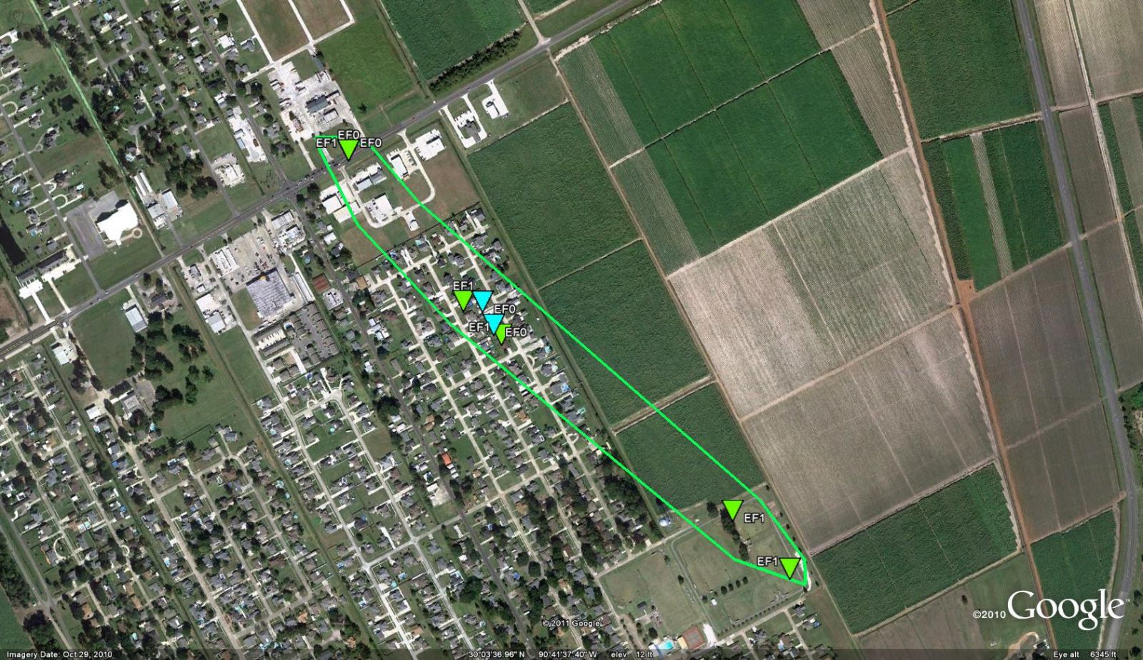
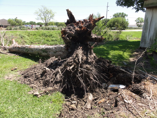
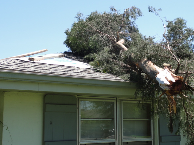
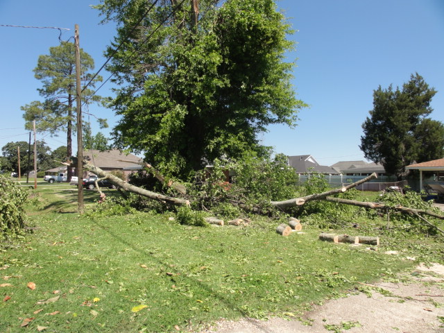
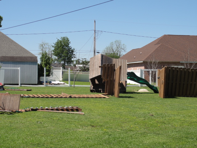
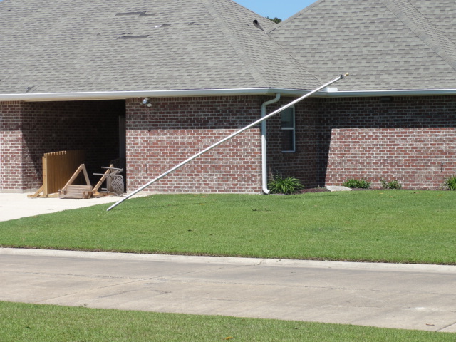
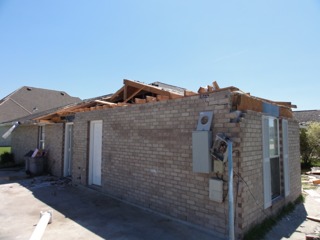
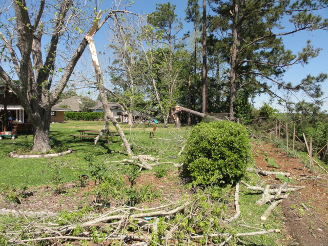
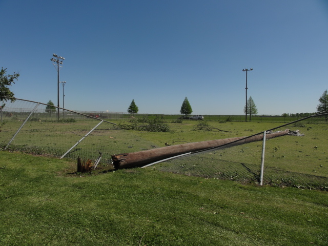
A National Weather Service Damage Assessment Team has surveyed the storm damage in St. James Parish in the city of Gramercy. It has been determined the damage was the result of a tornado. The tornado has been rated a high end EF-0 on the Enhanced Fujita Scale. Damage estimates were consistent with winds of 80 mph. The tornado touched down near the intersection of North Airline Avenue and Highway 3125. The tornado moved to the south-southeast through a residential neighborhood. The worst damage was observed along Ezildore Avenue between 6th and 7th Streets. A carport was lifted off a home causing significant damage to the home. The tornado continued on a south-southeast path causing additional signficant tree damage and some minor to moderate roof damage. The tornado finally lifted near the end of East 2nd Street. The tornado damage path was 1 mile long and was 50 yards wide at its widest point. No injuries were reported. |
|
|
|
|
||||||||||||||||
Current Hazards
Extended Outlooks
Outlooks
Fire Manager Quick Brief
Briefing Page
Storm Prediction Center
Forecasts
Activity Planner
River Forecasts
Tropical Forecast
Forecast Discussion
Aviation Weather Forecast
Graphical Forecast
Weather Models and Maps
Fire Weather Forecast
Hourly Weather Graph
Air Quality Forecasts
Marine Forecast
US Dept of Commerce
National Oceanic and Atmospheric Administration
National Weather Service
New Orleans/Baton Rouge
62300 Airport Rd.
Slidell, LA 70460-5243
504.522.7330 985.649.0429
Comments? Questions? Please Contact Us.