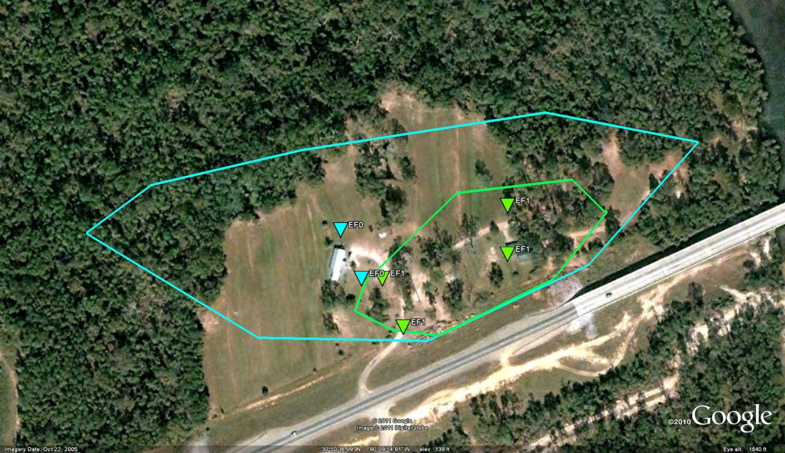
Franklinton, LA Tornado - April 4, 2011
|
Rating:
|
EF-1
|
|
Estimated Maximum Wind:
|
105 mph
|
|
Injuries/Fatalities:
|
None
|
|
Damage Path Length:
|
400 yards
|
|
Maximum Path Width:
|
75 yards
|
|
Approximate Start Point/Time:
|
0.50 miles W of Franklinton, LA at 640 PM
|
|
Approximate End Point/Time:
|
0.25 miles W of Franklinton, LA at 641 PM
|
|
A National Weather Service Damage Assessment Team has surveyed the storm damage in Washington Parish in the city of Franklinton. It has been determined the damage was the result of a tornado. The tornado has been rated an EF-1 on the Enhanced Fujita Scale. Damage estimates were consistent with winds of 105 mph. The tornado touched down just west of Woody Road to the north of Louisiana Highway 10 and traveled to the east-northeast parallel to Louisiana Highway 10. Tow homes experienced minor to moderate roof damage. Another home had most of the roofing structure including the trusses completely blown off. Several large trees were also uprooted. The tornado quickly lifted as it approached the Bogue Chitto River. The tornado damage path was 400 yards long and was 75 yards wide at its widest point. No injuries were reported. |
|
|
|
|
||||||||||||||||||