Biloxi, MS Tornado - December 14, 2022
|
Rating:
|
EF-1
|
|
Estimated Maximum Wind:
|
90 mph
|
|
Injuries/Fatalities:
|
None
|
|
Damage Path Length:
|
2.36 miles
|
|
Maximum Path Width:
|
100 yards
|
|
Approximate Start Point/Time:
|
3 miles SW of Biloxi, MS at 552 PM CST
|
|
Approximate End Point/Time:
|
1 mile W of Biloxi, MS at 555 PM CST
|
|
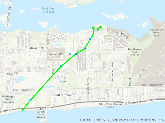
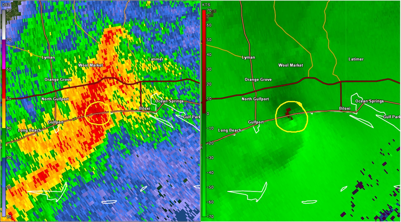
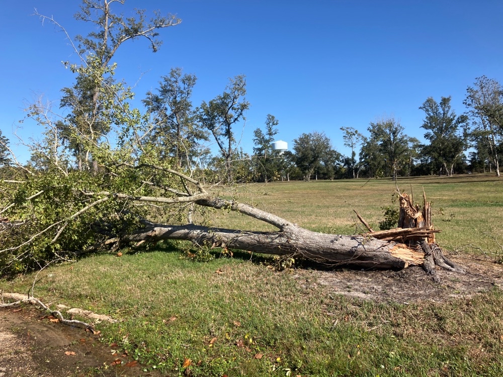
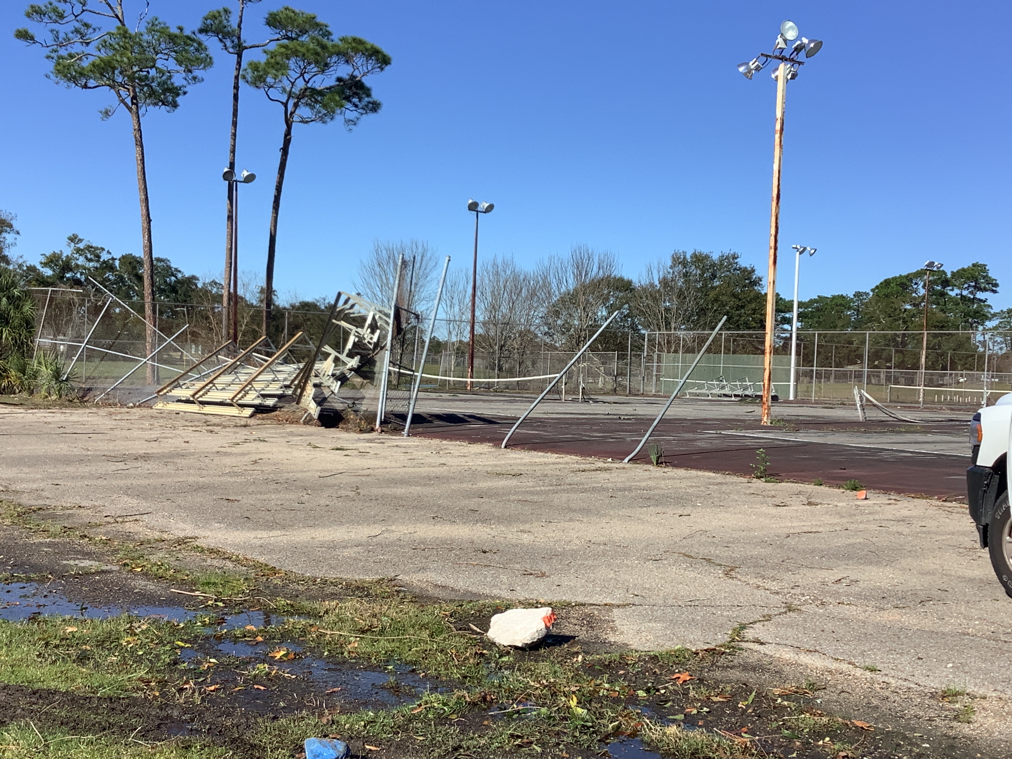
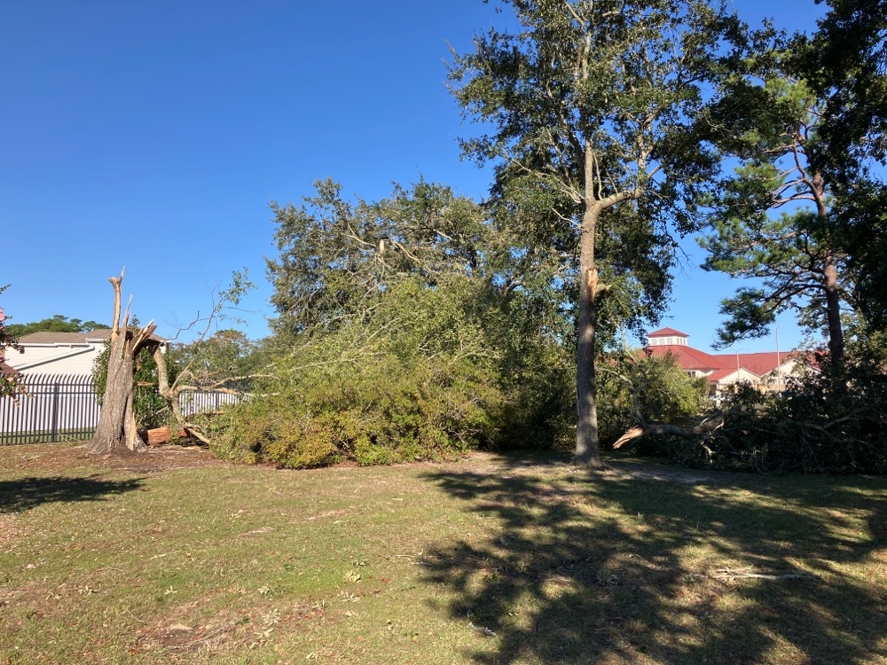
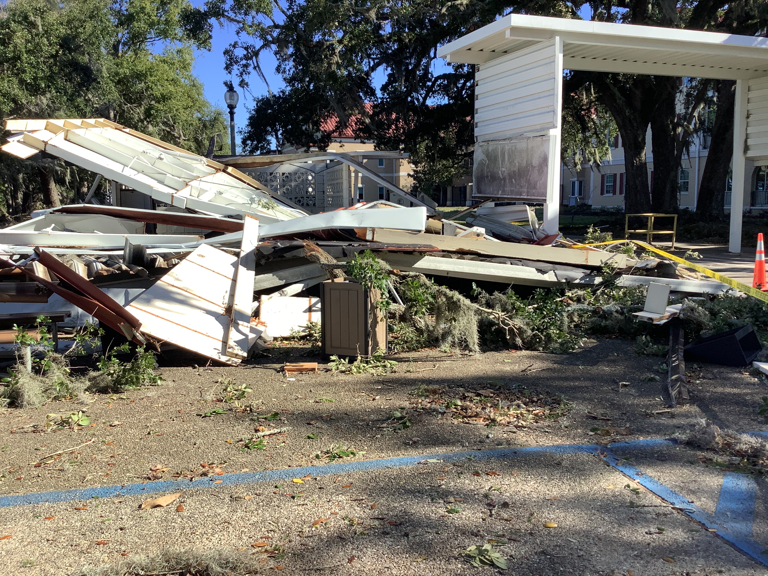
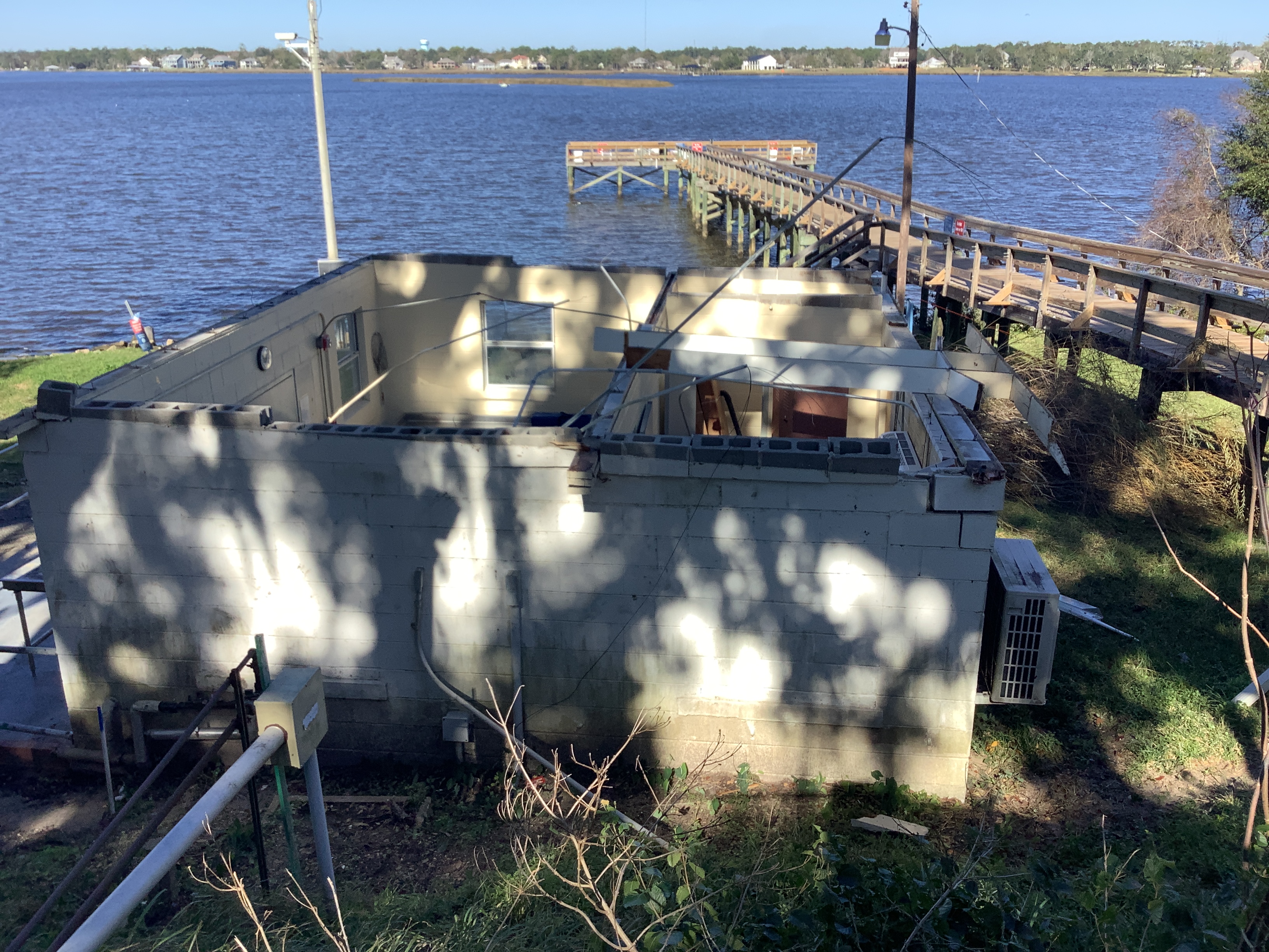
A National Weather Service Damage Assessment Team has surveyed the storm damage near Biloxi, MS. It has been determined the damage was the result of a tornado. The tornado has been rated an EF-1 on the Enhanced Fujita Scale. Damage estimates were consistent with winds of 90 mph. A waterspout likely came onshore near the Beauvoir section of Biloxi around 5:52 PM CST. The first surveyed damage revealed numerous large limbs snapped on Brady Drive. The tornado then moved northeastward over marsh, reaching Tara Lane where a pine tree fell onto a pavilion and caused damage to the roof. It continued northeast across Pass Road and then through the intersection of Belvedere Drive and Belvedere Circle where tree limbs fell on power lines. The roof of a metal shed was ripped off. The tornado continued across Hiller Park where several pine trees were partially uprooted and unsecured bleachers were thrown 50 yards to the northeast through a chain link fence and on a tennis court. A few roof shingles were missing at nearby military housing. The tornado crossed near Atkinson Rd and Veterans Ave where several oak trees had large limbs snapped. Numerous snapped tree limbs fell, damaging markers at Biloxi National Cemetery. The most significant tornadic damage in the path occurred in the VA Gulf Coast Health Care System Campus along Veterans Avenue where damage was consistent with a EF-1 tornado and maximum winds of 90 mph. A window on the south-facing side of a campus building was blown in and another window was blown out on the northern side of the building. A roof from a small building was peeled off and thrown back to the southeast into an adjacent partially covered outbuilding, causing the outbuilding to collapse. The tornado uprooted several trees just before lifting as it reached Mullet Lake around 5:55 pm. |
|
|
|
|
|||||||||||||