New Orleans/Baton Rouge
Weather Forecast Office
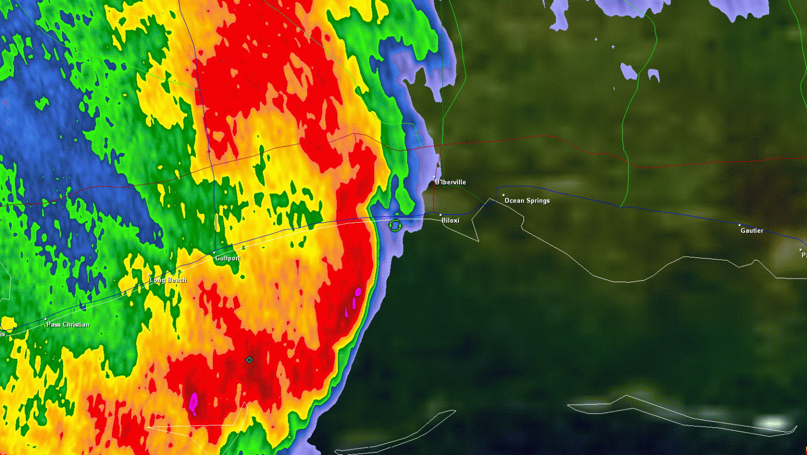
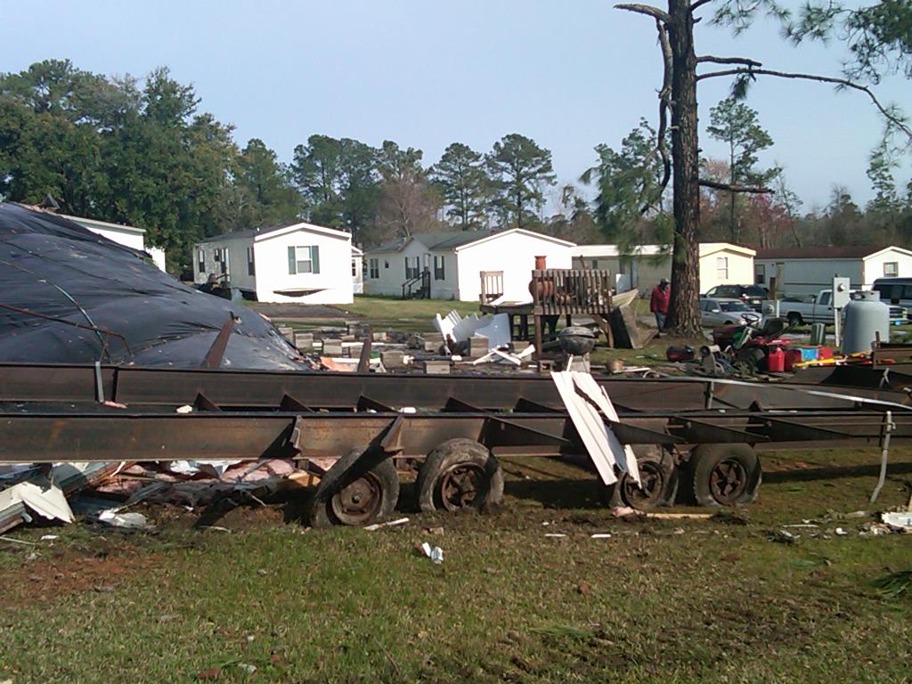
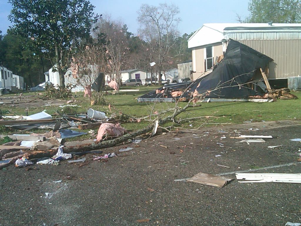
Biloxi, MS Tornado - March 9, 2011
|
Rating:
|
EF-1
|
|
Estimated Maximum Wind:
|
105 mph
|
|
Injuries/Fatalities:
|
None
|
|
Damage Path Length:
|
0.25 miles
|
|
Maximum Path Width:
|
30 yards
|
|
Approximate Start Point/Time:
|
2 miles N of Biloxi, MS at 747 AM
|
|
Approximate End Point/Time:
|
2 miles N of Biloxi, MS at 747 AM
|
|
A National Weather Service Damage Assessment Team has surveyed the storm damage in Harrison County near Biloxi, MS. It has been determined the damage was the result of a tornado. The tornado has been rated an EF-1 on the Enhanced Fujita Scale. Damage estimates were consistent with winds of 105 mph. The tornado touched down near Cedar Lake Road and Popps Ferry Road damaging several mobile homes. One mobile home was rolled and destroyed with minor to moderate damage to several other mobile homes. Several large limbs were also snapped from pine trees. The tornado damage path was 0.25 miles long and was 30 yards wide at its widest point. No injuries or deaths were reported. |
|
|
|
|
||||||||||
Current Hazards
Outlooks
Fire Manager Quick Brief
Briefing Page
Storm Prediction Center
Extended Outlooks
Forecasts
Tropical Forecast
Forecast Discussion
Aviation Weather Forecast
Graphical Forecast
Weather Models and Maps
Fire Weather Forecast
Hourly Weather Graph
Air Quality Forecasts
Marine Forecast
Activity Planner
River Forecasts
US Dept of Commerce
National Oceanic and Atmospheric Administration
National Weather Service
New Orleans/Baton Rouge
62300 Airport Rd.
Slidell, LA 70460-5243
504.522.7330 985.649.0429
Comments? Questions? Please Contact Us.