New Orleans/Baton Rouge
Weather Forecast Office
Akers, LA Tornado - February 23, 2016
|
Rating:
|
EF-1
|
|
Estimated Maximum Wind:
|
100 mph
|
|
Injuries/Fatalities:
|
None
|
|
Damage Path Length:
|
estimated 3 miles
|
|
Maximum Path Width:
|
250 yards
|
|
Approximate Start Point/Time:
|
Akers, LA at 415 PM
|
|
Approximate End Point/Time:
|
Akers, LA at 417 PM
|
|
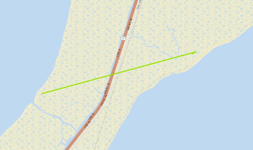
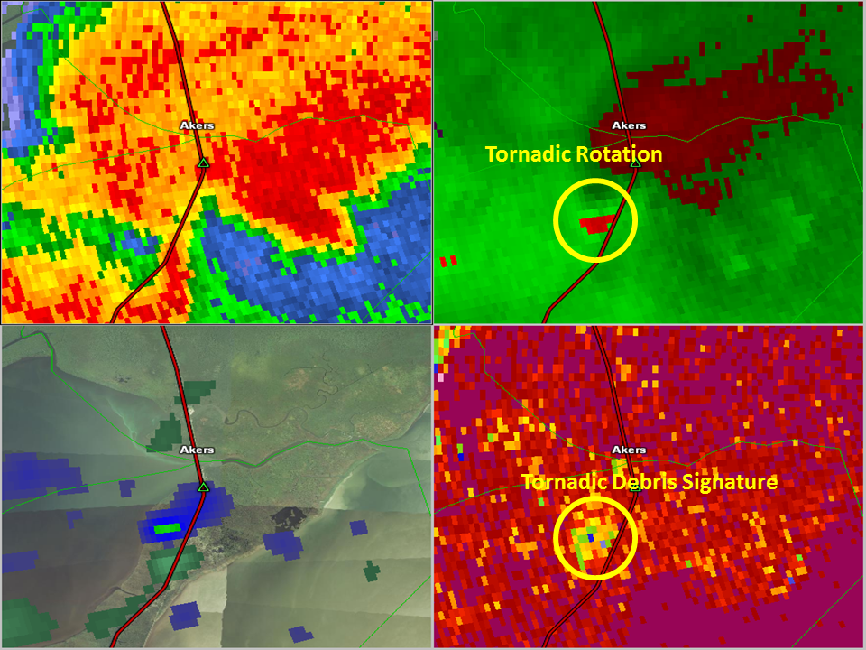
A National Weather Service Damage Assessment Team has surveyed the storm damage at mile marker 12 on Interstate 55 in rural St. John the Baptist Parish near Akers, LA. It has been determined the damage was the result of a tornado. The tornado has been rated an EF-1 on the Enhanced Fujita Scale. Damage estimates were consistent with winds of 100 mph. A tornadic waterspout came ashore from Lake Maurepas snapping cypress trees at mile marker 12 on Interstate 55 near Akers, LA. The tornado damage path was estimated at 3 miles long and was 250 yards wide at its widest point. |
|
|
|
|
|||||||||
Current Hazards
Briefing Page
Storm Prediction Center
Extended Outlooks
Outlooks
Fire Manager Quick Brief
Forecasts
Graphical Forecast
Weather Models and Maps
Fire Weather Forecast
Hourly Weather Graph
Air Quality Forecasts
Marine Forecast
Activity Planner
River Forecasts
Tropical Forecast
Forecast Discussion
Aviation Weather Forecast
US Dept of Commerce
National Oceanic and Atmospheric Administration
National Weather Service
New Orleans/Baton Rouge
62300 Airport Rd.
Slidell, LA 70460-5243
504.522.7330 985.649.0429
Comments? Questions? Please Contact Us.