New Orleans/Baton Rouge
Weather Forecast Office
Pascagoula Tornado - March 26, 2009
|
Rating:
|
EF-0
|
|
Estimated Maximum Wind:
|
75 mph
|
|
Injuries/Fatalities:
|
None
|
|
Damage Path Length:
|
250 yards
|
|
Maximum Path Width:
|
50 yards
|
|
Approximate Start Point/Time:
|
Intersection of Tucker and 8th St. in Pascagoula at 533 AM
|
|
Approximate End Point/Time:
|
Intersection of Paul Harvey and Taylor Ave. in Pascagoula at 534 AM
|
|
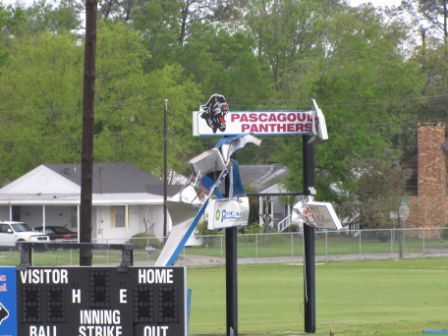
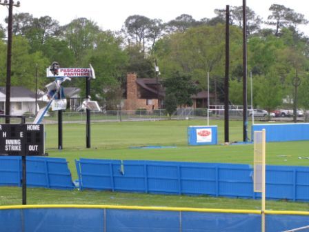
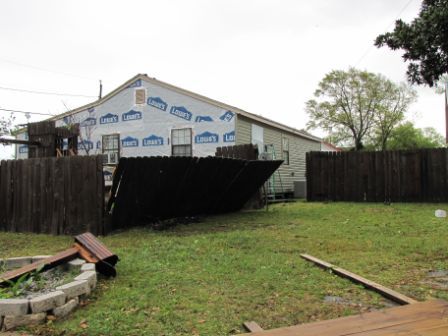
A National Weather Service Damage Assessment Team has surveyed the storm damage in Pascagoula, MS. It has been determined the damage was the result of a tornado. The tornado has been rated an EF-0 on the Enhanced Fujita Scale. Damage estimates were consistent with winds of approximately 75 mph. The tornado traveled to the east causing the most damage around Tucker and 8th St at Pascagoula High School. The score board on the football field was blown down along with numerous fences with debris scattered across the school grounds. The tornado moved toward Paul Harvey and Taylor St. causing light damage to traffic lights...minor roof damage...and bringing down several trees. A trampoline was also blown into a van. |
|
|
|||||||||||
Current Hazards
Outlooks
Fire Manager Quick Brief
Briefing Page
Storm Prediction Center
Extended Outlooks
Forecasts
Tropical Forecast
Forecast Discussion
Aviation Weather Forecast
Graphical Forecast
Weather Models and Maps
Fire Weather Forecast
Hourly Weather Graph
Air Quality Forecasts
Marine Forecast
Activity Planner
River Forecasts
US Dept of Commerce
National Oceanic and Atmospheric Administration
National Weather Service
New Orleans/Baton Rouge
62300 Airport Rd.
Slidell, LA 70460-5243
504.522.7330 985.649.0429
Comments? Questions? Please Contact Us.