New Orleans/Baton Rouge
Weather Forecast Office
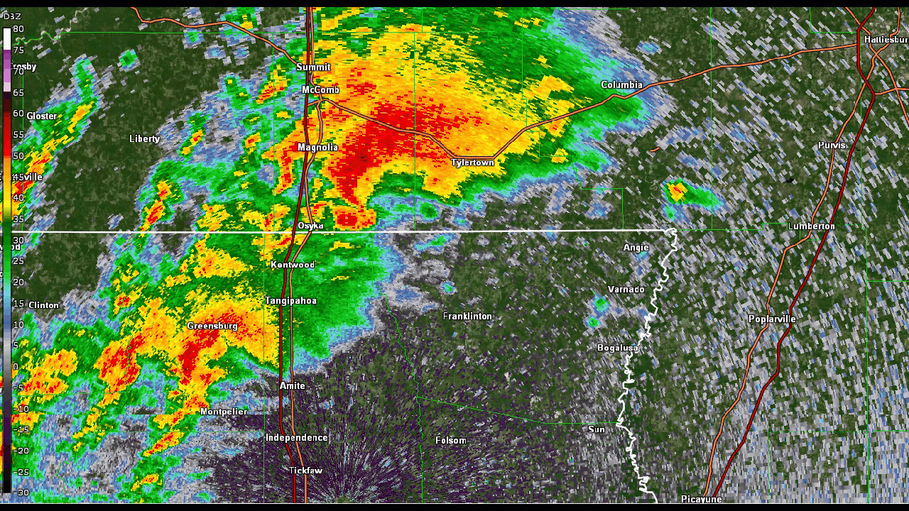
A strong upper level disturbance, surface low, and cold front produced several supercell thunderstorms that pushed across Southeast Louisiana and Southern Mississippi in early to mid-afternoon hours of Saturday, March 15, 2025. The supercell thunderstorms produced two strong tornadoes near Tylertown, MS and a weak tornado near Covington, LA. The strongest tornado was an EF-4 tornado that impacted rural areas of Tangipahoa Parish, Pike County, and Walthall County in the early afternoon hours of the 15th.
3 tornadoes have been confirmed from this event. These tornadoes have been determined to range in strength from EF1 to EF4 after NWS storm surveys and high resolution satellite analysis were conducted.
Current Hazards
Extended Outlooks
Outlooks
Fire Manager Quick Brief
Briefing Page
Storm Prediction Center
Forecasts
Activity Planner
River Forecasts
Tropical Forecast
Forecast Discussion
Aviation Weather Forecast
Graphical Forecast
Weather Models and Maps
Fire Weather Forecast
Hourly Weather Graph
Air Quality Forecasts
Marine Forecast
US Dept of Commerce
National Oceanic and Atmospheric Administration
National Weather Service
New Orleans/Baton Rouge
62300 Airport Rd.
Slidell, LA 70460-5243
504.522.7330 985.649.0429
Comments? Questions? Please Contact Us.

