Updated Three Times Daily:
10 AM, Noon, and 4 PM Eastern Time
Data displayed is considered preliminary. Contact sr-jax.webmaster@noaa.gov with questions.
|
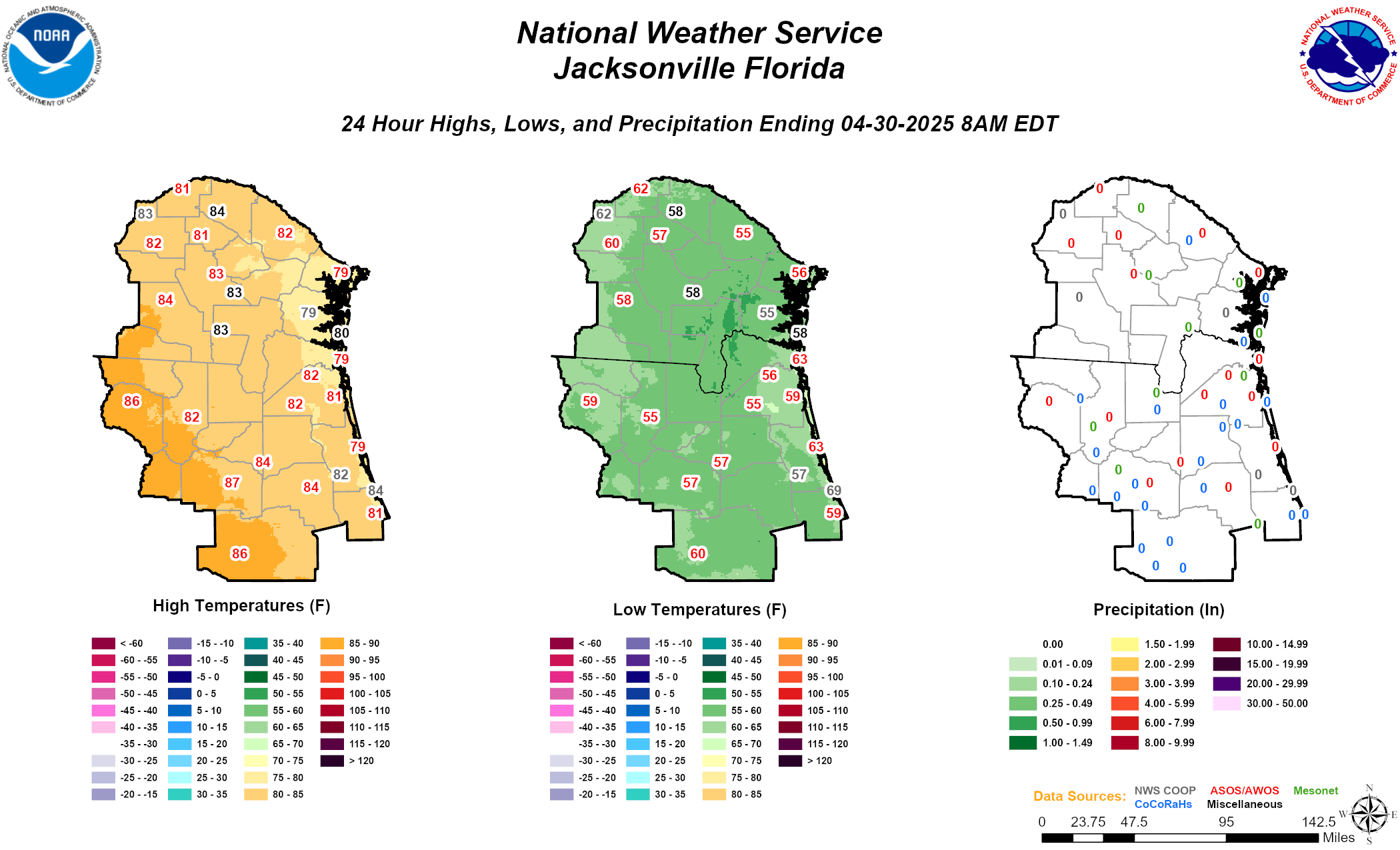
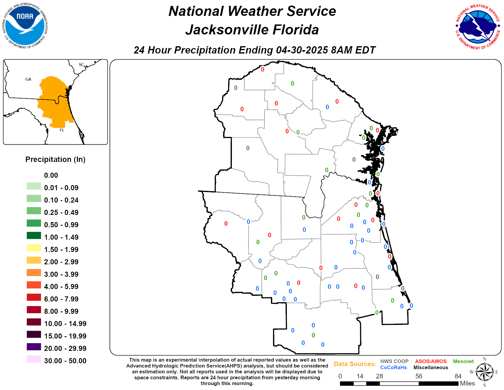
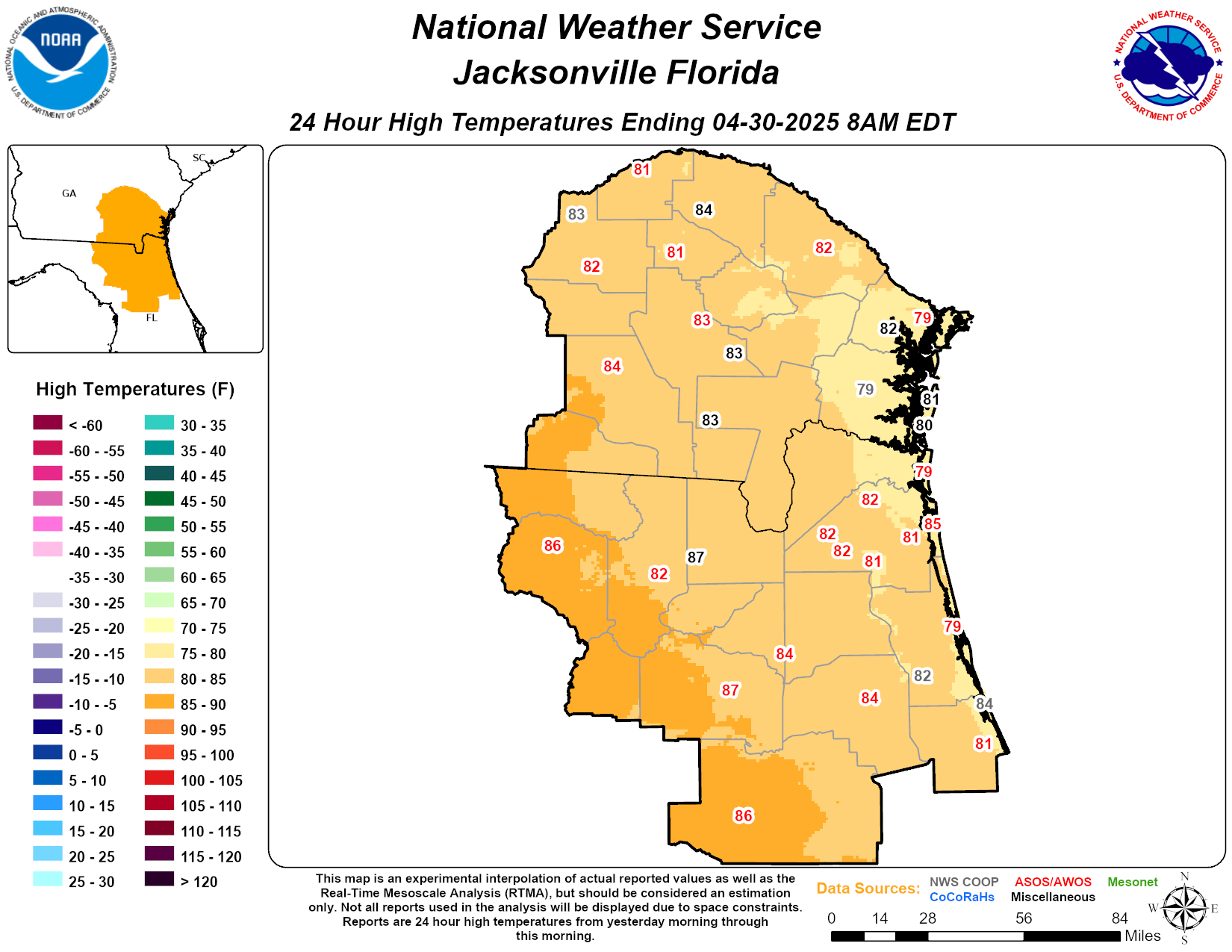
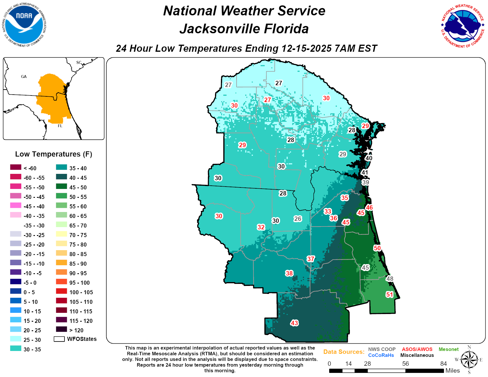
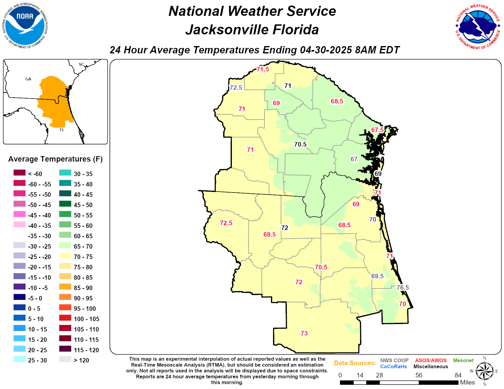
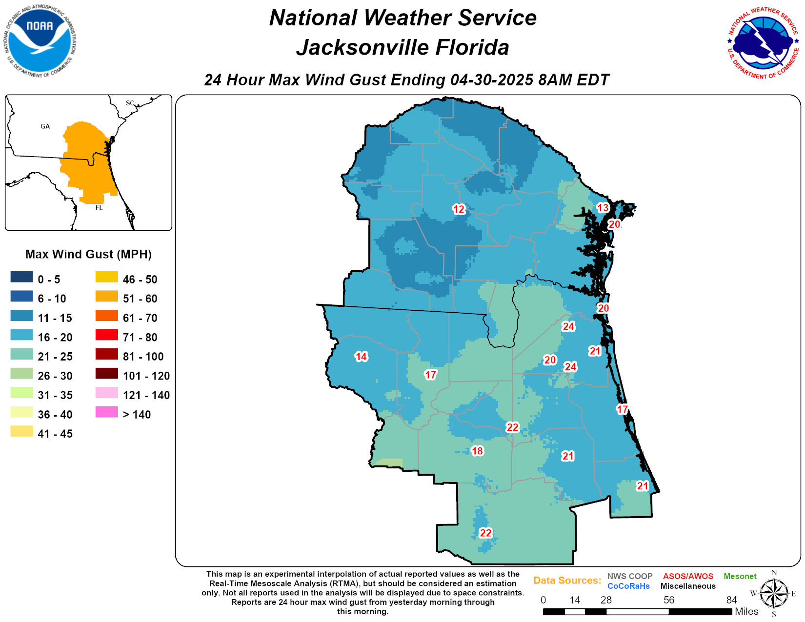
Past 24 Hour Observed Weather across northeast Florida and southeast Georgia |
||
|---|---|---|
|
|
||
 |
 |
 |
 |
 |
 |
Map archives available beginning September 4, 2024*
(Archived maps are generally available for the last 365 Days)
Click image for a larger version
Map archives available beginning September 4, 2024*
(Archived maps are generally available for the last 365 Days)
Click image for a larger version
Map archives available beginning September 4, 2024*
(Archived maps are generally available for the last 365 Days)
Click image for a larger version
*Map production began on September 4, 2024. Maps may be available prior to this date but the record may not be complete or representative.
Credits:
Webpage design credit to NWS MLB and NWS MRX.
Configured for NWS Jacksonville by andrew.kennedy@noaa.gov