The past several hurricane seasons have proven that the St. Johns River System between Lake George and Downtown Jacksonville, as well as the Trout River System require special attention due to the higher wind speeds over its wide-open spaces, significant tidal flooding and seiche effect flooding on the river between Downtown Jacksonville and Palatka. The river system considered includes, but is not limited to, the Trout River, Ribault River, Ortega River, Cedar River, Doctor's Lake and Dunns Creek. Because the original Public and Fire Weather Zone configurations were based on county geopolitical boundaries, and not meteorology, which has resulted in wind watches/warnings and coastal flood watches/warnings being placed over areas well removed from the river to account for impacts along relatively narrow swaths of the St Johns and Trout Rivers. These changes will address and improve on those circumstances.
After coordinating with local officials, it was decided that new boundaries largely following Florida State Road 19, U.S. Highway 17, the CSX Railroad line through Clay County, Blanding Blvd, and then several other main roadways/railroad lines in Duval County would be used to delineate the St Johns, Ortega, Cedar, and Trout Rivers. The boundary was easily derived in Clay and Putnam Counties utilizing only a few reference points. The Ortega, Cedar, and Trout Rivers made the Duval County boundary changes much more complicated. As much as possible railroad lines, major roadways, and highways were used; however, the northwestern portion of the Trout River did not have easily recognizable boundaries that could be used...For that area, between U.S. Highway 1 in Dinsmore and the intersection of Interstate-295 and Lem Turner Road, a straight line was drawn largely utilizing the existing power transmission lines.
Zone realignment is scheduled for March 30th, 2021
If severe weather precludes the orginal implementation, the back up date is April 1st, 2021
The local NWS office has reconfigured both Public and Frie Weather Zones several times and that includes changes previously made to Duval county in 2015. Additionally, other offices throughout the country have also completed Zone reconfigurations to fit their local weather differences. These reconfigurations have shown to provide increased forecast detail, especially when dealing with fire weather and tropical conditions. The intent of any Zone reconfiguration is to better serve the public and local officials including emergency management.
Below we will use a series of figures/maps to illustrate the current Zones, why these changes are necessary, and how they will be implemented.
The first four figures will be a broad overview of the changes to all three counties, followed by a more detailed explanation for each county/Zone change. Please click on the thumbnails for a larger version of the image.
|
Figure 1
|
Figure 2
|
Figure 3
|
Figure 4
|
|||
 |
 |
 |
 |
|||
| Click to Enlarge Image | ||||||
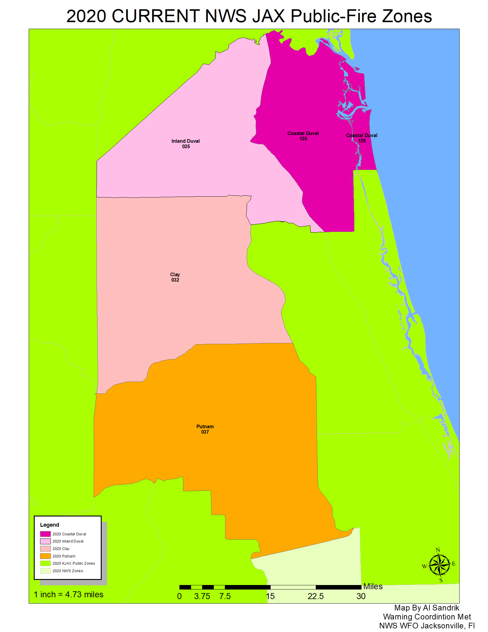
Figure 1 (outer left) depicts the current (2020) Public and Fire Weather Zone configuration for the three counties (Clay, Duval and Putnam) which will be reconfigured in 2021. Currently, Duval County is divided into a Coastal and an Inland Zone. In 2015 it was thought this configuration would serve the public and local officials well; however, since that time hurricanes Hermine, Matthew, Irma, Dorian, and Isaias have shown the importance of further subdividing of Duval County to better define impacts along the river system. Similar observations were made for both Clay and Putnam Counties.
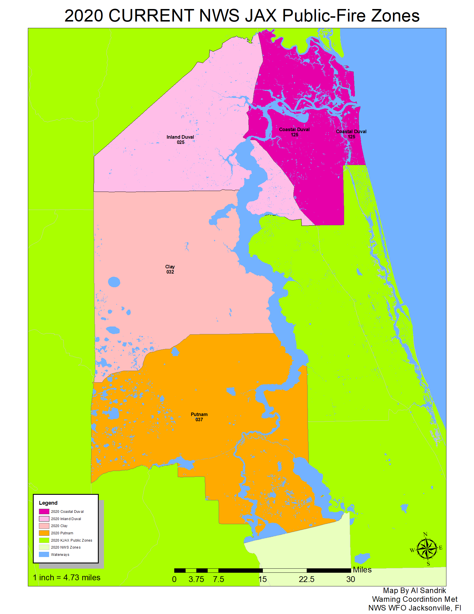
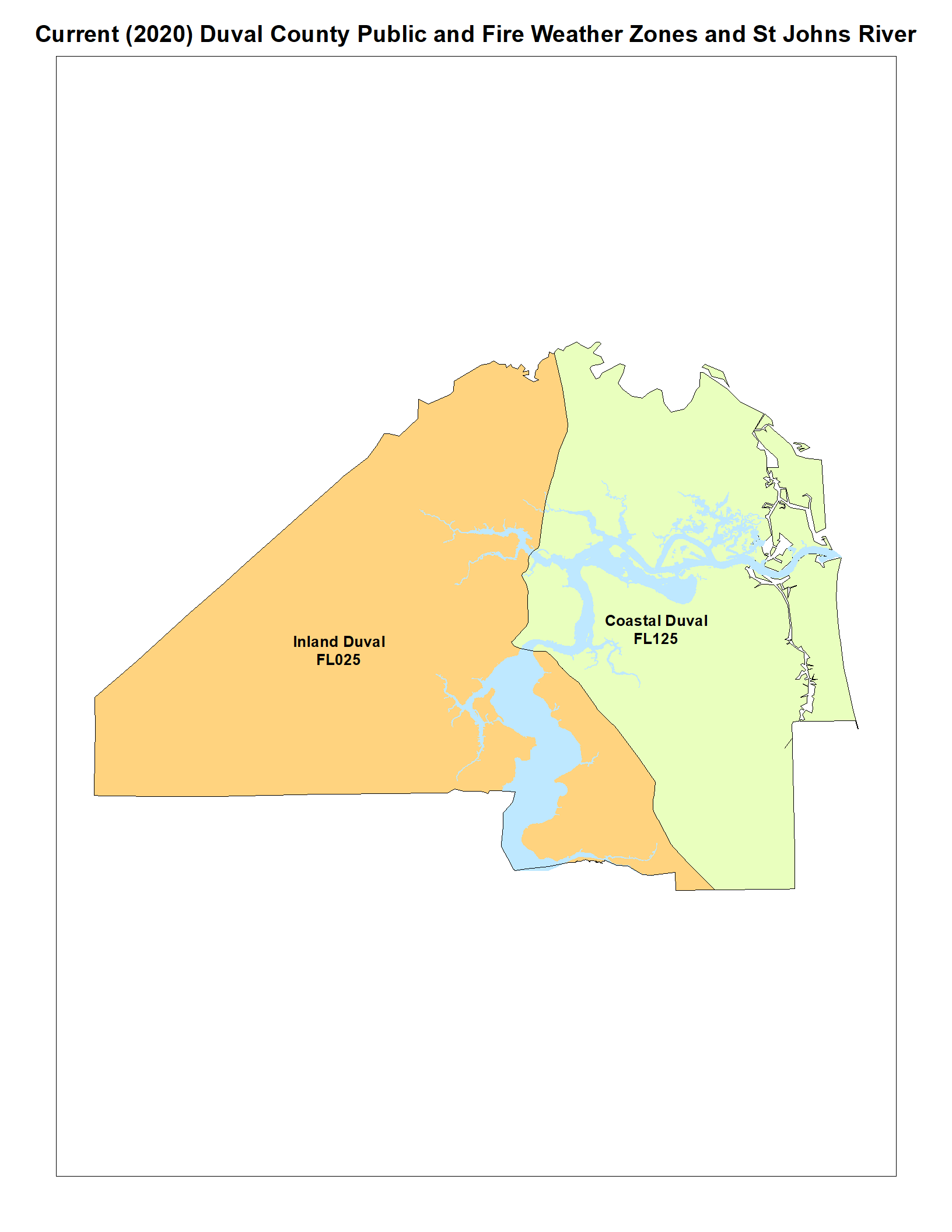
Figure 2 (inner left) illustrates the issue of the Trout and St Johns River systems extending into the current "Inland Duval County" Zone. Because of these features, it is necessary to issue higher-level wind products for ALL of "Inland Duval County" even though higher winds are only expected along a very narrow area near the river systems. Also, Tropical Storm and Hurricane Watches/Warnings were issued for all of Clay and Putnam counties when it was more desirable to restrict those products to the immediate river areas, where impacts are more likely.
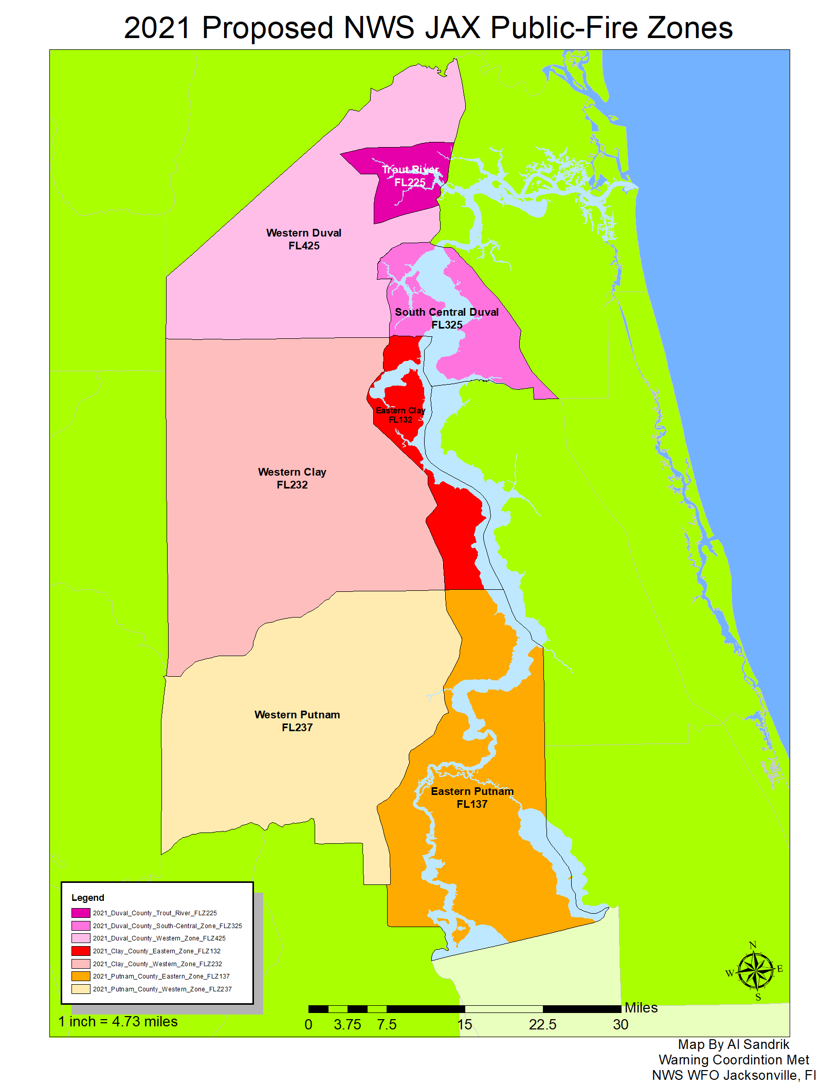
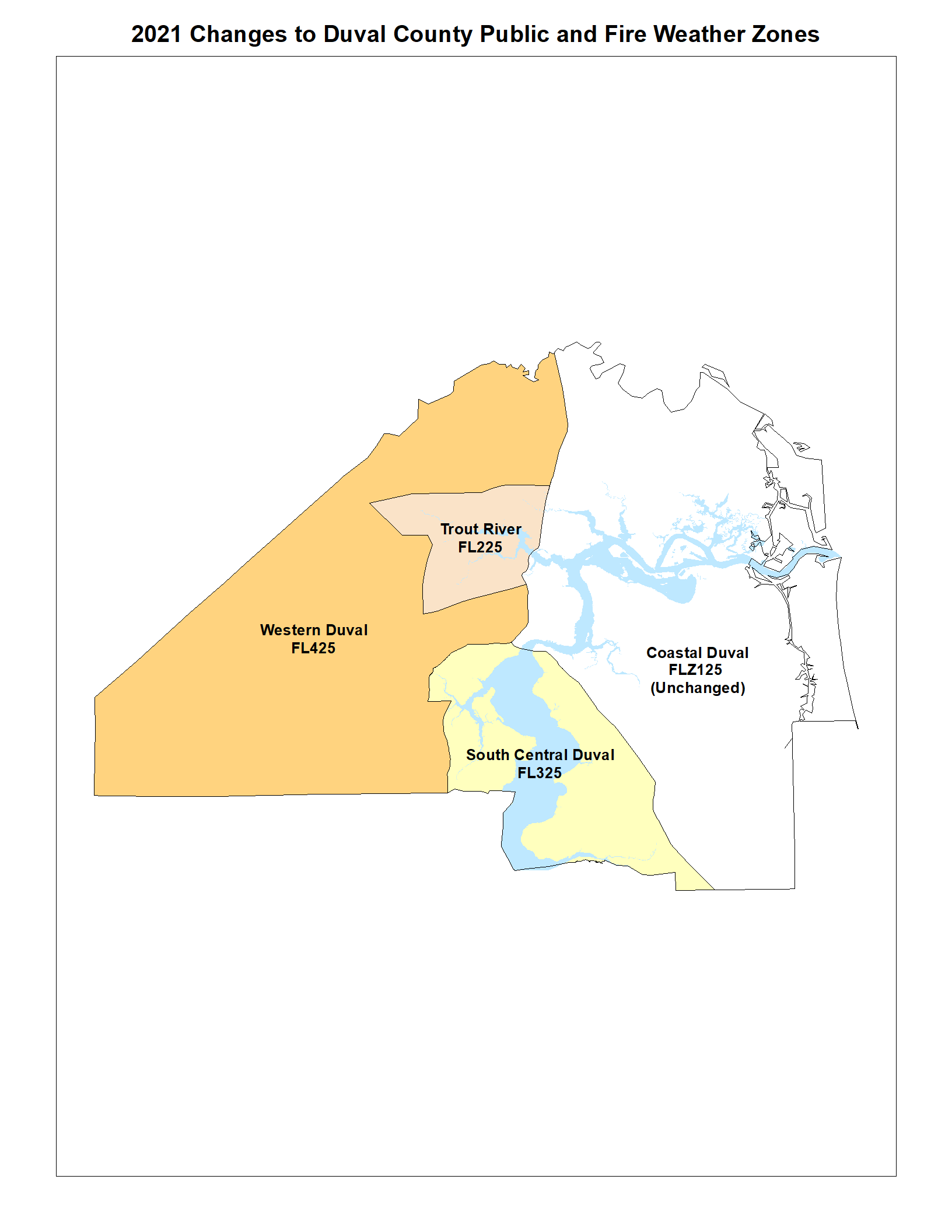
The new Zone configuration for the three counties is shown in Figure 3 (inner right). This realignment will better define the various river systems and thus allow NWS Jacksonville to better warn threatened areas without warning less threatened, more westward/inland locations.
Figure 4 (outer right)is the same as Figure 3 but it includes an overlay of the river systems for reference for the Zone changes.
|
Figure 5
|
Figure 6
|
Figure 7
|
||||
 |
 |
 |
||||
| Click to Enlarge Image | ||||||
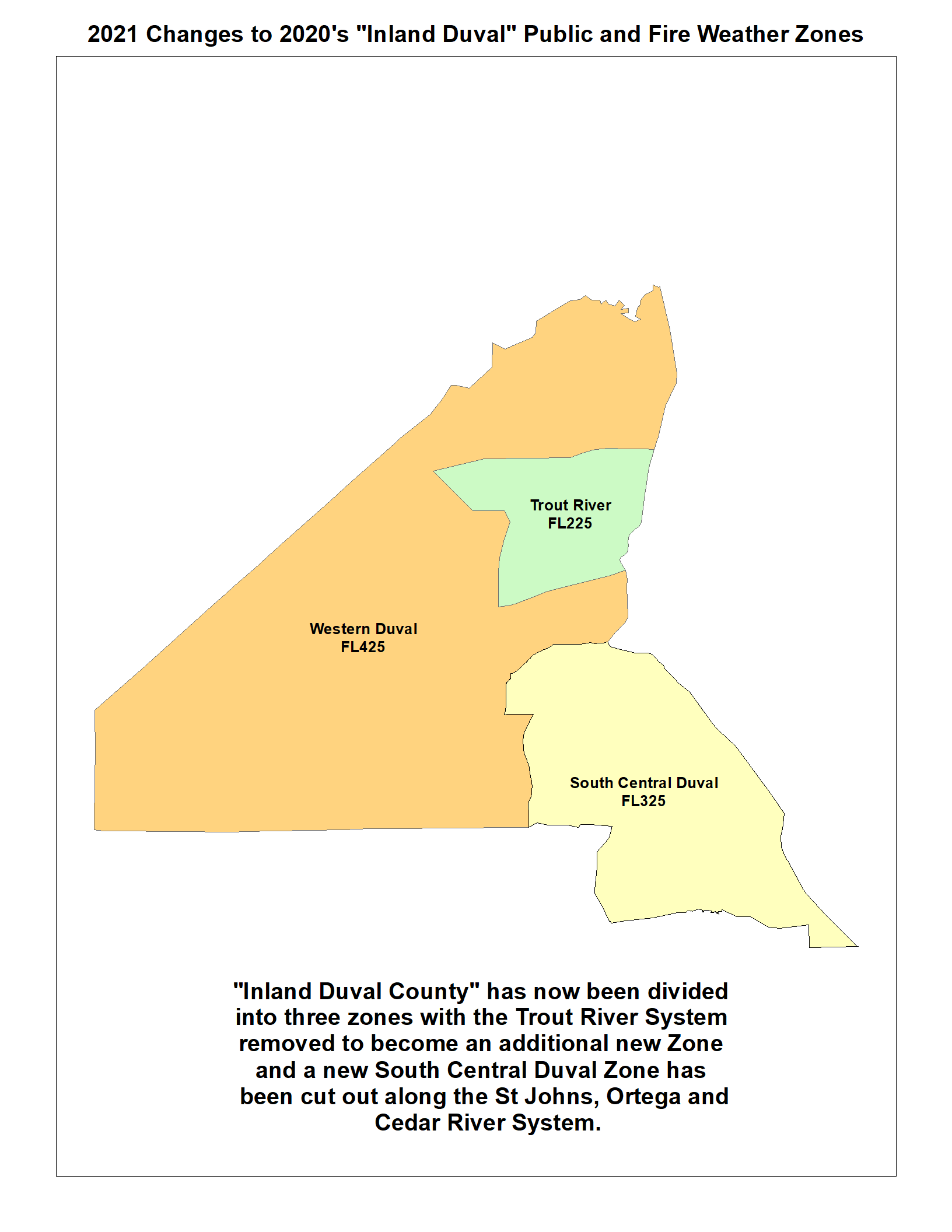
Figure 5 (left) zooms into the current, 2020, Zone configuration which will be changed for 2021. It includes the St. Johns and Trout Rivers so the reader can visualize how the river impacts the forecast, watch and warning products for the current "Inland Duval" Zone.
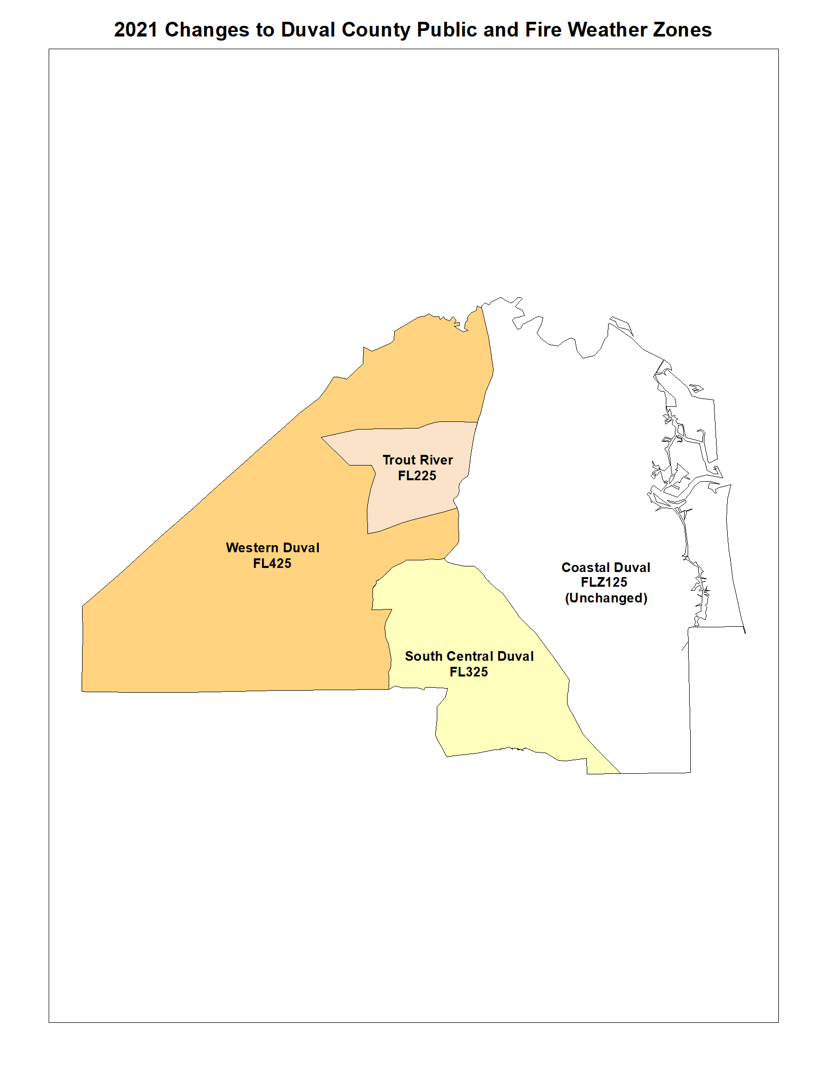
Figure 6 (middle) indicates the new Public and Fire Weather Zones with the St. Johns and Trout Rivers included. Note that the "Trout River" area will become a new Public/Fire weather Forecast Zone, and will be numbered FLZ225 . Meteorologically, this is due to the northeast flow events and coastal flooding on the Trout River system predominantly flowing into it directly from the St Johns River, resulting in significant impacts along this water body.
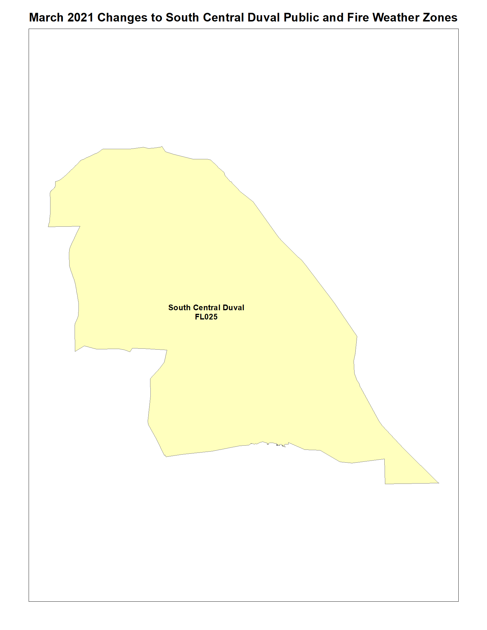
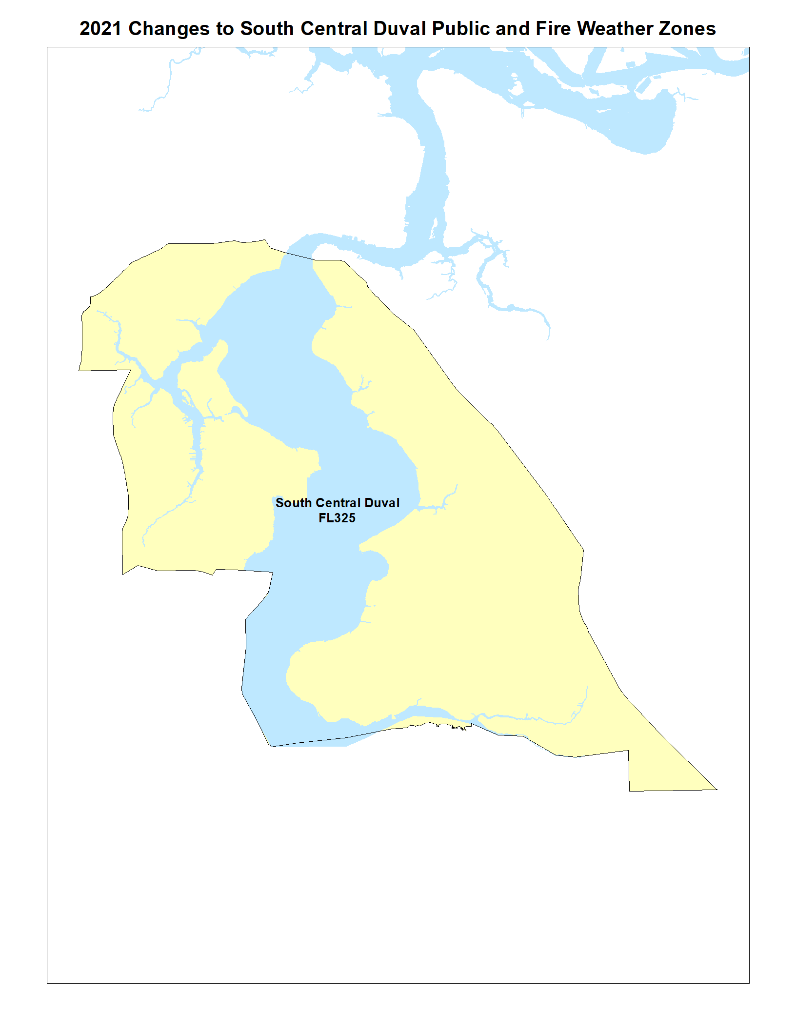
A second new "South Central Duval" Zone, to be numbered FLZ325 , has been created to account for the St Johns River south of Downtown Jacksonville and includes the Ortega and Cedar Rivers. This was necessary both due to the large open area of the river and the seiche effect the river is subject to during storms.
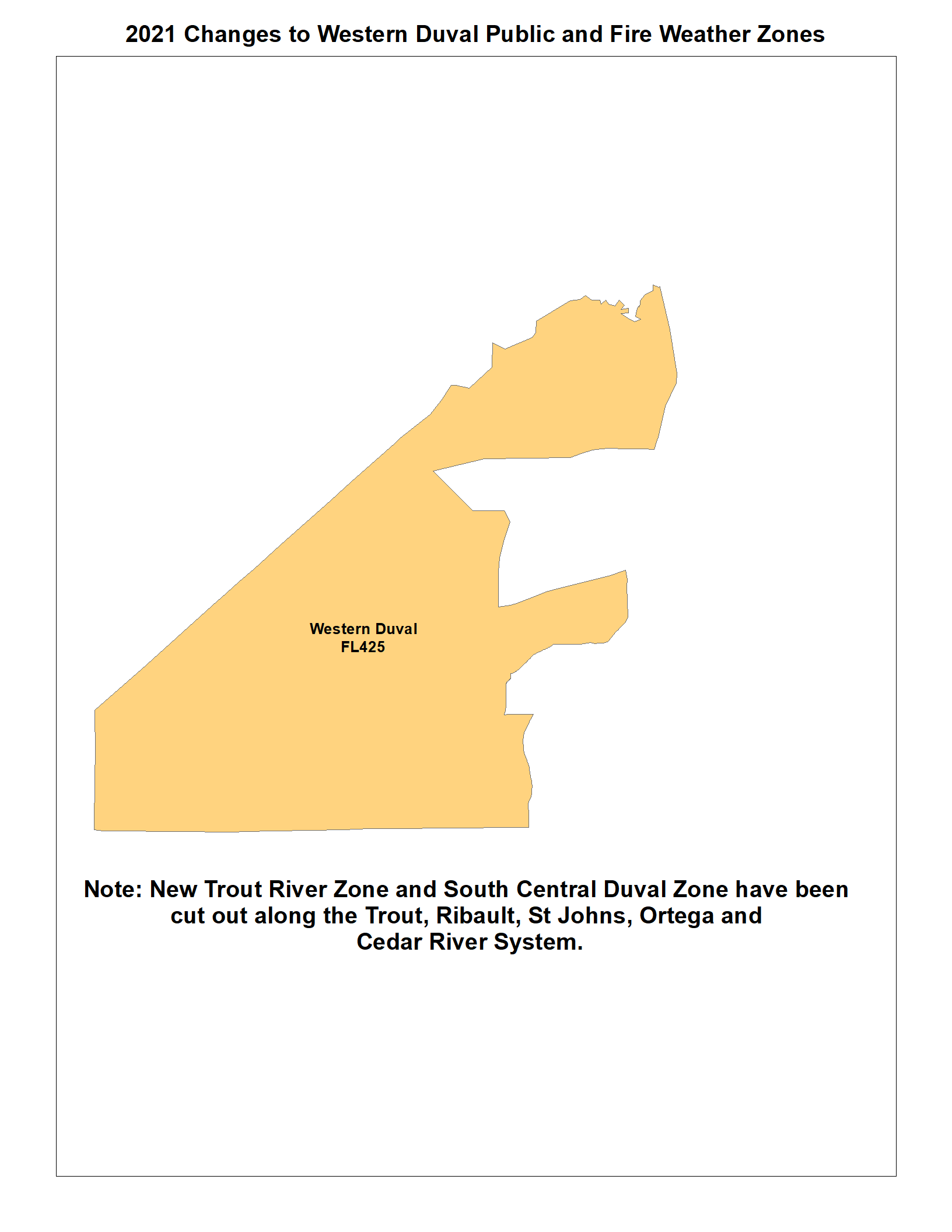
Finally, with the Trout and St Johns River systems removed, a description of "Western Duval" better describes the new geographic area west of the St Johns River and a new Zone number designation of FLZ425 was appropriate for that location. The coastal areas east of Interstate 95 will remain UNCHANGED and will retain the current zone number of FLZ125.
Figure 7 (right) depicts the changes made to the 2020/Current "Inland Duval" Zone. Note that the areas colored green and yellow have been removed from the former "Inland Duval" (now in 2021 "Western Duval" Zone).
|
Figure 8a
|
Figure 8b
|
|||
 |
 |
|||
| Click to Enlarge Image | ||||
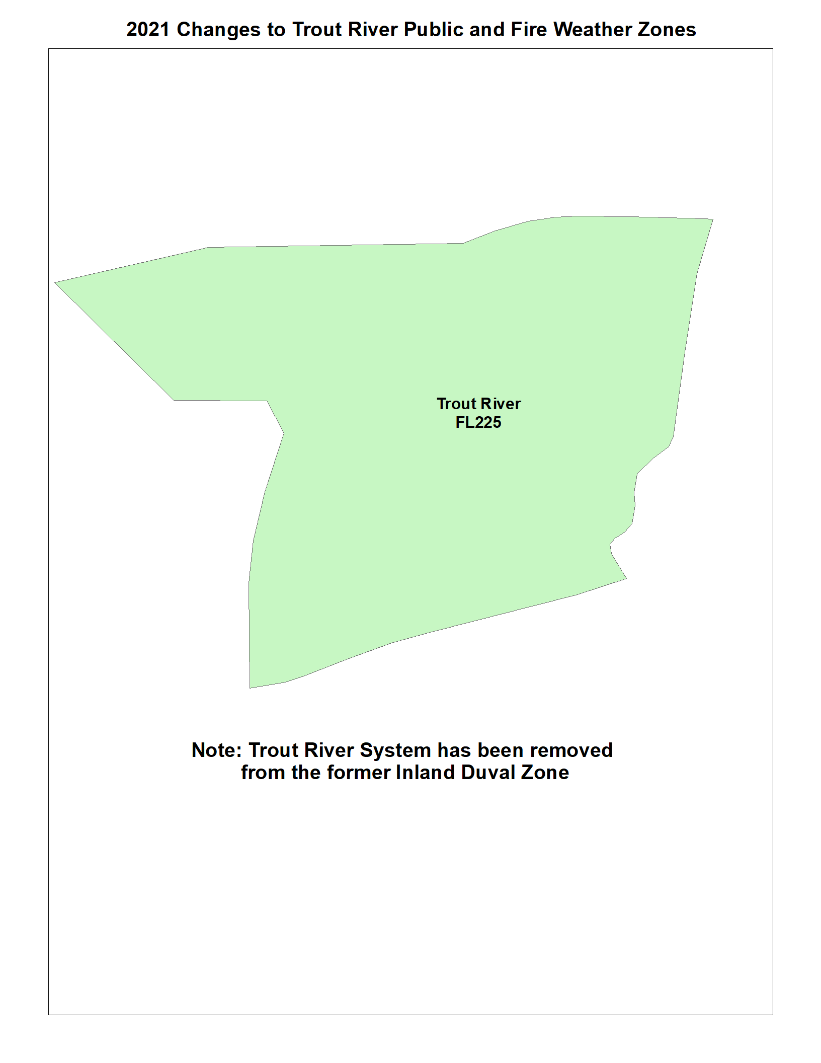
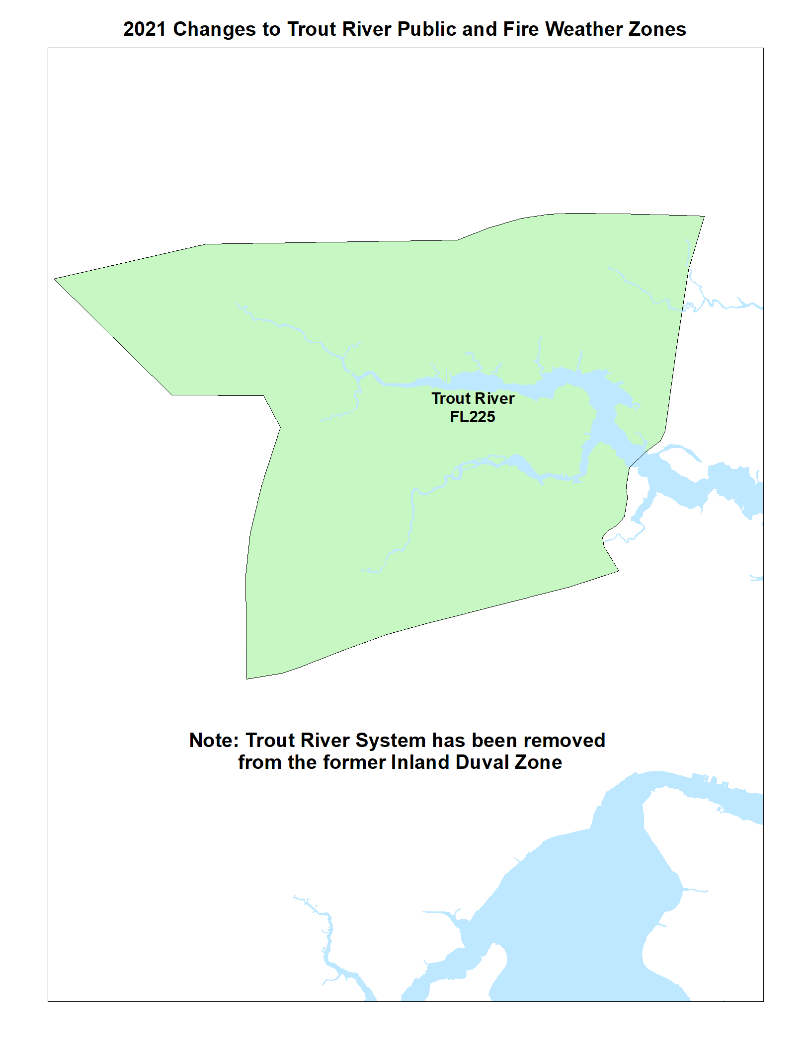
Figures 8a & 8b represent the new 2021 "Trout River" Public and Fire Weather Zone without (8a) and with the Trout River system (8b). The Trout River Zone includes both the Trout and Ribualt rivers. This new zone will be assaigned a new Zone Number FLZ225
|
Figure 9a
|
Figure 9b
|
|||
 |
 |
|||
| Click to Enlarge Image | ||||
Figures 9a & 9b depict the shape of the new 2021 "South Central Duval" Public and Fire Weather Zone (9a) which will enhance service to the river areas of Duval County south of the Fuller Warren Bridge (9b). This new Zone will be assigned a new Zone Number FLZ325
|
Figure 10
|
Figure 11
|
|
 |
 |
|
| Click to Enlarge Image | ||
Figure 10 (left) shows the reconfigured and renamed "Western Duval" Zone created by carving out the Trout and St Johns River systems from the former "Inland Duval" Zone. The Western Duval Zone will be assigned a new Zone Number of FLZ425 .
The Figure 11 ( right) illustrates the three changes to Duval County, without the St Johns River system.
|
Figure 12
|
Figure 13
|
Figure 14
|
||||
 |
.png) |
.png) |
||||
| Click to Enlarge Image | ||||||
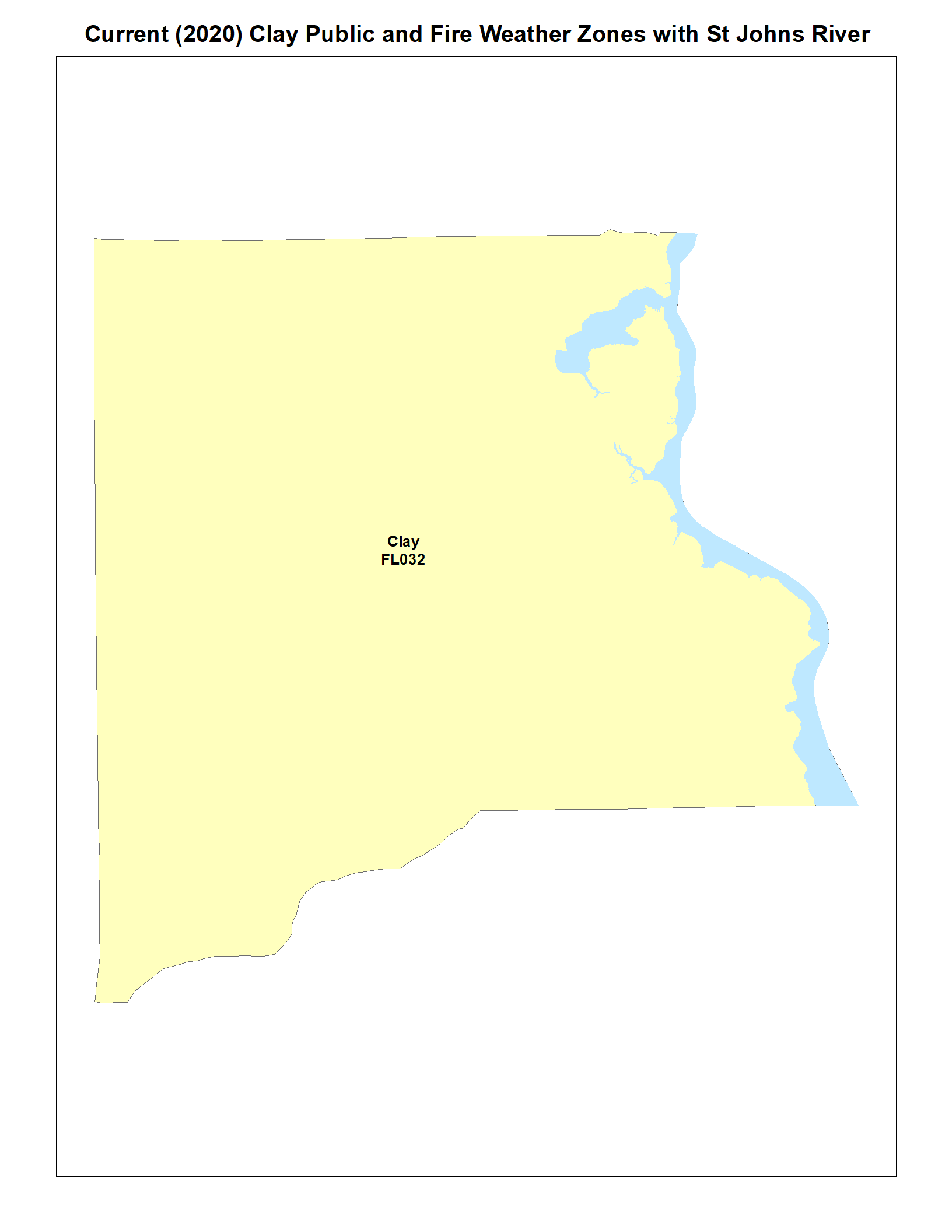
The changes to Clay County are illustrated in Figures 12 through 14 below. The division in Clay County is relatively straight forward along U.S. Highway 17 and the CSX Railroad line, but does extend northwest to Blanding Blvd northwest of Doctors Lake.
Following the same approach as with Duval above, Figure 12 (left) shows the 2020/current Zone configuration for Clay County with the St Johns River included. Note the narrow strip of the St Johns River in eastern Clay County necessitating the differentiation between the more eastern/riverfront portions of the county and the more western areas.
Figure 13 (middle) depicts the new 2021 Clay County Zone Configuration with the St Johns River included for reference. Clay County is now divided into an "Eastern Clay" Zone, assaigned a new Zone number of FLZ132 and a "Western Clay" Zone assaigned a new Zone number of FLZ232 .
The Figure 14 (right) illustrates the 2021 Clay County Zone configuration without the St Johns River.
|
Figure 15
|
Figure 16
|
Figure 17
|
||||
 |
.png) |
.png) |
||||
| Click to Enlarge Image | ||||||
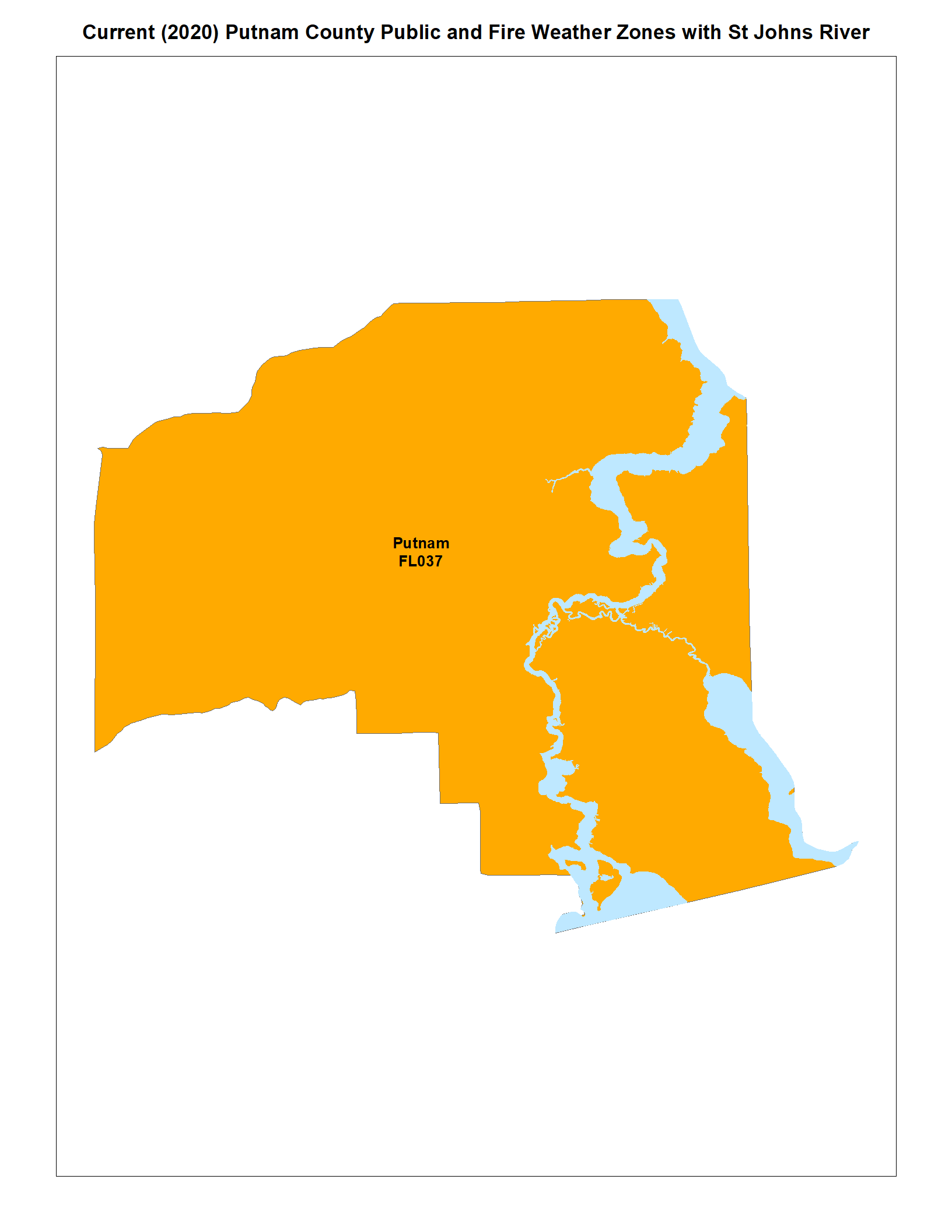
The Zone changes to Putnam County are illustrated in Figures 15 through 17. In general Putnam County is a bit more complicated with a broader St. Johns River system south of Federal Point necessitating a wider Zone. Also, much of the area near Dunns Creek, Satsuma, Crescent Lake, and The Locks is subject to tidal flooding and thus the " Eastern Putnam" Zone is larger than the " Eastern Clay" Zone. Conversely, the line used to split the county was much easier to define than Duval and was roughly along Florida State Road 19 from the southern portion of the county, through Palatka to the intersection with U.S. Highway 17 and then north on U.S. Highway 17 to the Clay County Line. The very southernmost portion of the Zone was adjusted west of State Road 19 to marry up with the Putnam County Line north of Marion County.
Following the same approach described above, Figure 15 (left) shows the 2020/current Zone configuration for Putnam County with the St. Johns River included. Note the wider, more extensive, strip of the St. Johns River system in Putnam County necessitating a broader approach to tropical cyclone winds and tidal flooding.
Figure 16 (middle) depicts the new 2021 Putnam County Zone configuration with the St Johns River included for reference. Putnam County is now divided into an "Eastern Putnam" Zone, assigned a new number of FLZ137 and a "Western Putnam" Zone assigned a new number of FLZ237
Figure 17 (right) illustrates the 2021 Putnam County Zone configuration without the St. Johns River system.
|
Figure 18
|
Figure 19
|
|||||
|
|
|
|||||
| Click to Enlarge Image | ||||||
Once again, for reference purposes, Figure 18 (right) shows all 2021 Zone changes for Clay, Duval and Putnam Counties and Figure 19 (right) shows the changes with the waterways overlayed.

