Overview
A dynamic storm system impacted northeast Florida during the pre-dawn hours of December 14, 2019. A broken squall line of supercells moved quickly east to northeast across Alachua, Putnam, St. Johns and Flagler counties with two prominent mesocyclones producing tornado touchdowns and wind damage from Micanopy south of Gainesville to Flagler Beach. Thankfully, there were no reports or injuries or deaths, but there were widespread reports of structural and tree damage.
 |
 |
| Overview of both tornado paths. | Loop of storm-relative velocity (left) and reflectivity (right) imagery from KJAX. |
Tornadoes:
|
Wauberg Lake Tornado
|
||||||||||||||||
|
Elkton Tornado
|
||||||||||||||||
|
Korona Tornado
|
||||||||||||||||
The Enhanced Fujita (EF) Scale classifies tornadoes into the following categories:
| EF0 Weak 65-85 mph |
EF1 Moderate 86-110 mph |
EF2 Significant 111-135 mph |
EF3 Severe 136-165 mph |
EF4 Extreme 166-200 mph |
EF5 Catastrophic 200+ mph |
 |
|||||
Environment
Synoptic Overview
On Friday, 13 December 2019, a warm front lifted and lingered across northeast Florida with surface dew points rising into the mid to upper 60s generally along and south of a line from St. Augustine to Gainesville. A strong upper level trough deepened across the central Gulf Coast region with a resultant surface low positioned over the northeast Gulf coast just south of Panama City that evening around 10 pm EST. As the upper level trough axis started to lift and becoming positively tilted overnight into 14 December, the surface low edge farther east northeast and tracked over southeast Georgia then offshore of the local Atlantic coast through 4 am EST. The corridor of unstable low-level air remained across our southern Florida zones with surface-based CAPE values rising into the 1000-1300 J/kg range per LAPS analysis while aloft strong directional (0-6 km) bulk shear under the trough axis increased to 50-60 kts. The phased low-level instability, plentiful deep layer moisture and strong dynamical lift under the upper low and just south of the surface low spawned a couple of persistent supercells with long-lived mesocyclones.
 |
 |
 |
| Figure 1: Radar imagery and surface front positions at 10 PM EST on 12/13/2019. | Figure 2: Radar imagery and SBCAPE analysis at 1 AM EST on 12/14/2019. | Figure 3: Radar imagery and SBCAPE analysis at 4 AM EST on 12/14/2019. |
 |
 |
 |
| Figure 4: Radar imagery and SBCAPE analysis at 5 AM EST on 12/14/2019. | Figure 5: Radar imagery and SBCAPE analysis at 6 AM EST on 12/14/2019. | Figure 6: Radar imagery and SBCAPE analysis at 7 AM EST on 12/14/2019. |
Mesoanalysis Perspective
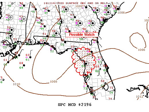
Mesoscale discussion 2196 (below, left) was sent at 12:38 AM EST on 12/14/2019. At that point, instability and shear were lacking over our area, but the warm front was approaching, with significant advection of warm, moist air into north-central Florida expected over the next few hours. Storms developing along/near the frontal boundary would pose a potential threat for damaging winds or a tornado.
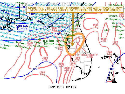
The next discussion (below, middle) was sent at 3:17 AM EST on 12/14/2019, a little over an hour ahead of our first tornado. Now, the instability axis (with SBCAPE around 1000 J/kg) was in north-central Florida, but just south/southwest of our area of responsibility. Deep layer (0-6 km) shear had risen to near 40 kts along the edge of the approaching front, with low level (0-1 km) shear of around 25 kts. With the moderate instability and strong low-level shear, the threat for discrete cells to produce a tornado was increasing and damaging straight-line winds remained a threat as well. Our first tornado would touch down about 40 minutes later on the western edge of Wauberg Lake.
The final discussion shown (below, right) was issued at 6:42 AM EST. By then, the storms had mostly exited our area of responsibility. There was, however, a continued threat to our south across central Florida, where instability was around 1500 J/kg and would continue to increase through the mid-morning hours. Deep layer shear continued to hang around 50 kts, and low-level shear around 30 kts, meaning discrete cells would still be the expected mode of convection, with tornadoes and wind still being the threat. In the end, no more tornadoes were reported on the 14th.
 |
 |
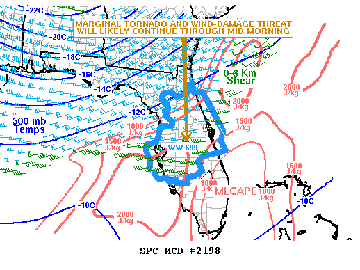 |
| SPC Mesoscale Discussion 2196 | SPC Mesoscale Discussion 2197 | SPC Mesoscale Discussion 2198 |
Climatological Significance of the December 14th, 2019 Tornado Event
Sea level pressures dropped to the 1002-1004 mb range just ahead of the tornadoes, reaching the top 20 event lowest sea level pressures for December at 5 climate sites in our area of responsibility. A pressure of 1001.5mb at Craig Field in Jacksonville, FL at 3:50 AM EST, which was the 9th lowest all-time record for the month of December (period of record in 1974-present). Jacksonville International Airport’s pressure dropped to 1002.5mb at 3:43 AM EST, which was a daily record minimum pressure for December 14th (period of record in 1871-present). Pressures at both St. Simon’s Island, GA and Alma, GA and dropped to 1002.9mb at 3:45 AM and 4:57 AM respectively, which were the 17th and 19th lowest pressures for the sites for the month of December (period of record for both is 1948-present). In Gainesville, FL, our closest climate site to the tornadoes, a minimum pressure of 1004.6 mb was reached at 3:39 AM EST, the 12th lowest sea level pressure there for the month of December (1973-present).
In addition to breaking into the 12th lowest pressure for the month, Gainesville reported heavy rainfall rates of 0.61” in 5 min (5th highest 5 min rainfall rate on record), 1.09” in 10 min (5th highest 10 min rainfall rate), and 1.25” in 15 min (9th highest 15 min rainfall rate on record). Those rainfall rates are all the latest records in the year for rainfall rates and are more like our summer sea-breeze storms than your typical cold front system!
SPC Forecast Data
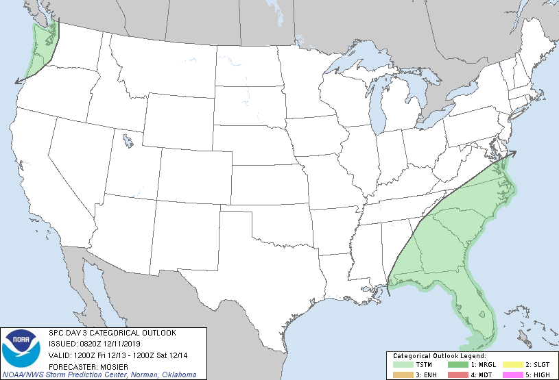
The Days 3, 2, and 1 outlooks issued by the Storm Prediction Center leading up to the event.
 |
 |
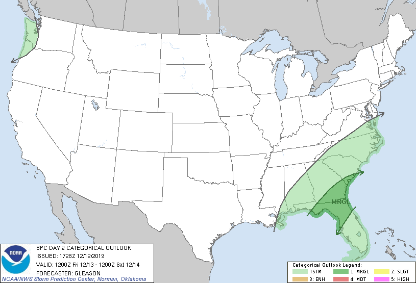 |
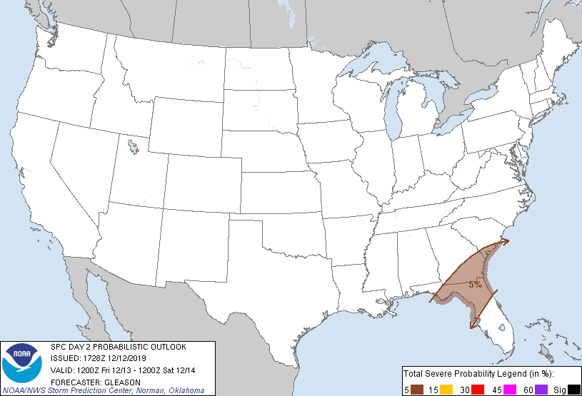 |
| SPC Day 3 Categorical Outlook | SPC Day 3 Probabilistic Outlook | SPC Day 2 Categorical Outlook | SPC Day 2 Probabilistic Outlook |
 |
 |
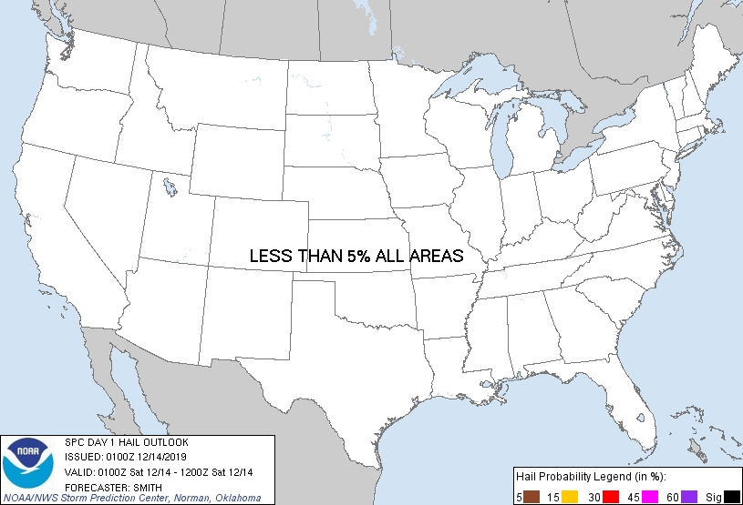 |
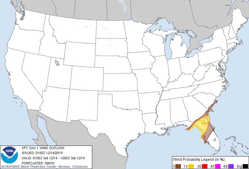 |
| SPC Day 1 Categorical Outlook | SPC Day 1 Tornado Outlook | SPC Day 1 Hail Outlook | SPC Day 1 Wind Outlook |
Photos & Video
Collection of Tweets for the December 14th, 2019 Tornado Event
Dec 14, 2019 Tornadoes - Curated tweets by NWSJacksonville |
Media use of NWS Web News Stories is encouraged! Please acknowledge the NWS as the source of any news information accessed from this site. |
 |