Overview
This is the event webpage for the winter storm and lake effect snow event December 8th-9th, 2017. A listing of all the specific snow totals can be found under the "Snow Reports" link. We also included some photos and videos that were submitted to us, and these can be found under the "photos & video" tab. Thanks for sending us your reports, photos, and videos!
Snow
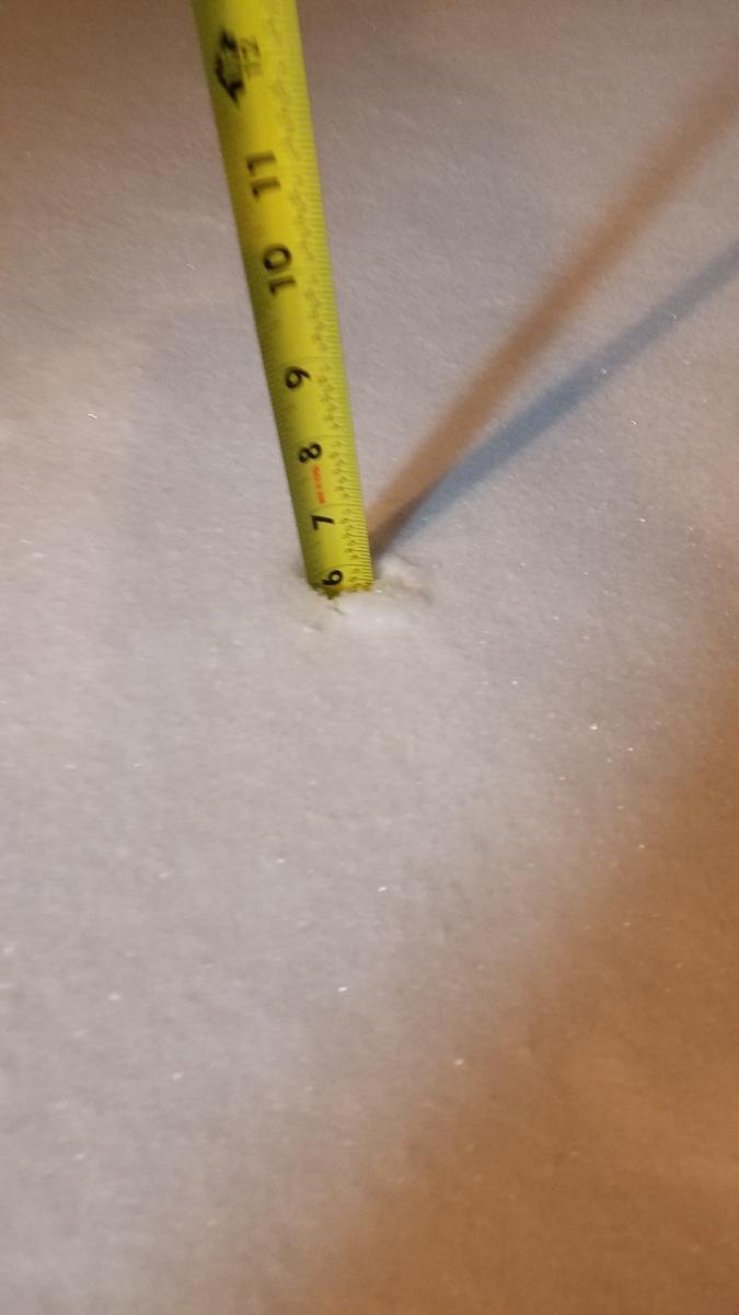
A listing of all the specific snow totals can be found under the "Snow Reports" tab. Thanks to those that submitted reports to us throughout the event.
 |
| Smoothed snowfall contours with reports overlaid. Note at least a general coating was observed across most of the area as a result of system snow. However, the lake effect packed the stronger punch delivering higher snow totals closer to the lake. |
Winds
Winds gusted up to around 40 mph near the lakeshore during the event. A Gale warning was in effect for Lake Michigan from December 8th into the 9th. Waves built up to 12-16 feet, and a lakeshore flood advisory was issued for potential beach erosion and minor lakeshore flooding. The wind reports from the event are listed below. These were sent out via our public information statement at 10:18 PM EST December 9th, 2017.
Public Information Statement
National Weather Service Northern Indiana
1018 PM EST Sat Dec 9 2017

...24 hour peak Wind Reports ending at 1015 PM EST...

Location                     Speed     Time/Date       Lat/Lon

...Indiana...

...Cass County...
Logansport/cass Cnty Ap      31 MPH    0435 PM 12/09   40.71N/86.37W

...Grant County...
Grant County Municipal Apt   38 MPH    0455 PM 12/09   40.48N/85.68W
3 NW Upland                  32 MPH    0520 PM 12/09   40.50N/85.55W

...La Porte County...
1 W Michigan City            41 MPH    0134 PM 12/09   41.71N/86.90W
2 E Trail Creek              39 MPH    0215 PM 12/09   41.70N/86.82W
La Porte                     38 MPH    0155 PM 12/09   41.57N/86.73W

...Miami County...
1 SSW Grissom Afb            33 MPH    0420 PM 12/09   40.65N/86.15W
3 W Amboy                    30 MPH    0436 PM 12/09   40.59N/85.98W
1 S Macy                     30 MPH    0520 PM 12/09   40.94N/86.13W

...St. Joseph County...
2 SE Mishawaka               36 MPH    0455 PM 12/09   41.65N/86.13W

...Starke County...
2 ESE Brems                  36 MPH    0315 PM 12/09   41.33N/86.66W

...White County...
White Cnty Ap                31 MPH    0455 PM 12/09   40.71N/86.77W

...Michigan...

...Berrien County...
Saint Joseph                 35 MPH    0700 PM 12/09   42.10N/86.49W

Observations are collected from a variety of sources with varying
equipment and exposures. We thank all volunteer weather observers
for their dedication. Not all data listed are considered official.
Photos & Video:
Thanks to those who submitted photos and videos to us during the event!
Photos
 |
 |
 |
 |
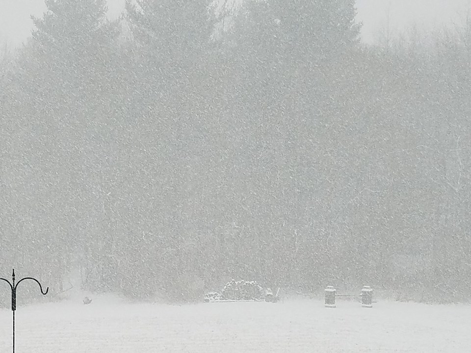
| Photo by Carol White Janik. Michigan City, IN on 12/9/17. | Photo by Chris Kuliczkowski. Chesterton, IN in Porter County, IN. Near zero visibility. | Photo by Coach Jen. Osceola, IN December 9th, 2017. | Photo by Coach Jen. Osceola, IN December 9th, 2017. |
 |
 |
 |
 |
| Photo by Twitter User Z06jen. Leesburg at 1:40 pm ET 12/9/17. | Photo by Geddy Davis from Columbus Grove, OH. Taken 12/9/17. | Photo by T. Teitge. Hamlet, IN | Photo by Alex Nofzinger. Taken in between Payne and Antwerp, OH. 10:50 AM ET 12/9/17 |
 |
 |
 |
 |
| Photo by Kimberly Anne Hibbard in Sturgis, MI on 12/9/17. | Photo by Mark Yohn. Georgetown, IN on 12/9/17. | Photo by Denise Nichols from the LaPorte, IN area on 12/9/17. | Photo by Kimberly Anne Hibbard in Sturgis, MI on 12/9/17. |
Videos
The video below was sent to us by Kathryn Zolman from Warsaw, Indiana. She took this video around 2:40 pm on December 9th, 2017.
Radar:
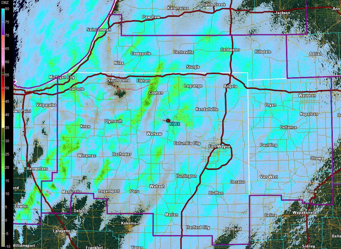
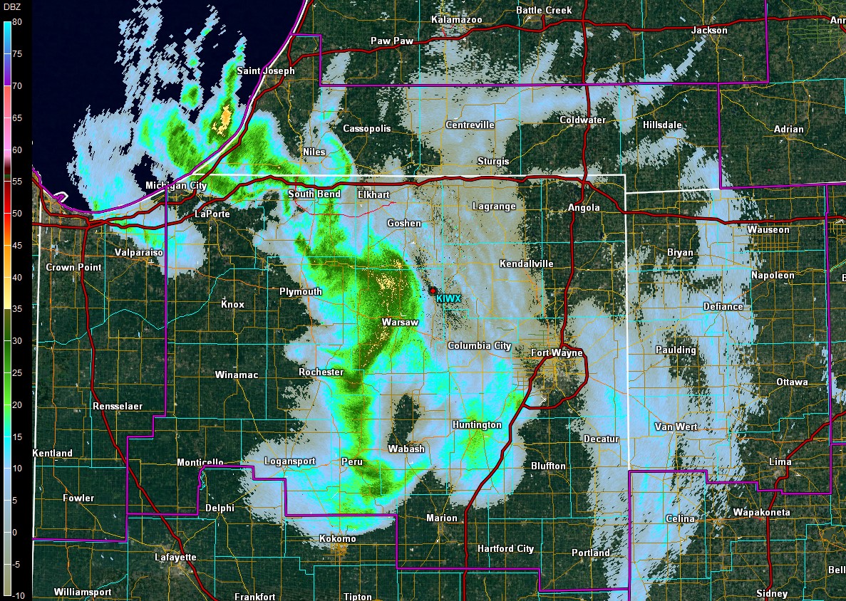
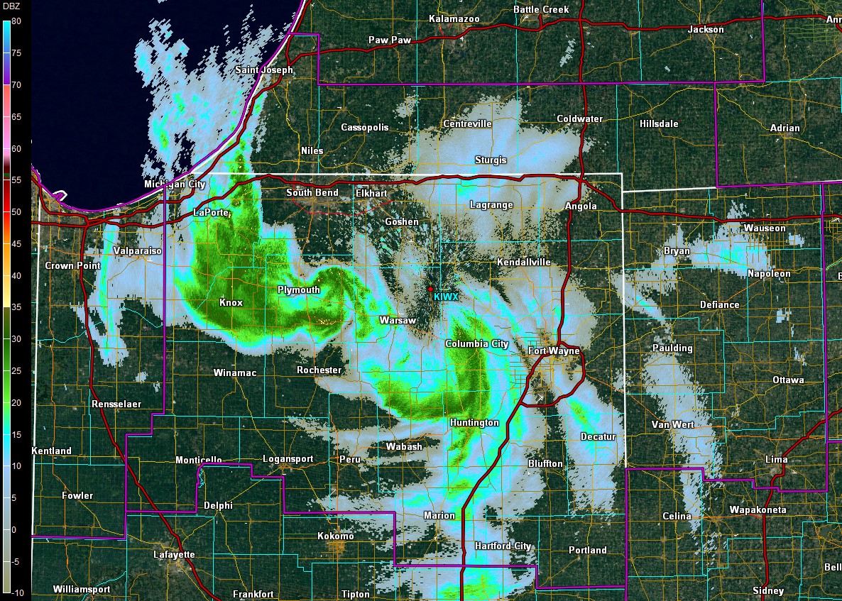
Below are a few radar images selected to show the overall system snow, the mesovortices, and the lake effect bands that impacted the area. Underneath each image is a description.
 |
 |
 |
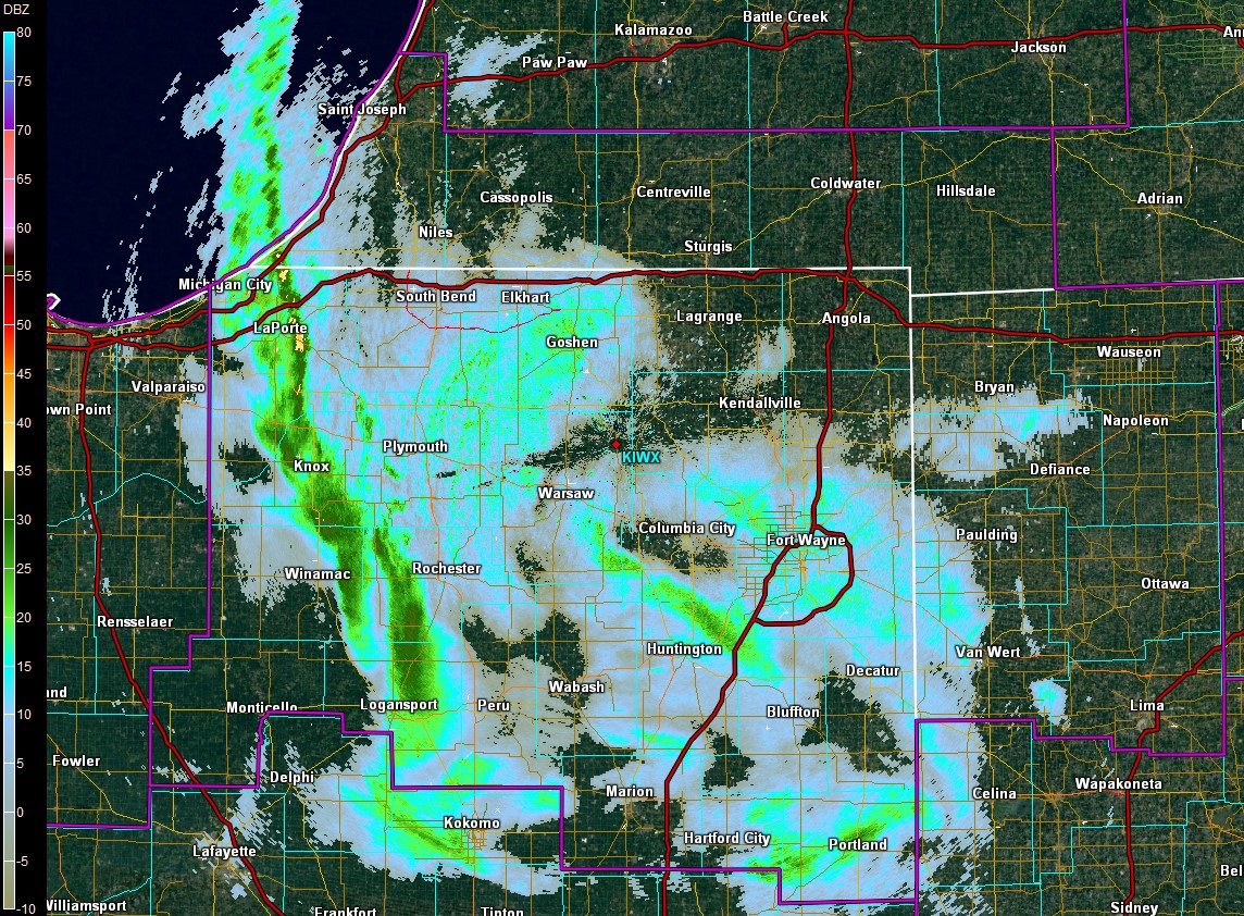 |
| The system started out with widespread system snow before changing over to lake effect during the afternoon. Image from 1045z (5:45AM local) | Depiction of the first mesovortex close to the radar at 1812z (1:12PM Local). Note both mesovortices had over 40 dBZ of reflectivity. | Both mesovortices over land at 1920z (2:20 PM Local). Note the more western mesovortex had reflectivities in the upper 30s of dBZ. | The Lake effect band that followed the mesovorices around 21z (4PM local). |
Snow Reports
These are the final reports we have of snowfall measurements at each location.
Public Information Statement
National Weather Service Northern Indiana
1246 PM EST Sun Dec 10 2017

...Updated Storm Total Snowfall Reports...

Location                     Amount    Time/Date       Lat/Lon

...Indiana...

...Adams County...
Decatur 1n                   1.0 in    0830 AM 12/10   40.85N/84.93W

...Allen County...
Fort Wayne 4.1 NE            1.7 in    0700 AM 12/10   41.12N/85.09W
2 W Woodburn                 1.4 in    0700 AM 12/10   41.12N/84.91W
Fort Wayne International Ap  1.2 in    0654 PM 12/09   40.98N/85.19W

...Blackford County...
Hartford City                0.8 in    0700 AM 12/10   40.46N/85.37W
(kc9dcr)hartford City 0.3 SS 0.3 in    0700 AM 12/10   40.45N/85.37W

...De Kalb County...
Auburn                       1.1 in    0600 AM 12/10   41.37N/85.05W
2 ESE Helmer                 1.0 in    1210 PM 12/09   41.51N/85.14W

...Elkhart County...
2 WSW Goshen                 3.0 in    0700 AM 12/10   41.56N/85.88W
Middlebury                   2.5 in    0908 AM 12/09   41.67N/85.71W
Nappanee                     2.5 in    1259 PM 12/09   41.45N/85.98W

...Fulton County...
2 NW Rochester               3.7 in    1000 PM 12/09   41.09N/86.23W
Rochester                    3.0 in    0700 AM 12/10   41.07N/86.21W
Akron                        2.5 in    0445 PM 12/09   41.04N/86.03W

...Grant County...
Fairmount                    1.0 in    0700 AM 12/10   40.42N/85.64W
3 NW Shamrock Lakes          0.8 in    0700 AM 12/10   40.45N/85.45W
Marion 2n                    0.8 in    0700 AM 12/10   40.58N/85.66W
Hanfield                     0.5 in    0600 AM 12/10   40.60N/85.59W

...Huntington County...
Huntington                   1.7 in    0700 AM 12/10   40.88N/85.51W

...Jay County...
1 SSW Blaine                 0.5 in    0700 AM 12/10   40.39N/85.06W

...Kosciusko County...
Silver Lake                  3.5 in    0506 PM 12/09   41.08N/85.89W
Leesburg                     3.2 in    0600 AM 12/10   41.33N/85.85W
1 NNW Warsaw                 3.0 in    1000 PM 12/09   41.25N/85.86W
Syracuse                     2.5 in    0506 PM 12/09   41.43N/85.75W
Northern Indiana Wfo         2.5 in    1200 AM 12/10   41.36N/85.70W
1 E Claypool                 2.0 in    0700 AM 12/10   41.13N/85.86W

...La Porte County...
Laporte                      9.7 in    0100 AM 12/10   41.61N/86.73W
1 SW La Porte                7.2 in    0800 AM 12/10   41.59N/86.73W
2 WSW Springville            6.7 in    0700 AM 12/10   41.67N/86.78W
Michigan City                2.0 in    0951 AM 12/09   41.71N/86.88W

...Marshall County...
2 WNW Culver                 10.0 in   0808 PM 12/09   41.23N/86.46W
1 SW Plymouth                2.0 in    1215 PM 12/09   41.34N/86.33W

...Noble County...
1 SSW Kimmel                 2.0 in    1027 AM 12/09   41.38N/85.55W
Kendallville                 0.8 in    0700 AM 12/10   41.44N/85.26W

...Pulaski County...
Monterey                     5.0 in    0507 PM 12/09   41.16N/86.48W

...St. Joseph County...
1 E Indian Village           7.6 in    1034 PM 12/09   41.72N/86.21W
South Bend                   6.2 in    1200 AM 12/10   41.70N/86.25W
Georgetown                   6.1 in    1000 PM 12/09   41.73N/86.23W
2 NNW Teegarden              6.0 in    1100 PM 12/09   41.49N/86.39W
South Bend International Ap  4.9 in    0654 PM 12/09   41.71N/86.32W
1 WNW Roseland               4.5 in    1208 PM 12/09   41.72N/86.27W
2 NE Gulivoire Park          4.1 in    0236 PM 12/09   41.64N/86.22W
Osceola                      3.5 in    0506 PM 12/09   41.67N/86.08W

...Starke County...
Hamlet                       7.0 in    0506 PM 12/09   41.38N/86.58W
Knox                         6.5 in    0507 PM 12/09   41.30N/86.62W

...Steuben County...
Angola                       1.6 in    0700 AM 12/10   41.64N/84.99W
1 W Golden Lake              1.6 in    0800 AM 12/10   41.60N/85.09W
2 ENE Crooked Lake           0.9 in    0545 AM 12/10   41.70N/84.99W
1 E Hamilton                 0.7 in    0700 AM 12/10   41.53N/84.89W

...Wabash County...
North Manchester             1.0 in    1010 AM 12/09   41.00N/85.77W
Wabash                       1.0 in    0600 AM 12/10   40.80N/85.83W

...Wells County...
2 NW Reiffsburg              2.0 in    0553 PM 12/09   40.67N/85.17W
Bluffton                     1.2 in    0700 AM 12/10   40.73N/85.16W

...Michigan...

...Berrien County...
1 SE Stevensville            8.1 in    0750 AM 12/10   41.99N/86.51W
1 WNW Buchanan               8.0 in    0600 AM 12/10   41.84N/86.39W
Saint Joseph                 7.8 in    0743 PM 12/09   42.10N/86.49W
2 W Niles                    6.0 in    0800 AM 12/10   41.84N/86.30W
Sawyer                       4.0 in    0506 PM 12/09   41.89N/86.59W

...Branch County...
Coldwater St School          2.0 in    1200 AM 12/10   41.96N/84.99W

...Hillsdale County...
Litchfield                   2.4 in    0630 AM 12/10   42.05N/84.75W
Hillsdale                    2.0 in    0800 AM 12/10   41.94N/84.64W

...St. Joseph County...
Three Rivers                 3.0 in    1102 AM 12/09   41.94N/85.63W

...Ohio...

...Allen County...
Delphos                      2.0 in    1242 AM 12/10   40.84N/84.34W
1 WSW Slabtown               1.3 in    0700 AM 12/10   40.77N/84.08W

...Fulton County...
1 NW Wauseon                 1.5 in    1230 PM 12/09   41.56N/84.16W

...Henry County...
Napoleon                     1.9 in    0800 AM 12/10   41.39N/84.14W
3 SE Mcclure                 1.2 in    0700 AM 12/10   41.33N/83.91W

...Putnam County...
1 N Ottawa                   1.1 in    0700 AM 12/10   41.04N/84.04W
Columbus Grove               1.0 in    0156 PM 12/09   40.92N/84.06W
Ottawa                       1.0 in    0330 PM 12/09   41.02N/84.04W

Observations are collected from a variety of sources with varying
equipment and exposures. We thank all volunteer weather observers
for their dedication. Not all data listed are considered official.

$$
Environment
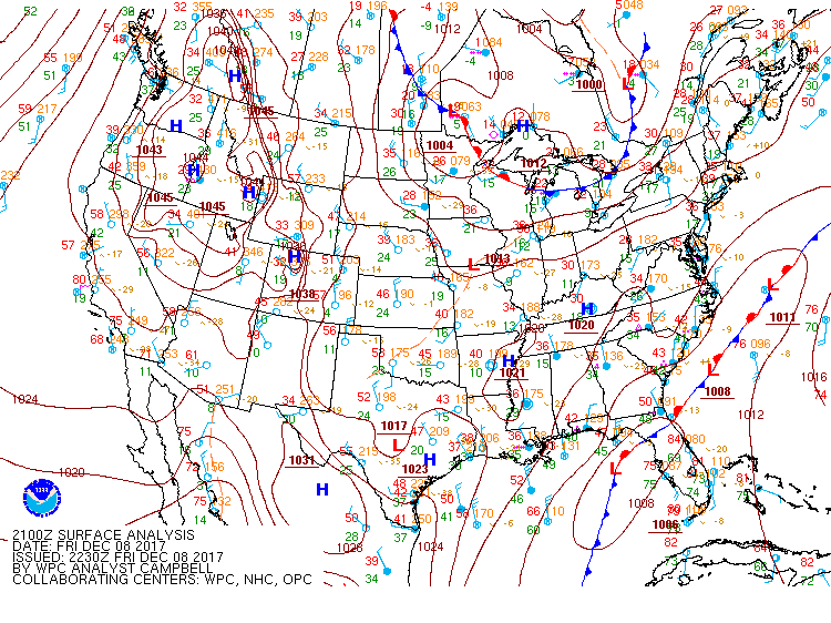
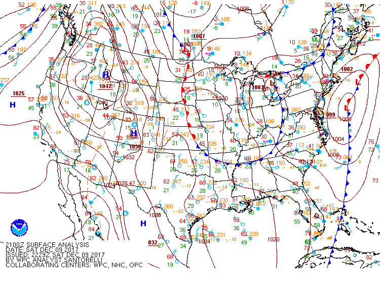
A clipper system brought widespread snow to much of the area December 8th-9th, 2017. In it's wake, lake effect snow developed in north-northwest wind favored regions. A summary of the environmental conditions is below.
Surface Weather Pattern
Depiction of the clipper system as it moved across our forecast area.
 |
 |
 |
| Figure 1: WPC Surface Analysis: 4 pm EST December 8th, 2017 | Figure 2: WPC Surface Analysis: 7 pm EST December 8th, 2017 | Figure 3: WPC Surface Analysis 1 am EST December 9th, 2017 |
 |
 |
 |
| Figure 4: WPC Surface Analysis 4 am EST December 9th, 2017 | Figure 5: WPC Surface Analysis 7 am EST December 9th, 2017 | Figure 6: WPC Surface Analysis 10 am EST December 9th, 2017 |
 |
 |
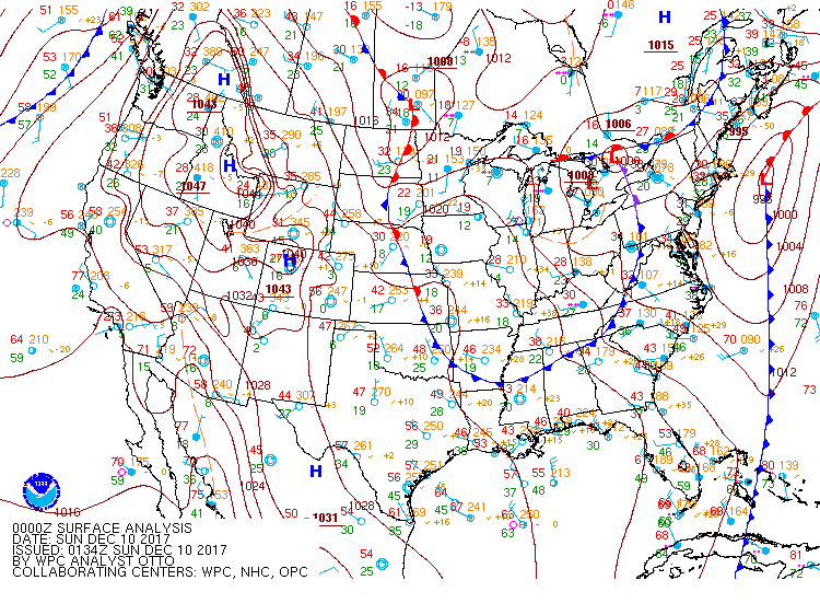 |
| Figure 7: WPC Surface Analysis 1 pm EST December 9th, 2017 | Figure 8: WPC Surface Analysis 4 pm EST December 9th, 2017 | Figure 9: WPC Surface Analysis 7 pm EST December 9th, 2017 |
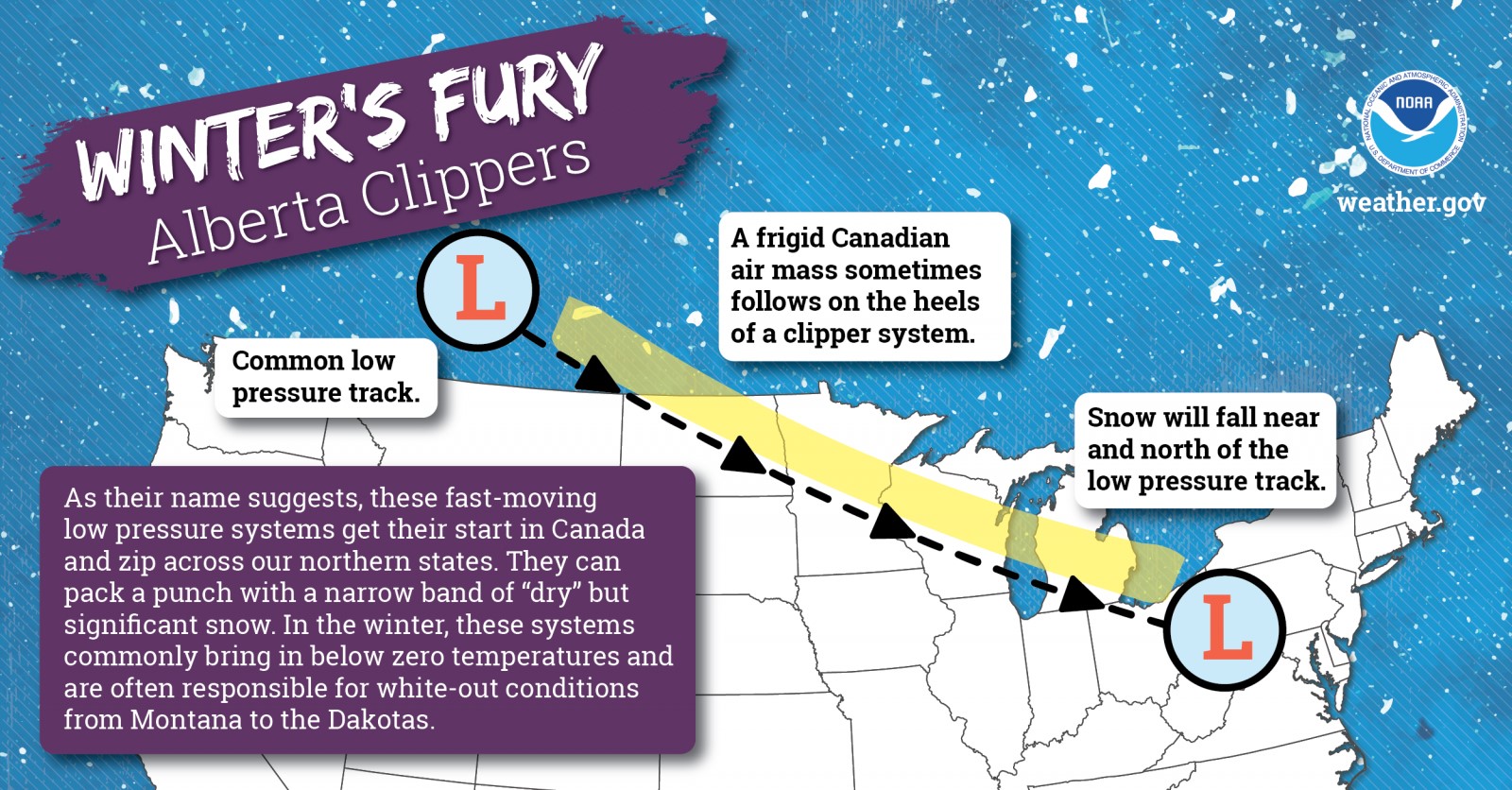 |
| Figure 10: Clipper systems originate in Canada (usually Alberta) and drop southeastward across our area. If it comes from Saskatchewan it can sometimes be called a "Saskatchewan Screamer" instead. Compare this to the surface analysis maps in Fig. 1-9 above. Graphic courtesy of NOAA NWS. |
Lake Effect Snow: Ingredients
Lake effect snow is common across the Great Lakes region during the late fall and winter. Lake Effect snow occurs when cold air, often originating from Canada, moves across the open waters of the Great Lakes. As the cold air passes over the unfrozen and relatively warm waters of the Great Lakes, warmth and moisture are transferred into the lowest portion of the atmosphere. The air rises, clouds form and grow into narrow band that produces 2 to 3 inches of snow per hour or more. Wind direction is a key component in determining which areas will receive lake effect snow. Heavy snow may be falling in one location, while the sun may be shining just a mile or two away in either direction. The physical geography of the land and water is also important. National Weather Service meteorologists consider these factors as well as others when forecasting lake effect snow.
For this event, winds were southwest ahead of the clipper system, and then shifted rapidly to the north-northwest, gusting up to 35-40 mph at times near Lake Michigan. This led to the development of lake effect snow, especially for N-NW wind favored regions.
To read more about lake effect snow on the Great Lakes, visit our winter webpage.
 |
 |
 |
| Snow Squall Parameter (low level moisture, wind speed and instability) showing the intense snowfall associated with the aforementioned mesovortices. Image time is 19z or 2PM local. | Strong low level lapse rates (instability) associated with those mesovortices around 18z or 1PM local. | Strong convergence (red contours) associated with the lake effect band that ended the storm. (22z or 5PM local) |
 |
| Low level winds and cold air providing the necessary ingredients for snow. (18z or 2PM local) |
 |
Media use of NWS Web News Stories is encouraged! Please acknowledge the NWS as the source of any news information accessed from this site. |
 |