Overview
On January 3rd, 2021 a narrow, intense band of snow formed along a line from Fulton County, IN to Hillsdale County, MI. It produced snow totals in the 3 to 5 inch range, with a few locally higher amounts. The county hardest hit was Kosciusko County, with the highest reports of 4-6" around Lake Wawasee (Syracuse, IN). Click the tabs below to view the summary of the snowfall totals, photos, and radar imagery from the event. Thank you to those who submitted reports and pictures, we appreciate it!
Snow
Here are the snowfall reports from the event as of Jan. 3rd, 2021.
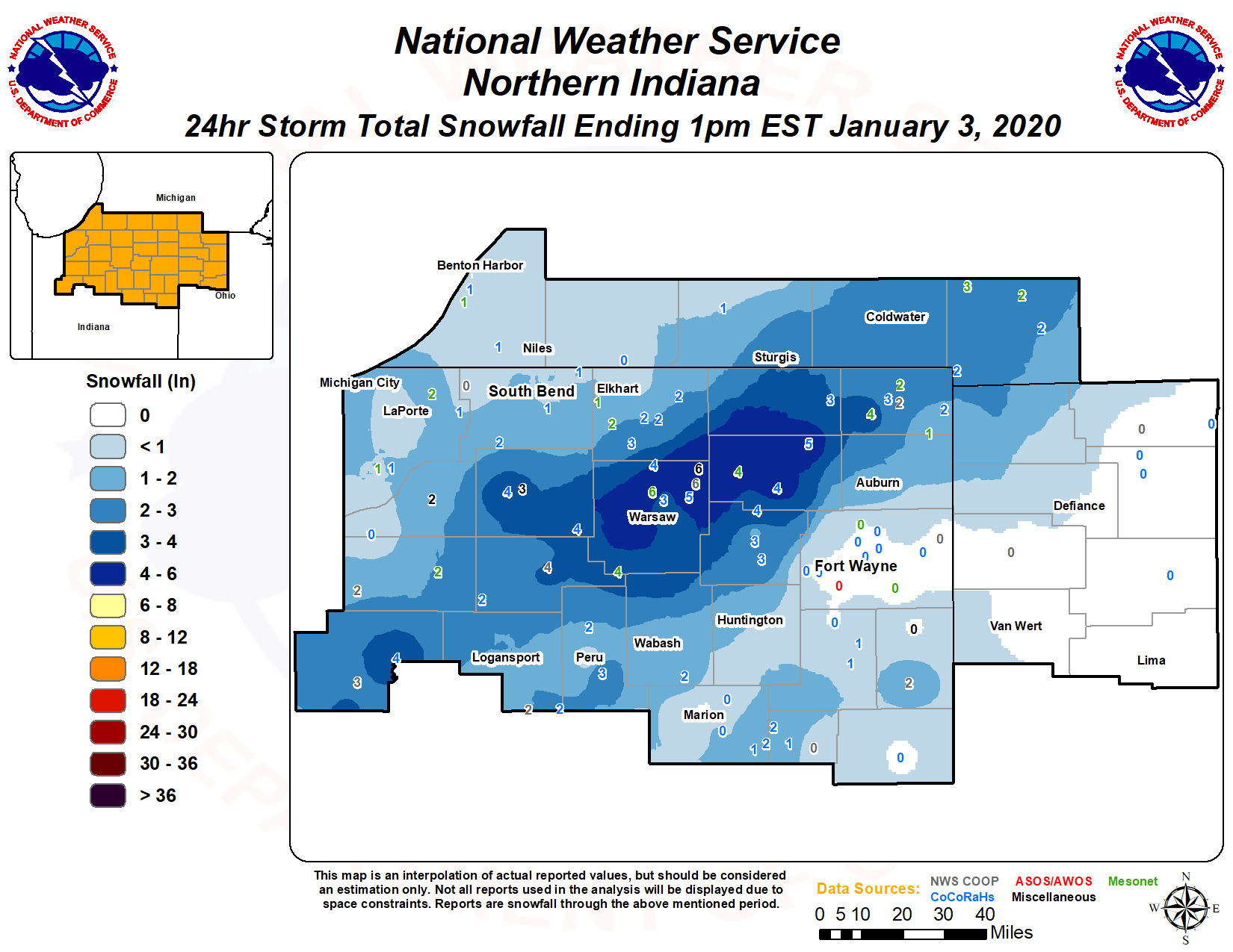 ...SNOWFALL REPORTS THROUGH JANUARY 3RD, 2021...
Those counties who received the most are in red and orange.
LOCATION AMOUNT TIME/DATE LAT/LON
...INDIANA...
...SNOWFALL REPORTS THROUGH JANUARY 3RD, 2021...
Those counties who received the most are in red and orange.
LOCATION AMOUNT TIME/DATE LAT/LON
...INDIANA...
...INDIANA...

...ADAMS COUNTY...
1.8 E BERNE                  1.5 IN    0800 AM 01/04   40.67N/84.92W

...ALLEN COUNTY...
HUNTERTOWN 2.6 ESE           0.5 IN    0800 AM 01/03   41.21N/85.12W
FORT WAYNE 9.3 W             0.5 IN    0700 AM 01/03   41.05N/85.31W
FORT WAYNE 4.1 NE            0.4 IN    0700 AM 01/04   41.12N/85.09W
FORT WAYNE 7.1 WSW           0.3 IN    0800 AM 01/04   41.05N/85.27W
WOODBURN 3 N                 0.2 IN    0700 AM 01/04   41.16N/84.85W
FORT WAYNE 9.0 NNE           0.2 IN    1100 AM 01/03   41.19N/85.07W
FORT WAYNE 2.6 NE            0.2 IN    0700 AM 01/04   41.10N/85.11W
WOODBURN 2.8 WSW             0.1 IN    0700 AM 01/04   41.12N/84.91W

...BLACKFORD COUNTY...
(KA9VIS) HARTFORD CITY 0.7 N 1.5 IN    0700 AM 01/03   40.46N/85.37W

...CASS COUNTY...
LOGANSPORT 2.2 NNW           2.5 IN    0800 AM 01/04   40.78N/86.37W
(WA9TTB)GALVESTON 1.0 ESE    2.1 IN    0700 AM 01/03   40.57N/86.17W
LOGANSPORT 0.6 E             1.8 IN    0800 AM 01/04   40.75N/86.35W
YOUNG AMERICA                1.6 IN    0800 AM 01/04   40.57N/86.33W

...DE KALB COUNTY...
ASHLEY                       6.9 IN    0900 AM 01/04   41.51N/85.13W
WATERLOO                     3.5 IN    0945 AM 01/03   41.43N/85.02W
0.6 S GARRETT                2.0 IN    0700 AM 01/03   41.34N/85.13W

...ELKHART COUNTY...
NAPPANEE 4.8 NE              2.6 IN    0700 AM 01/03   41.50N/85.92W
WAKARUSA 2.4 NNE             2.3 IN    0700 AM 01/04   41.57N/85.99W
GOSHEN 2.8 NW                2.0 IN    0930 AM 01/03   41.60N/85.88W
GOSHEN 1.2 SW                1.8 IN    0700 AM 01/03   41.57N/85.85W
GOSHEN 2.3 WNW               1.5 IN    0800 AM 01/03   41.59N/85.88W
GOSHEN 0.3 NE                1.3 IN    0800 AM 01/03   41.58N/85.83W
ELKHART 4.8 SW               1.0 IN    0800 AM 01/03   41.64N/86.04W

...FULTON COUNTY...
ROCHESTER                    4.0 IN    0700 AM 01/04   41.07N/86.21W
KEWANNA                      3.5 IN    0900 AM 01/03   41.02N/86.41W
AKRON                        3.0 IN    0650 AM 01/03   41.04N/86.02W
ROCHESTER 2.4 NW             2.5 IN    0700 AM 01/04   41.09N/86.23W
KEWANNA 4.9 SSW              1.9 IN    0830 AM 01/04   40.95N/86.45W

...GRANT COUNTY...
GAS CITY                     2.5 IN    0948 AM 01/03   40.49N/85.61W
(KD9CQQ)UPLAND 0.7 ENE       2.0 IN    0700 AM 01/03   40.47N/85.50W
(KC9QCJ) SHAMROCK LAKES 3.0  1.7 IN    0700 AM 01/03   40.45N/85.45W
UPLAND 2.4 SSE               0.8 IN    0700 AM 01/04   40.43N/85.50W
MARION 5.6 NE                0.5 IN    0700 AM 01/04   40.60N/85.59W
2.2 N MARION                 0.5 IN    0700 AM 01/04   40.58N/85.66W

...HUNTINGTON COUNTY...
HUNTINGTON                   1.8 IN    0749 AM 01/03   40.88N/85.51W

...KOSCIUSKO COUNTY...
1 NE LAKE WAWASEE            6.1 IN    0900 AM 01/03   41.41N/85.69W
NORTH WEBSTER 2.3 N          5.7 IN    0700 AM 01/04   41.36N/85.70W
LEESBURG 0.1 WNW             5.5 IN    0700 AM 01/04   41.33N/85.85W
1 NW TIPPECANOE LAKE         5.3 IN    1000 AM 01/03   41.34N/85.78W
MONOQUET                     5.0 IN    0900 AM 01/03   41.28N/85.86W
LEESBURG 6.7 ESE             4.8 IN    0700 AM 01/04   41.31N/85.72W
TIPPECANOE LAKE              4.5 IN    0830 AM 01/03   41.33N/85.75W
CLAYPOOL                     4.5 IN    1100 AM 01/03   41.13N/85.88W
WINONA LAKE 0.9 SW           4.3 IN    0630 AM 01/03   41.21N/85.83W
1 WSW WARSAW                 4.2 IN    1000 AM 01/03   41.24N/85.86W
2 ESE WINONA LAKE            4.0 IN    0848 AM 01/03   41.21N/85.79W
3 S BEAVER DAM LAKE          4.0 IN    0930 AM 01/03   41.05N/85.97W
WARSAW 1.4 N                 3.6 IN    0740 AM 01/03   41.26N/85.85W
MILFORD 0.9 N                3.4 IN    0700 AM 01/03   41.42N/85.85W
WARSAW 4.6 NNE               3.2 IN    0845 AM 01/03   41.30N/85.81W
WARSAW 3.7 E                 3.2 IN    0815 AM 01/03   41.23N/85.78W
WARSAW 3.0 SE                3.0 IN    0800 AM 01/03   41.21N/85.80W

...LA PORTE COUNTY...
ROLLING PRARIE               2.0 IN    0900 AM 01/03   41.67N/86.62W
WANATAH 4.4 ESE              1.3 IN    0900 AM 01/04   41.41N/86.81W
MILL CREEK 1.9 NNE           0.9 IN    0800 AM 01/04   41.61N/86.52W
HANNA 1.1 E                  0.9 IN    0800 AM 01/04   41.41N/86.76W
LA PORTE 1.6 SW              0.5 IN    0800 AM 01/03   41.59N/86.73W

...LAGRANGE COUNTY...
LAGRANGE 9.9 E               3.0 IN    0800 AM 01/03   41.65N/85.23W

...MARSHALL COUNTY...
1.2 W PLYMOUTH               3.4 IN    0800 AM 01/03   41.34N/86.34W

...MIAMI COUNTY...
PERU 4.6 SSE                 2.7 IN    0600 AM 01/03   40.70N/86.02W
1 SSE BUNKER HILL            2.5 IN    1130 AM 01/03   40.64N/86.09W
DENVER 1.3 NE                2.0 IN    0700 AM 01/03   40.88N/86.06W
DENVER 0.5 SSE               2.0 IN    0700 AM 01/04   40.86N/86.07W
0.8 NW PERU                  0.1 IN    0745 AM 01/04   40.76N/86.07W

...NOBLE COUNTY...
ALBION 2.9 S                 5.1 IN    0900 AM 01/03   41.35N/85.42W
KENDALLVILLE 4.5 NW          5.0 IN    0700 AM 01/04   41.50N/85.31W
ALBION 3.7 S                 4.5 IN    0930 AM 01/04   41.34N/85.42W
KIMMEL                       4.0 IN    0800 AM 01/03   41.40N/85.55W

...PULASKI COUNTY...
FRANCESVILLE                 2.4 IN    0800 AM 01/03   40.98N/86.89W
WINAMAC                      2.0 IN    0800 AM 01/03   41.05N/86.60W

...ST. JOSEPH COUNTY...
WALKERTON 5.7 ENE            2.1 IN    0730 AM 01/04   41.50N/86.39W
SOUTH BEND 4.5 SE            1.4 IN    0900 AM 01/03   41.62N/86.22W
MISHAWAKA 3.9 ENE            1.4 IN    0730 AM 01/04   41.68N/86.10W
1 S ROSELAND                 0.8 IN    0716 AM 01/03   41.70N/86.25W
GRANGER 1.8 ENE              0.7 IN    0700 AM 01/04   41.75N/86.11W
NEW CARLISLE                 0.5 IN    0730 AM 01/03   41.71N/86.50W

...STARKE COUNTY...
1.0 NW KNOX                  1.5 IN    0800 AM 01/03   41.31N/86.63W

...STEUBEN COUNTY...
HUDSON 4.6 N                 3.8 IN    0715 AM 01/04   41.60N/85.09W
HUDSON                       3.4 IN    0830 AM 01/03   41.53N/85.08W
2 E SALEM CENTER             3.3 IN    1000 AM 01/03   41.59N/85.11W
ORLAND                       3.0 IN    0715 AM 01/03   41.73N/85.17W
CLEAR LAKE                   3.0 IN    1100 AM 01/03   41.74N/84.83W
ANGOLA 1.7 WNW               3.0 IN    0700 AM 01/04   41.65N/85.03W
2 E NEVADA MILLS             2.8 IN    0830 AM 01/03   41.73N/85.05W
ANGOLA                       2.4 IN    0630 AM 01/04   41.64N/84.99W
ANGOLA 8.8 ESE               2.0 IN    0900 AM 01/03   41.62N/84.83W
ANGOLA 4.1 N                 1.6 IN    0545 AM 01/04   41.70N/84.99W

...WABASH COUNTY...
LA FONTAINE 1.1 NW           1.5 IN    0700 AM 01/03   40.68N/85.74W
WABASH 1.2 SSW               1.3 IN    0600 AM 01/03   40.78N/85.83W

...WELLS COUNTY...
BLUFFTON 0.9 SE              1.0 IN    0800 AM 01/03   40.73N/85.16W
CRAIGVILLE 2.7 NW            0.7 IN    0800 AM 01/04   40.80N/85.13W
OSSIAN 2.4 W                 0.4 IN    0800 AM 01/03   40.87N/85.21W

...WHITE COUNTY...
MONTICELLO 0.9 E             3.5 IN    0700 AM 01/03   40.75N/86.75W
5.6 N BADGER GROVE           3.3 IN    0600 AM 01/03   40.67N/86.95W

...WHITLEY COUNTY...
2 WNW ETNA                   4.8 IN    1000 AM 01/03   41.28N/85.61W
COLUMBIA CITY 7.4 N          4.1 IN    0800 AM 01/03   41.26N/85.50W
TRI-LAKES 3.0 N              3.7 IN    0745 AM 01/04   41.26N/85.49W
COLUMBIA CITY 5.4 N          3.0 IN    0800 AM 01/03   41.24N/85.49W
COLUMBIA CITY 4.6 S          2.6 IN    0600 AM 01/04   41.09N/85.47W
COLUMBIA CITY 1.5 NNW        1.2 IN    0500 AM 01/04   41.18N/85.49W

...MICHIGAN...

...BERRIEN COUNTY...
BUCHANAN 1.3 WNW             3.5 IN    0600 AM 01/04   41.84N/86.39W
STEVENSVILLE 1.7 SSE         2.7 IN    0700 AM 01/04   41.99N/86.51W
STEVENSVILLE                 1.0 IN    0723 AM 01/03   42.01N/86.53W
SHOREHAM 2.0 SE              1.0 IN    0800 AM 01/04   42.03N/86.49W
NILES 2.7 W                  0.8 IN    0800 AM 01/04   41.84N/86.30W
ST. JOSEPH 1.5 SSE           0.2 IN    0700 AM 01/04   42.08N/86.48W

...HILLSDALE COUNTY...
JONESVILLE 5.9 ENE           2.1 IN    0730 AM 01/04   42.01N/84.56W
MONTGOMERY 1.9 SSE           2.0 IN    0800 AM 01/04   41.75N/84.79W
OSSEO 2.7 NE                 1.8 IN    0930 AM 01/04   41.90N/84.49W
OSSEO                        1.2 IN    0800 AM 01/03   41.89N/84.54W

...ST. JOSEPH COUNTY...
STURGIS                      3.0 IN    0830 AM 01/03   41.80N/85.42W
THREE RIVERS 2.4 NE          1.0 IN    0700 AM 01/04   41.97N/85.60W
0.7 S THREE RIVERS           1.0 IN    0700 AM 01/03   41.93N/85.63W

...OHIO...

...ALLEN COUNTY...
LIMA 2.7 NE                  0.5 IN    0700 AM 01/04   40.77N/84.08W

...PUTNAM COUNTY...
OTTAWA 1.0 N                 0.4 IN    0700 AM 01/04   41.04N/84.04W

OBSERVATIONS ARE COLLECTED FROM A VARIETY OF SOURCES WITH VARYING
EQUIPMENT AND EXPOSURES. WE THANK ALL VOLUNTEER WEATHER OBSERVERS
FOR THEIR DEDICATION. NOT ALL DATA LISTED ARE CONSIDERED OFFICIAL.
$$
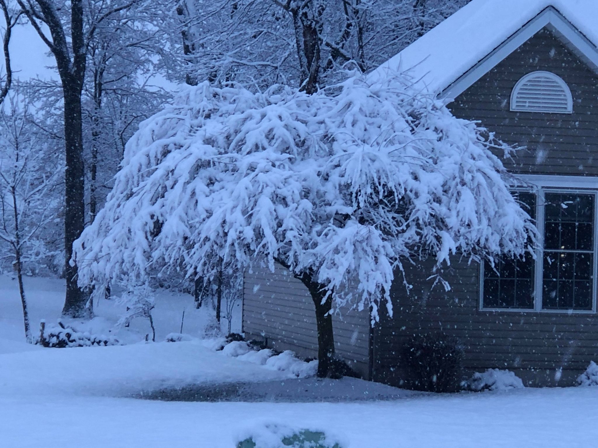
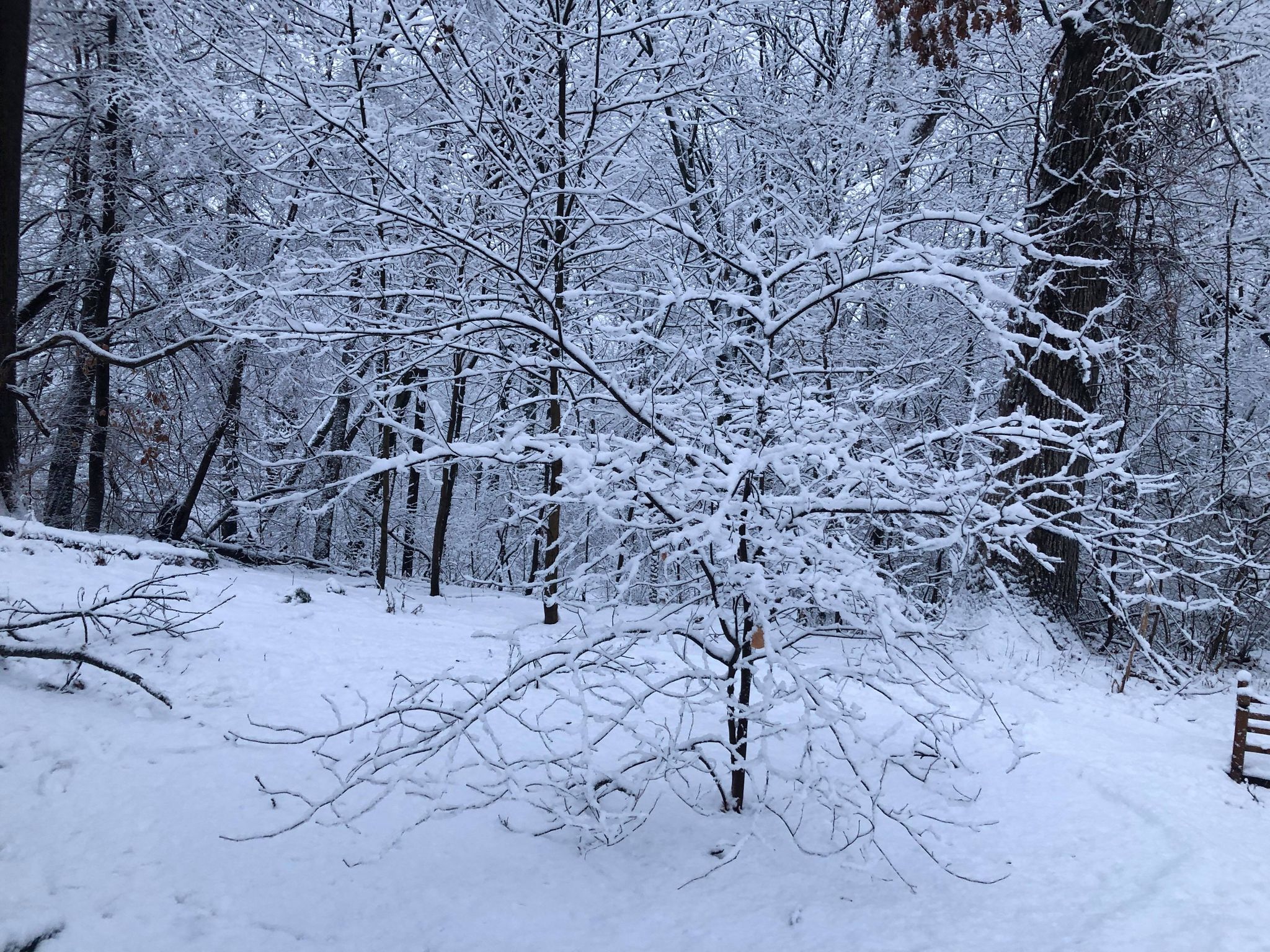
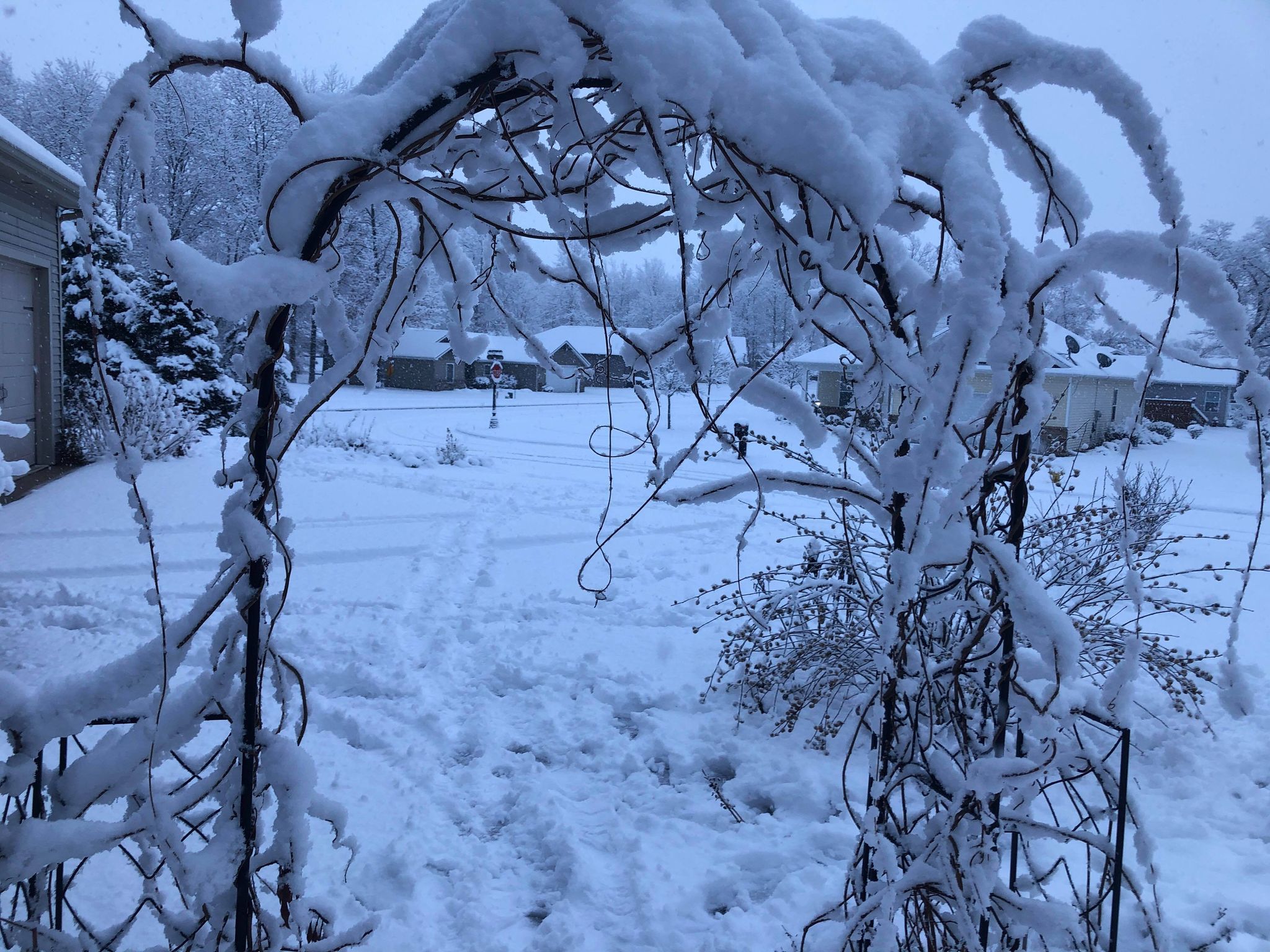
Photos
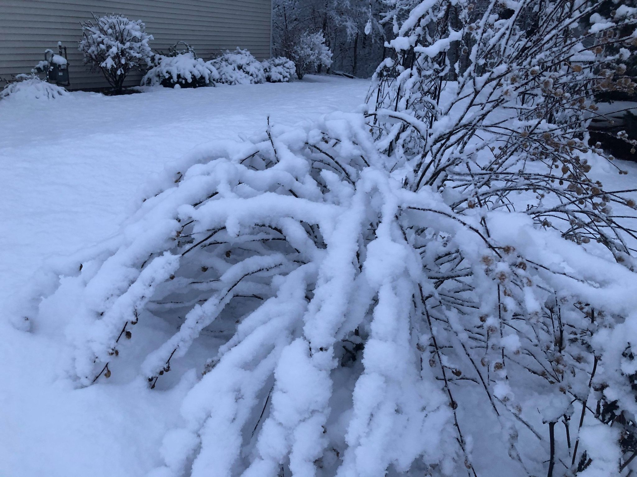
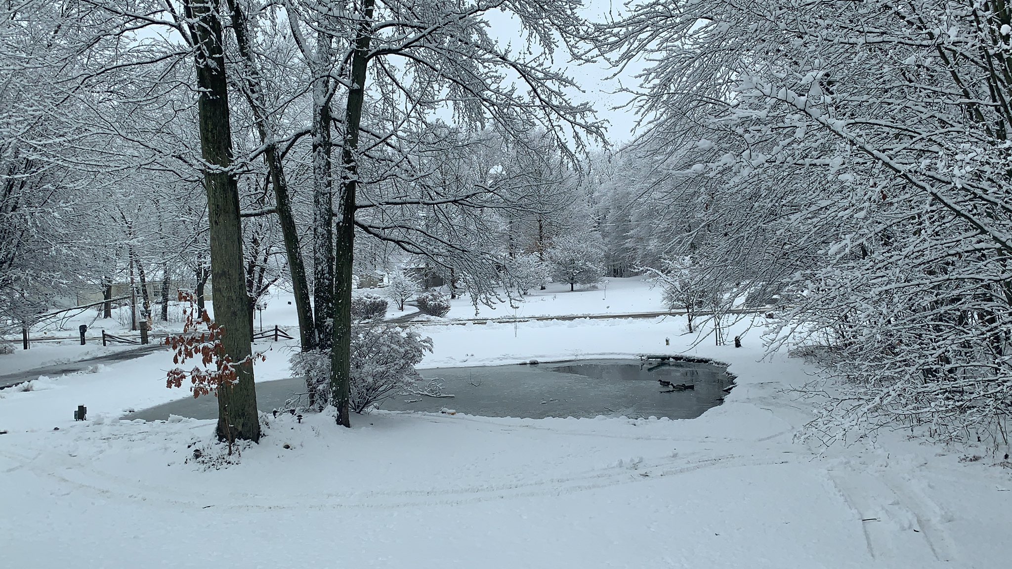
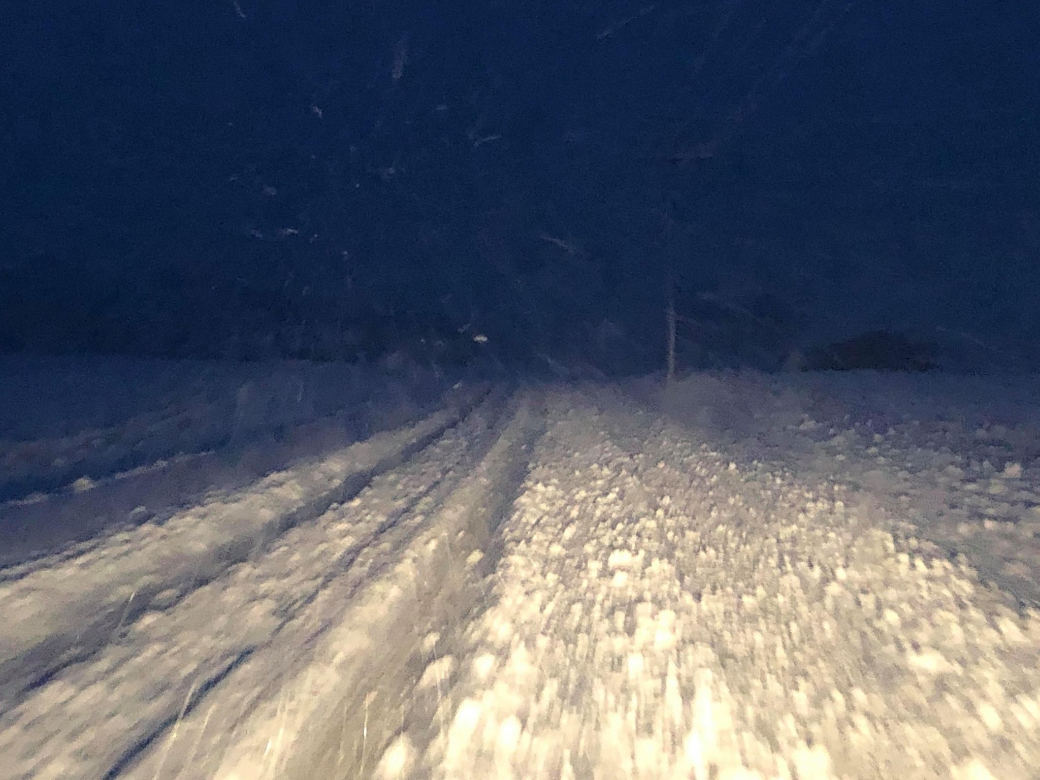
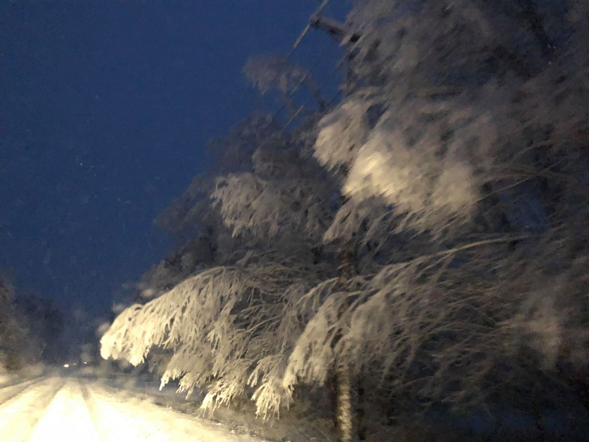
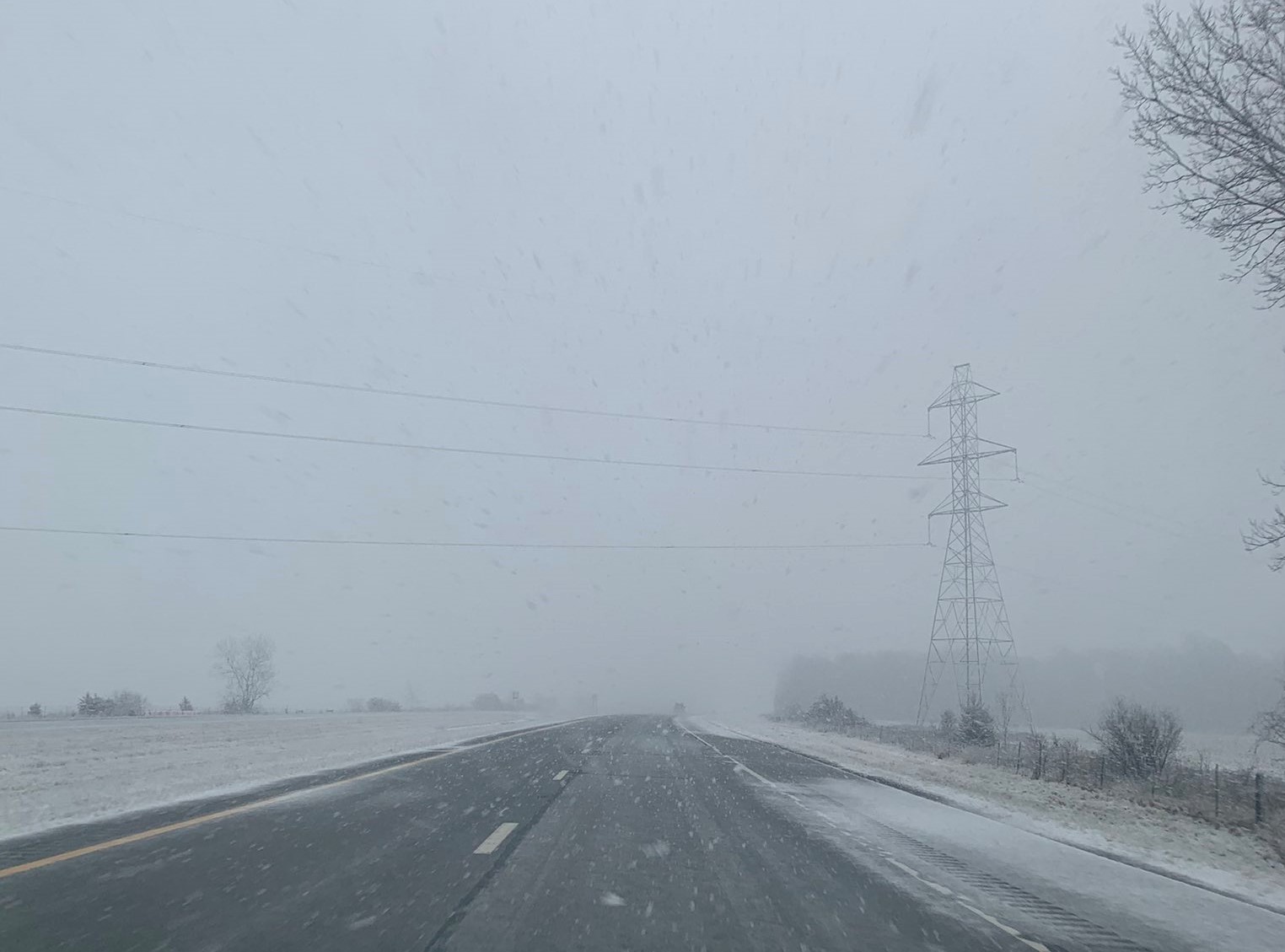
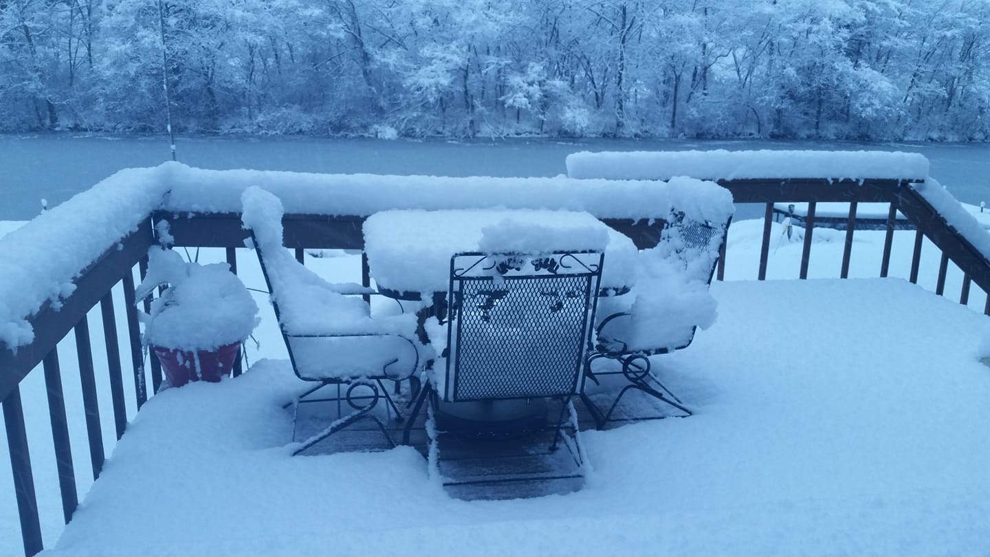
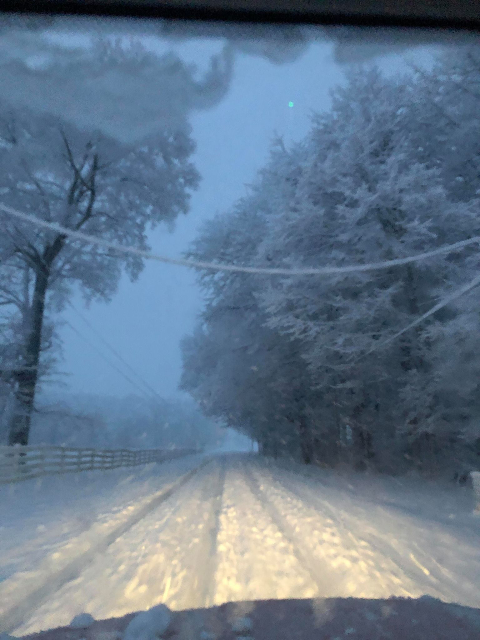
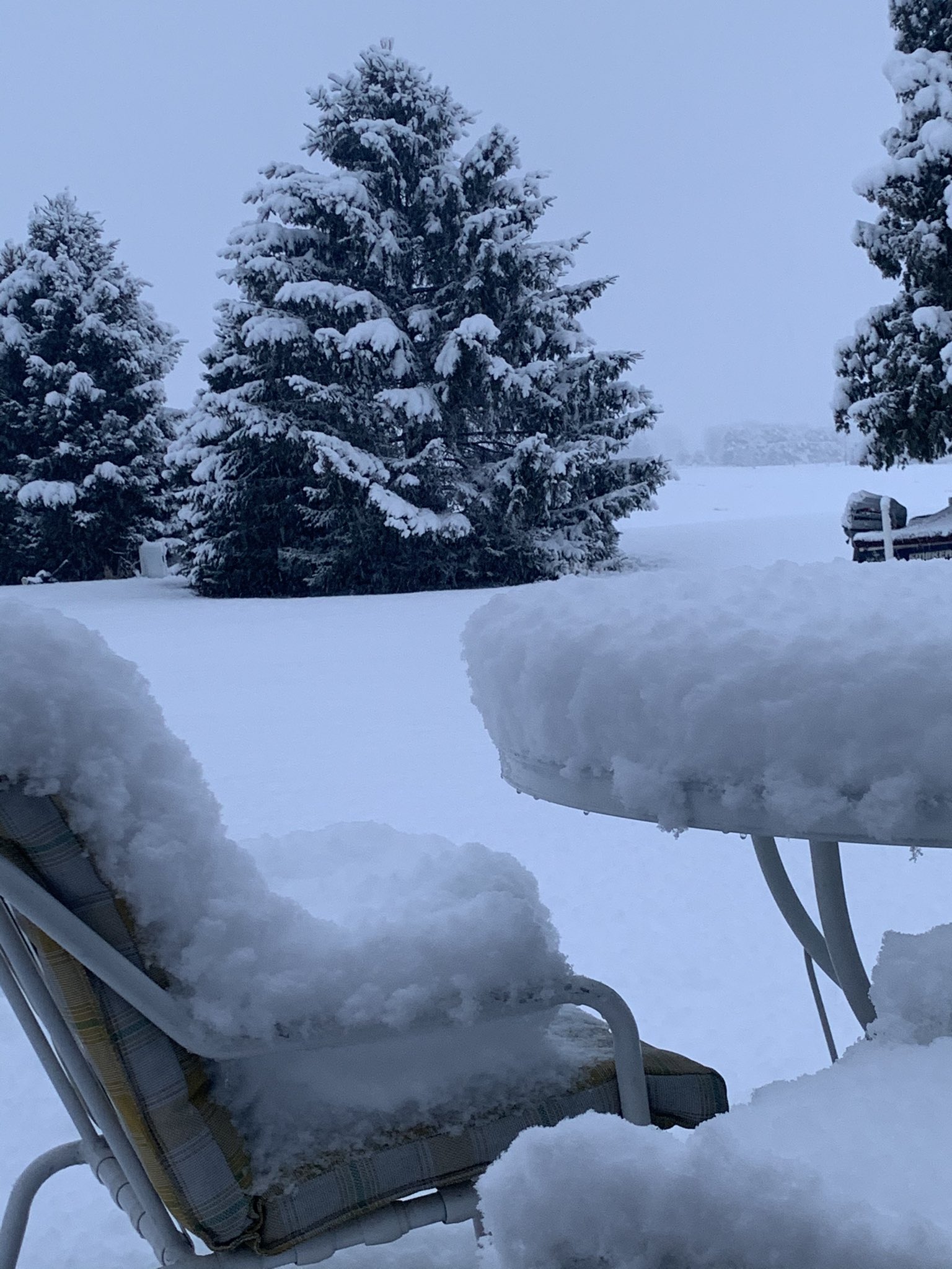
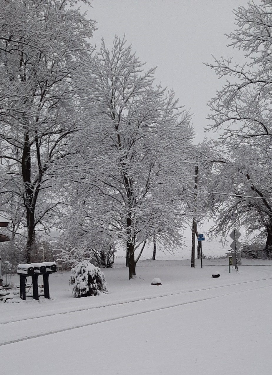
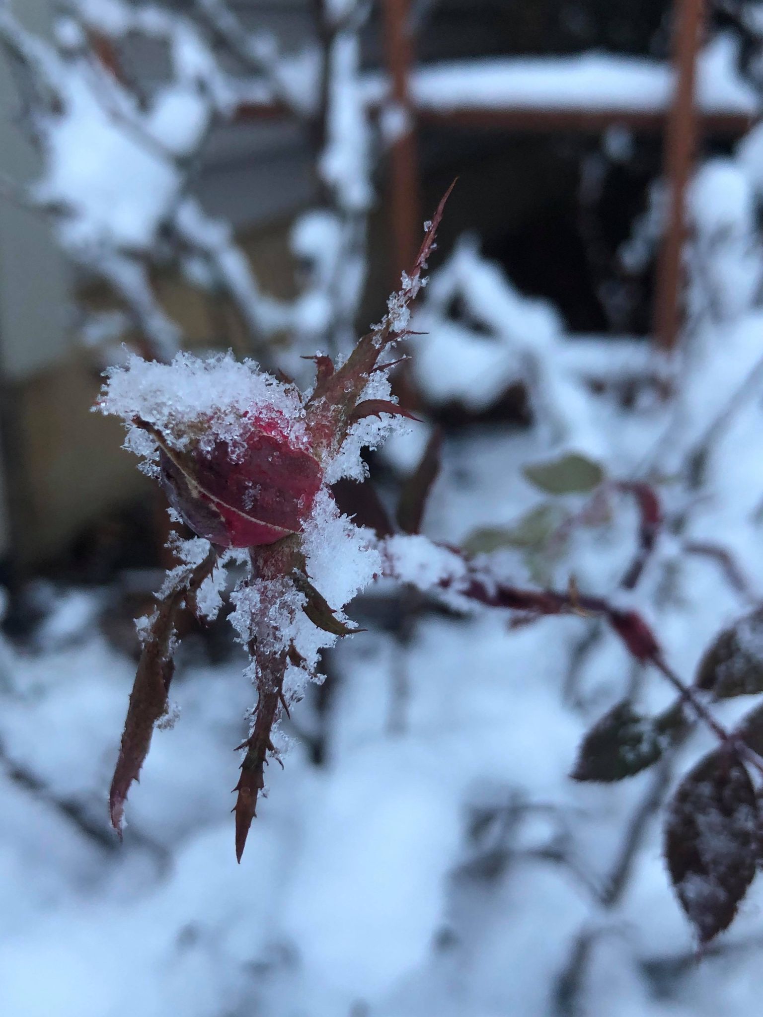
Those beneath the heaviest band of snow January 3rd woke up to quite a picturesque winter wonderland. In some cases, roads were completely snow covered. Power lines and tree branches were sagging under the weight of the ice from the event on New Years day, and heavy, wet snow from January 3rd. Below are some photos we received during the event. Thank you to those who sent them to us on social media!
 |
 |
 |
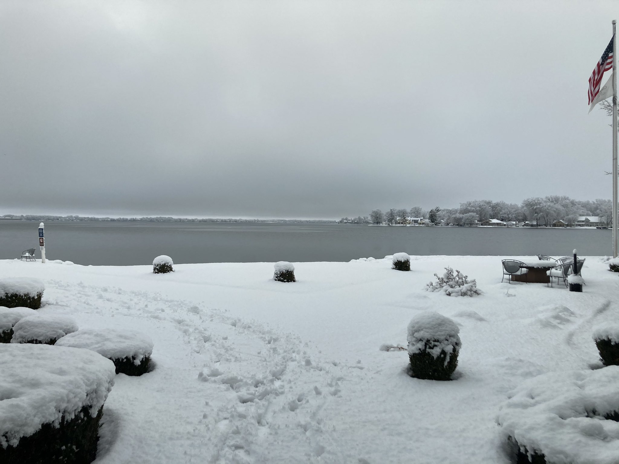 |
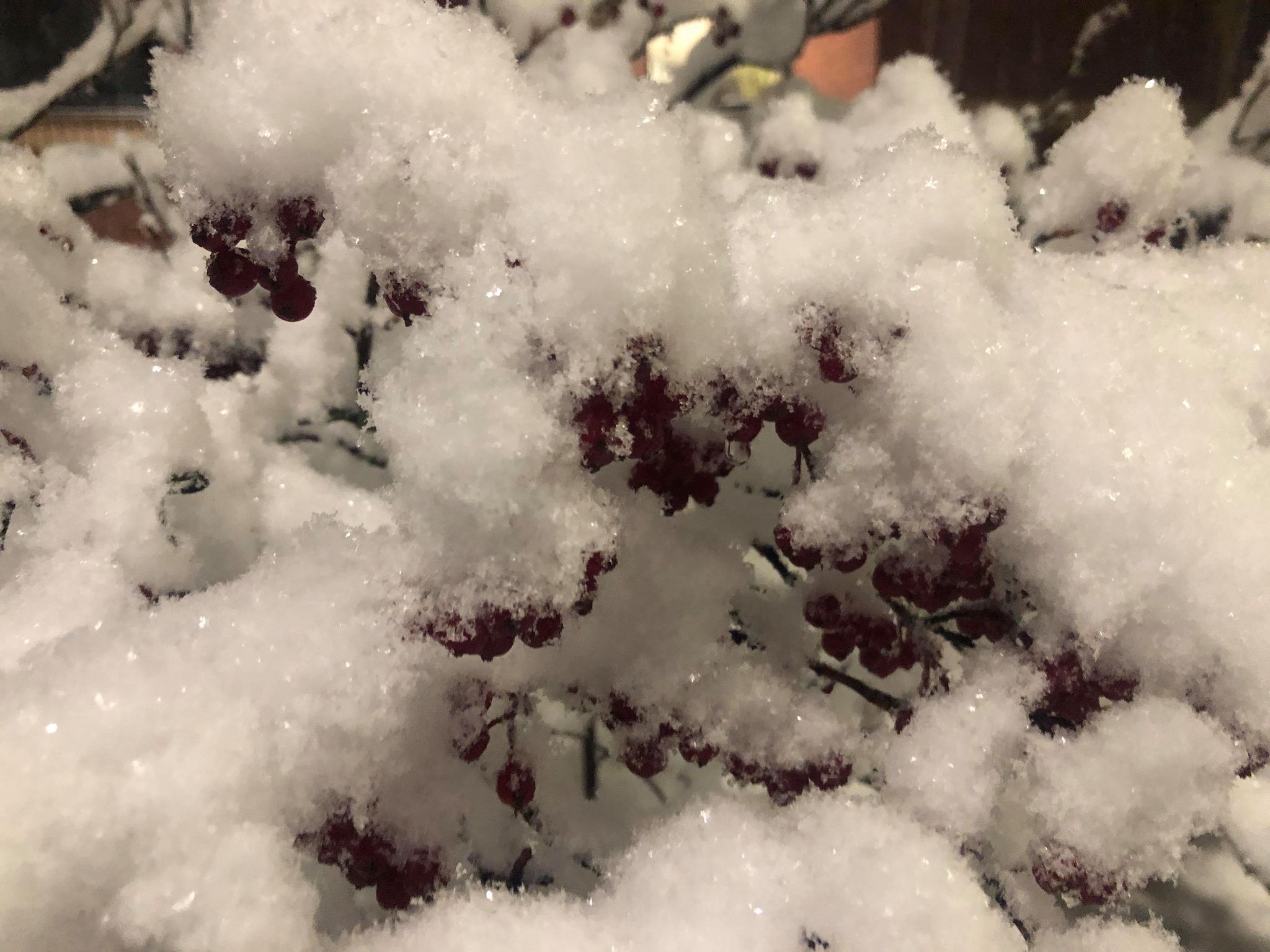
| 1S Monoquet, IN (Megan Dodson) | 1S Monoquet, IN (Megan Dodson) | Snow-laden Wisteria Vines from 1S Monoquet, IN (Megan Dodson) | Lake Wawasee at Oakwood Resort (Josh Patterson, @cjdubbya) |
 |
 |
 |
 |
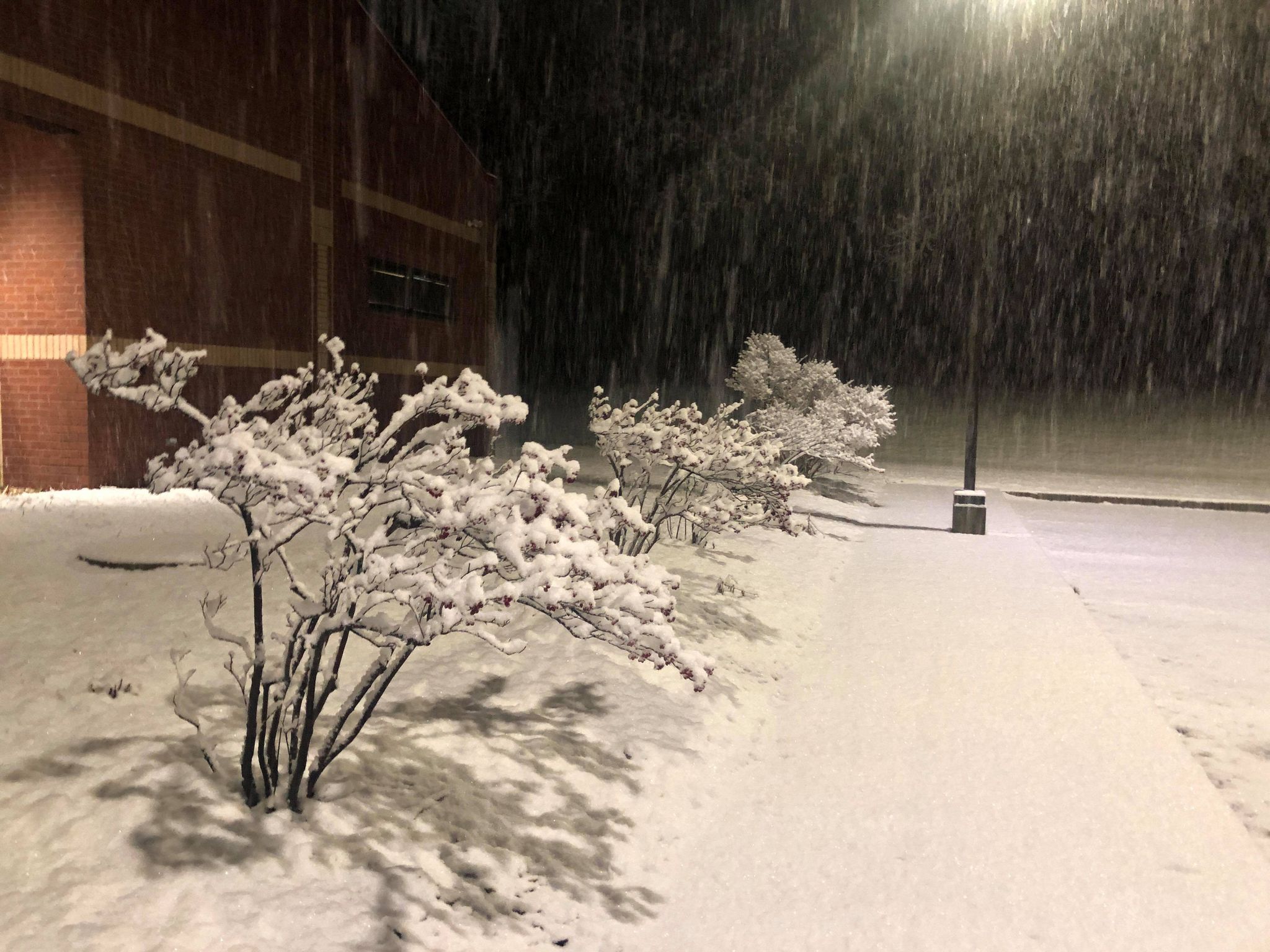
| Snow at NWS IWX (Megan Dodson) | Snow at NWS IWX (Megan Dodson) | 1S Monoquet, IN (Megan Dodson) |
Claypool, IN (Dr. John Lippe, @jonlippe) |
 |
 |
 |
 |
| 1N James Lake, IN on E 800 N at 7:25 am EST (Megan Dodson) | 11N James Lake, IN on E 800 N at 7:25 am EST (Megan Dodson) | Lima, OH (Alexander Hall, @AlexanderHall) |
Lake Wawasee at South Kanata Channel (Sherry McKay Lantz) |
 |
 |
 |
 |
| 1N Oswego, IN on E 700N at 7:30 am EST January 3rd. Sagging powerline. (Megan Dodson) |
Leesburg, IN (Justin Shoemaker, @jushoemaker25) |
Winimac, IN (Dr. Joe Henson, @joehens32696762) |
1S Monoquet, IN (Megan Dodson) |
Radar
Here is a radar loop from 2-8 am EST January 3rd, 2021. The initial wave of snow was light to moderate, bringing around 1-3" of snow to the central forecast area. At IWX, which is marked by the red dot in the image, we had about 2.7 inches by 3:30 am EST. The center of the low pressure system went from central IL, crossed over IWX (you can see the circulation in radar data), and then slowed before exiting into Lake Erie by mid Sunday afternoon. As the low passed overhead you can kind of see the two waves of better snow merge (pivot point right around our office). This intense snow brought totals up to 4 to 6 inches.
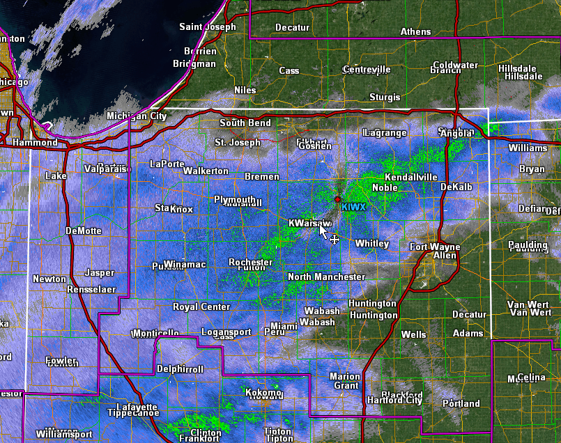 |
| Radar imagery from IWX during the event January 3rd, 2021 from roughly 2 am-8 am EST (GR2Analyst). We decreased the number images outside of the period of heavy banding to make the loop shorter, so at times it appears to jump. |
 |
Media use of NWS Web News Stories is encouraged! Please acknowledge the NWS as the source of any news information accessed from this site. |
|

