Overview
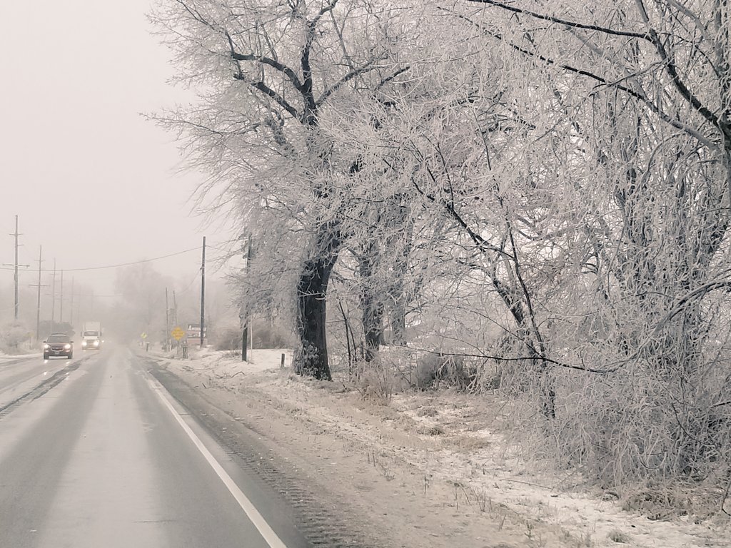
An area of freezing rain and sleet that began with a small pocket of snow overspread the region Monday evening. The event transitioned into all freezing rain during the overnight as temperatures remained below freezing. Ice accumulations ranged reached as high as 0.30" inches in northwest Ohio and Southern Michigan as plenty of moisture continued to stream into the region. Temperatures were able to slowly rise during the day Tuesday as the low pressure system approached the region from the southwest so that the ice was able to melt and fall off the trees.Snow/Ice
The freezing rain caused widespread issues across the forecast area. Below is a summary of impacts:
Photos & Video
Header
 |
 |
 |
 |
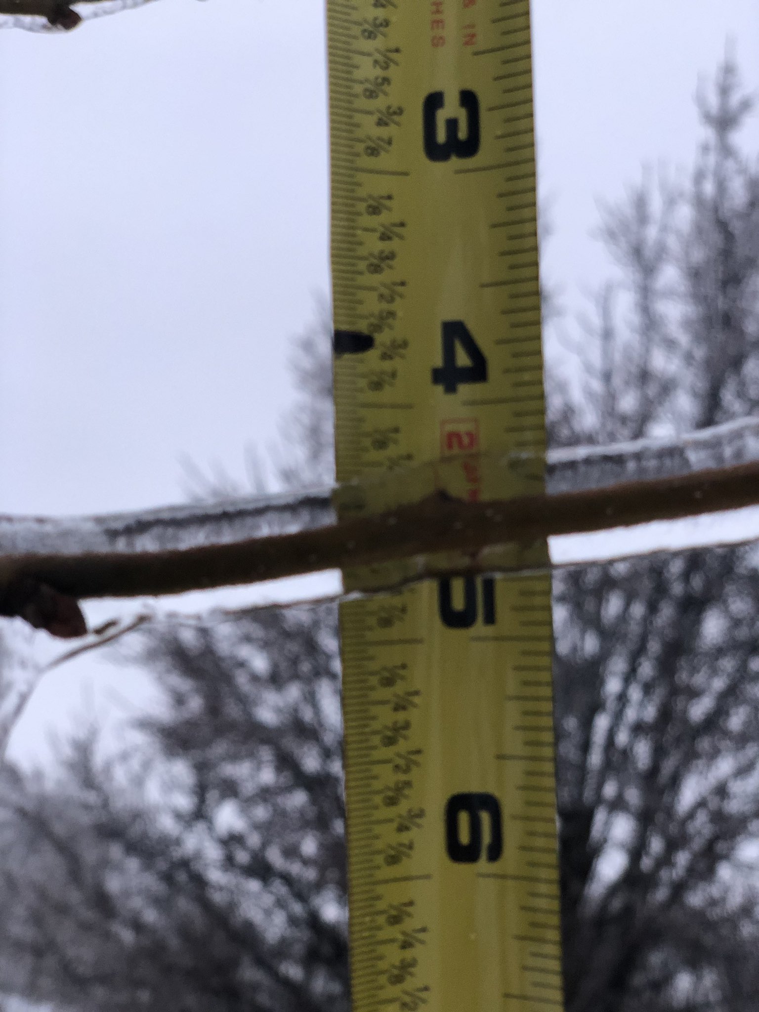
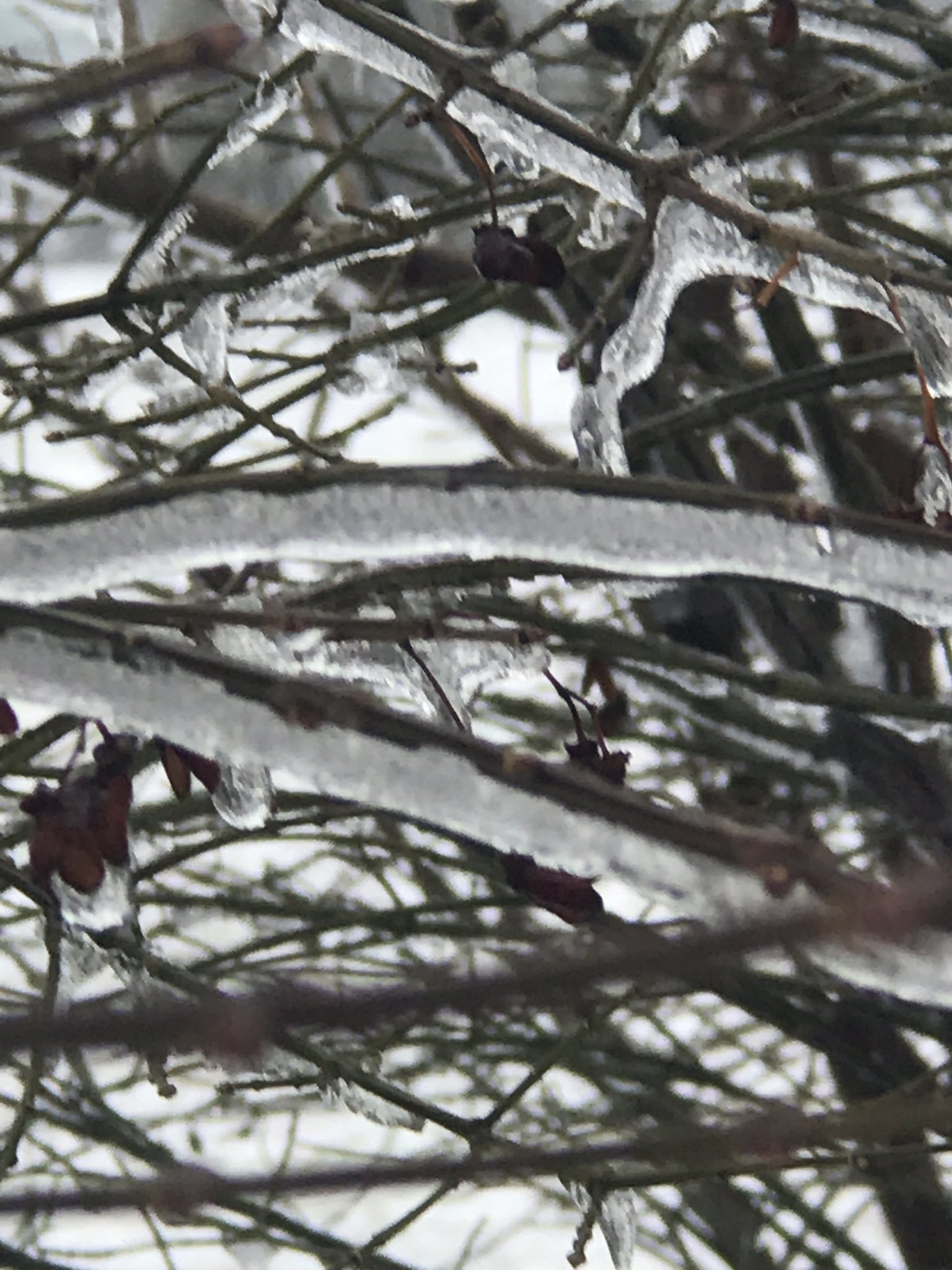
| The scene in Goshen, IN where ice encased the trees and lined the streets. (Deb Mann) | Measuring the thickness of ice that accreted in Goshen, IN (GHS Weather) |
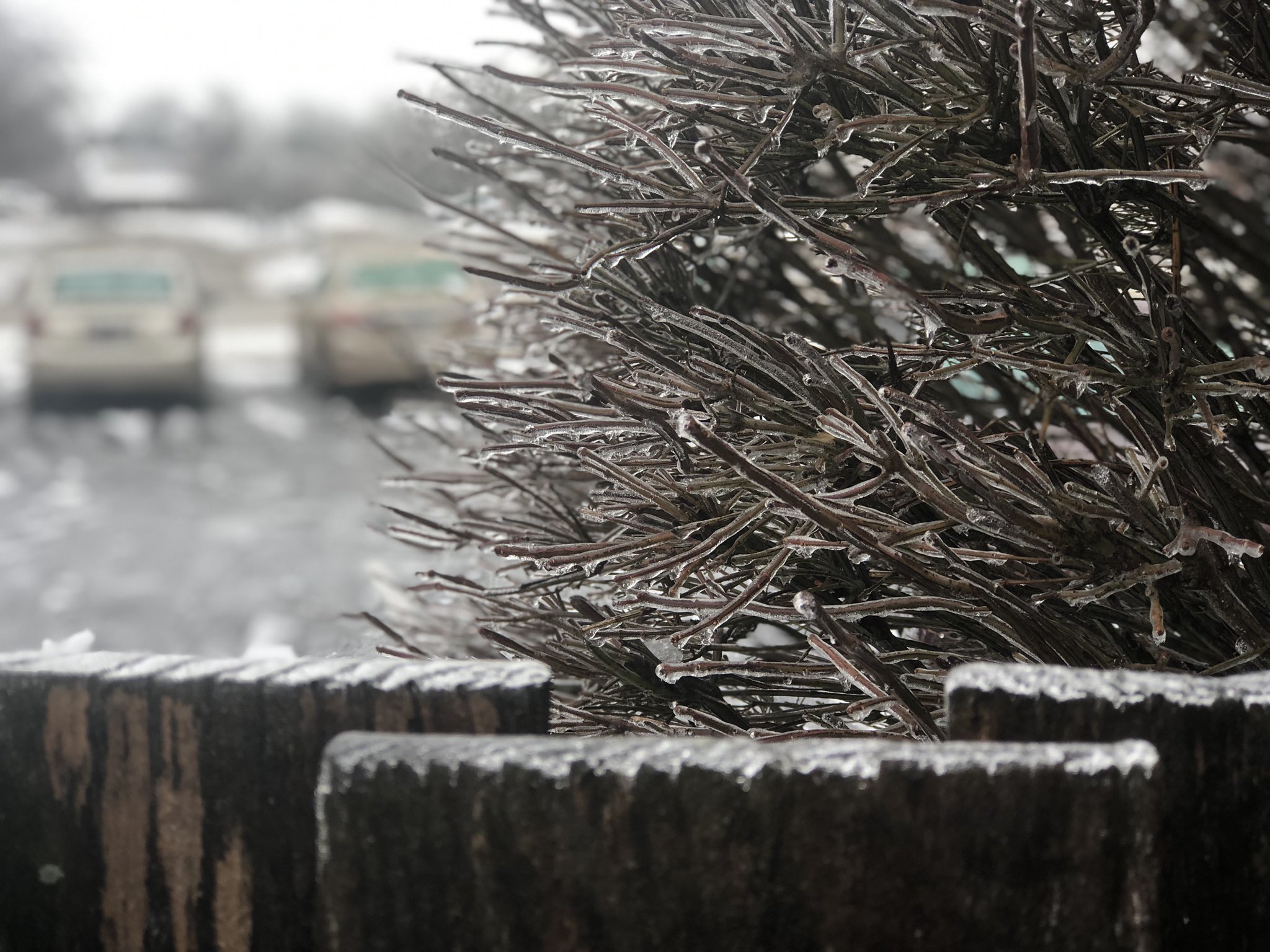
The scene in South Bend, IN where ice accreted on trees and lined the tops of fences. (Tiffany Salameh) |
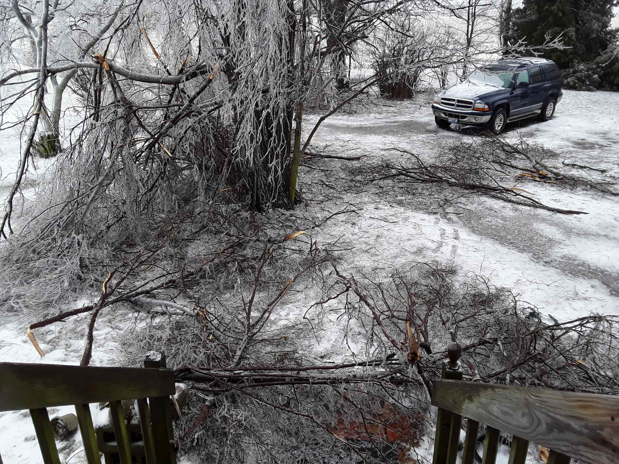
The scene in Hicksville, OH where ice lined trees and many limbs were lost in the area (Aleisha Delagrange) |
 |
 |
 |
 |
| Trees being weighed down in Kendalville, IN. (Adam Solarczyk) | Ice accretion in Columbia City, IN (Rick Hyndman) |
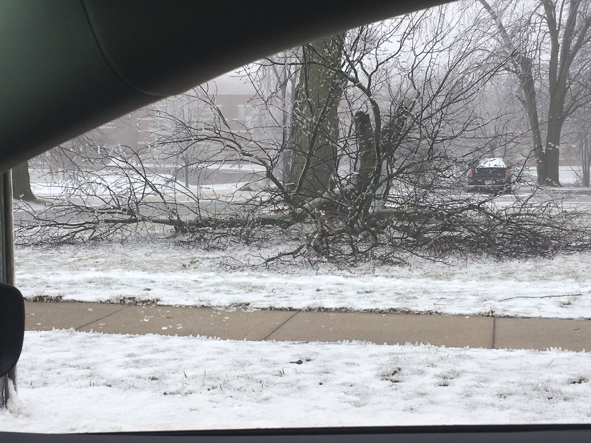
Tree limbs fell down in Hicksville, OH (Neil Byers) |
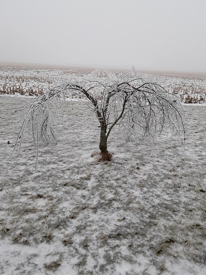
Ice lined tree bends from the weight of the ice in Hicksville, OH (Aleisha Delagrange) |
Radar
Header
.gif) |
| Radar loop for the event |
Storm Reports
PUBLIC INFORMATION STATEMENT
NATIONAL WEATHER SERVICE NORTHERN INDIANA
504 PM EST TUE FEB 12 2019
...ICE ACCUMULATION REPORTS FROM TODAY...

LOCATION                     AMOUNT    TIME/DATE       LAT/LON

...INDIANA...

...ALLEN COUNTY...
2 E NINE MILE                0.20 IN   0206 AM 02/12   40.98N/85.19W

...CASS COUNTY...
LOGANSPORT                   0.10 IN   0330 AM 02/12   40.76N/86.37W

...ELKHART COUNTY...
3 W GOSHEN                   0.20 IN   0830 AM 02/12   41.58N/85.89W

...KOSCIUSKO COUNTY...
2 N NORTH WEBSTER            0.20 IN   0800 AM 02/12   41.36N/85.70W
1 SSE MONOQUET               0.20 IN   0900 AM 02/12   41.28N/85.86W
1 ENE WINONA LAKE            0.10 IN   0100 AM 02/12   41.22N/85.80W

...LAGRANGE COUNTY...
1 ENE LAGRANGE               0.20 IN   0824 AM 02/12   41.65N/85.40W
2 N HOWE                     0.10 IN   0417 AM 02/12   41.75N/85.42W

...OHIO...

...HENRY COUNTY...
NAPOLEON                     0.20 IN   0500 AM 02/12   41.40N/84.13W

...VAN WERT COUNTY...
VAN WERT                     0.15 IN   1154 AM 02/12   40.86N/84.58W

...WILLIAMS COUNTY...
BRYAN                        0.20 IN   0540 AM 02/12   41.47N/84.55W

OBSERVATIONS ARE COLLECTED FROM A VARIETY OF SOURCES WITH VARYING
EQUIPMENT AND EXPOSURES. WE THANK ALL VOLUNTEER WEATHER OBSERVERS
FOR THEIR DEDICATION. NOT ALL DATA LISTED ARE CONSIDERED OFFICIAL.
PRELIMINARY LOCAL STORM REPORT...SUMMARY
NATIONAL WEATHER SERVICE NORTHERN INDIANA
504 PM EST TUE FEB 12 2019

..TIME...   ...EVENT...      ...CITY LOCATION...     ...LAT.LON...
..DATE...   ....MAG....      ..COUNTY LOCATION..ST.. ...SOURCE....
            ..REMARKS..
0600 AM     ICE STORM        MILLERSBURG             41.52N 85.70W
02/12/2019                   ELKHART            IN   NWS EMPLOYEE

            0.3 INCHES OF ICE ACCRETION.

0615 AM     ICE STORM        2 ENE SALEM CENTER      41.60N 85.11W
02/12/2019                   STEUBEN            IN   COCORAHS

            MEASURED 0.3 INCHES OF ICE ACCRETION.

0621 AM     ICE STORM        MONTPELIER              41.59N 84.60W
02/12/2019                   WILLIAMS           OH   EMERGENCY MNGR

            REPORTS OF TREES AND UTILITY POLES DOWN DUE
            TO ICE ACCRETION. MULTIPLE SLIDE OFFS AND
            CRASHES ACROSS THE COUNTY.

0700 AM     ICE STORM        DIXON                   40.95N 84.80W
02/12/2019                   ALLEN              IN   TRAINED SPOTTER

            MEASURED 0.25 INCHES OF ICE ACCRETION.
            SEVERAL LARGE TREE LIMBS DOWN IN THE AREA.

0830 AM     ICE STORM        NAPOLEON                41.40N 84.13W
02/12/2019                   HENRY              OH   EMERGENCY MNGR
Environment
A strong high pressure system came in from Canada and, combined with a remnant snow pack, helped to provide a cold layer that rain was able to freeze to. A warm nose poked into the region allowing precipitation initially falling as snow in the upper atmosphere to melt before refreezing on surfaces on the ground.
Here are some images that describe the why when it comes to freezing rain.
 |
 |
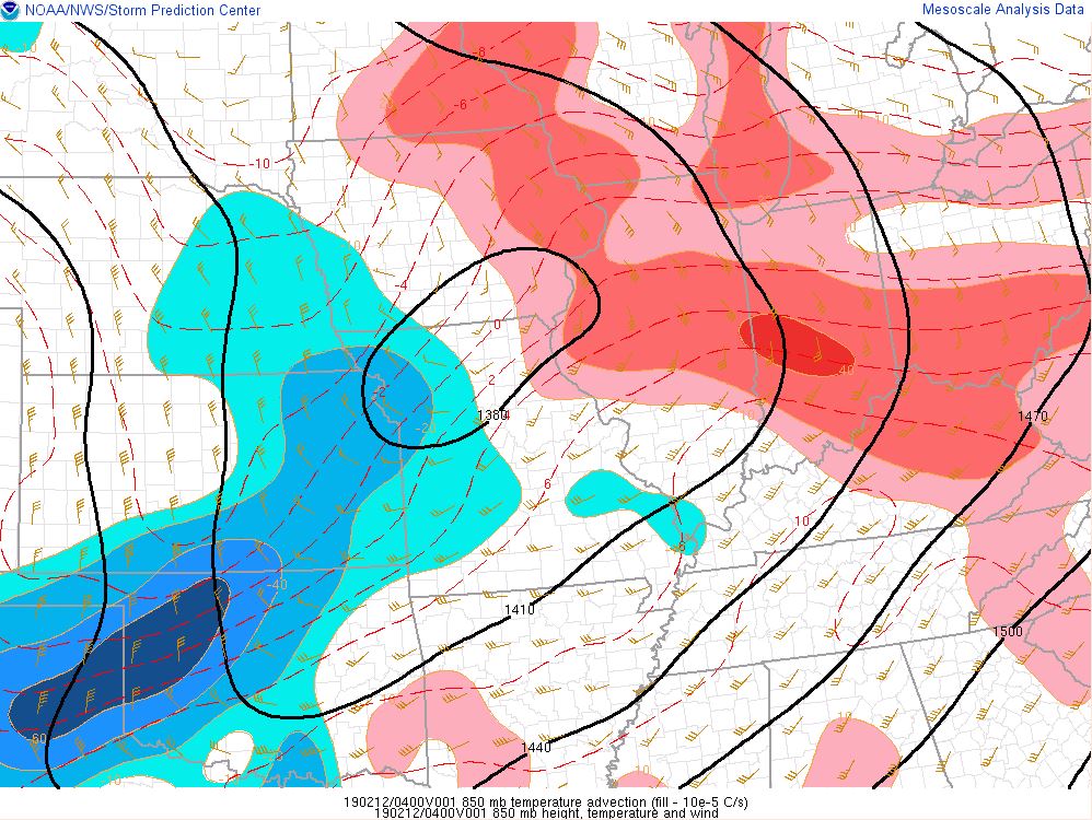 |
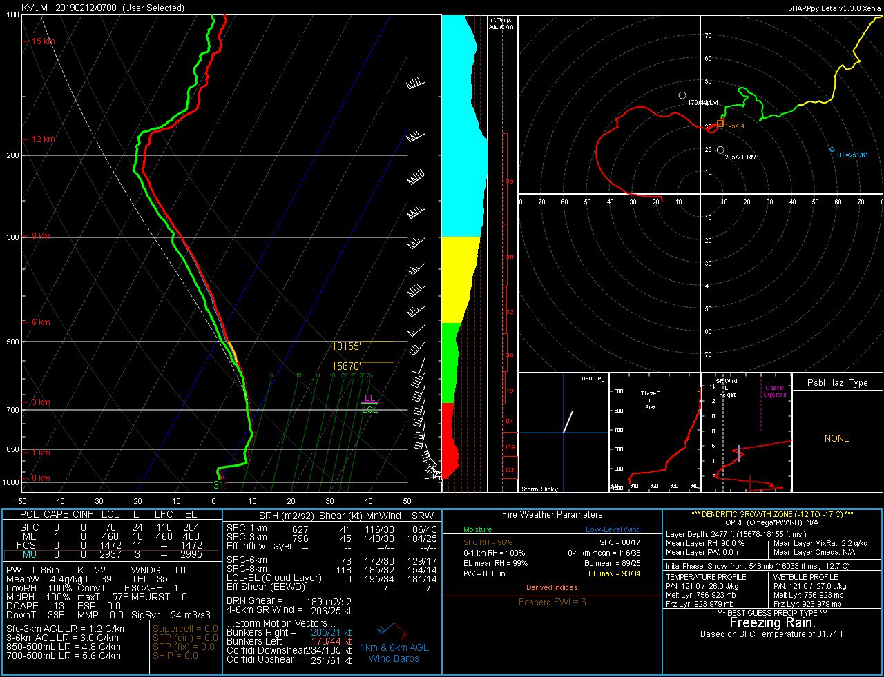
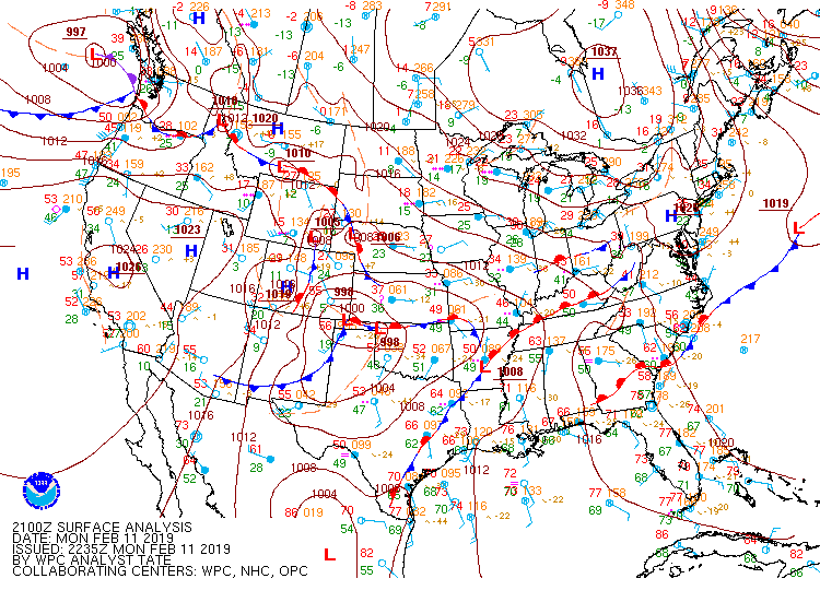
| Figure 1: The atmospheric sounding that the University of Valporaiso sent up at 2AM ET. Notice the cold air at the surface and the warm air aloft. This allows snow to melt in the warm layer and then refreeze at the surface as it falls, thus creating freezing rain. | Figure 2: Animation of the surface features as freezing rain changed to rain and then to snow. Notice the strong high pressure to the northeast. This provided plenty of cold air at the surface. The sounding at left shows warm air streaming into the warm nose, which helped to create the icing. (SPC) | Figure 3: Diagram showing the area where warm air is being inserted into the low levels above the surface at 11pm. (SPC) |
 |
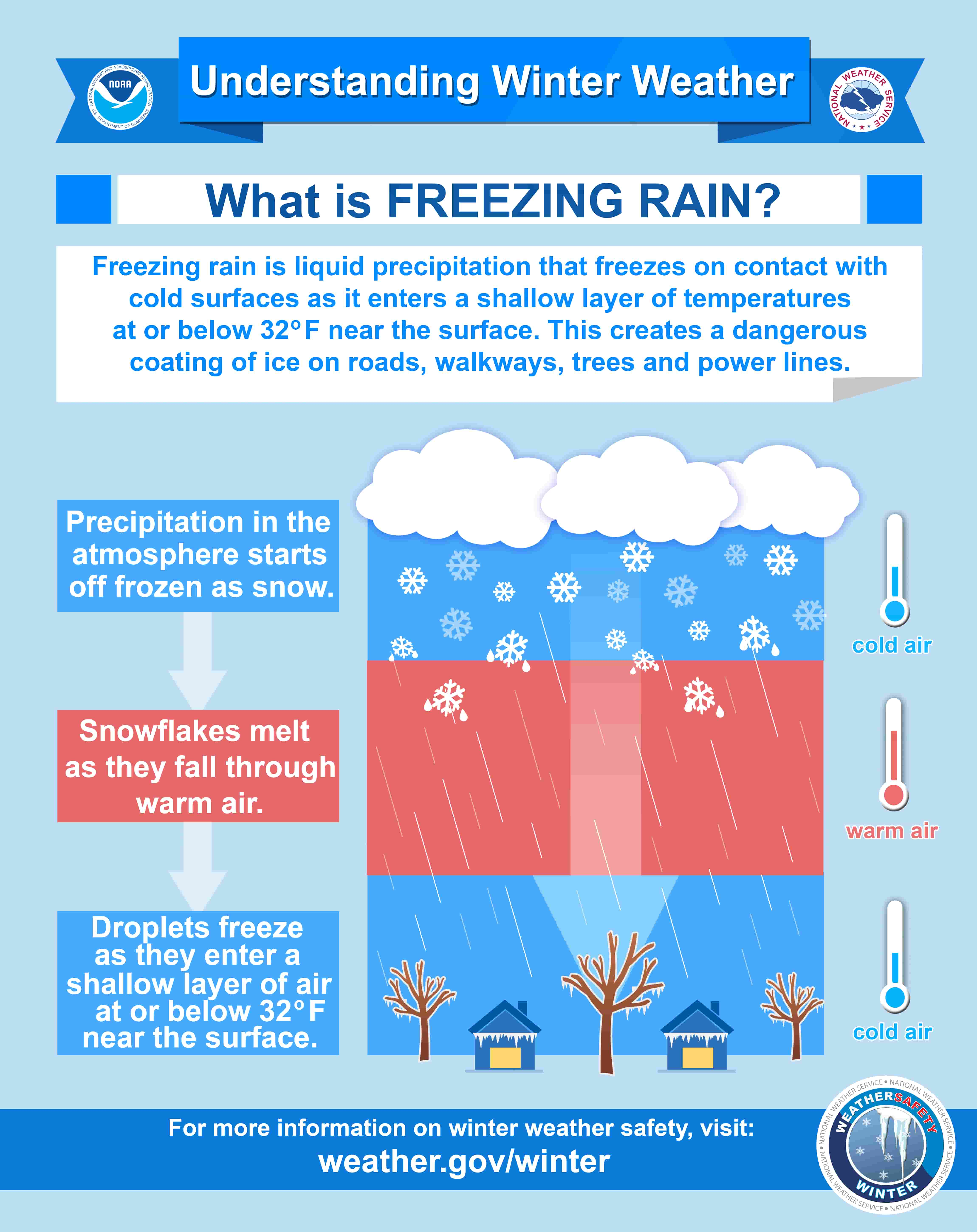 |
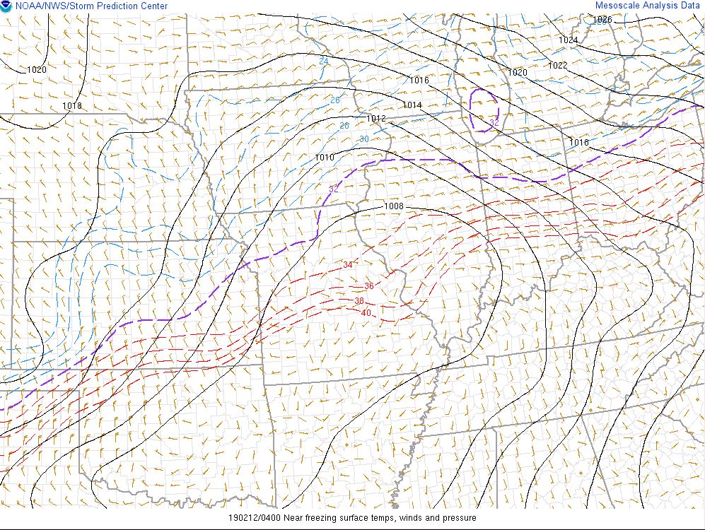
| Figure 4: Image showing the surface temperatures at 11pm. Notice the areas remaining below freezing (north of the purple line) allowing for more accretion of ice from freezing rain. (SPC) | Figure 5: This shows how freezing rain forms in a graphical format. |
 |
Media use of NWS Web News Stories is encouraged! Please acknowledge the NWS as the source of any news information accessed from this site. |
|

