Overview
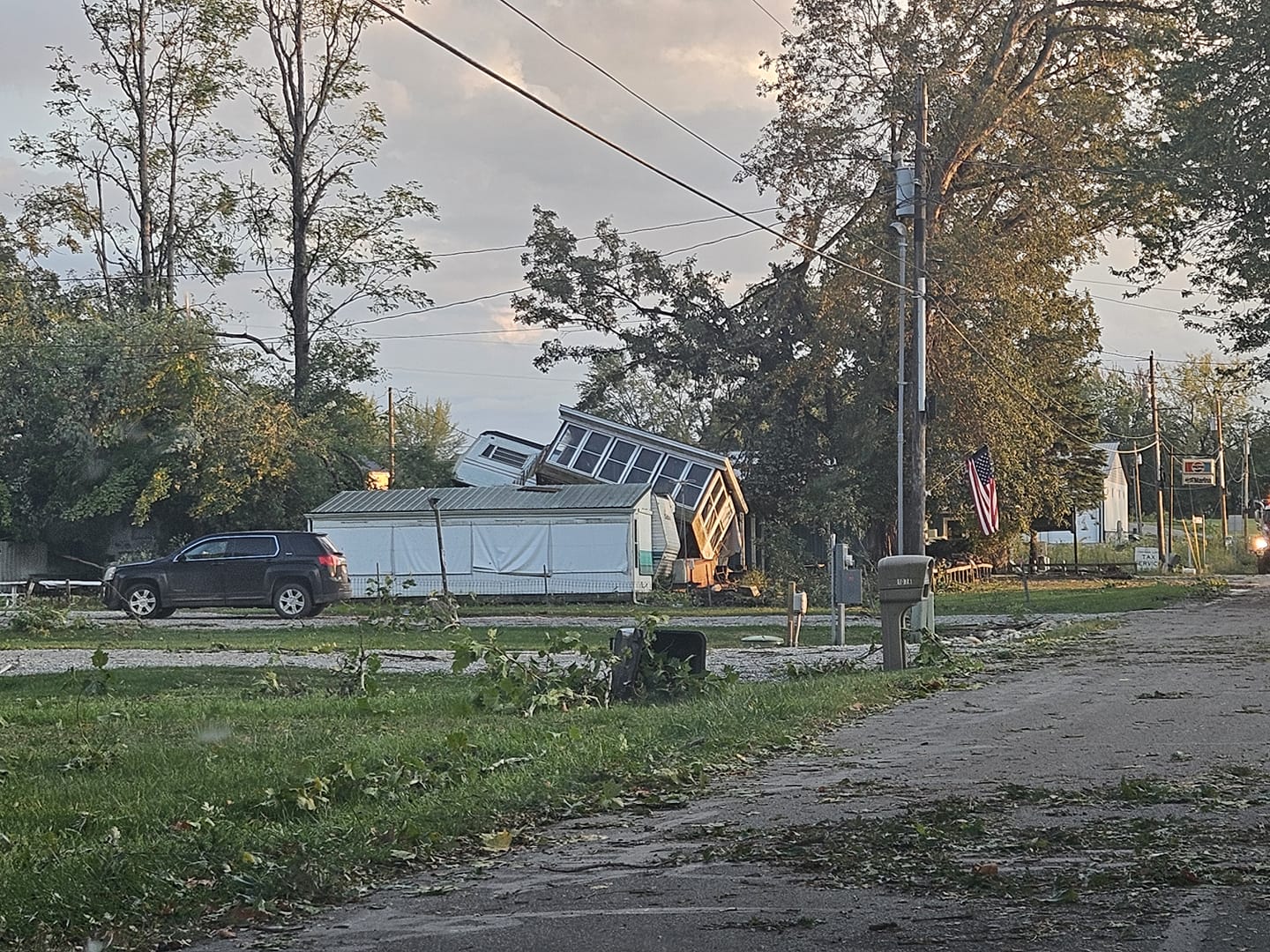
Tornadoes:
|
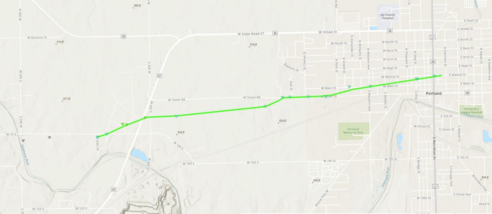
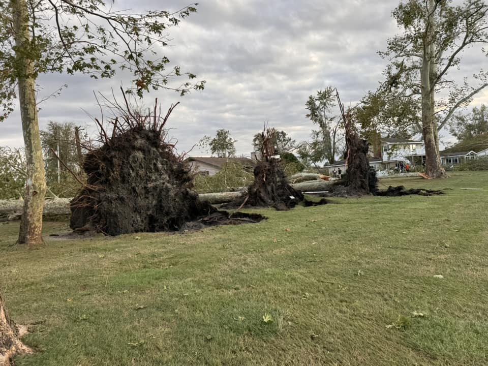
Tornado -Portland, IN
|
||||||||||||||||
 |
 |
 |
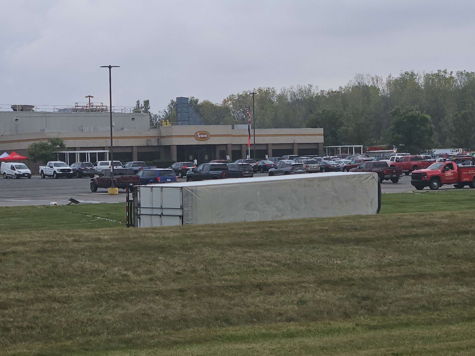 |
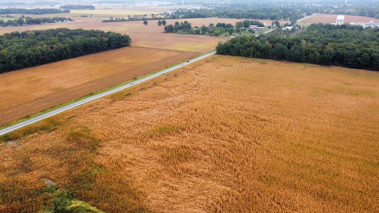
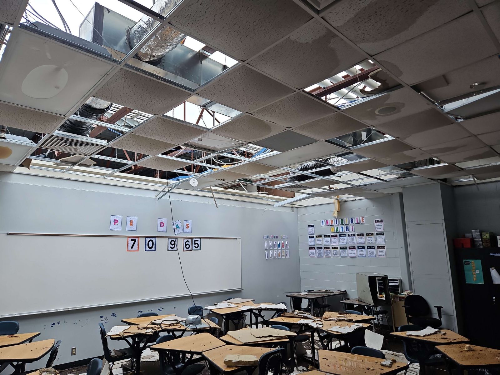
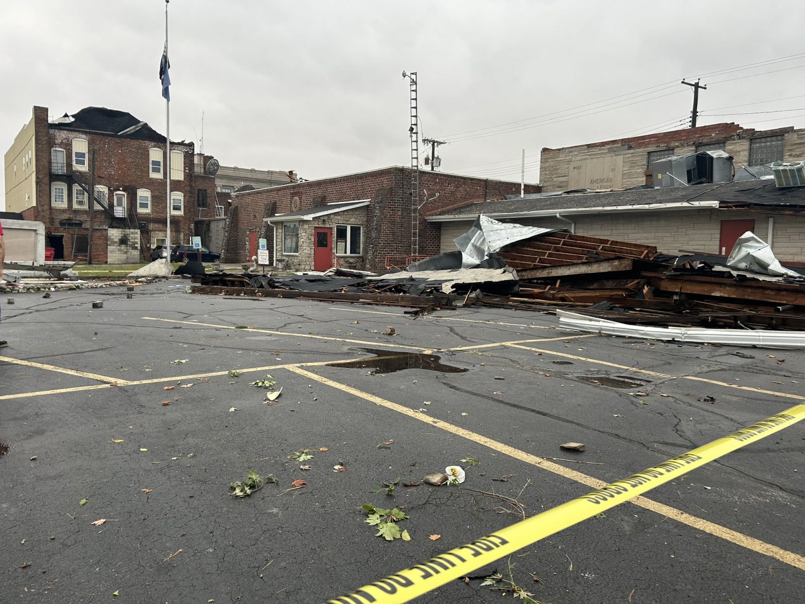
| Corn was flattened by an EF-U tornado west of Jay County High School. (Sam Rhodehamel, Jay Co, EMA) | Jay County High School sustained significant roof damage. (NWS Storm Survey) | Damage to the second story of the American Legion in Portland. (Liz Braden, 21 Alive) | A semi truck trailer was toppled (NWS Storm Survey) |
The Enhanced Fujita (EF) Scale classifies tornadoes into the following categories:
| EF0 Weak 65-85 mph |
EF1 Moderate 86-110 mph |
EF2 Significant 111-135 mph |
EF3 Severe 136-165 mph |
EF4 Extreme 166-200 mph |
EF5 Catastrophic 200+ mph |
 |
|||||
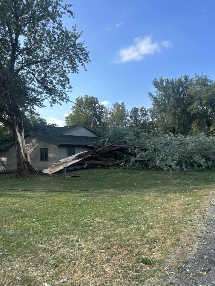
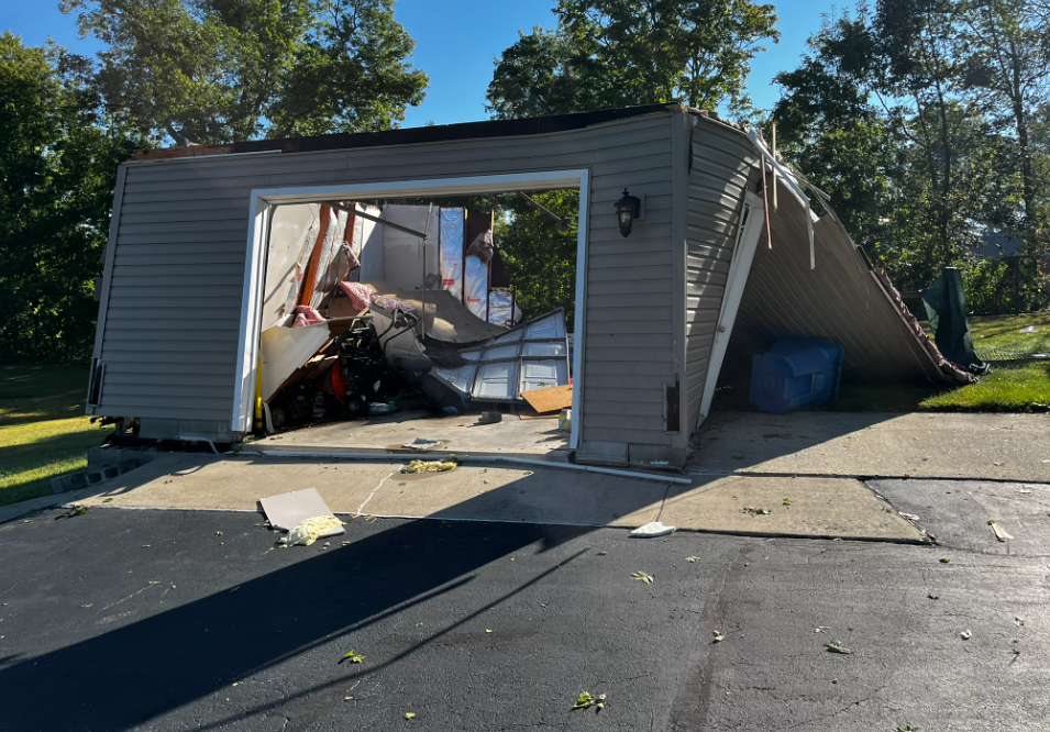
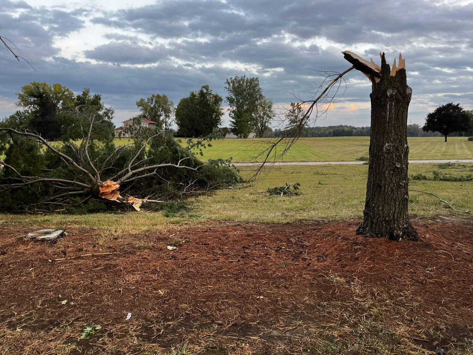
September 20th Kosciusko County Microburst:
In the mid-afternoon of September 20th, a microburst caused an approximately 10 mile swath of damage from just south of Leesburg, through Chapman Lake, east to Ridinger Lake. Numerous trees and limbs were down, some onto structures and power lines. Several roads were blocked with debris. Damage is consistent with 60 to 80 mph wind. The most concentrated damage occurred in the Chapman Lake area where 80 mph wind caused extensive damage.
Learn more about microbursts from NWS Birmingham, AL and NWS Louisville, KY.
 |
 |
 |
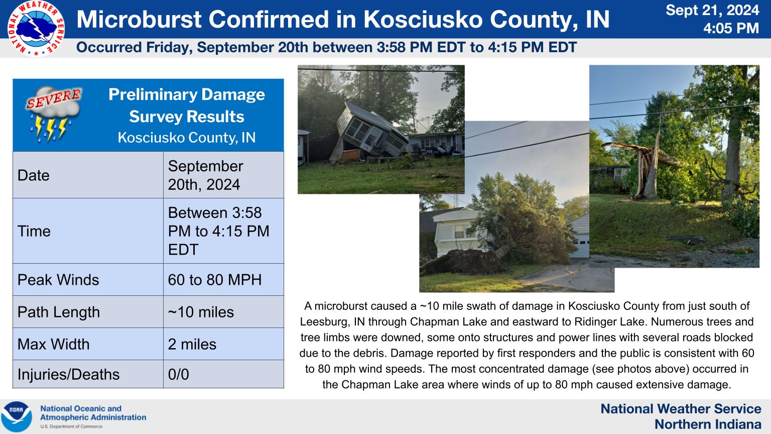 |
| Several trees were uprooted, including this one, at Chapman Lake (Hilary Kiser) | This home was dislodged from its foundation at Chapman Lake (Jane Serovy) | This tree was split in two at Barbee Lake (Julie Larson) | A graphical summary of the Kosciusko County Microburst |
September 20th Whitley County Microburst:
On September 20th, the same storm that produced the extensive damage in portions of Kosciusko County continued into Whitley County. The majority of the damage occurred from NNW of Columbia City (Five Points area) southeast to the southeast side of State Route 205. Damage along this swath was more spread out with trees and some structures damaged in several non-continuous locations. Some crops were also damaged, especially in the Riley Road area. Damage is consistent with 60 to 70 mph wind gusts.
Learn more about microbursts from NWS Birmingham, AL and NWS Louisville, KY.
 |
 |
.png) |
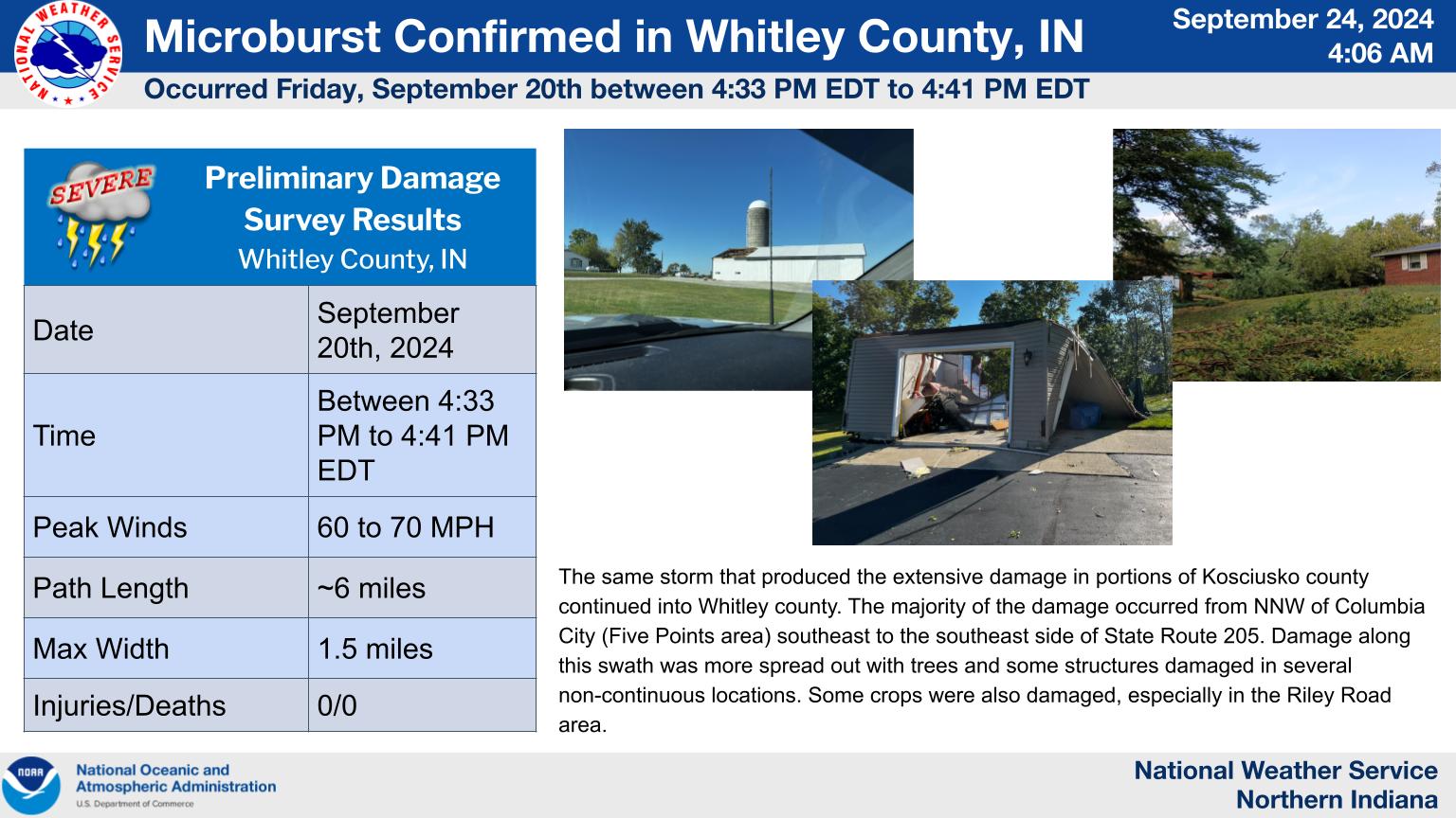 |
| This structure sustained significant damage from the microburst (Whitley County EMA) | Tree damage was common, including several snapped trees at this location in Whitley County (Whitley County EMA) | An outbuilding had its garage doors blown in, followed by the exterior wall panels being blown out (Whitley County EMA) | A graphical summary of the Whitley County Microburst |
 |
Media use of NWS Web News Stories is encouraged! Please acknowledge the NWS as the source of any news information accessed from this site. |
|

