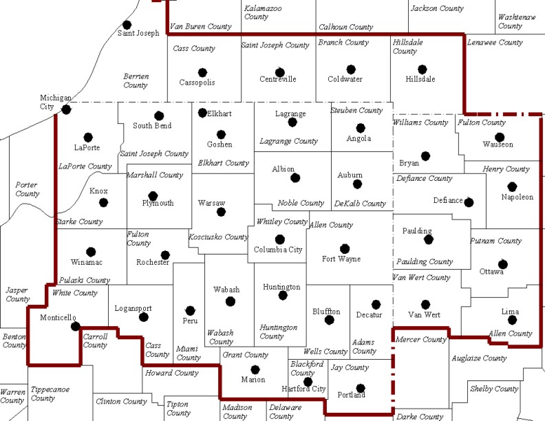
Overview
Two winter storms impacted the forecast area (CWA Map Here) in early February, 2022. The first storm brought widespread rain to the area ahead of a cold front on February 1st, 2021, then as the front dropped slowly southeast it changed to snow by the morning of February 2nd. The transition occurred very slowly in the southeastern portions of our area, resulting in lower snow totals than initially expected. However, with cold air in place the second system that was centered just to our southeast brought another swatch of heavy snow to the central and southeastern forecast area through the late evening on February 3rd, 2022. North-northeast winds also strengthened to 15 to 25 mph or so, which led to blowing and drifting. Roads became quickly snow covered, especially in open areas where blowing and drifting added to the poor travel conditions.
This webpage is under construction as of 2/5/2022. Please check back as we fill in snow reports for the two events.
Click the tabs to find the latest reports and other information.
Snow
The map below is a rough analysis of the combined snow accumulations snow totals through 7 am EST February 4rd, 2022. . A more detailed map will be forthcoming by Monday. Many more reports were received that this map depicts and amounts may vary locally given some areas saw narrow bands (few miles wide) of heavier snow rates at times. You can click the link to the interactive map below to see other reports.
Interactive Local Storm Reports Map

Photos & Video
 |
 |
 |
 |
| A snow plow siting. (WxScoop) |
Fun for the pets too! (Jeremy Belcher) |
The weight of the snow caused some tree limbs to fall. This one in South Bend. (Dave Caulfield ABC57) |
A view of the conditions from Warsaw (Samantha Johns ABC57) |
 |
 |
 |
 |
| The scene from Elkhart, Indiana (Amber Robb) |
The scene from Bluffton, Indiana (Matthew Hartman) |
Snow field at NWS IWX (Megan Dodson) |
Snow field at NWS IWX (Megan Dodson) |
Radar
 |
|
Late morning radar image from Feb 2, 2022 showing the rain/snow line from near Defiance, OH to near Kokomo, IN. Notice the waviness in the changeover line, which results from shear and density differences in various layers of the atmosphere. This can indicate strong atmospheric forcing for precipitation (like snow). |
Storm Reports
PUBLIC INFORMATION STATEMENT
NATIONAL WEATHER SERVICE NORTHERN INDIANA
329 AM EST FRI FEB 4 2022

...SNOWFALL REPORTS RECEIVED AS OF MIDNIGHT FEBRUARY 4TH 2022...

...INDIANA...

...ALLEN COUNTY...
1 SE NEW HAVEN               13.4 IN   1030 PM 02/03   41.06N/85.01W
1 SSW LEO-CEDARVILLE         13.1 IN   0515 PM 02/03   41.20N/85.03W
3 NE ROLLING HILLS           13.0 IN   0643 PM 02/03   41.06N/85.22W
5 N NEW HAVEN                12.4 IN   1122 PM 02/03   41.14N/85.02W
1 ESE WALLEN                 12.0 IN   0500 PM 02/03   41.15N/85.14W
2 N WALLEN                   11.0 IN   0701 PM 02/03   41.19N/85.16W
4 NW NEW HAVEN               10.8 IN   0300 PM 02/03   41.11N/85.06W
1 NNE LEO-CEDARVILLE         10.2 IN   1142 AM 02/03   41.23N/85.01W
3 ESE WALLEN                 10.0 IN   0714 PM 02/03   41.15N/85.10W
3 NW FORT WAYNE              9.5 IN    0450 PM 02/03   41.10N/85.18W
1 NNW HUNTERTOWN             9.5 IN    0930 PM 02/03   41.24N/85.17W
ROLLING HILLS                9.2 IN    0959 PM 02/03   41.03N/85.27W
2 ENE NINE MILE              9.2 IN    1159 PM 02/03   40.98N/85.19W
4 ENE WALLEN                 9.1 IN    0919 AM 02/03   41.18N/85.10W
3 SE WALLEN                  9.0 IN    0200 PM 02/03   41.13N/85.11W
1 S PALESTINE LAKE           9.0 IN    1030 PM 02/03   41.17N/85.94W
4 S FORT WAYNE               8.0 IN    1030 AM 02/03   41.02N/85.13W
1 ESE HUNTERTOWN             8.0 IN    0100 PM 02/03   41.22N/85.15W
3 SSE DUNFEE                 8.0 IN    0200 PM 02/03   41.05N/85.31W
2 S DUNFEE                   7.8 IN    1100 AM 02/03   41.06N/85.34W
1 SE NEW HAVEN               7.5 IN    0723 PM 02/03   41.05N/85.01W
3 NW FORT WAYNE              7.1 IN    0913 AM 02/03   41.11N/85.18W
5 SSW LEO-CEDARVILLE         7.0 IN    0956 AM 02/03   41.15N/85.05W
5 NE NEW HAVEN               7.0 IN    0400 PM 02/03   41.11N/84.95W

...BLACKFORD COUNTY...
HARTFORD CITY                7.6 IN    0359 PM 02/03   40.45N/85.37W

...CASS COUNTY...
3 SW ADAMSBORO               15.0 IN   0745 PM 02/03   40.76N/86.30W
LOGANSPORT                   11.0 IN   1230 PM 02/03   40.76N/86.36W
1 ENE LOGANSPORT             11.0 IN   0526 PM 02/03   40.76N/86.35W
1 ESE DUNKIRK                9.5  IN   1000 AM 02/03   40.75N/86.38W

...DE KALB COUNTY...
2 N FAIRFIELD CENTER         10.0 IN   0223 PM 02/03   41.51N/85.13W
3 ESE HAMILTON               10.0 IN   0850 PM 02/03   41.52N/84.86W
AUBURN                       9.5 IN    0505 PM 02/03   41.36N/85.06W
1 NNE AUBURN                 9.0 IN    1218 PM 02/03   41.37N/85.05W
1 SW GARRETT                 8.5 IN    1230 PM 02/03   41.34N/85.14W
1 SSW SPENCERVILLE           8.0 IN    0300 PM 02/03   41.27N/84.93W

...ELKHART COUNTY...
4 ENE DUNLAP                 10.0 IN   0603 PM 02/03   41.66N/85.85W
GOSHEN                       10.0 IN   0200 PM 02/03   41.59N/85.84W

...FULTON COUNTY...
LEITERS FORD                 17.0 IN   0756 PM 02/03   41.13N/86.38W
AKRON                        14.2 IN   0545 PM 02/03   41.04N/86.03W
1 WNW ROCHESTER              10.0 IN   1206 PM 02/03   41.07N/86.21W
GRASS CREEK                  8.7 IN    0700 AM 02/03   40.95N/86.41W

...GRANT COUNTY...
1 S SWAYZEE                  10.0 IN   0300 PM 02/03   40.49N/85.82W
1 NNW JONESBORO              8.6 IN    0450 PM 02/03   40.49N/85.63W
1 NNE MARION                 8.5 IN    0224 PM 02/03   40.56N/85.66W
ROSEBURG                     6.0 IN    1150 PM 02/03   40.53N/85.72W

...HUNTINGTON COUNTY...
1 NE HUNTINGTON              12.0 IN   0639 PM 02/03   40.89N/85.49W
4 E BIPPUS                   8.0 IN    0139 PM 02/03   40.94N/85.55W
MARKLE                       3.0 IN    1030 AM 02/03   40.82N/85.34W

...JAY COUNTY...
1 SSW PORTLAND               3.5 IN    0700 AM 02/03   40.43N/84.99W
2 SW COMO                    2.0 IN    0700 AM 02/03   40.36N/85.11W

...KOSCIUSKO COUNTY...
WINONA LAKE                  14.5 IN   0430 PM 02/03   41.22N/85.82W
1 SSE JAMES LAKE             14.1 IN   1030 PM 02/03   41.31N/85.72W
2 N NORTH WEBSTER-IWX        14.1 IN   1159 PM 02/03   41.36N/85.70W
2 SE PACKERTON               14.0 IN   1031 PM 02/03   41.10N/85.77W
PIERCETON                    14.0 IN   0830 PM 02/03   41.20N/85.71W
WARSAW                       14.0 IN   0830 PM 02/03   41.24N/85.85W
1 N SYRACUSE                 13.0 IN   1011 PM 02/03   41.43N/85.75W
1 S MONOQUET                 13.0 IN   1000 PM 02/03   41.28N/85.86W
1 SSW JAMES LAKE             12.0 IN   1229 PM 02/03   41.31N/85.73W
2 SSW ATWOOD                 11.0 IN   0400 PM 02/03   41.23N/85.99W
SILVER LAKE                  11.0 IN   1100 PM 02/03   41.07N/85.89N
1 SSW OSWEGO                 10.5 IN   0613 PM 02/03   41.31N/85.79W
2 NNW DEWART LAKE            10.0 IN   0726 PM 02/03   41.41N/85.79W
MILFORD                      10.0 IN   0733 PM 02/03   41.41N/85.85W
OSWEGO                       9.5 IN    0844 AM 02/03   41.32N/85.79W
TIPPECANOE LAKE              9.5 IN    0954 AM 02/03   41.33N/85.77W

...LA PORTE COUNTY...
ROLLING PRARIE               12.0 IN   1130 PM 02/03   41.68N/86.62W
2 SW LA PORTE                10.6 IN   0157 PM 02/03   41.59N/86.73W
UNION MILLS                  10.0 IN   1130 PM 02/03   41.49N/86.78W

...LAGRANGE COUNTY...
1 W TOPEKA                   12.5 IN   0500 PM 02/03   41.54N/85.56W
1 SSE HOWE                   10.0 IN   0438 PM 02/03   41.71N/85.41W
1 NE LAGRANGE                9.1 IN    0815 AM 02/03   41.66N/85.40W
2 N HOWE                     8.3 IN    1148 AM 02/03   41.75N/85.42W

...MARSHALL COUNTY...
CULVER                       10.0 IN   1004 AM 02/03   41.22N/86.42W
3 E RUTLAND                  9.5 IN    0946 AM 02/03   41.24N/86.31W

...MIAMI COUNTY...
PERU                         14.0 IN   0930 PM 02/03   40.75N/86.07W
2 SSE DENVER                 14.0 IN   1013 PM 02/03   40.84N/86.06W
1 NNW GRISSOM AFB            13.4 IN   1225 AM 02/04   40.68N/86.16W
2 SSE MEXICO                 12.4 IN   0451 PM 02/03   40.79N/86.10W
2 E WELLS                    11.7 IN   0655 PM 02/03   40.73N/86.08W
1 NNE WELLS                  11.5 IN   0535 PM 02/03   40.74N/86.10W

...NOBLE COUNTY...
2 NNW GREEN CENTER           12.5 IN   0545 PM 02/03   41.34N/85.38W
2 NE BIG LAKE                12.0 IN   0504 PM 02/03   41.30N/85.48W
3 N WOLFLAKE                 10.0 IN   0525 PM 02/03   41.37N/85.49W

...PULASKI COUNTY...
1 S DENHAM                   13.5 IN   1027 PM 02/03   41.13N/86.71W

...ST. JOSEPH COUNTY...
1 SSW NEW CARLISLE           12.0 IN   1248 PM 02/03   41.69N/86.52W
SOUTH BEND REG AP            11.2 IN   1159 PM 02/03   41.70N/86.25W
2 E SOUTH BEND               10.3 IN   0958 AM 02/03   41.68N/86.23W
MISHAWAKA                    8.5 IN    1152 AM 02/03   41.66N/86.17W
4 SE CRUMSTOWN               8.3 IN    1220 PM 02/03   41.59N/86.35W
1 NNE ROSELAND               8.3 IN    0830 PM 02/03   41.73N/86.25W

...STARKE COUNTY...
3 NE KNOX                    9.3 IN    1245 PM 02/03   41.32N/86.58W

...STEUBEN COUNTY...
1 E SALEM CENTER             12.6 IN   0900 PM 02/03   41.59N/85.11W
2 WNW ANGOLA                 11.0 IN   0514 PM 02/03   41.65N/85.04W
3 S FLINT                    10.0 IN   0445 PM 02/03   41.64N/85.14W
SALEM CENTER                 10.0 IN   0436 PM 02/03   41.58N/85.14W
2 SE CROOKED LAKE            9.9 IN    1230 PM 02/03   41.66N/85.02W
1 NE HAMILTON LAKE           9.0 IN    0439 PM 02/03   41.56N/84.91W

...WABASH COUNTY...
1 NE NORTH MANCHESTER        11.0 IN   0500 PM 02/03   41.01N/85.76W
1 NNW WABASH                 11.0 IN   0752 PM 02/03   40.81N/85.83W
LA FONTAINE                  10.0 IN   0634 PM 02/03   40.67N/85.72W
2 SSE SPEICHERVILLE          9.3 IN    1200 PM 02/03   40.83N/85.78W
1 NW NORTH MANCHESTER        9.0 IN    0528 PM 02/03   41.02N/85.79W

...WELLS COUNTY...
1 SSW BLUFFTON               10.1 IN   1018 PM 02/03   40.73N/85.18W
BLUFFTON                     8.8 IN    0732 PM 02/03   40.74N/85.17W
1 S BLUFFTON                 8.6 IN    0900 PM 02/03   40.73N/85.17W

...WHITE COUNTY...
MONTICELLO                   14.0 IN   1230 AM 02/04   40.75N/86.76W
WOLCOTT                      11.0 IN   0958 AM 02/03   40.76N/87.04W

...WHITLEY COUNTY...
PEABODY                      15.2 IN   1109 PM 02/03   41.09N/85.48W
1 ENE PEABODY                14.7 IN   0525 PM 02/03   41.09N/85.47W
SOUTH WHITLEY                14.0 IN   1120 AM 02/03   41.09N/85.63W
2 NE COLUMBIA CITY           12.5 IN   0909 PM 02/03   41.18N/85.47W
2 N LAKE EVERETT             11.0 IN   1153 AM 02/03   41.18N/85.31W
2 NNE TRI-LAKES              11.0 IN   0140 PM 02/03   41.25N/85.46W
2 SSW LARWILL                10.8 IN   1230 PM 02/03   41.16N/85.63W
GOOSE LAKE                   10.4 IN   0200 PM 02/03   41.24N/85.56W
1 WSW COLUMBIA CITY          10.4 IN   1030 PM 02/03   41.16N/85.49W
3 ENE TRI-LAKES              10.3 IN   0234 PM 02/03   41.24N/85.44W
COLUMBIA CITY                10.2 IN   0654 PM 02/03   41.16N/85.49W
2 ENE COLUMBIA CITY          9.8 IN    0615 PM 02/03   41.17N/85.45W
2 ENE RABER                  9.5 IN    1258 PM 02/03   41.09N/85.41W
COESSE                       8.0 IN    0110 PM 02/03   41.13N/85.39W
CHURUBUSCO                   7.0 IN    1208 PM 02/03   41.24N/85.32W

...MICHIGAN...

...BERRIEN COUNTY...
1 S SAINT JOSEPH             13.8 IN   0647 AM 02/03   42.08N/86.49W
BUCHANAN                     11.7 IN   0530 PM 02/03   41.83N/86.36W
FAIRPLAIN                    10.5 IN   1100 PM 02/03   42.08N 86.45W
4 W BERRIEN SPRINGS          9.5 IN    1200 PM 02/03   41.95N/86.41W
BERRIEN SPRINGS              8.5 IN    1028 AM 02/03   41.95N/86.34W
1 ESE SHOREHAM               8.3 IN    1135 AM 02/03   42.05N/86.49W

...BRANCH COUNTY...
UNION CITY                   10.0 IN   0630 AM 02/03   42.07N/85.14W
3 SE COLON                   7.9 IN    0728 AM 02/03   41.92N/85.28W

...HILLSDALE COUNTY...
1 NE MOSCOW                  12.0 IN   0817 PM 02/03   42.06N/84.50W
HILLSDALE                    7.0 IN    1152 AM 02/03   41.93N/84.63W
1 NNE JEROME                 6.8 IN    0419 PM 02/03   42.04N/84.46W

...ST. JOSEPH COUNTY...
3 ESE FAWN RIVER             9.5 IN    0230 PM 02/03   41.77N/85.29W
2 SW FISHERS LAKE            9.0 IN    0700 AM 02/03   41.97N/85.60W

...OHIO...

...ALLEN COUNTY...
1 WNW LIMA-WLIO              8.0 IN    1000 PM 02/03   40.75N/84.13W
ROCKPORT                     8.5 IN    0850 PM 02/03   40.87N/84.00W
1 ENE ROCKPORT               6.0 IN    0442 PM 02/03   40.87N/83.98W
2 ESE DELPHOS                4.0 IN    0600 AM 02/03   40.83N/84.30W

...DEFIANCE COUNTY...
3 S RIDGEVILLE CORNERS       11.3 IN   0310 PM 02/03   41.40N/84.25W

...FULTON COUNTY...
1 SW OAKSHADE                12.6 IN   0843 PM 02/03   41.65N/84.17W
WAUSEON                      12.6 IN   1000 PM 02/03   41.55N/84.13W
3 SW ASSUMPTION              8.0 IN    0524 PM 02/03   41.65N/83.96W

...HENRY COUNTY...
MALINTA                      6.0 IN    0426 PM 02/03   41.32N/84.04W

...PAULDING COUNTY...
PAULDING                     5.0 IN    0650 AM 02/03   41.13N/84.59W
ANTWERP                      4.5 IN    0219 PM 02/03   41.19N/84.74W

...PUTNAM COUNTY...
1 NW OTTAWA                  11.0 IN   1116 PM 02/03   41.03N/84.05W

...VAN WERT COUNTY...
CONVOY                       9.1 IN    0925 PM 02/03   40.92N/84.71W
VAN WERT                     8.0 IN    0700 PM 02/03   40.87N/84.58W


...WILLIAMS COUNTY...
3 SSE PULASKI                10.5 IN   0830 PM 02/03   41.47N/84.49W
EDGERTON                     8.3 IN    1250 PM 02/03   41.45N/84.75W
1 NNW BRYAN                  7.0 IN    1209 PM 02/03   41.48N/84.55W
MONTPELIER                   6.5 IN    1125 AM 02/03   41.58N/84.60W


OBSERVATIONS ARE COLLECTED FROM A VARIETY OF SOURCES WITH VARYING
EQUIPMENT AND EXPOSURES. WE THANK ALL VOLUNTEER WEATHER OBSERVERS
FOR THEIR DEDICATION. NOT ALL DATA LISTED ARE CONSIDERED OFFICIAL.

$$
Environment
Figures 1-9 show the surface maps roughly every 6 to 12 hours through the event. The first round of snow occurred behind the cold front seen at 7 pm Tuesday February 1st, which stalled out as it headed eastward overnight into Wednesday morning February 2nd, 2022. The surface low developing over SE Illinois around that time eventually lifts northeastward into IN through Thursday February 3rd. Figures 10-12 show the frontal zones in the low-mid levels in part responsible for the snowfall we saw during the event (Frontogenesis).
 |
 |
 |
 |
| Figure 1: Surface map 7 pm ET 2/1 (WPC Surface Analysis Archive) | Figure 2: Surface Map 1 am ET 2/2 (WPC Surface Analysis Archive) | Figure 3: Surface Map 7 am ET 2/2 (WPC Surface Analysis Archive) | Figure 4: Surface Map 1 pm ET 2/2 (WPC Surface Analysis Archive) |
 |
 |
 |
 |
| Figure 5: Surface Map 7 pm ET 2/2 (WPC Surface Analysis Archive) | Figure 6: Surface Map 1 am ET 2/3 (WPC Surface Analysis Archive) | Figure 7: Surface Map 7 am ET 2/3 (WPC Surface Analysis Archive) | Figure 8: Surface Map 1 pm ET 2/3 (WPC Surface Analysis Archive) |
 |
 |
 |
 |
| Figure 9: Surface Map 11 pm ET 2/3 (WPC Surface Analysis Archive) | Figure 10: 925-850mb mean Petterssen Frontogenesis (SPC) | Figure 11: 700-500 mb mean Petterssen Frontogenesis (SPC) | Figure 12: 925-850mb mean Petterssen Frontogenesis (SPC) |
 |
Media use of NWS Web News Stories is encouraged! Please acknowledge the NWS as the source of any news information accessed from this site. |
|

