Overview
A positively tilted 500-mb trough moved through the Great Lakes region. Locally, the southern Great Lakes was positioned in a 70kt jet at this level. The southwesterly 850-mb jet (40 knots) developed downstream of this feature in the afternoon and allowed for sufficient moisture flux into the area to support severe storm development across southern Michigan. 18z surface analysis showed a surface low over far northern Lake MI, with a cold front trailing soutwest toward eastern Iowa where storms initiated early afternoon. Ahead of these storms, gusty southwest winds led to high temps well into the upper 80s to low 90s.
 |
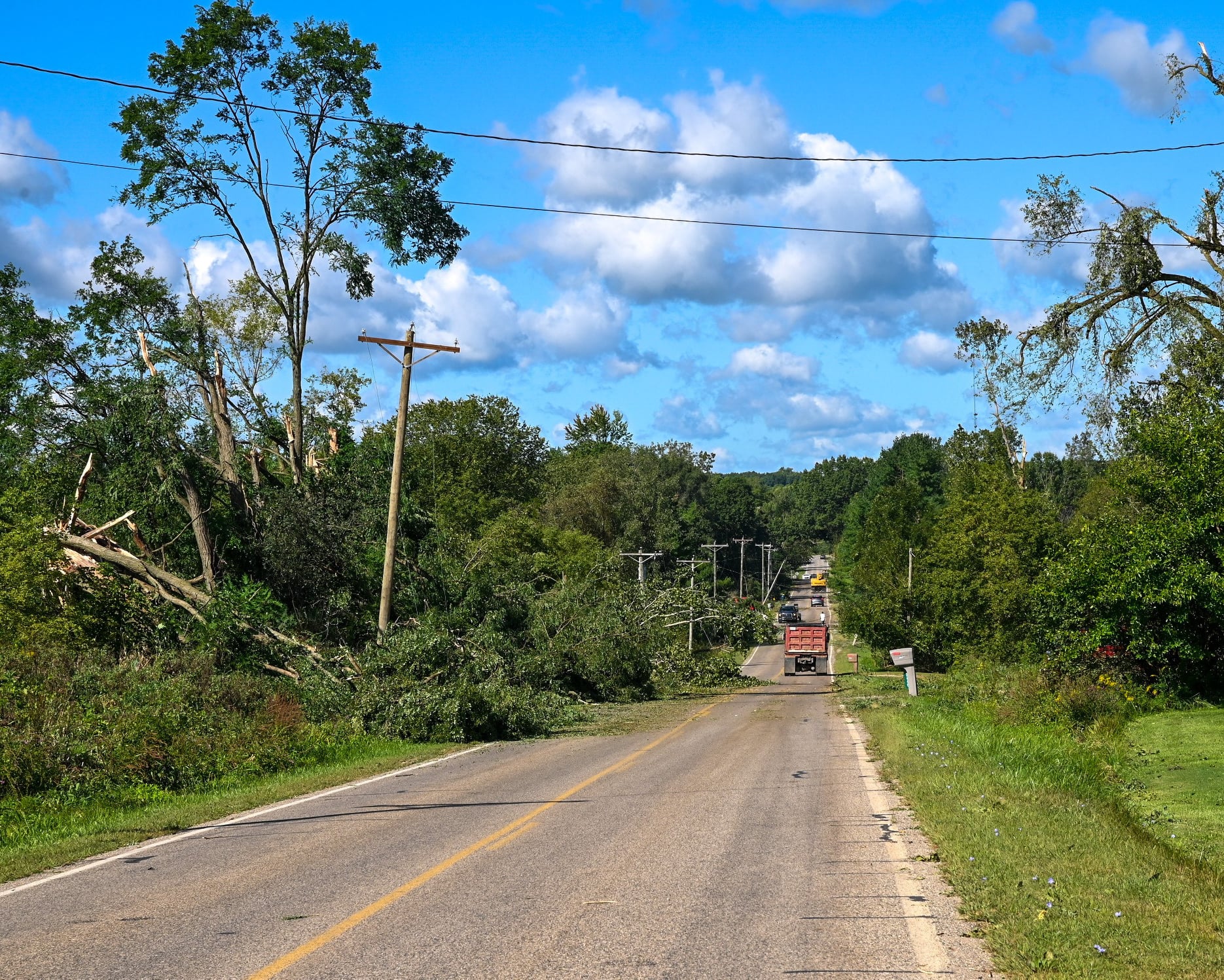
| Looking northwest from the south side of Hillsdale. Picture courtesy of Emma Wickham |
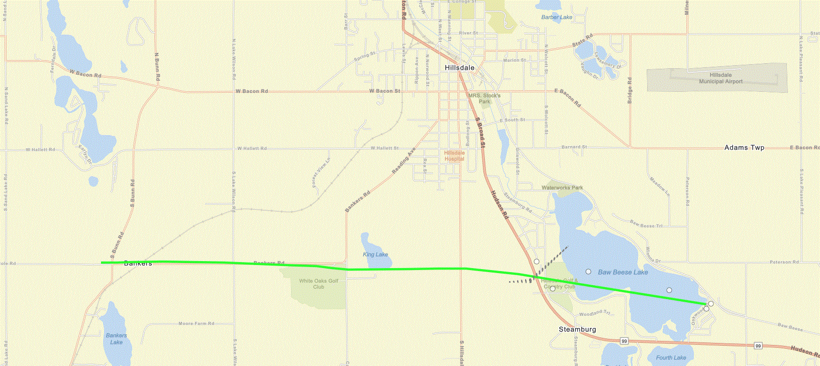
Tornadoes:
|
Tornado - E of Bryant, IN
|
||||||||||||||||
The Enhanced Fujita (EF) Scale classifies tornadoes into the following categories:
| EF0 Weak 65-85 mph |
EF1 Moderate 86-110 mph |
EF2 Significant 111-135 mph |
EF3 Severe 136-165 mph |
EF4 Extreme 166-200 mph |
EF5 Catastrophic 200+ mph |
 |
|||||
Video:
|
Looking southeast at wall cloud and tornado moving through the south side of Hillsdale. |
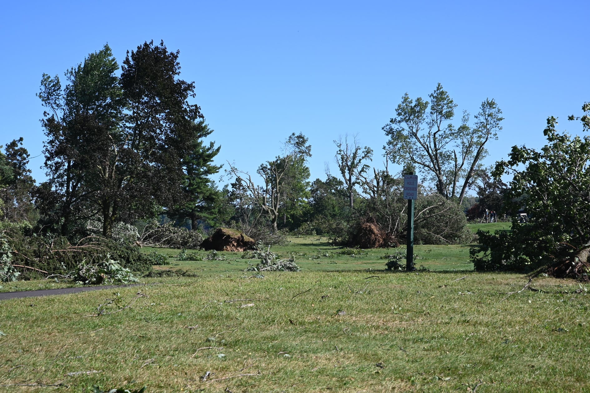
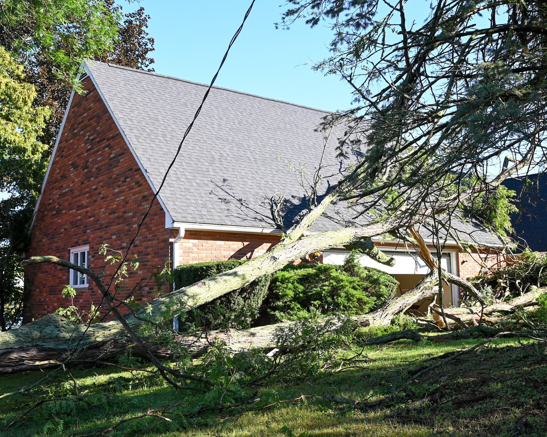
Photos
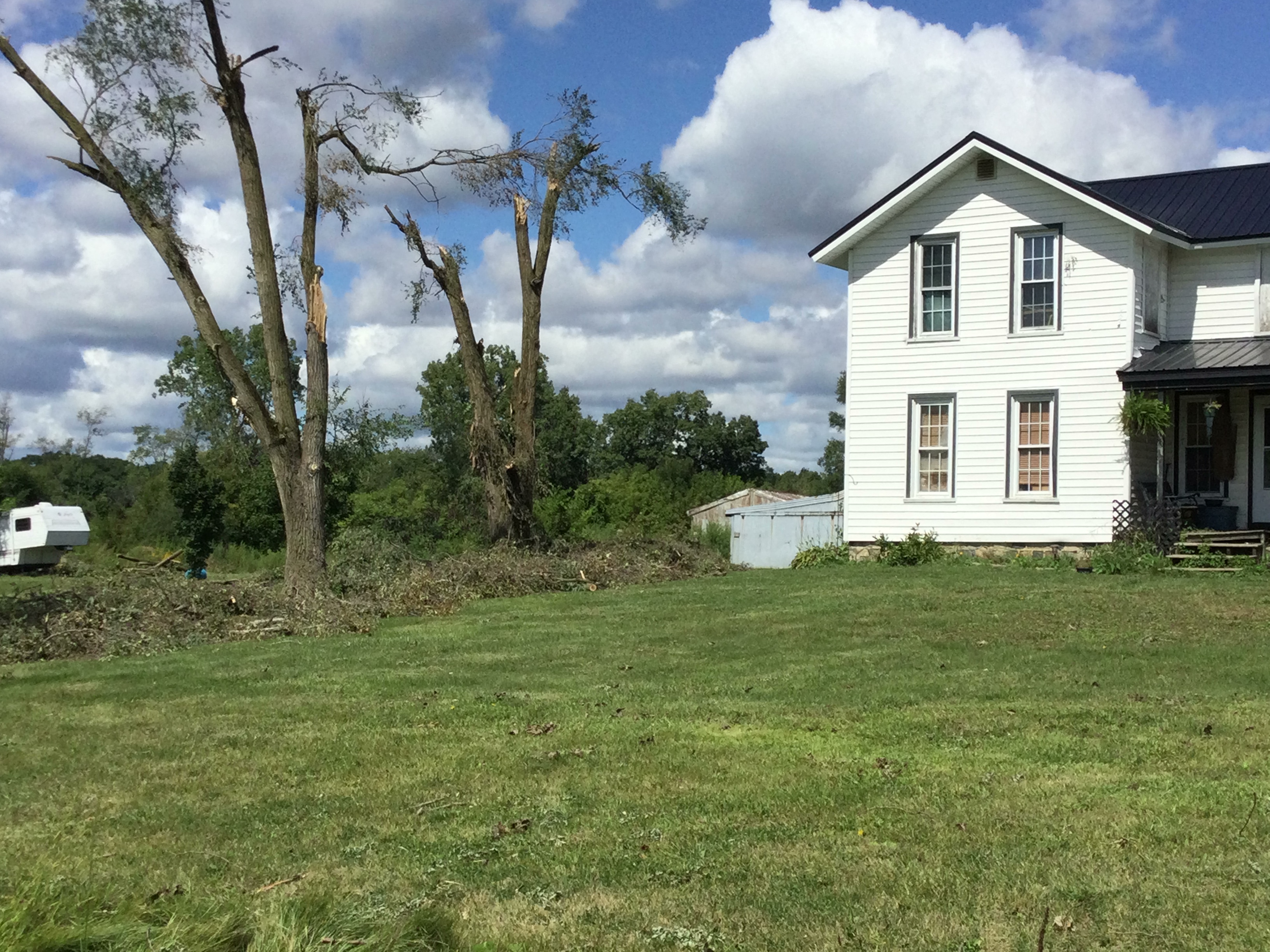
Damage photos from September 7th in the Hillsdale area. Thank you to the Hillsdale Board of Public Utilities who submitted many of them! If you have pictures of damage or storms that you want us to see, send it to our email account (nws.northernindiana@noaa.gov) or post it on our Twitter (@NWSIWX) or Facebook. Remember to use the TEL method when you submit your report, including the Time, Event, & Location.
 |
 |
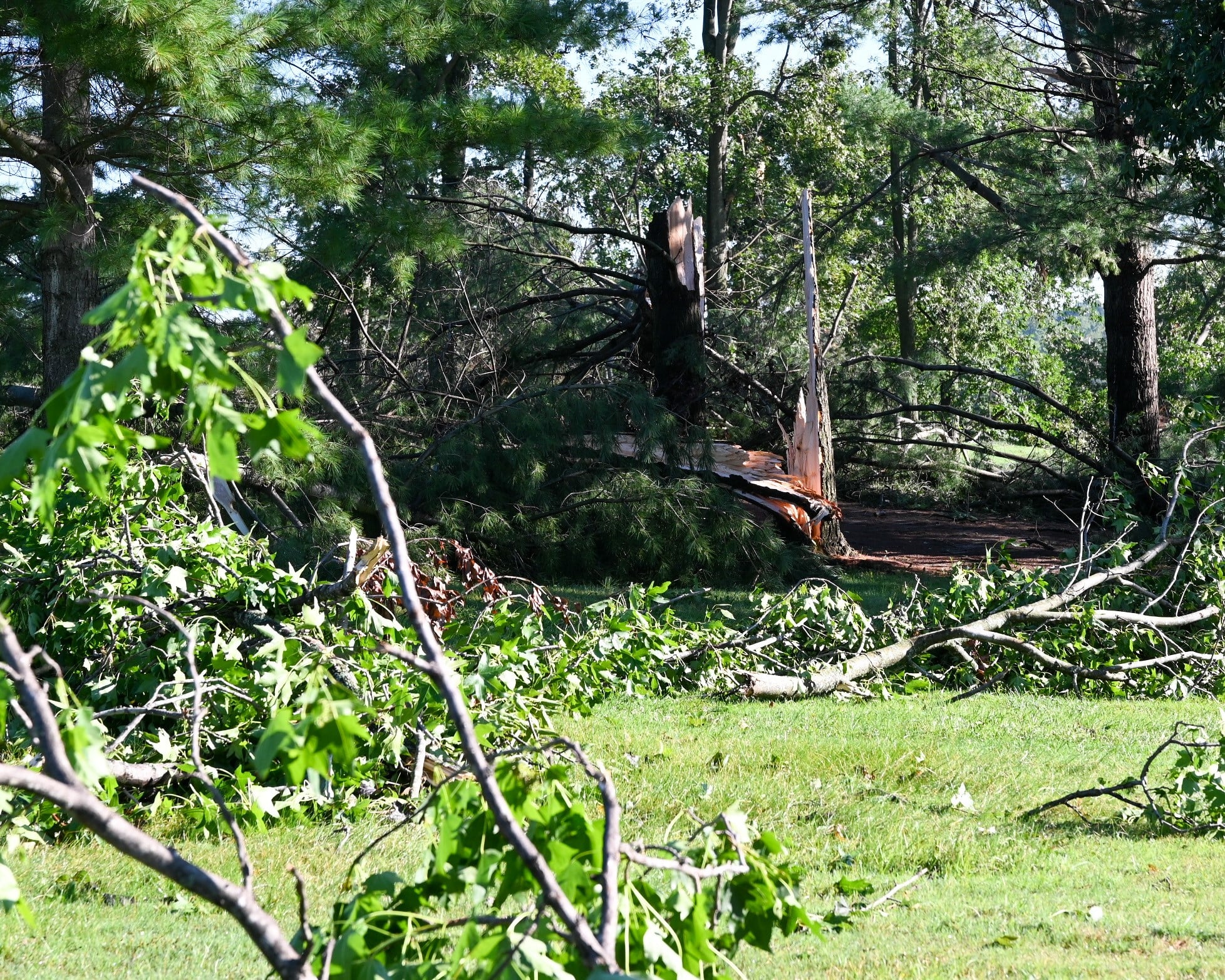 |
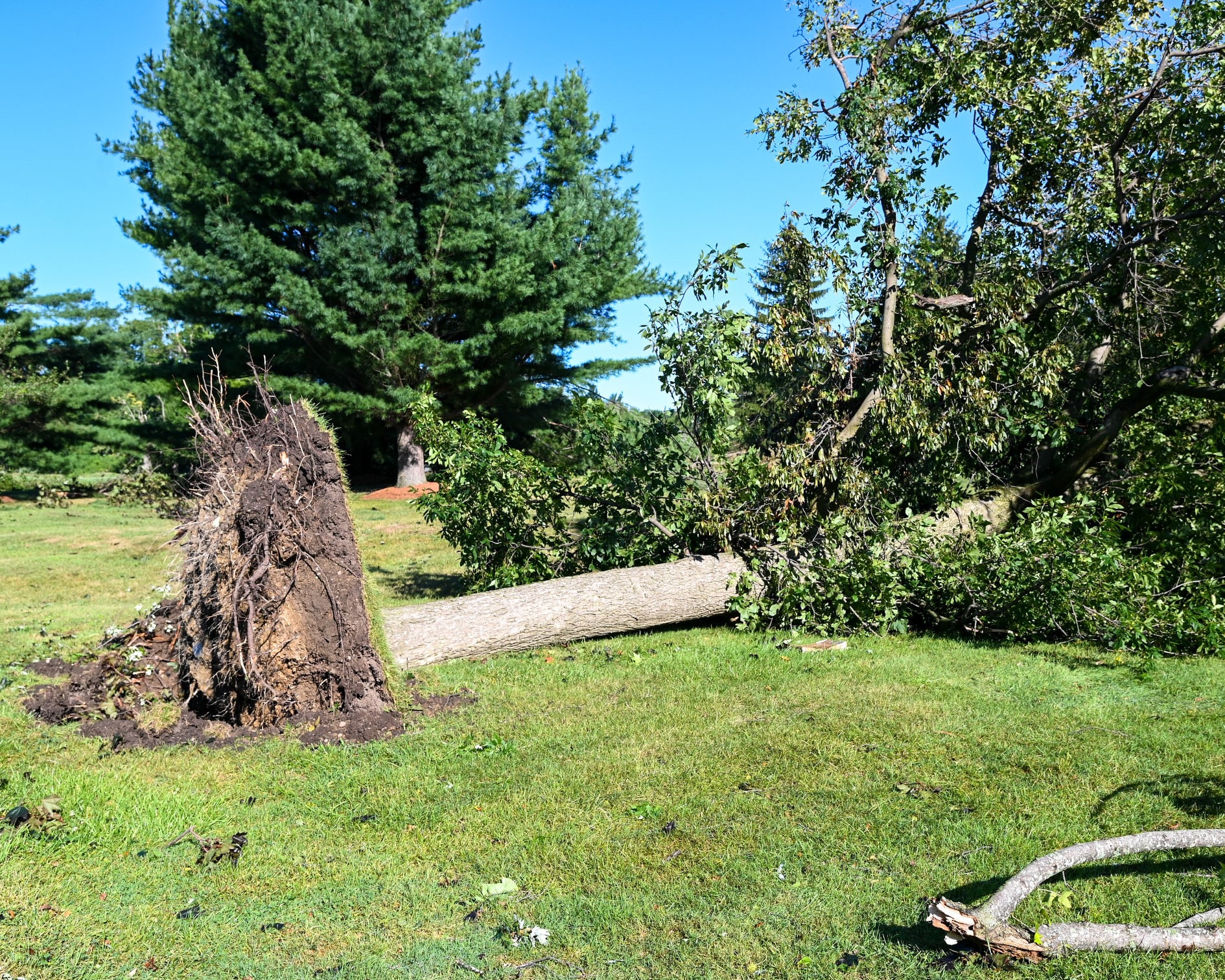
| Hillsdale Country Club devastation | Tree down on home | Trees snapped |
 |
 |
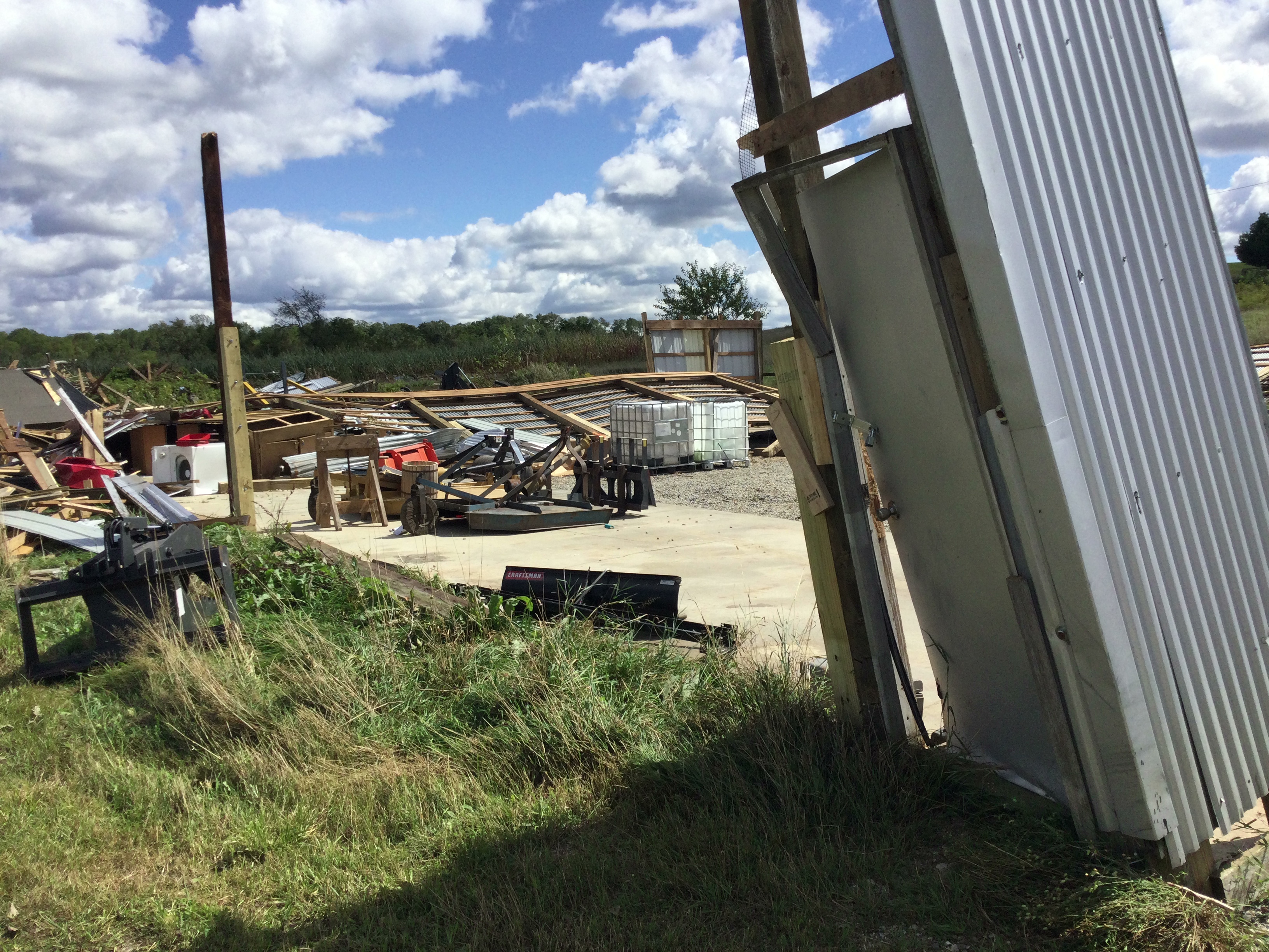 |
| Trees and powerpoles down on Bankers Rd | Large tree uprooted | Pole Barn destroyed |
 |
 |
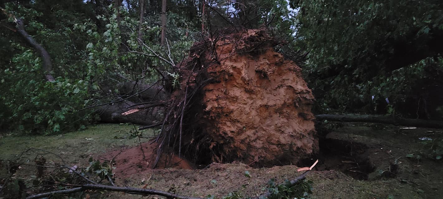 |
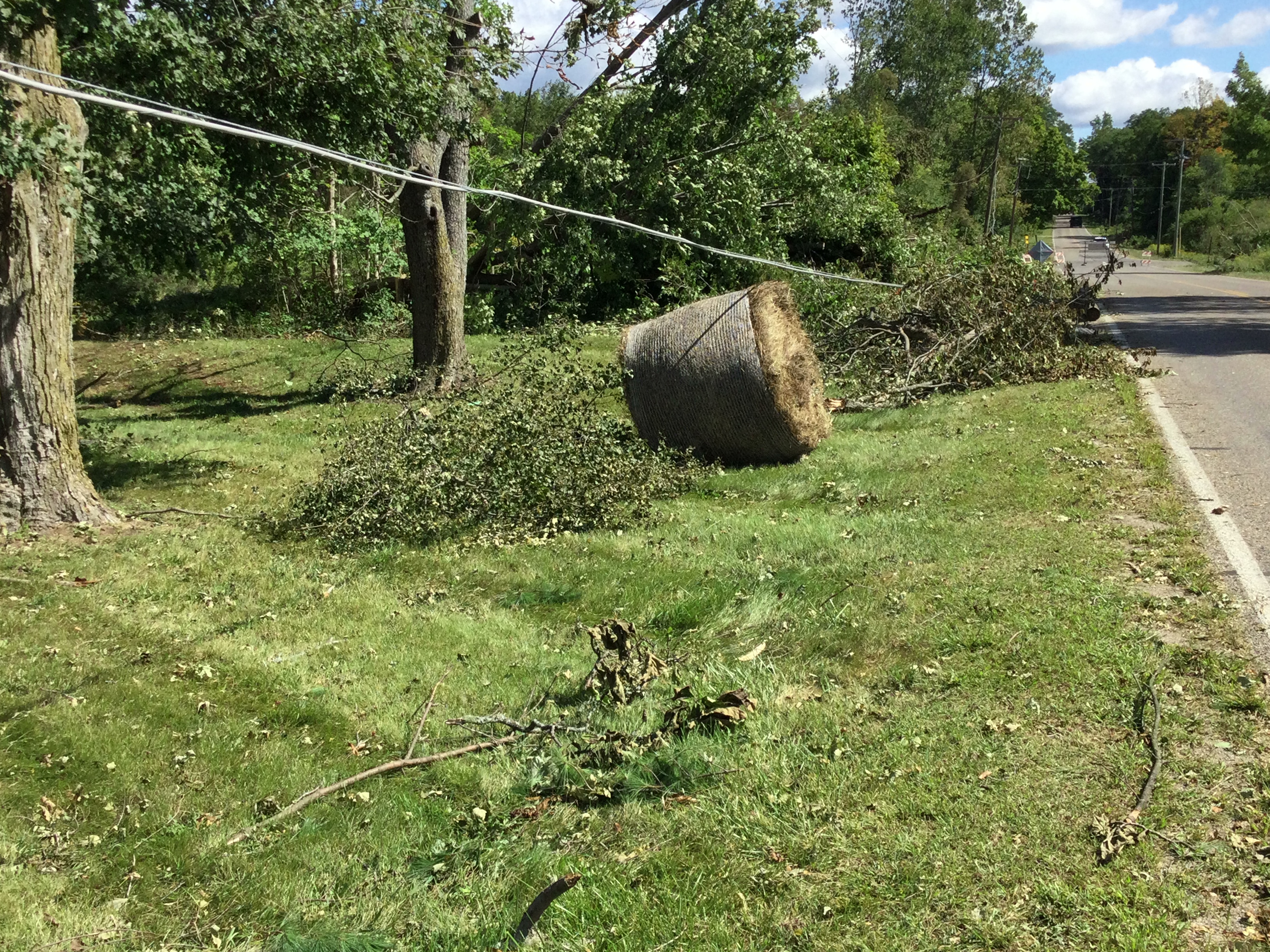
| Hay bales rolled | Trees Topped | Massive tree uprooted - Michelle Dix |
Radar
A 0.5° radar loop of reflectivity (left) and storm relative velocity (right) of this rotating supercell thunderstorm moving through Hillsdale county the evening of September 7th, 2021. Click on the square on the bottom right of the loop to enlarge the video.
Storm Reports
PRELIMINARY LOCAL STORM REPORT...SUMMARY
NATIONAL WEATHER SERVICE NORTHERN INDIANA
402 PM EDT WED SEP 8 2021

..TIME...   ...EVENT...      ...CITY LOCATION...     ...LAT.LON...
..DATE...   ....MAG....      ..COUNTY LOCATION..ST.. ...SOURCE....
            ..REMARKS..

0746 PM     TSTM WND DMG     ALLEN                   41.96N 84.77W
09/07/2021                   HILLSDALE          MI   EMERGENCY MNGR

            TREES AND POWER POLES/LINES DOWNED.

0747 PM     TSTM WND DMG     HILLSDALE               41.92N 84.63W
09/07/2021                   HILLSDALE          MI   EMERGENCY MNGR

            TREES DOWNED, SOME ONTO BUILDINGS. POWER
            LINES AND POLES DOWNED.

0755 PM     TSTM WND DMG     OSSEO                   41.88N 84.54W
09/07/2021                   HILLSDALE          MI   EMERGENCY MNGR

            ROOF BLOWN OFF HOUSE. POLE BARN AND FARM
            SILO DESTROYED.

0440 PM     TSTM WND DMG     4 E MAGICIAN LAKE       42.06N 86.09W
09/07/2021                   CASS               MI   EMERGENCY MNGR

            6 TREES DOWNED ACROSS ROADWAY. 2 REPORTS OF
            POWER LINES DOWNED.

0415 PM     TSTM WND DMG     1 S MOORE PARK          42.00N 85.64W
09/07/2021                   ST. JOSEPH         MI   PUBLIC

            CORRECTION TO FISHERS LAKE REPORT. REPORTS
            OF TREES AND TREE LIMBS NORTH OF THREE
            RIVERS NEAR THE INTERSECTION OF HEIMBACH AND
            WILBUR ROADS.

0740 PM     TSTM WND DMG     ALLEN                   41.96N 84.77W
09/07/2021                   HILLSDALE          MI   TRAINED SPOTTER

            SEVERAL LARGE TREES DOWN OVER THE ROAD. VIA
            SPOTTER NETWORK. TIMES ESTIMATED FROM RADAR.

0747 PM     TSTM WND DMG     2 NNE LAKE WILSON       41.90N 84.67W
09/07/2021                   HILLSDALE          MI   EMERGENCY MNGR

            TREES DOWN BLOCKING THE ROAD. LOCATION IS
            APPROXIMATE. TIME ESTIMATED FROM RADAR.

0416 PM     NON-TSTM WND GST 1 N BENTON HEIGHTS      42.13N 86.42W
09/07/2021  M54 MPH          BERRIEN            MI   ASOS

            ASOS STATION KBEH BENTON HARBOR.

0421 PM     TSTM WND DMG     SPINKS CORNERS          42.10N 86.32W
09/07/2021                   BERRIEN            MI   EMERGENCY MNGR

            EMERGENCY MANAGER REPORTS A FEW TREES DOWN
            IN NORTHERN BERRIEN COUNTY. ESTIMATED TIME
            AND ESTIMATED LOCATION.

0450 PM     HAIL             2 NE STEVENSVILLE       42.03N 86.50W
09/07/2021  M0.50 INCH       BERRIEN            MI   COCORAHS


0450 PM     HAIL             1 N STEVENSVILLE        42.02N 86.53W
09/07/2021  E0.50 INCH       BERRIEN            MI   PUBLIC

            REPORT FROM MPING: HALF-INCH (0.50 IN.).

0453 PM     HAIL             2 SE SHOREHAM           42.04N 86.49W
09/07/2021  M0.50 INCH       BERRIEN            MI   TRAINED SPOTTER


0454 PM     HAIL             3 SSE FAIR PLAIN        42.05N 86.44W
09/07/2021  M0.25 INCH       BERRIEN            MI   PUBLIC

            PHOTO ON TWITTER.

0557 PM     HAIL             1 SW RIVERSIDE          42.17N 86.40W
09/07/2021  E0.25 INCH       BERRIEN            MI   PUBLIC

            ESTIMATED LOCATION FROM TWITTER MENTION.

0617 PM     FLOOD            2 E SHOREHAM            42.05N 86.48W
09/07/2021                   BERRIEN            MI   EMERGENCY MNGR

            EM REPORTS FLOODING AT THIS LOCATION. DEPTH
            OF WATER IS UNKNOWN. VIA CHAT.

0621 PM     FLOOD            1 NNE SAINT JOSEPH      42.11N 86.49W
09/07/2021                   BERRIEN            MI   EMERGENCY MNGR

            LIONS PARK DR IS IMPASSABLE TO PASSENGER
            CARS.

0625 PM     HEAVY RAIN       SODUS                   42.04N 86.37W
09/07/2021  E1.83 INCH       BERRIEN            MI   PUBLIC

            RAINFALL SO FAR.

0639 PM     FLOOD            3 WSW SODUS             42.04N 86.42W
09/07/2021                   BERRIEN            MI   PUBLIC

            PUBLIC REPORTS NEIGHBORHOOD ROADS COMPLETELY
            FLOODED OVER.

0654 PM     FLOOD            1 ENE FAIR PLAIN        42.09N 86.43W
09/07/2021                   BERRIEN            MI   PUBLIC

            PUBLIC REPORTS ROAD FLOODING AT
            INTERSECTION.

0657 PM     FLOOD            3 SSE FAIR PLAIN        42.04N 86.44W
09/07/2021                   BERRIEN            MI   LAW ENFORCEMENT

            LAW ENFORCEMENT REPORTS FLOODING ABOUT ONE
            FOOT DEEP NEAR M139 AND SCOTTDALE ROAD.

0714 PM     HEAVY RAIN       SODUS                   42.05N 86.37W
09/07/2021  M2.78 INCH       BERRIEN            MI   PUBLIC

            STORM TOTAL RAINFALL OF 2.78 INCHES.

0722 PM     HEAVY RAIN       SODUS                   42.05N 86.37W
09/07/2021  E3.60 INCH       BERRIEN            MI   PUBLIC

            PUBLIC REPORTS 3.6 INCHES IN LESS THAN 3
            HOURS.

0410 PM     TSTM WND GST     4 NW BRIDGMAN           41.99N 86.62W
09/07/2021  M49 MPH          LMZ043             MI   BUOY


&&

$$
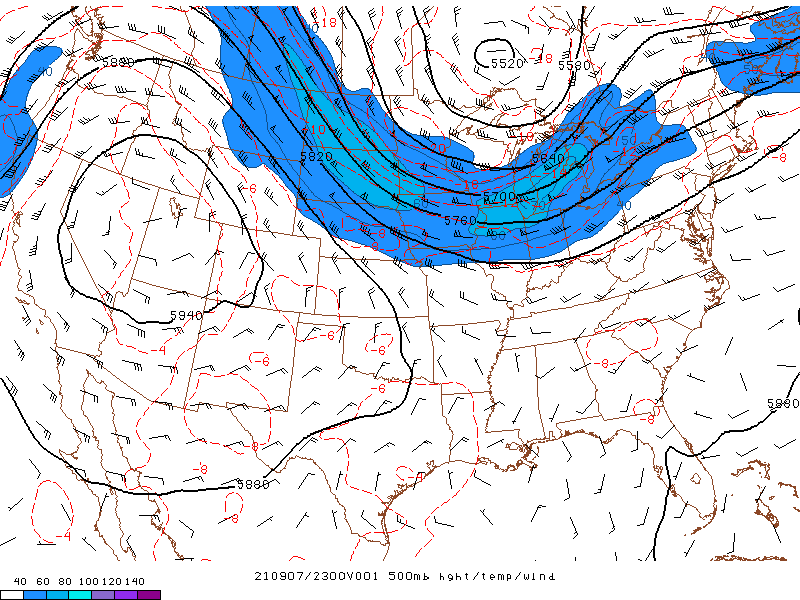
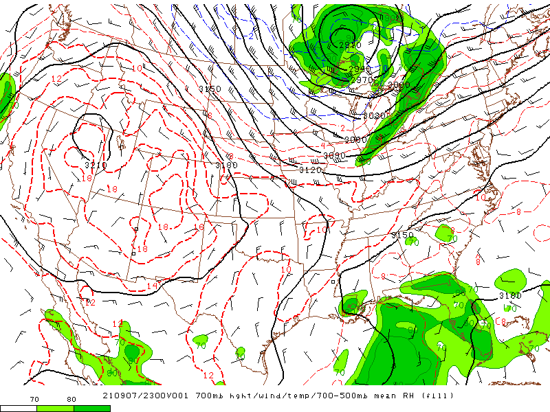
Environment
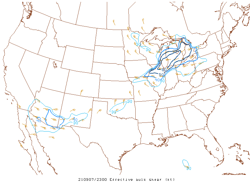
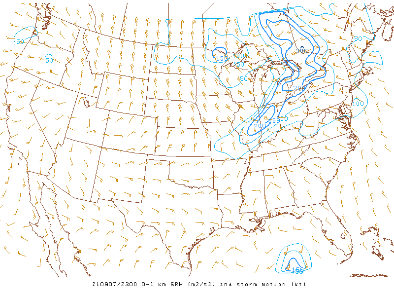
Conditions were favorable for severe storms from northern Illinois east across southern lower Michigan and northwest Indiana. Good moisture return along with substantial lift along the cold frontal zone and increasing wind shear developed in by Tuesday evening. To learn more about thunderstorm ingredients and lifecycle, check out our spotter training video here.
 |
 |
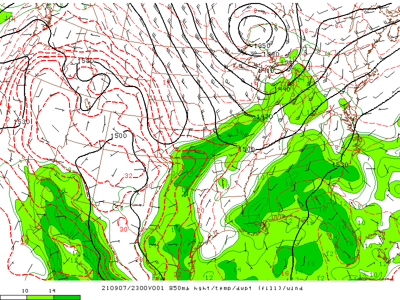 |
| 500 mb Height/Temp/Wind | 700 mb Height/Temp/700-500 RH | 850 mb Height/Temp/Dewpoint |
 |
 |
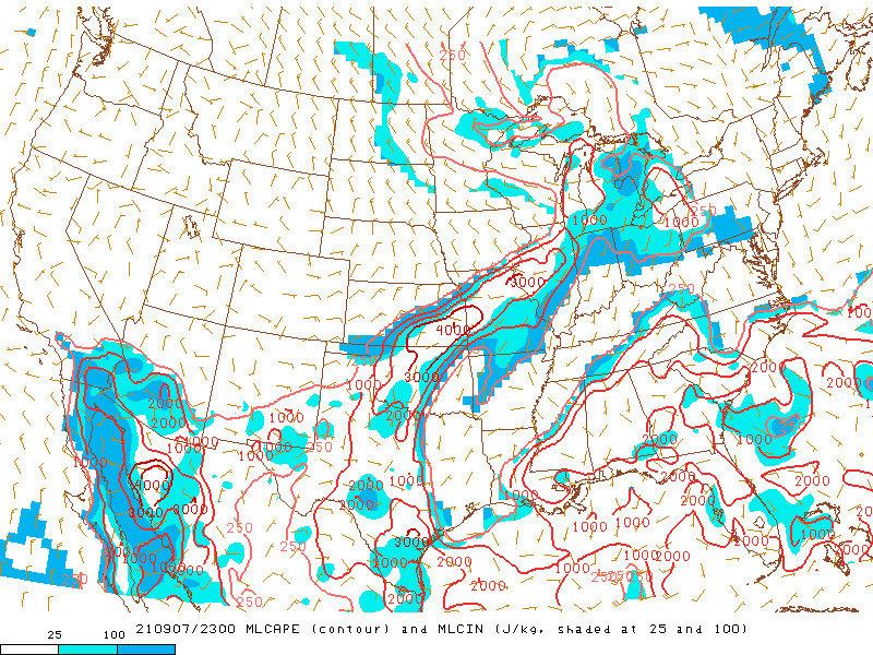 |
| Effective Bulk Shear (kts) | 0-1km SRH (kts) | MLCAPE/MLCIN (J/kg) |
 |
Media use of NWS Web News Stories is encouraged! Please acknowledge the NWS as the source of any news information accessed from this site. |
|