Overview
Two EF-0 tornadoes have been confirmed in St. Joseph county Indiana, on the south/southwest side of South Bend from October 12th, 2016. These two tornadoes were embedded within two larger areas of straight line wind damage associated with a microburst. Showers and isolated storms developed across the area during the afternoon of Wednesday October 12th. The storm that produced the microburst and two tornadoes developed immediately ahead of a cold frontal boundary advancing through the area.
A National Weather Service damage survey team from this office was dispatched to investigate storm damage on the south side of South Bend. Two EF-0 tornadoes briefly touched down and details regarding these tornadoes can be found below. The only other severe weather report outside of St. Joseph County was in Elkhart County near Goshen were some tree damage was noted at a residence.
Tornadoes:
|
Tornado 1: 3.5 miles SW South Bend, IN
Track Map  
|
||||||||||||||||
|
Tornado 2: South Bend, IN
Track Map 
|
||||||||||||||||
The Enhanced Fujita (EF) Scale classifies tornadoes into the following categories:
| EF0 Weak 65-85 mph |
EF1 Moderate 86-110 mph |
EF2 Significant 111-135 mph |
EF3 Severe 136-165 mph |
EF4 Extreme 166-200 mph |
EF5 Catastrophic 200+ mph |
 |
|||||
Radar Loop -South Bend
 |
|
KIWX Radar Loop from 6:06 - 6:52 PM EDT on 10/12/2016 This radar loop contains reflectivity and storm relative velocity. An embedded cell within a larger line began to intensify as it moved Northeast from Crumstown, IN towards South Bend, IN and had a broad circulation as seen by radar storm relative velocity. The storm was just southeast of South Bend, IN around 6:27 pm when the first tornado touched down and one minute later it lifted. The second tornado touched down at 6:30 pm and lifted within one minute. Both tornadoes were associated with a larger microburst event that led to strong winds at the surface. While the velocity couplet is broad at most times, it is likely that for a short period it tightened and hence produced both short lasting tornadoes. |
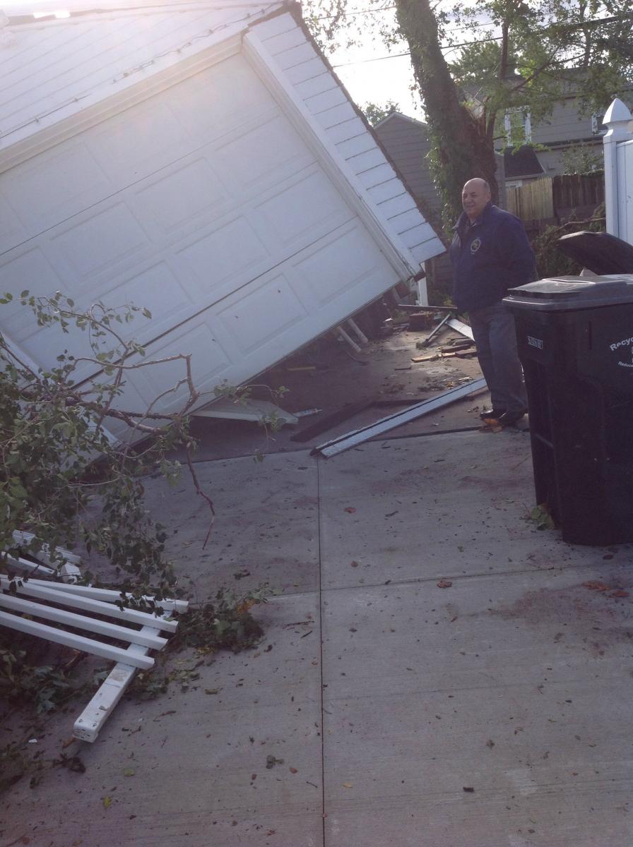
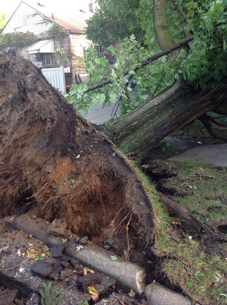
Photos - South Bend
 |
 |
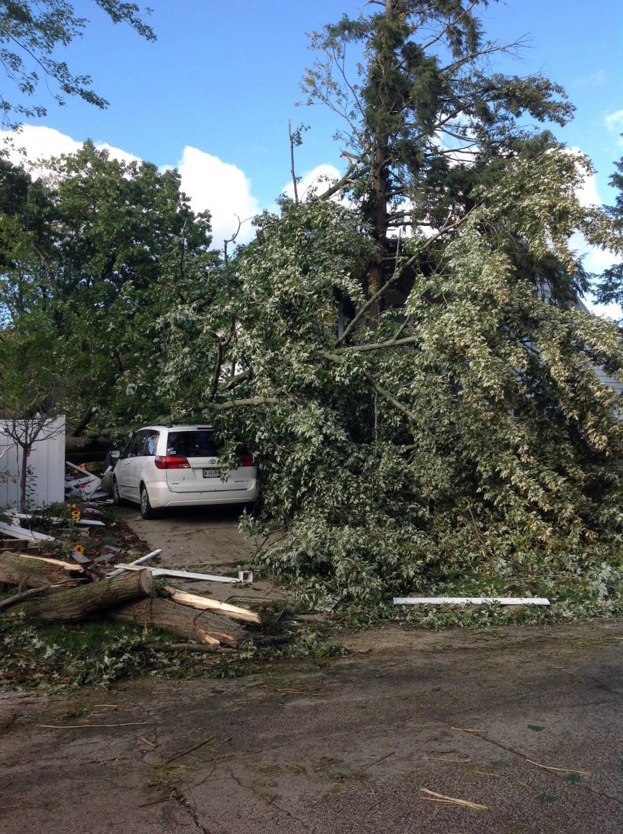 |
| Shed lifted off its foundation | Large tree blown over | Tree branches snapped |
 |
 |
 |
| Tree fell on top of a pickup truck |
Shingles blown off roof
|
Aerial view of tornado damage |
Environment
Showers and isolated storms developed across the area during mid/afternoon hours ahead of lead short wave trough. Storms formed along a line with mainly 25-40 mph winds as they lifted northeast across central/northeast portions of the forecast area. Additional showers/isolated storms developed closer to the approaching cold front early in the evening. One of these storms produced significant wind damage (fairly localized) on south side of South Bend. Narrow pre-frontal moisture axis lifted into the area, with fairly strong low/mid level flow ahead of the front (40-50 knots). Lead short wave appeared to aid in convective development along weak instability axis (200-500 J/kg). Effective shear was on the order of 30 knots, although low level shear was in the 20-25 knot range along narrow pre-frontal axis in the South Bend vicinity.
 |
 |
 |
| Figure 1: SPC 22Z 0-1km shear | Figure 2: SPC 22Z Precipitable Water | Figure 3: SPC 22Z Surface Based CAPE |
SPC Products
 |
| Figure 4: SPC Day 1 Convective Outlook 4:00pm October 12, 2016 |
 |
Media use of NWS Web News Stories is encouraged! Please acknowledge the NWS as the source of any news information accessed from this site. |
|

