Several rounds of thunderstorms trained across northern and north central Indiana on August 21st and through early morning hours of the 22nd. These storms dropped in excess of 5 inches of rain in many counties with an area in eastern Grant and Blackford counties which received in excess of 10 inches of rain. A majority of this rain fell in a 6 to 8 hour period during the early morning hours of August 22nd. Interstate 69 was shut down for several hours in eastern Grant county due to high water flowing over the interstate. There were many reports of water rescues and stranded vehicles in the hardest hit areas.
This map shows the 24 hour precipitation totals across our forecast area. The greatest bullseye is in eastern Grant, Blackford, and western Jay counties where 7 to 10 inches of rain fell.
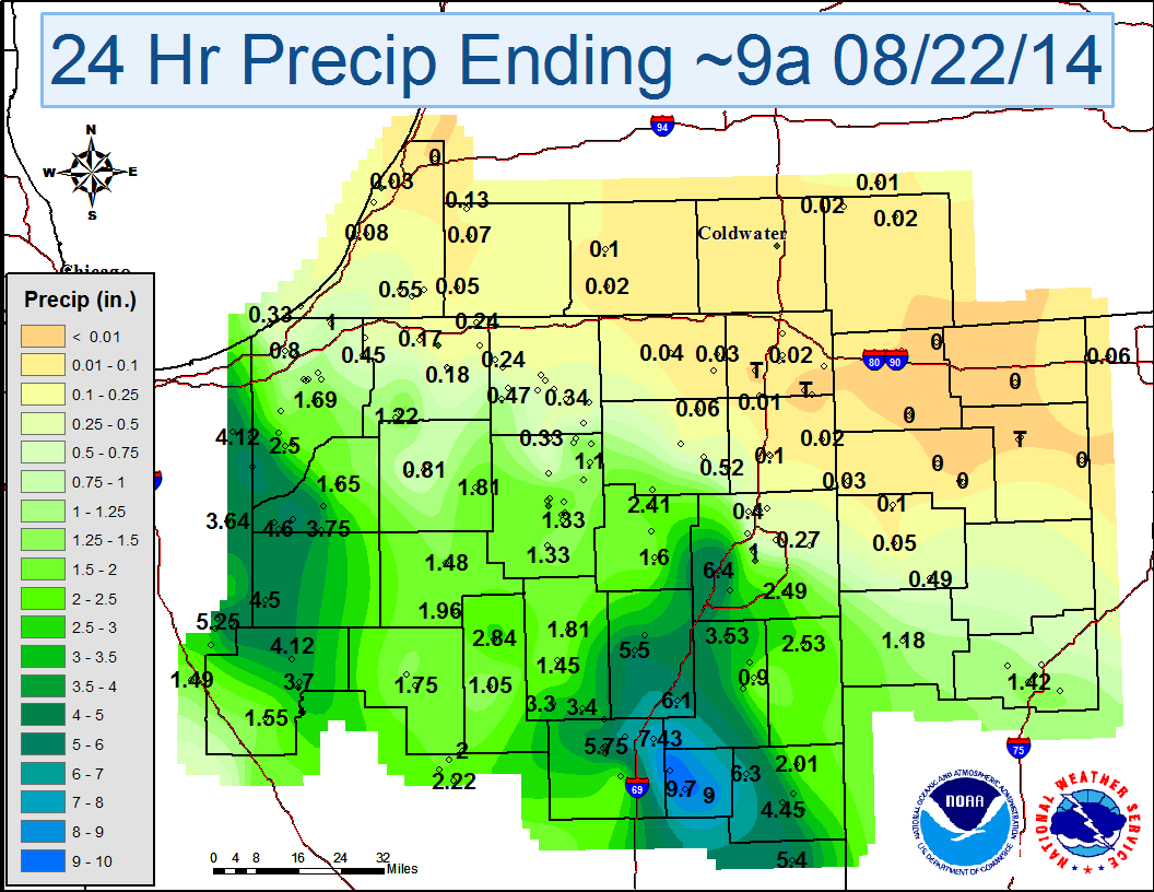
Greatest 24 Hour Rainfall Totals (August 21 at 9am through August 22 at 9 am):
| HARTFORD CITY 4.8 NW | 10.63 |
| HARTFORD CITY 0.2 NNW (WB9HLA) | 9.70 |
| HARTFORD CITY 4 ESE | 9.00 |
| VAN BUREN 1.8 SE | 7.43 |
| MARION 5.6 NE | 7.35 |
| FORT WAYNE 5.4 WSW | 6.40 |
| (KE9ML)NORTH JUDSON 0.7 SSW | 6.35 |
| PENNVILLE 0.3 WNW | 6.30 |
| LA CROSSE 3.2 NW | 6.13 |
| WARREN 1.6 ENE | 6.10 |
| MARION 2 N | 5.75 |
| (WA9QGL)ANDREWS 3.2 ESE | 5.50 |
| RIDGEVILLE 3 SSE | 5.40 |
| RENSSELAER 7.5 E | 5.25 |
| RENSSELAER 4.9 E | 5.05 |
| MARION 1.8 N | 4.77 |
| VALPARAISO | 4.62 |
| (KB9GPW)NORTH JUDSON 3.9 SW | 4.60 |
| FRANCESVILLE 2 SW | 4.50 |
| PORTLAND 2.7 WSW | 4.45 |
| NORTH JUDSON 4 W | 4.35 |
| MONTICELLO 5.5 NNW | 4.12 |
| WANATAH 2 WNW | 4.12 |
| KNOX 4.1 SW | 4.05 |
| PORTLAND 0.4 NW | 4.04 |
Our radar did an excellent job of estimating total rainfall accumulation from this event. The KIWX Dual Polarization upgrade proved its value once again with very little error in the estimations.
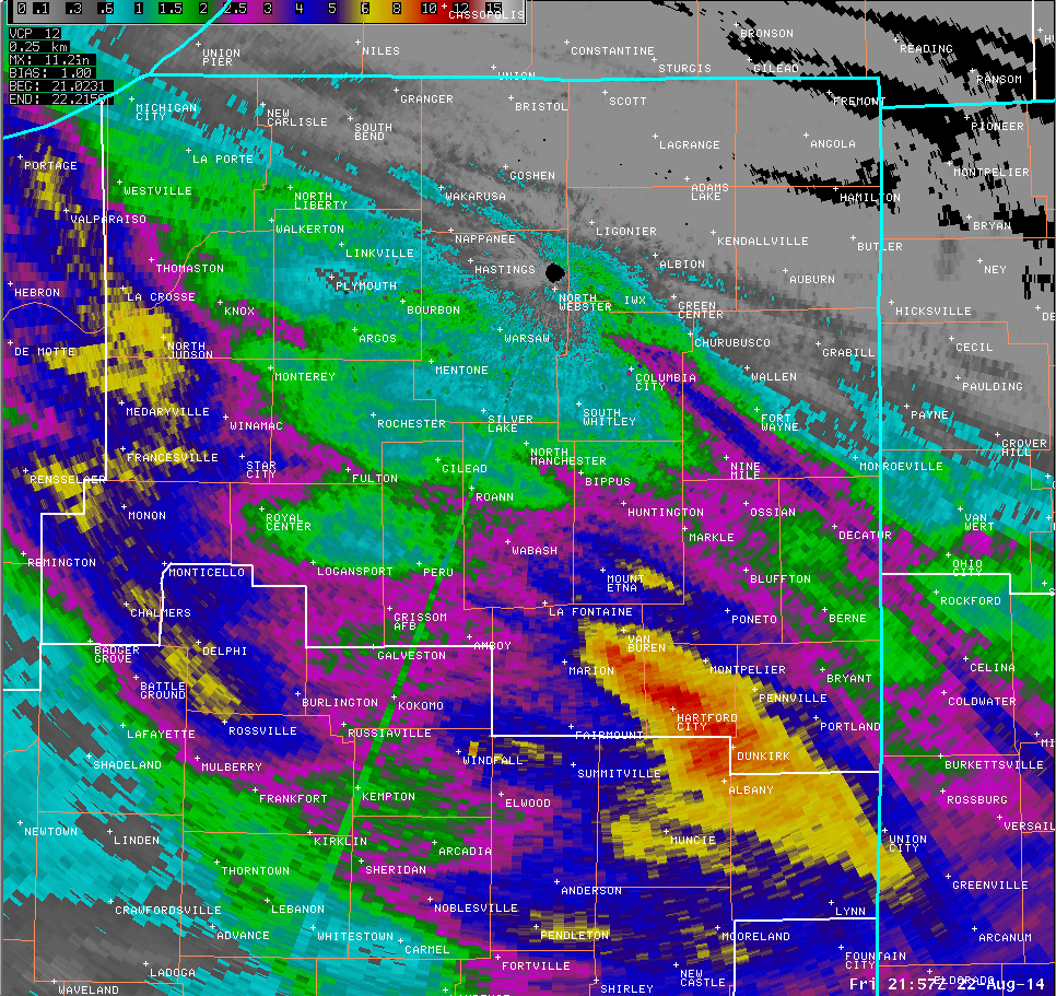
This radar loop shows the 3 rounds of storms which tracked across the southwestern half of the forecast area. In addition to the long duration of rainfall, the storms had rainfall rates in excess of 4 inches per hour at times.
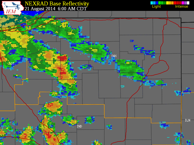
Synoptic Conditions: A weak shortwave topping the broad upper level ridge over the mississippi valley provided sufficient forcing to initiate convection over northern portions of Illinois and Indiana during the early morning hours on August 22nd, a stationary nearly E-W oriented surface boundary was across the area. The nose of a 30 knot westsouthwesterly low level jet was located over norhern Illinois. The southwestern half of the CWA had received heavy rain during the previous evening, but downwind propagation allowed that round of convection to be fairly short-lived. Storms also developed in northwestern Indiana and moved southeast into Laporte and Starke counties over areas that had seen rain earlier in the day.
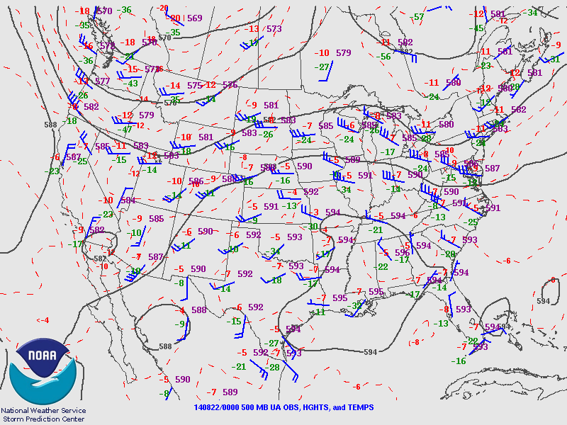
500 mb weather pattern at 8 pm on August 21st. A mid level ridge built in across the central portion of the United States allowing hot and humid conditions to devleop across the southern Great Lakes.
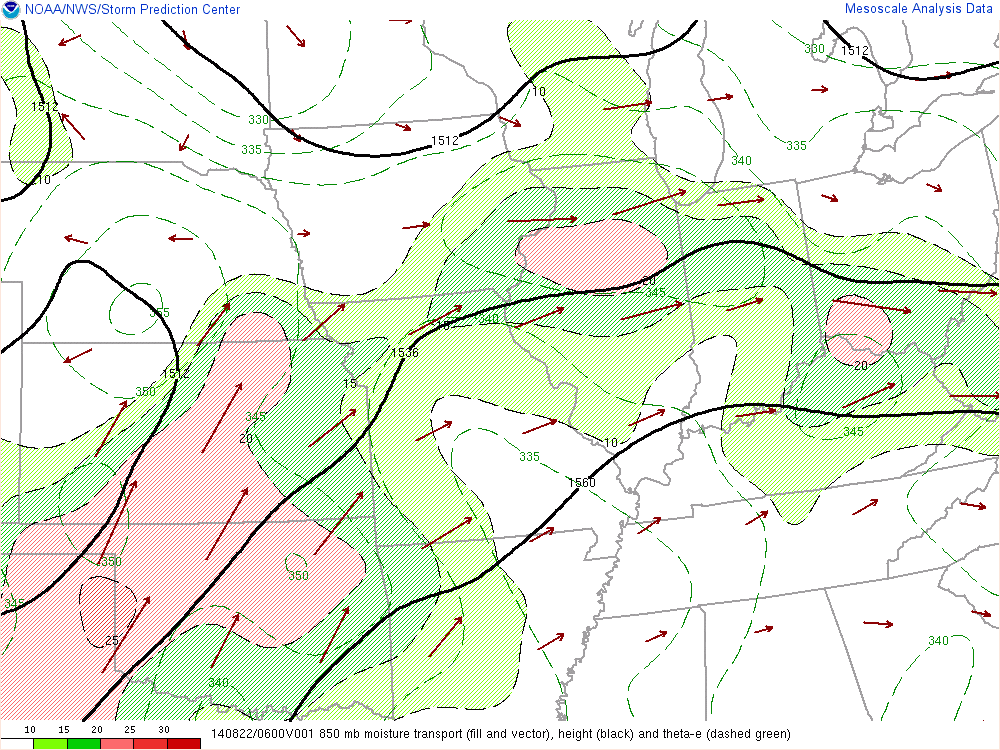
A focused area of moderately strong moisture transport at 850 mb was pointed directly towards our forecast area. This provided the consistent moisture feed the storms needed.
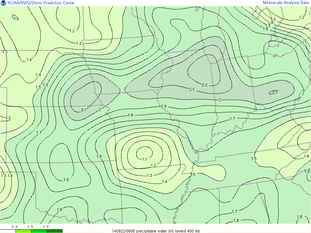
Precipitable water values were approaching extreme levels in excess of 2 inches.

Updated 8/24/2014 1:00 PM EDT
Bentley/NG

