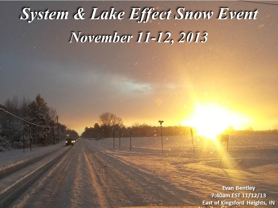
An arctic cold front dropped southeast across the local area during the afternoon and evening hours of November 11, 2013. The system brought widespread rainfall to the area which quickly changed to snow as colder air from the northwest wrapped into the system. Most locations received a dusting to 1.5 inches of a wet snow accumulation with the system. Temperatures quickly dropped from the mid 40s into the 20s as the front exited the area. Lake effect snow then developed over southeastern Lake Michigan in northerly flow behind the front. An intense single band of lake effect snow developed late in the night on November 11th and persisted into the early afternoon hours on November 12th from eastern Berrien County, Michigan into La Porte and western St. Joseph counties in Indiana. Highest snowfall totals were found in western Berrien county with totals of 14 to 17 inches. 6 to 9 inches of snow fell in La Porte and western St. Joseph counties.
This early season lake effect snow event was spawned by a deep upper-level trough across the eastern United States which allowed cold Canadian air to move across the Great Lakes. Below freezing temperatures dug as far south as the Gulf States with snow reported in the Carolinas. This cold, northerly flow over a relatively warm Lake Michigan triggered lake effect snow bands to form. Winds directly out of the north were perfect for convergence over the lake and a strong lake effect band to form.

The radar loop below shows the lake effect band developing quickly after the cold front passed. The band reached it's peak intensity between 4 am and 10 am before quickly dissipating by the early afternoon on November 12th. While the band moved back and forth across the shoreline through the event, the band stayed over St. Joseph, Michigan for the entire event and the snow never stopped which is why they received almost a foot and a half of snow. Snowfall rates in the heart of this band exceeded 2 inches per hour!

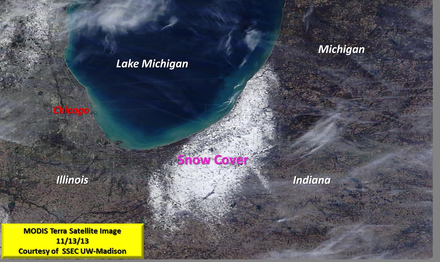
This MODIS Terra satellite image (courtesy of SSEC UW-Madison) from November 13 shows just how isolated of an area was affected by this lake effect snow event. The white area near Lake Michigan is where there is snow on the ground.
The distance from St. Joseph, MI (17 inches) to the nearest location with no snow is less than 10 miles!
The map and table below show some of the highest storm total snowfall reports received at NWS Northern Indiana through November 12th. This map includes system snow from the cold front passage and lake effect snow that developed behind the front.

| Location | Snowfall |
| Saint Joseph, MI | 17 |
| Stevensville 1.7 SSE | 16 |
| Stevensville, MI | 14 |
| 3 NNE Stevensville, MI | 13 |
| 1 NE Stevensville, MI | 12 |
| Kingsbury 0.3 WNW | 10 |
| Kingsbury 1 N | 10 |
| Kingsbury | 9 |
| La Porte | 8.2 |
| La Porte 1.6 SW | 8.2 |
| Kingsbury 5.0 ENE | 8.1 |
| SW Berrien Springs | 8 |
| Rolling Prairie | 8 |
| Buchanan | 8 |
| New Carlisle | 8 |
| 2 W Hanna | 7.5 |
| Wanatah 4.4 ESE | 7.5 |
| 2 SW La Porte | 7.4 |
| La Porte 1.7 SW | 7 |
Thanks to those of you who sent us your reports!
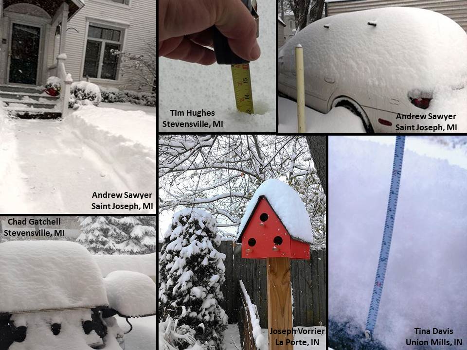
Here are a few images of the event from around the region...
Story published 6:30pm 11/12/2013
CEO/KG/EB

