A National Weather Service survey team confirmed EF-0 tornado damage on the east side of Nappanee. The tornado touched down approximately 2 miles east of downtown between county roads 7 and 9 along US 6 at approximately 12:56 P.M on Tuesday, September 27th. The tornado continued north for 0.6 miles before lifting north of US 6. Minor tree and roof damage consistent with winds of 70 to 75 miles per hour was observed. Several witnesses saw rotating debris in the air and heard a loud roar as the rain-wrapped tornado passed by.
Fall tornadoes are not uncommon in Northern Indiana although the environmental conditions under which this tornado formed are actually quite rare. Typically tornadoes form in unstable environments under thunderstorms with cloud tops greater than 40,000 feet. This tornado formed in very weak instability. The storm that formed the tornado only had cloud tops to 16,000 feet and never produced any lightning. The main ingredient that was present in the environment today was significant low-level wind shear (change in wind speed and direction).
The vertically stacked low pressure system which has kept conditions cool and wet across our area for the past several days provided just enough low-level wind shear to support the isolated tornado today. On satellite this low pressure system actually looked remarkably similar to a tropical system. While this low pressure center is far from tropical, in some ways the environment this tornado formed in can be compared to that of a tropical system.
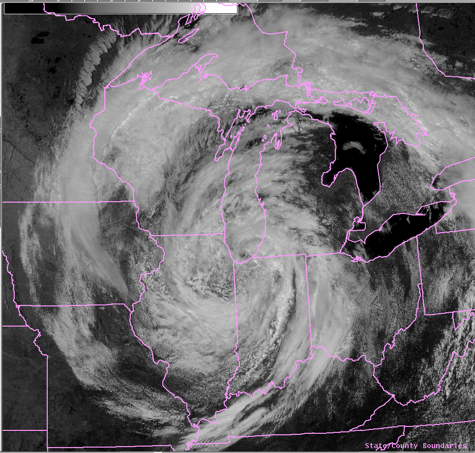
Visible Satellite at 1:01 pm
The Northern Indiana National Weather Service Doppler radar was able to detect a weak rotation couplet. A 4-panel radar image shows the base reflectivity in the top left, the storm-relative velocity at approximately 800 feet in the top right, the storm-relative velocity at approximately 2100 feet in the bottom right, and the storm-relative velocity at approximately 3500 feet in the bottom left. On the storm-relative velocity images, green indicates wind blowing towards the radar and red indicates wind blowing away from the radar.
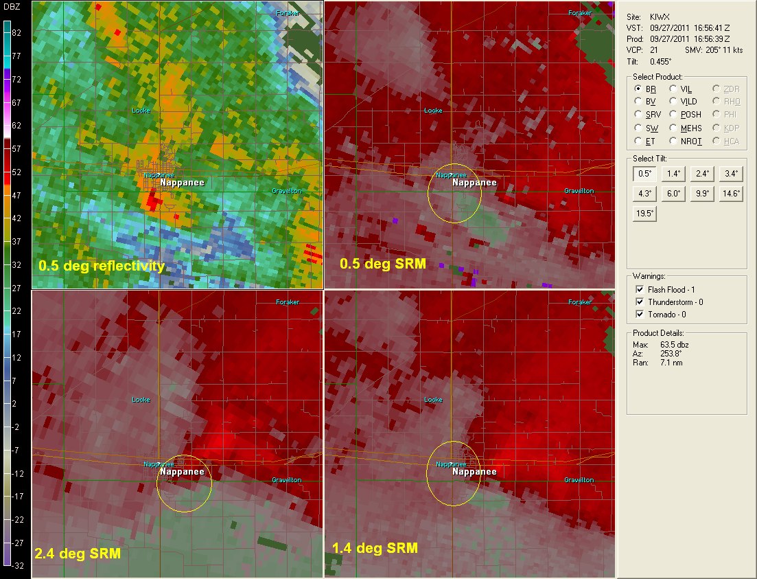
This radar image at 12:56 pm (the approximate time the tornado touched down) shows weak rotation at all 3 levels, but shows the strongest rotation at the 1.4* tilt where there are outbound velocities of 33 knots and inbound velocity at 1 knot which gives an approximate gate-to-gate velocity couplet of 34 knots.
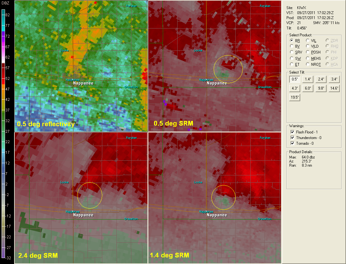
By 1:02 pm the circulation is still evident in radar data, but based on data collected by the survey, the tornado had already lifted.
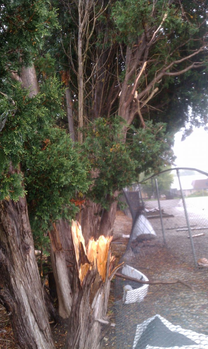
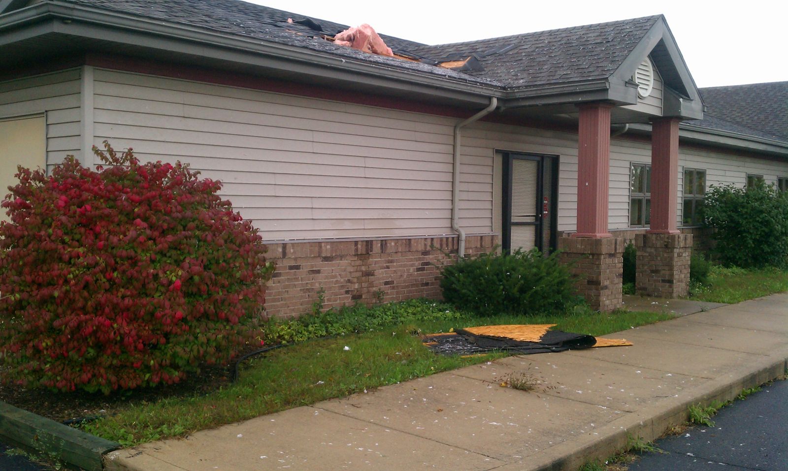
Below are several pictures taken by the National Weather Service during the damage survey. The roof damage appears to have occurred when the wind punctured a hole in the eaves on the north side of the building and blew out a hole in a weak part of the roof. The fence pictured was bent northward on the right side of the circulation and southward on the west side of the circulation showing the rotation of the tornado. Also, the pine trees which were snapped slightly above their bases were laying in a convergent pattern which is also consistent with tornado damage.
 North side of building |
 Insulation plastered against siding |
 Hole blown out of roof |
|
 Hole in eaves |
 Facing North |
 Sheet metal peeled back on corner of roof |
|
 Line of trees where tornado crossed |
 |
 |
|
|
|
|
|
|
 |
|