Severe Storms of May 29th, 2011
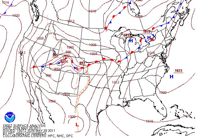
Thunderstorms developed across southern Iowa during the morning hours on Sunday. These storms intensified as they crossed the Mississippi River toward midday producing widespread wind damage. The following surface analysis valid at 2pm Sunday afternoon indicates that these storms were developing along and just to the north of a warm frontal boundary that was beginning to retreat northward.
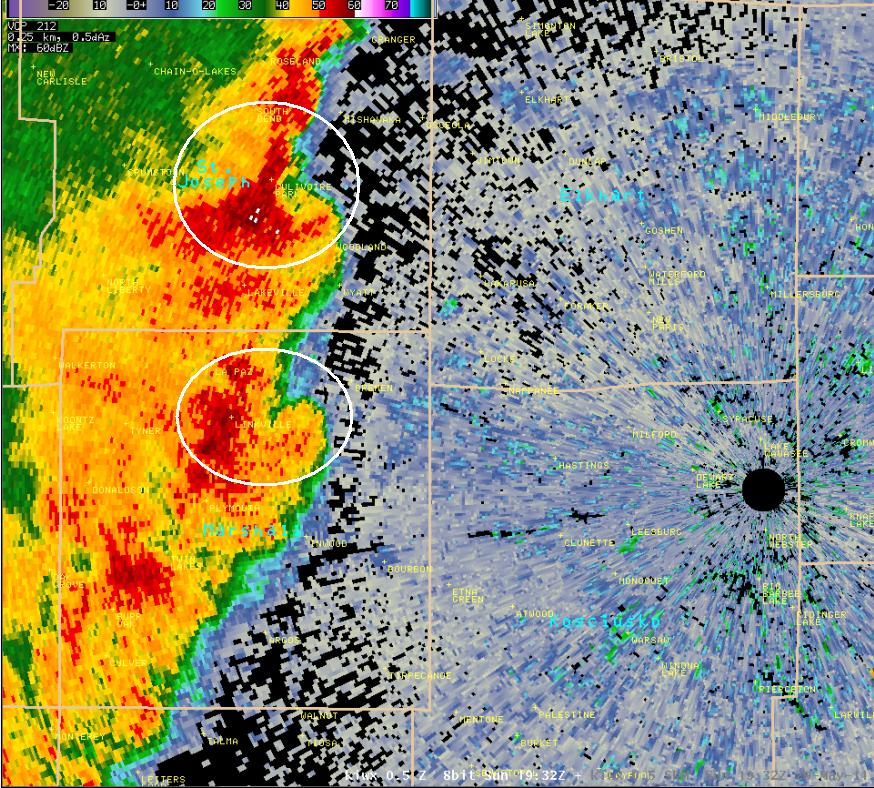
The cluster of thunderstorms eventually formed into a bow echo across northern Illinois as it moved into northwest Indiana. Atmospheric conditions were favorable for small mesoscale circulations to develop along the squall line, which can be associated with brief tornado spin ups or more focused areas of straight line wind damage. The following image shows base reflectivity with this squall line, and circled are two areas where these mesoscale circulations began to develop. Notice the circled bow-like appearance to the base reflectivity which can be indicative of more focused areas of stronger winds.

These smaller scale circulations persisted across portions of the squall line as it moved across northwest and north central Indiana. The following images show base reflectivity and storm relative motion as the storms entered north central Indiana around 330 pm EDT. Note the circled areas where the storm relative motion couplets indicate low level circulations embedded in the squall line.
 |
 |
Base velocity data also indicated very strong winds just above the surface (94 mph approximately 750 above ground level at the location circled in the below image). Extensive straight line wind damage was reported from Milford to Syracuse as the storms passed through.

The squall line maintained its intensity into far northeast Indiana, southeast lower Michigan, and northwest Ohio. The following images depict base reflectivity and base velocity late in the afternoon. Note the area of brighter reds in the base velocity data indicating areas of potentially stronger winds mixing down to the surface.
 |
 |
Below is an image of storm reports as the storms progressed across the Midwest. A summary of local storm reports can be found here.

In addition to numerous reports of straight line wind damage, two EF1 tornadoes have been confirmed, one in Coldwater, Michigan and one near Moore Park, Michigan.
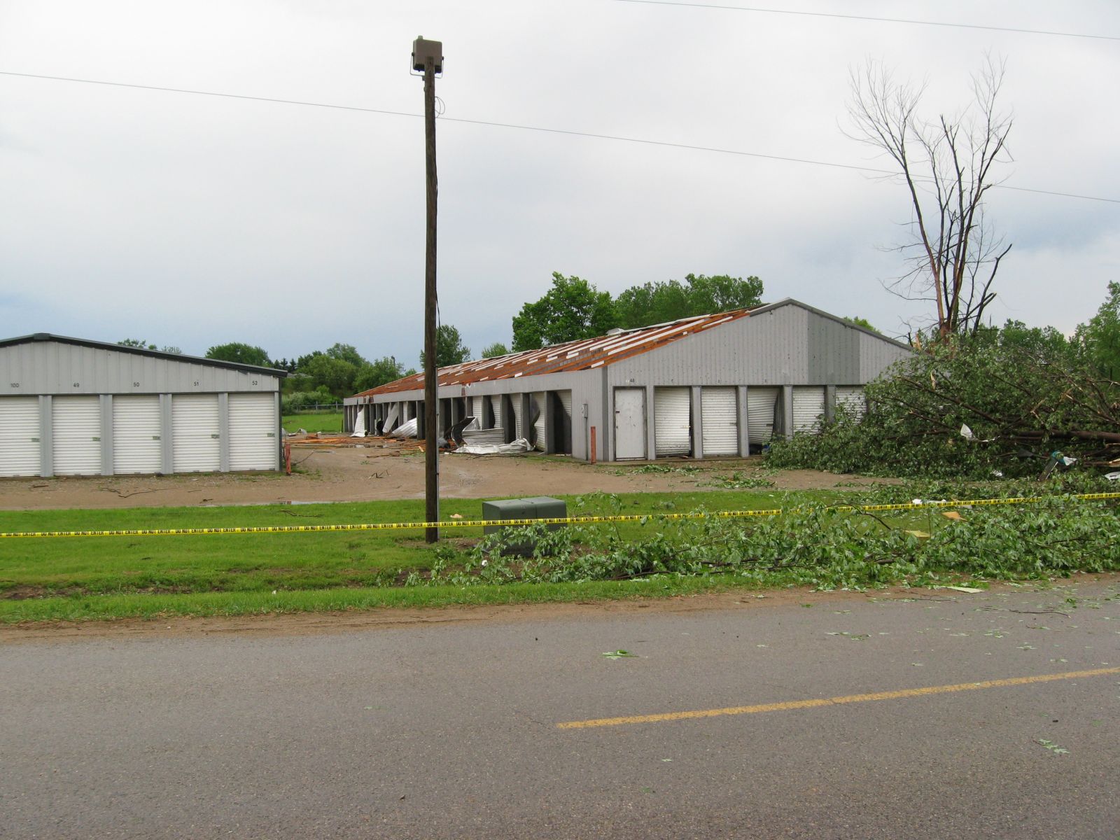
EF1 Tornado near Coldwater in Branch County, Michigan
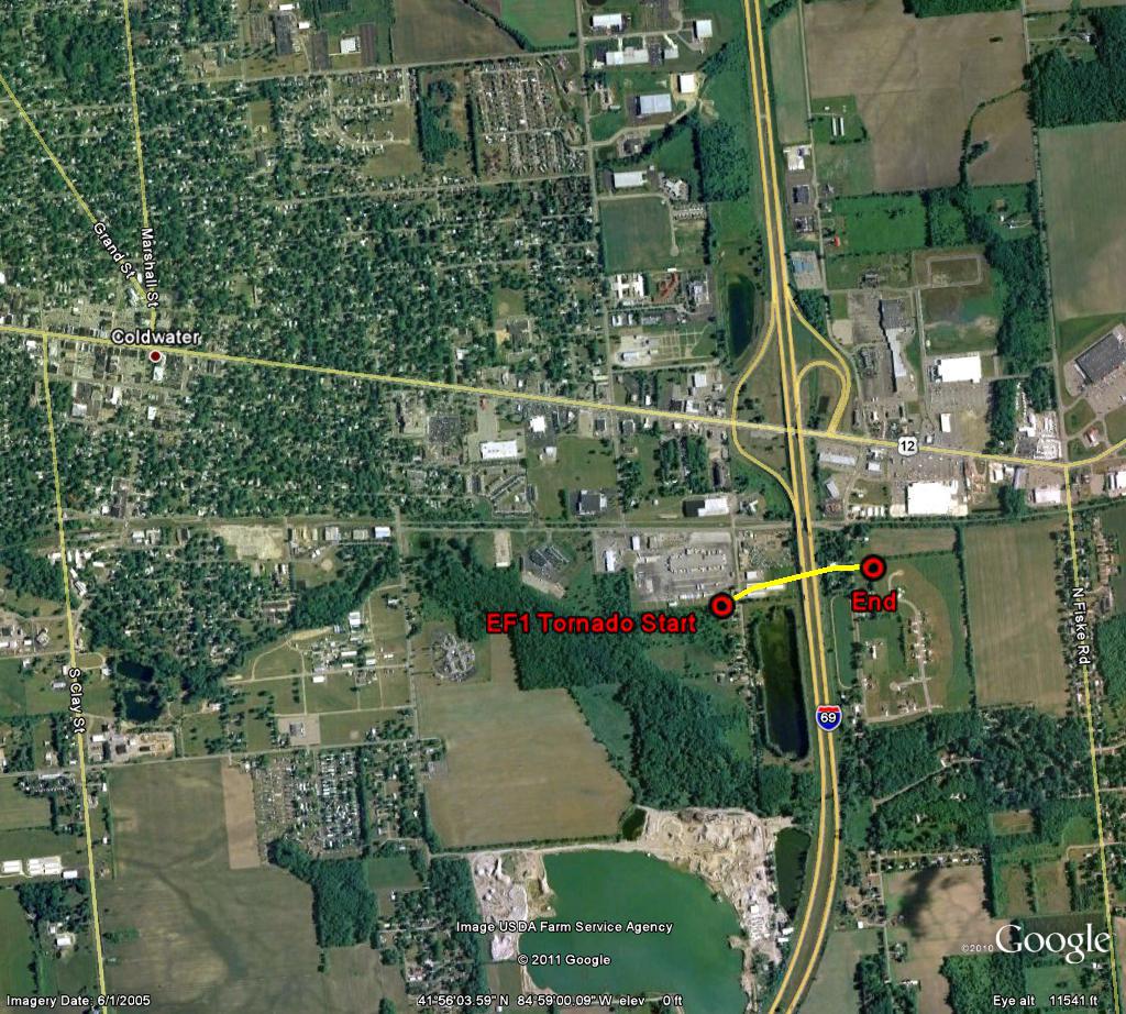
A DAMAGE SURVEY WAS CONDUCTED IN COLDWATER MICHIGAN WHICH HAS BEEN FOUND TO BE CONSISTENT WITH A BRIEF TORNADO TOUCHDOWN. THE TORNADO BEGAN NEAR THE AREA OF US 12 AND INTERSTATE 69...IN THE VICINITY OF 364 SOUTH MICHIGAN AVENUE WHERE MAJOR ROOF DAMAGE TO A STORAGE FACILITY OCCURRED...ALONG WITH SUBSTANTIAL ROOF DAMAGE TO A HOUSE. THE TORNADO CONTINUED APPROXIMATELY DUE EAST ACROSS INTERSTATE 69 WHERE SUBSTANTIAL TREE DAMAGE OCCURRED AND A GARAGE DOOR ON THE EAST SIDE OF A HOUSE WAS ALSO BLOWN IN JUST SOUTH OF WOODWARD DRIVE. DEBRIS FROM THE TORNADO WAS PUSHED ACROSS INTERSTATE 69.
PATH LENGTH 0.34 MILES
PATH WIDTH 100 TO 150 FEET
RATING EF1 WITH WINDS TO 90 MPH
WE WOULD LIKE TO THANK BRANCH COUNTY EMERGENCY MANAGEMENT FOR PROVIDING A GREAT DEAL OF HELP IN THIS SURVEY.
(Pictures below are courtesy of Branch County Emergency Management)
 |
 |
 |
 |
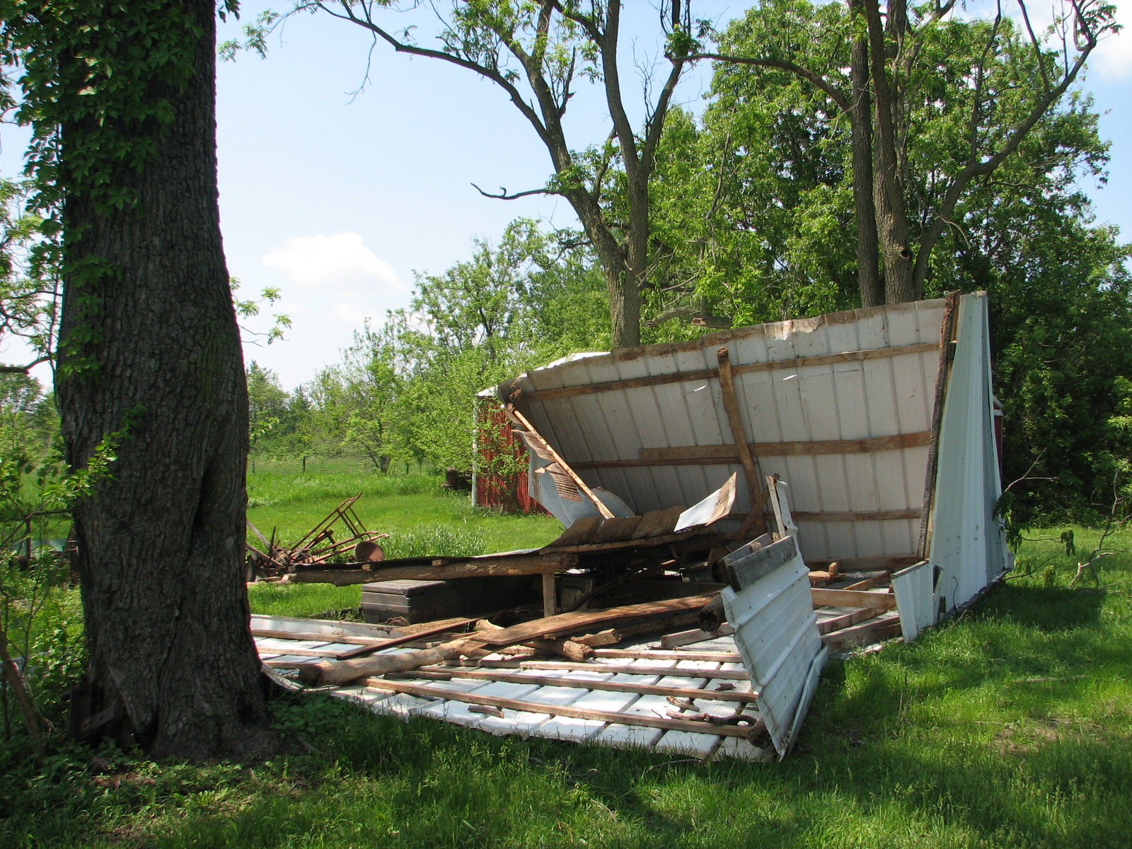
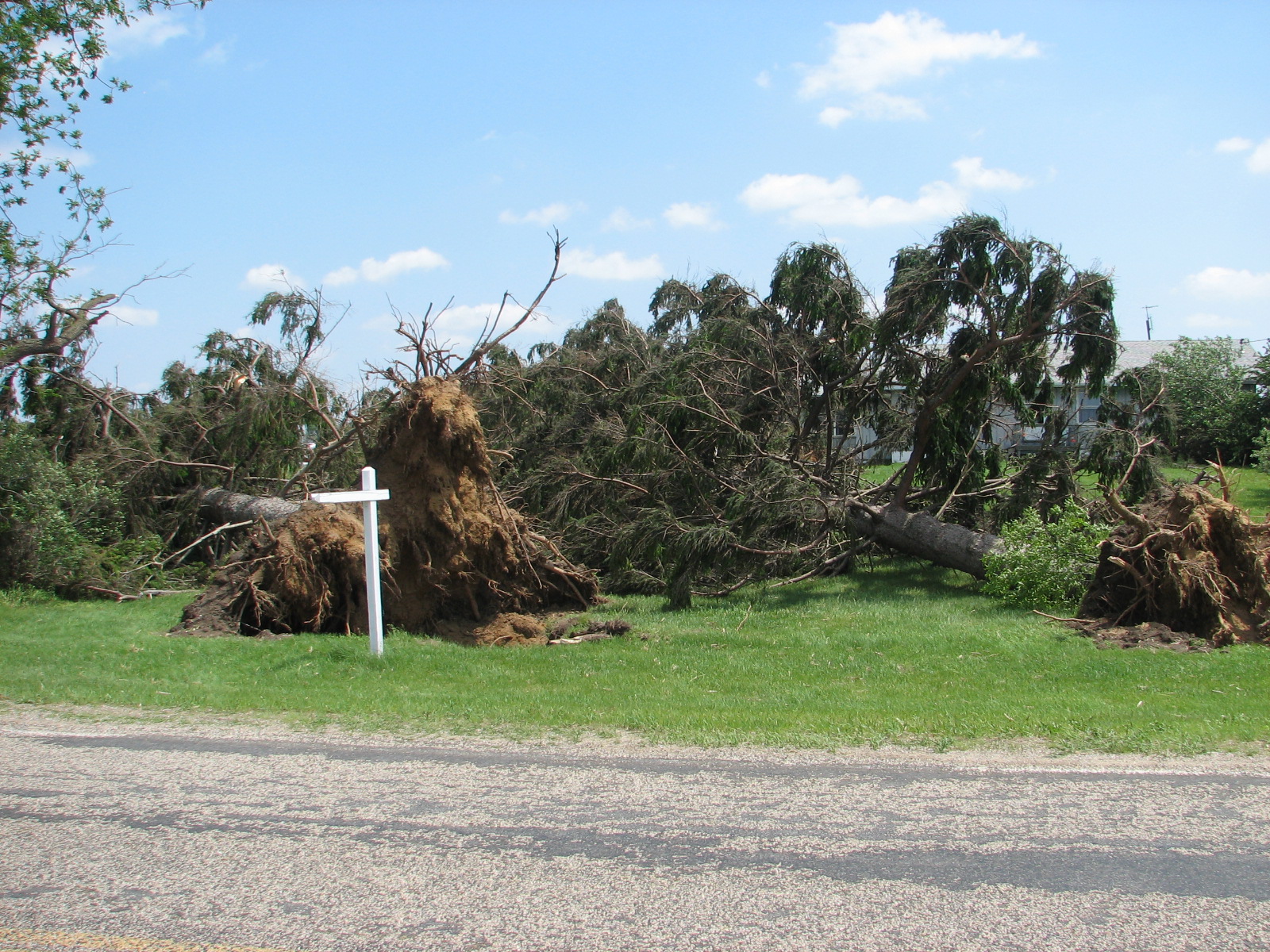
EF1 Tornado near Moore Park in St. Joseph County, Michigan
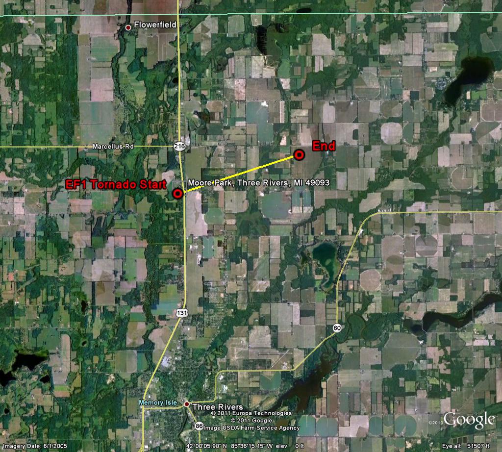
NATIONAL WEATHER SERVICE AND EMERGENCY MANAGEMENT CONDUCTED A DAMAGE SURVEY IN NORTHERN ST. JOSEPH COUNTY ON MAY 30TH. HUNDREDS OF TREES WERE TOPPLED BY STRAIGHTLINE WINDS FROM THUNDERSTORMS ON MAY 29TH FROM JUST NORTH OF LONG LAKE TO NEAR PORTAGE LAKE OVER NORTHWEST ST. JOSEPH COUNTY. WITHIN THIS AREA OF WIDESPREAD WIND DAMAGE... MORE CONCENTRATED DAMAGE AND EVIDENCE OF A TORNADIC CIRCULATION WAS FOUND NEAR MOORE PARK. THE TORNADO THAT TOUCHED DOWN JUST WEST OF MOORE PARK WAS 100 YARDS WIDE AND 2.85 MILES LONG. THE TORNADO WAS AN EF-1 WITH 94 TO 104 MPH WINDS. MANY HOMES IN THE AREA WERE DAMAGED BY THE FALLING TREES...THOUGH OTHERWISE STRUCTURAL DAMAGE WAS MAINLY LIMITED TO OUTBUILDINGS AND ROOF SHINGLE DAMAGE.
 |
 |
 |
 |
OBERGFELL/MARSILI

