...A Preliminary Confirmation Of Four Tornadoes In Northern Indiana and Northwest Ohio...
Two brief touchdowns in Wabash County Indiana...one touchdown in Putnam County Ohio...and one touchdown along the state line in Adams County Indiana into Van Wert County Ohio on May 30th and May 31st 2008 confirmed...
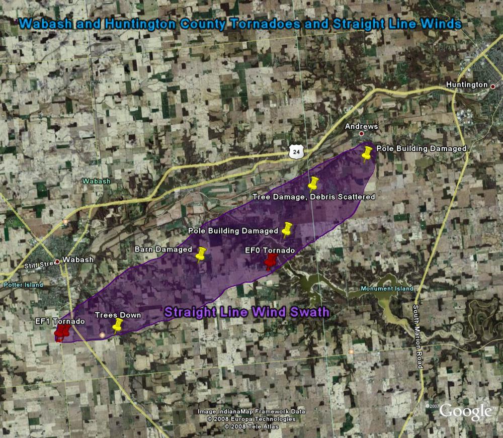
Staff from the National Weather Service office in Northern Indiana did an extensive survey of Wabash...Huntington...Grant...and Adams Counties in Indiana and Van Wert...Paulding...and Putnam Counties in Ohio investigating damage from several thunderstorms that affected the area during the evening hours of the 30th.
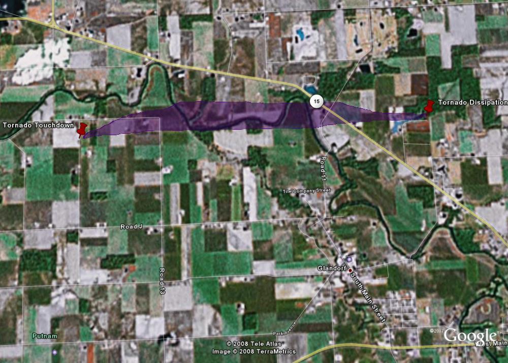
A high-end EF1 tornado on the Enhanced Fujita scale with winds estimated between 105-110 mph was found in Putnam County just north and west of the town of Glandorf. The tornado formed near Road 13I just south of Township Highway I and dissipated near the Firefox Lake Private Subdivision. As the tornado moved toward the Blanchard River it quickly widened to a peak width of 464 yards or just a little over a quarter of a mile. The tornado continued east before crossing the river again and quickly weakening. The most significant damage occurred along Township Highway I between Roads 13 and 13I. The tornado destroyed six outbuildings including pole barns and “stick-built” buildings constructed on a foundation. Over a half dozen homes were damaged with several sustaining major damage including the complete removal of roofs. A large amount of agricultural equipment and eleven vehicles were also damaged or destroyed with total monetary losses initially estimated at $1,200,000.
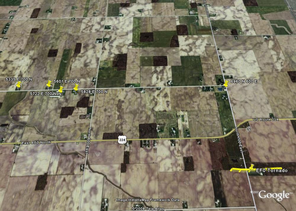
An EF0 tornado was found on the Indiana/Ohio state line. It touched down in Adams County Indiana and moved one half mile into Van Wert County Ohio before dissipating. Wind speeds in this tornado were estimated between 80 and 85 mph with trees and a large shed damaged.
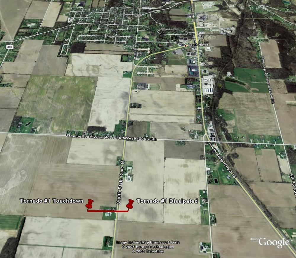
In Wabash…Huntington…and Grant Counties the majority of the damage found was in the form of straight line winds in the 65 to 80 mph range. However...damage did indicate two brief tornado touchdowns in Wabash County. The first touchdown occurred in an open field south of the city of Wabash…southwest of the intersection of 400 S and State Road 13. Several trees were damaged with a new pole barn suffering partial destruction. A second barn had a wall and partial roof collapse from the winds. As the tornado crossed State Road 13, it pushed over or snapped twelve power poles before dissipating in an open field. The tornado was on the ground for around two tenths of a mile with a maximum width of 50 yards. The worst damage was consistent with an EF1…with estimated winds of 90 mph.
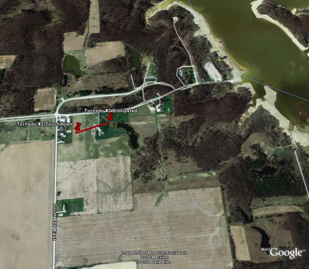
Another brief touchdown was located near the intersection of 600 E and 250 S, just north of Lincolnville. After touching down in an open field, the circulation struck an older wood barn, causing the west facing wall to fall in and some roof materials to be blown off. A few trees were observed blown down immediately north of the touchdown location. The tornado then quickly dissipated as it approached the Salamonie Lake Reservoir. The tornado was on the ground for around one tenth of a mile with a maximum width of 25 yards. The worst damage was consistent with an EF0 with estimated winds of 80 mph.
Below are maps of the some of the more significant damage which occurred in Wabash, Huntington, and Putnam Counties: