Severe Storms and damaging winds blast the area on August 24th 2007
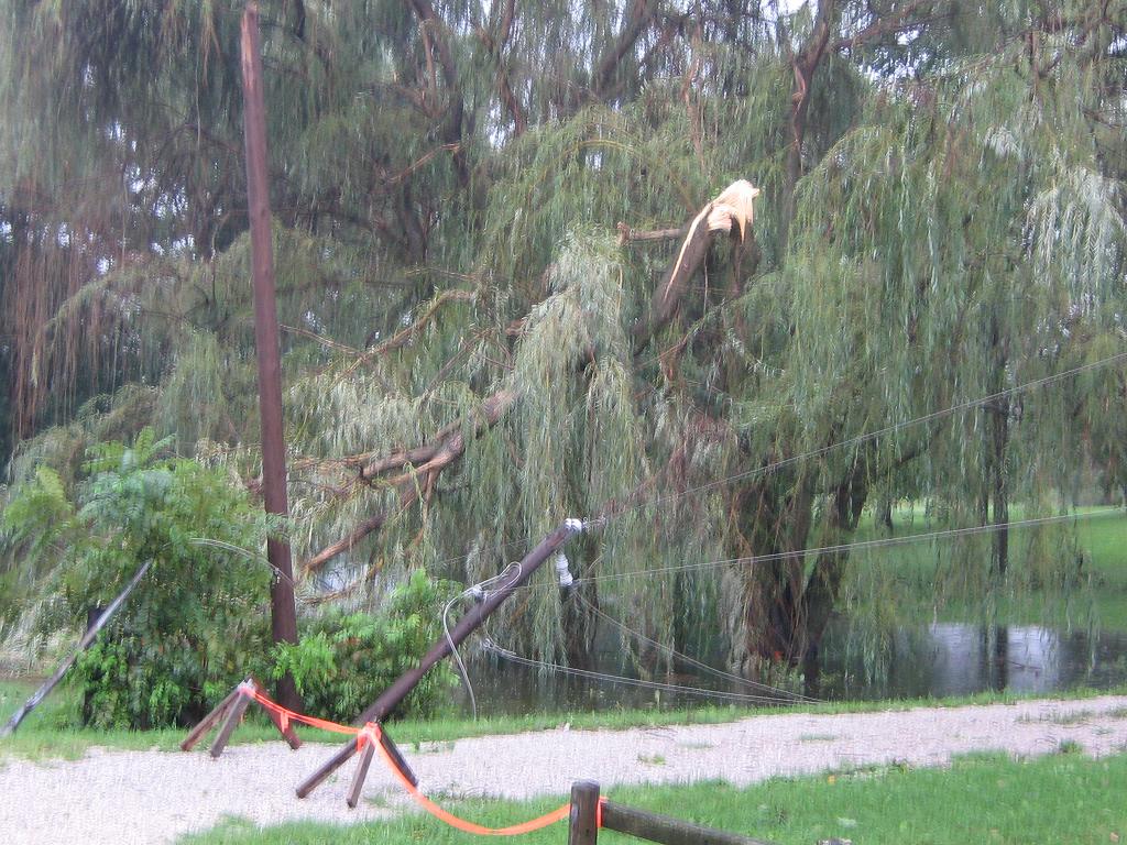
A stationary cold front combined with several upper level disturbances provided the focus for powerful thunderstorms Thursday and Friday August 23-24. Thunderstorms raced through sections of northern Indiana, southern Michigan, and northwest Ohio both days producing widespread wind damage in many areas. The first round of thunderstorms developed in western portions of Illinois on the 23rd and raced toward the region at speeds approaching 60 mph. The thunderstorms were responsible for widespread wind damage across Illinois and northwest Indiana including the Chicagoland area. By 4:00 pm CDT, the thunderstorms rolled into LaPorte county and subsequently produced widespread damage across LaPorte and Berrien counties. A wind gust of 81 mph was recorded at the Michigan City Lighthouse as the thunderstorm complex took on a bowing/spearhead shape…a typical feature of thunderstorms that produce damaging wind. Numerous trees and power lines were reported toppled along with some structural damage to buildings. There were also a few reports of trees falling onto cars. Luckily no injuries were sustained. The thunderstorms also impacted the annual Michigan City Boat Show…coincidentally one year to the day in which thunderstorm winds of over 100 mph produced heavy damage to the area. The thunderstorms continued to produce wind damage as they pushed across southern Michigan and extreme northern Indiana through the evening.
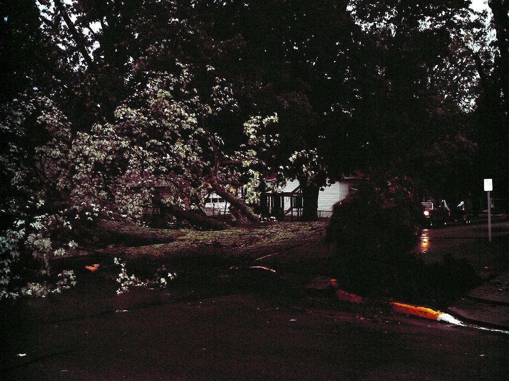
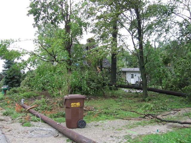
The very next day another disturbance pushed northeast into the region along the frontal zone, and again ignited a line of intense thunderstorms. Wind damage was again reported due to this system with some places receiving intense tree and power line damage. Some of the most intense damage occurred in northeastern and east central portions of Indiana along with northwest Ohio. Many reports of snapped/uprooted trees and structural damage came into the office from these areas. One area particularly hard hit and very localized location was the Barbee/Kuhn Lake area where the National Weather Service confirmed a microburst had occurred. The wind swath began 1/2 mile west of SR13 and extended NE for 1.5 miles. There were at least seven homes with structural damage…including roofs peeled off and large trees down on structures. Numerous trees were uprooted and/or sheared off taking several power lines down along SR13, which created an extended power outage in North Webster that evening. Below are a few radar images and pictures from both days. Click on the image for a larger version.
 |
 |
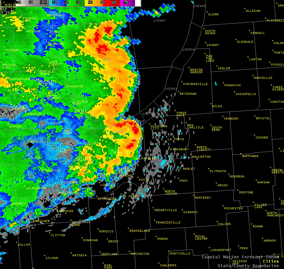
| Doppler radar image taken from the Chicago radar on 8-23-07. The reflectivity data exhibits a well defined bow shaped line segment, a feature typical of thunderstorms with strong winds. |
Velocity data from the same time confims the strong winds associated with the thunderstorm...as 80 knots can be seen at about 4000 feet above the ground. |
 |
 |
|
Menacing clouds rolled into St. Joseph, MI with winds to 80 mph. The clouds pictured above were along the gust front or outflow boundary of the thunderstorm. The turbulent look to the clouds is a result of the intense outflow winds.
|
 |
 |
|
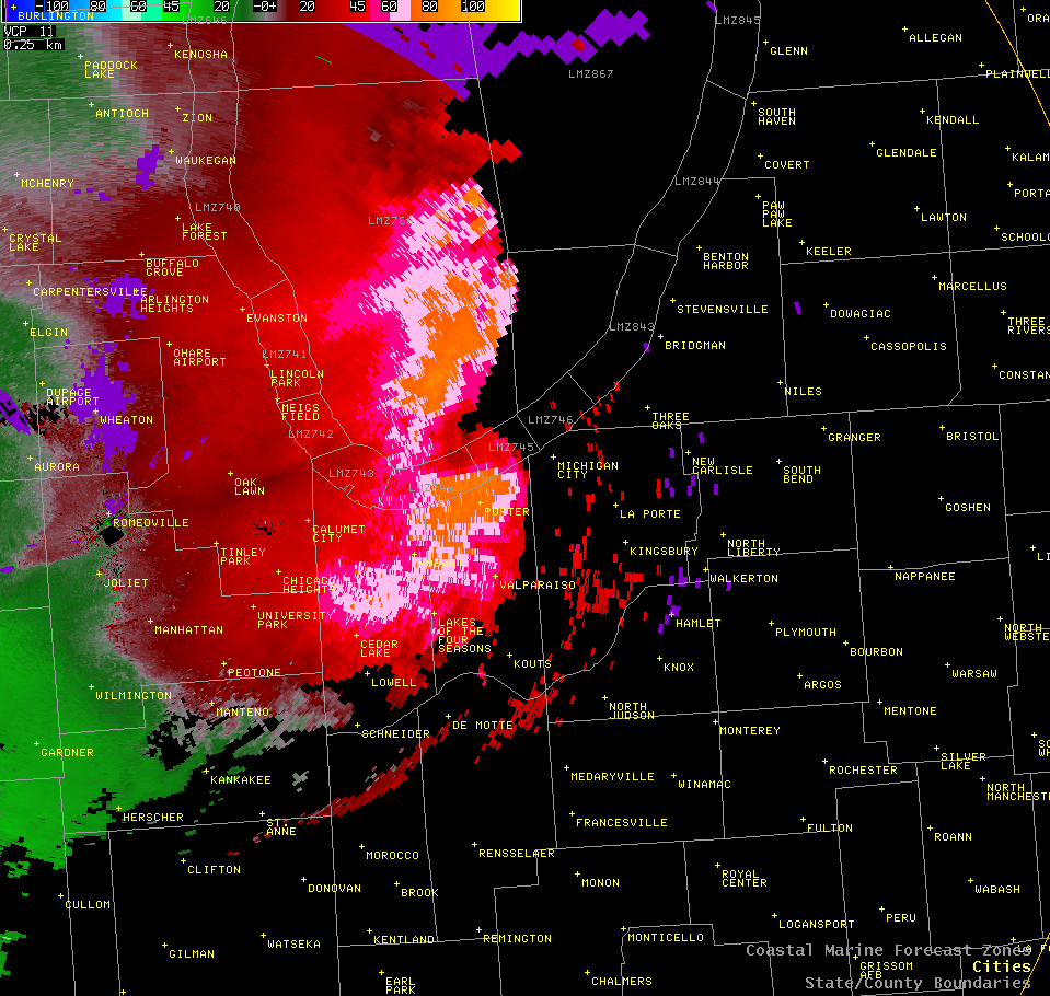
The above images are base velocity data from the Northern Indiana Doppler radar taken on 8-24-07. The two images capture the microburst that occurred just south of the office in the Barbee/Kuhn Lake area. Green data indicates motion toward the radar while red is away. The large black circle is the location of the radar. The couplet just south of the radar (north being the top of the image) clearly shows the divergence signature associated with the microburst winds centered over the Barbee/Kuhn Lake area. A microburst is a concentrated area of intense thunderstorm winds formed when dry air aloft interacts with favorable atmospheric conditions. Wind speeds in microbursts can be very strong. One of the highest wind gusts recorded with a thunderstorm microburst was measured at Grissom Air Base in 1995 when wind speeds of 136 mph were observed. Wind speeds from the Barbee/Kuhn Lake event were estimated at 80 mph.
|
 |
 |
|
Thunderstorms in southern portions of the forecast area also produced significant damage in Marion, IN where several trees were uprooted and snapped.
|
Wabash, IN also was not spared from wind damage. This large tree was uprooted on the east side of town.
|
 |
 |
|
Damaging Thunderstorm winds were also observed across Steuben county
|
JC