Northern Indiana
Weather Forecast Office
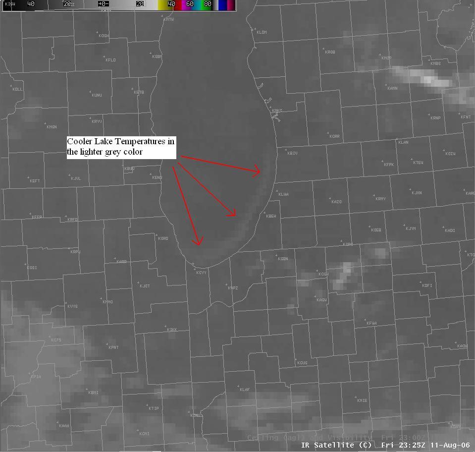
Over the past several days, persistent east to northeast winds of 10 to 20 mph have blown over the southern end of Lake Michigan. This wind direction often causes upwelling along the eastern shore of the lake. Upwelling is a process by which offshore winds push surface water away from shore, allowing cold lake water to rise up to the surface from beneath. The following infrared satellite image has captured the plume of colder surface water which has upwelled along the southeast shore of Lake Michigan. The light grey plume along the southeast shore of the lake has satellite derived surface temperatures in the mid to upper 50’s, while the buoy in the middle of Lake Michigan is reporting a surface water temperature in the low 70’s.
Upwelling on Lake Michigan can often suprise beachgoers who arrive at the beach to find very cold water temperatures. The onset of upwelling can occur very quickly, with lake temperatures falling 20 to 30 degrees in just a few days! For example, on Monday August 7th both Warren Dunes State Park and Silver Beach County Park reported lake temperatures of 75 and 76 respectively. Just two days later on Wednesday August 9th, Warren Dunes was down to 55 and Silver Beach down to 49 degrees. Swimmers don’t despair, once the offshore winds subside and switch direction, the cooler upwelled water will quickly mix with surrounding warmer lake waters and warm back up to typical late summer temperatures.
Hazards
Heat Related
Watch/Warning
Outlook
Storm Prediction Center
Storm Reports
Submit a Report
Outdoor Event Watcher
EM Briefing
Current Conditions
Hourly Weather
Surface Observations
Regional Temps/Precip
Precip Reports
Satellite
Climate
CoCoRaHS
FWA Daily
SBN Daily
FWA Monthly
SBN Monthly
Cliplot
Spring Frost Climatology
Fall Frost Climatology
Severe Climatology
Tornado Climatology
Local Information
Public Information Statement
Probabilistic Snowfall
Storm Data
Skywarn
COOP
Our Office
WSR-88D
Headline Criteria
NOAA Weather Radio
Weather History
Social Media Feeds
Weather Events Page
US Dept of Commerce
National Oceanic and Atmospheric Administration
National Weather Service
Northern Indiana
7506 E 850 N
Syracuse, IN 46567
574-834-1104
Comments? Questions? Please Contact Us.


