Northern Indiana
Weather Forecast Office
A STORM SURVEY WAS PERFORMED BY NATIONAL WEATHER SERVICE STAFF FROM
NORTHERN INDIANA...THE MORNING OF APRIL 8 2006. THIS SURVEY WAS
REQUESTED BY EMERGENCY MANAGEMENT OFFICIALS IN ADAMS COUNTY TO
EXAMINE DAMAGE REPORTED 3 MILES NORTHWEST OF DECATUR. THE SURVEY
TEAM HAS DETERMINED THAT BASED ON EYEWITNESS REPORTS...COMBINED WITH
DAMAGE AND RADAR OBSERVATIONS...A LOWER END F1 TORNADO WITH WINDS OF
75 TO 80 MPH CAUSED THE DAMAGE. AN F1 TORNADO HAS A WIND RANGE OF 73
TO 112 MPH ON THE FUJITA SCALE.
THE TORNADO TOUCHED DOWN A QUARTER MILE NORTH OF THE INTERSECTION OF
CR 200 W AND CR 750 N AROUND 514 PM EDT...PROCEEDED SOUTHEAST FOR
THREE QUARTERS OF A MILE AND DISSIPATED IN A GROVE OF TREES AROUND
516 PM EDT. AT ITS WIDEST POINT...THE DAMAGE PATH WAS AROUND 200
YARDS.
DAMAGE OBSERVED INCLUDES
*TIN ROOF ON A BARN WAS PARTIALLY PEELED BACK
*SECTION OF GARAGE/OUTBUILDING WAS BLOWN OFF
*WALL OF A REFINISHED GARAGE/ADDITION WAS SUCKED OUT
*SEVERAL ROLLING BARN DOORS SUFFERED DAMAGE
*LARGE BRANCH OF A WILLOW TREE DOWN ONTO A POWER LINE
*2 TREES UPROOTED ON EDGE OF GROVE OF TREES
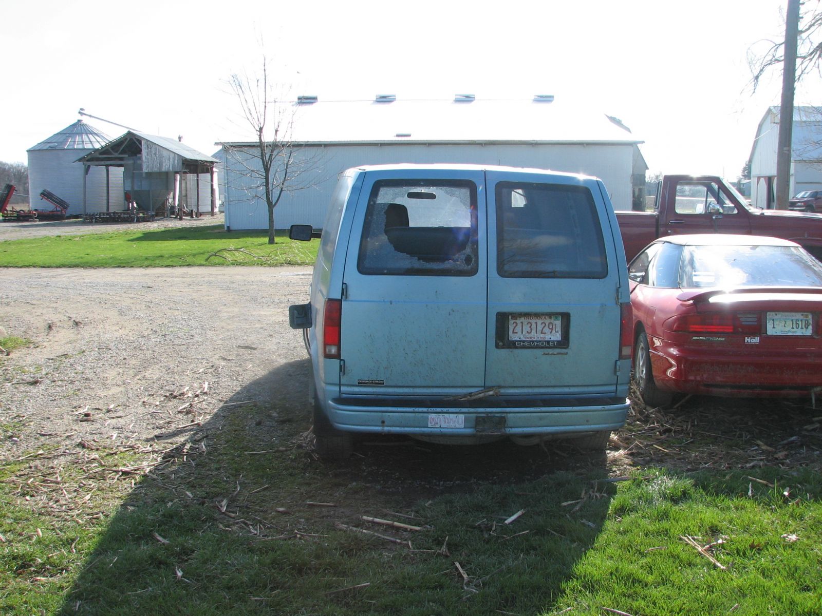
*MINIVAN HAD BACK WINDOW BROKE OUT RESULTING FROM CORNCOBS
*IMPACT DAMAGE TO OTHER VEHICLES AND BUILDINGS FROM FLYING TRAMPOLINE
*8 TO 10 FOOT LONG METAL BOAT WAS THROWN/ROLLED A QUARTER MILE AND
BROKE INTO SEVERAL PIECES.
Damage Map and Path of Tornado

4/10/06 LF/TH
Hazards
Heat Related
Watch/Warning
Outlook
Storm Prediction Center
Storm Reports
Submit a Report
Outdoor Event Watcher
EM Briefing
Current Conditions
Hourly Weather
Surface Observations
Regional Temps/Precip
Precip Reports
Satellite
Climate
CoCoRaHS
FWA Daily
SBN Daily
FWA Monthly
SBN Monthly
Cliplot
Spring Frost Climatology
Fall Frost Climatology
Severe Climatology
Tornado Climatology
Local Information
Public Information Statement
Probabilistic Snowfall
Storm Data
Skywarn
COOP
Our Office
WSR-88D
Headline Criteria
NOAA Weather Radio
Weather History
Social Media Feeds
Weather Events Page
US Dept of Commerce
National Oceanic and Atmospheric Administration
National Weather Service
Northern Indiana
7506 E 850 N
Syracuse, IN 46567
574-834-1104
Comments? Questions? Please Contact Us.


