Northern Indiana
Weather Forecast Office
One person was killed and 47 people hurt, including six seriously, when a sudden snow squall swept over Interstate 94 near Benton Center, Michigan, in Berrien County, at 1:30pm, causing a large chain reaction accident. Vehicles were strewn about both carriageways of the busy Chicago-Detroit link for a mile and a half, and closed down a nearly 12-mile stretch of the expressway for over 10 hours. Some vehicles caught fire during the whiteout, and some were so badly damaged that the cars had to be cut apart to extract the occupants. One woman was trapped in her truck for two hours.
The intense band of snow that caused the deadly conditions was part of a system meteorologists call a "mesolow". This mesolow was able to concentrate the snow into a powerful, narrow band and sweep it through extreme southwest Michigan. Snowfall rates were as high as two inches per hour within the band, with total accumulations up to a foot. Winds were around 20 mph.
The Northern Indiana office of the National Weather Service issued a Lake Effect Snow Warning for Berrien County at 11:30am, two hours before the crash.
The graphic below shows how one of the National Weather Service's computer forecast models predicted the mesolow. The center of the low is represented by the red "L" over northwest Allegan County. Wind barbs and streamlines show how the wind swirled in a counterclockwise direction around the low, and converged at the center.
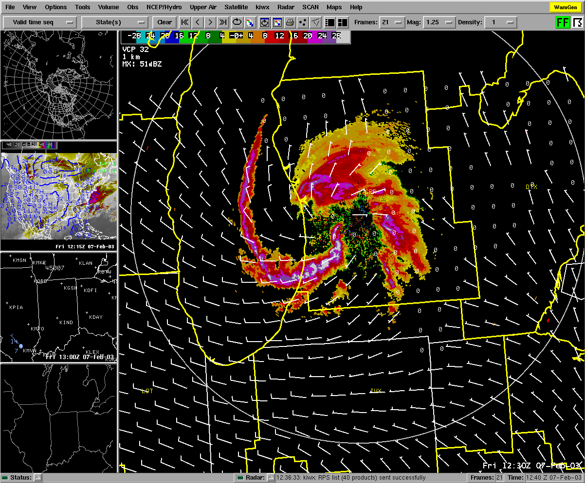
The next two pictures are radar images of the snow bands that were spiraling around the low. The first picture was captured at the time the accident occurred. The band of very heavy snow, represented by the white and purple colors, was moving southeastward through Berrien County.
Hazards
Heat Related
Watch/Warning
Outlook
Storm Prediction Center
Storm Reports
Submit a Report
Outdoor Event Watcher
EM Briefing
Current Conditions
Hourly Weather
Surface Observations
Regional Temps/Precip
Precip Reports
Satellite
Climate
CoCoRaHS
FWA Daily
SBN Daily
FWA Monthly
SBN Monthly
Cliplot
Spring Frost Climatology
Fall Frost Climatology
Severe Climatology
Tornado Climatology
Local Information
Public Information Statement
Probabilistic Snowfall
Storm Data
Skywarn
COOP
Our Office
WSR-88D
Headline Criteria
NOAA Weather Radio
Weather History
Social Media Feeds
Weather Events Page
US Dept of Commerce
National Oceanic and Atmospheric Administration
National Weather Service
Northern Indiana
7506 E 850 N
Syracuse, IN 46567
574-834-1104
Comments? Questions? Please Contact Us.


