Northern Indiana
Weather Forecast Office
Van Wert County
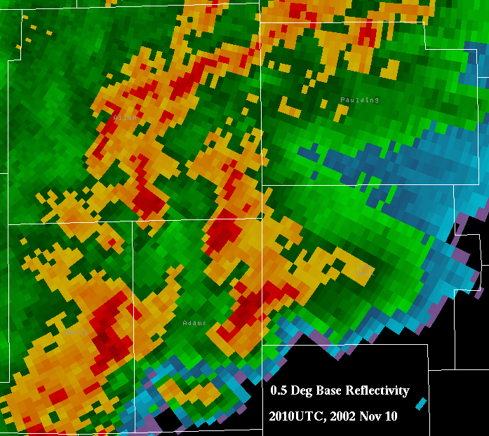
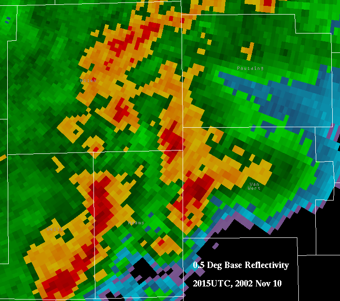
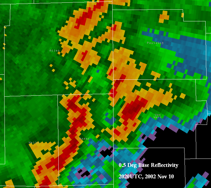
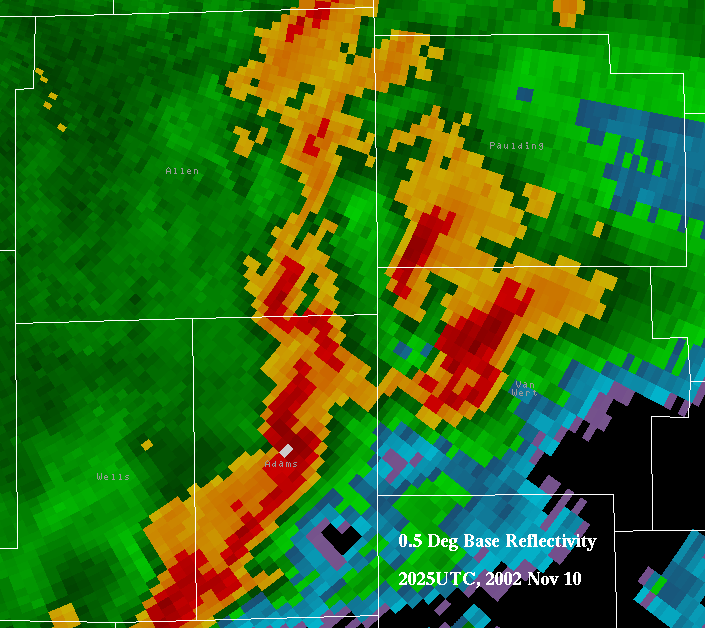
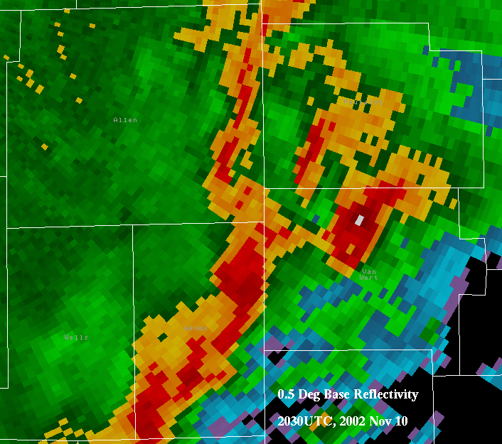
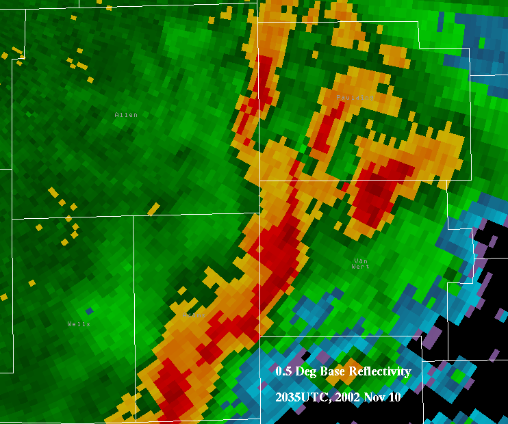
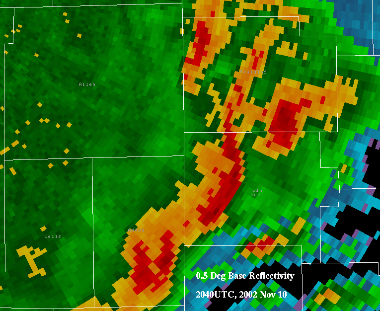
Reflectivity
The oranges and reds signify heavy rainfall and possible hail.
These radar reflectivity pictures show the storm moving out of Adams County and across Van Wert County. Note that the storm never really displays a classic "hook echo", despite producing a tornado of F4 strength.
Example of classic hook echo, courtesy WFO Norman
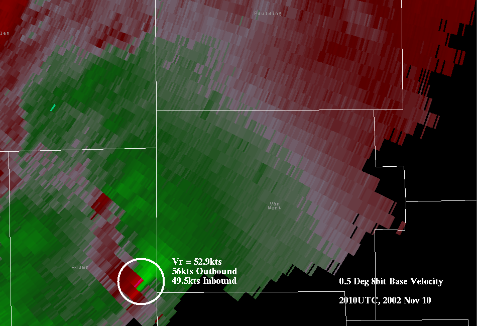
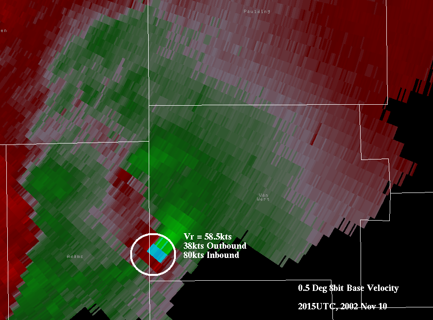
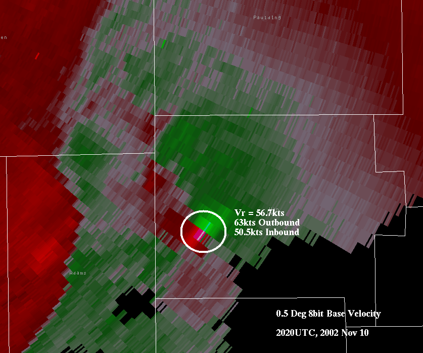
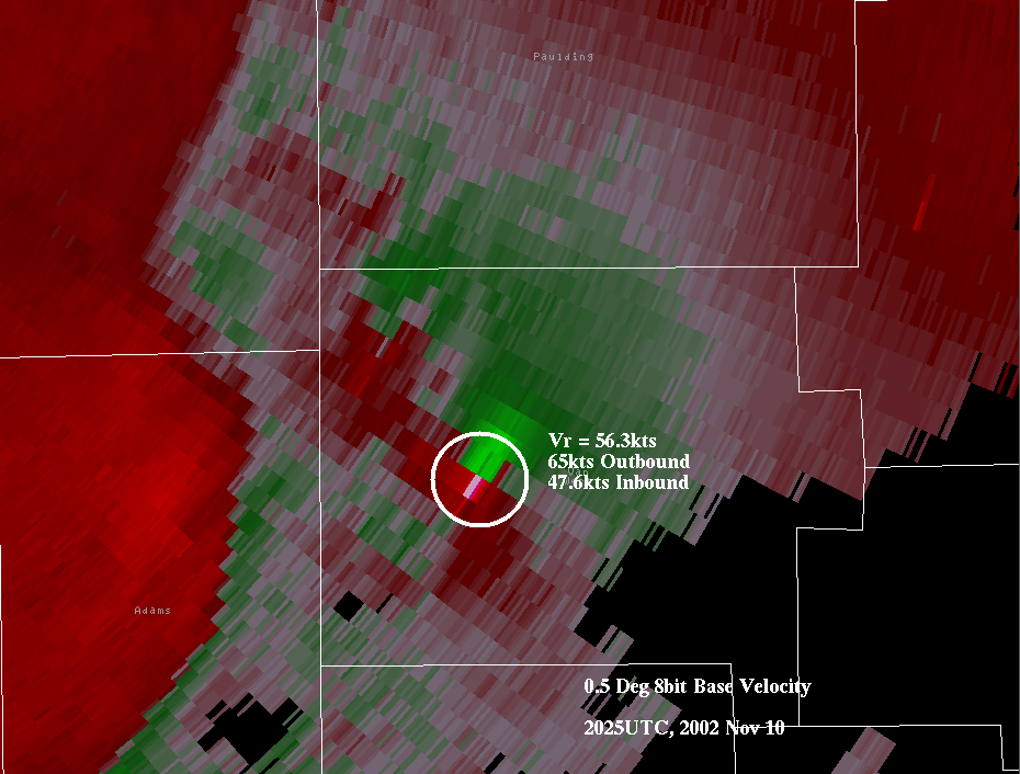
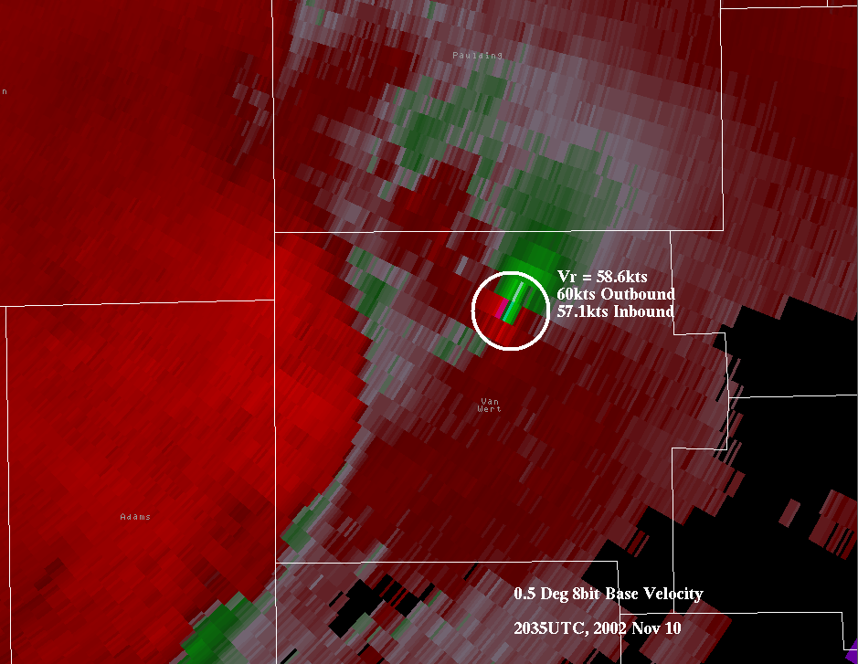
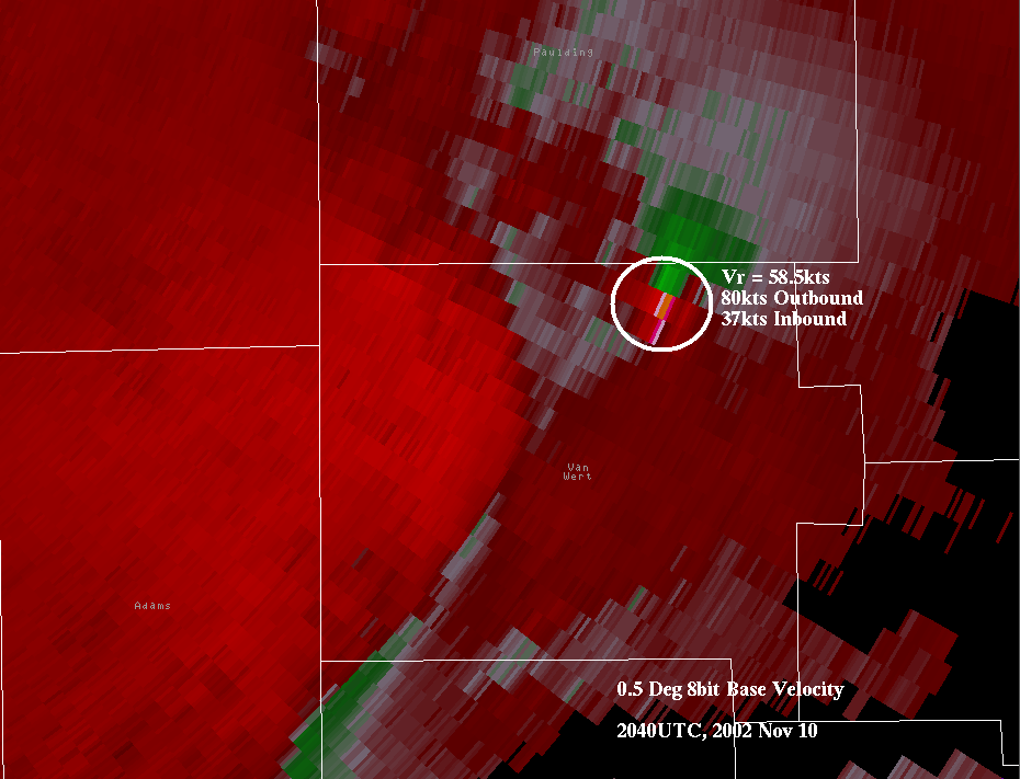
Velocity
The reds depict air moving away from the radar (outbound), the greens depict air moving inbound toward the radar (in these pictures, the radar is to the upper left, out of the picture). Reds and greens right next to each other suggest circulation, since there are air currents flowing in opposite directions in close proximity to each other.
"Vr" is rotational velocity, which is simply the average of the maximum outbound wind speeds and maximum inbound wind speeds. It can be used to give an idea of the strength of the circulation. Note that the circulation peaks in intensity over the west side of Van Wert, which is where the F4 damage was found.

On to Paulding County...
Back to Adams County...
Back to Blackford County...
Hazards
Heat Related
Winter Related
Watch/Warning
Outlook
Storm Reports
Storm Prediction Center
Submit a Report
Event Ready
Climate
CoCoRaHS
FWA Daily
SBN Daily
FWA Monthly
SBN Monthly
Cliplot
Spring Frost Climatology
Fall Frost Climatology
Severe Climatology
Tornado Climatology
Local Information
Public Information Statement
Probabilistic Snowfall
Storm Data
Skywarn
COOP
Our Office
WSR-88D
Headline Criteria
NOAA Weather Radio
Weather History
Social Media Feeds
Weather Events Page
US Dept of Commerce
National Oceanic and Atmospheric Administration
National Weather Service
Northern Indiana
7506 E 850 N
Syracuse, IN 46567
574-834-1104
Comments? Questions? Please Contact Us.

