
Tropical moisture from Isaias and Rachel will impact portions of the Southeast and Southwest this weekend. Flash flooding, strong winds and even a threat for severe thunderstorms and tornadoes are possible. Meanwhile, strong winds and dry fuels are raising fire weather concerns across the central Great Basin and western High Plains. Across the northern Rockies, first winter storm of the season. Read More >
Overview
In the morning of August 6, a supercell developed and tracked east-southeast through southern Michigan, far northeast Indiana and far northwest Ohio. This storm produced an EF2 tornado in northwest St. Joseph county from Lewis Lake to the north side of Three Rivers. This storm did weaken with eastward extent but did maintain some rotation with reports of wall clouds and funnel clouds. Additional thunderstorms then developed east of I-69 Tuesday afternoon, with a few reports of wind damage in northwest Ohio.
Tornadoes:
|
Tornado -Howardsville to Three Rivers
Track Map 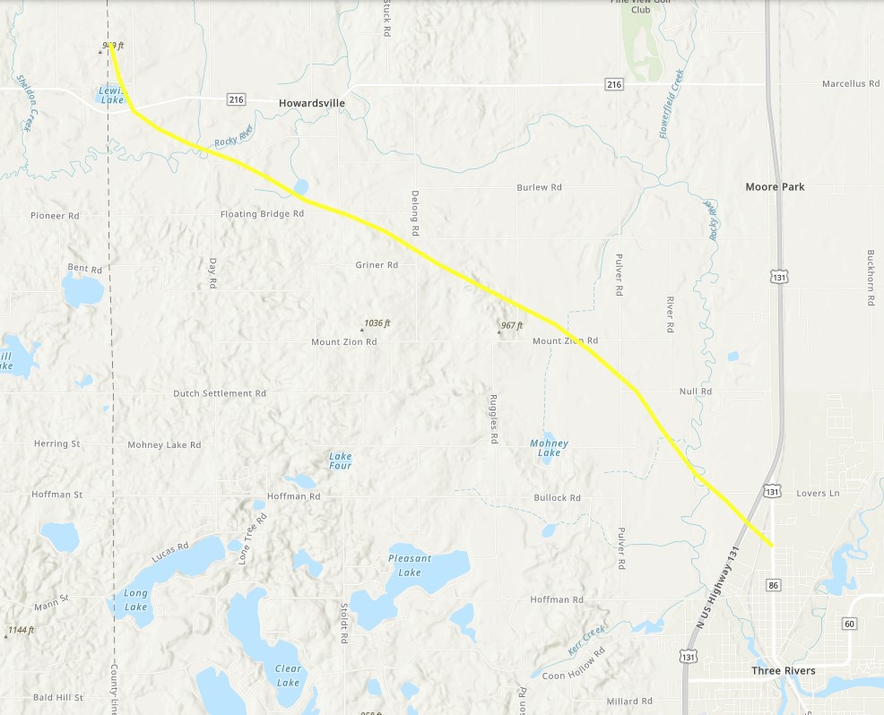 
|
||||||||||||||||
The Enhanced Fujita (EF) Scale classifies tornadoes into the following categories:
| EF0 Weak 65-85 mph |
EF1 Moderate 86-110 mph |
EF2 Significant 111-135 mph |
EF3 Severe 136-165 mph |
EF4 Extreme 166-200 mph |
EF5 Catastrophic 200+ mph |
 |
|||||
Photos & Video
 |
 |
 |
 |
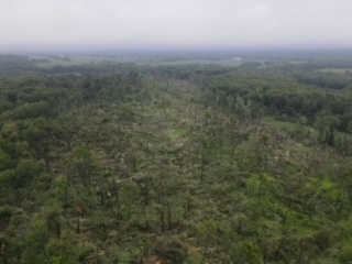
| Extensive tree damage southeast of Howardsville, MI in St. Joseph County MI. (Chris Burrows) |
Trees down and roofing removed near Marcellus, MI (Cicily Porter WSBT ) |
Structure damage in Marcellus, MI (Cicily Porter WSB) |
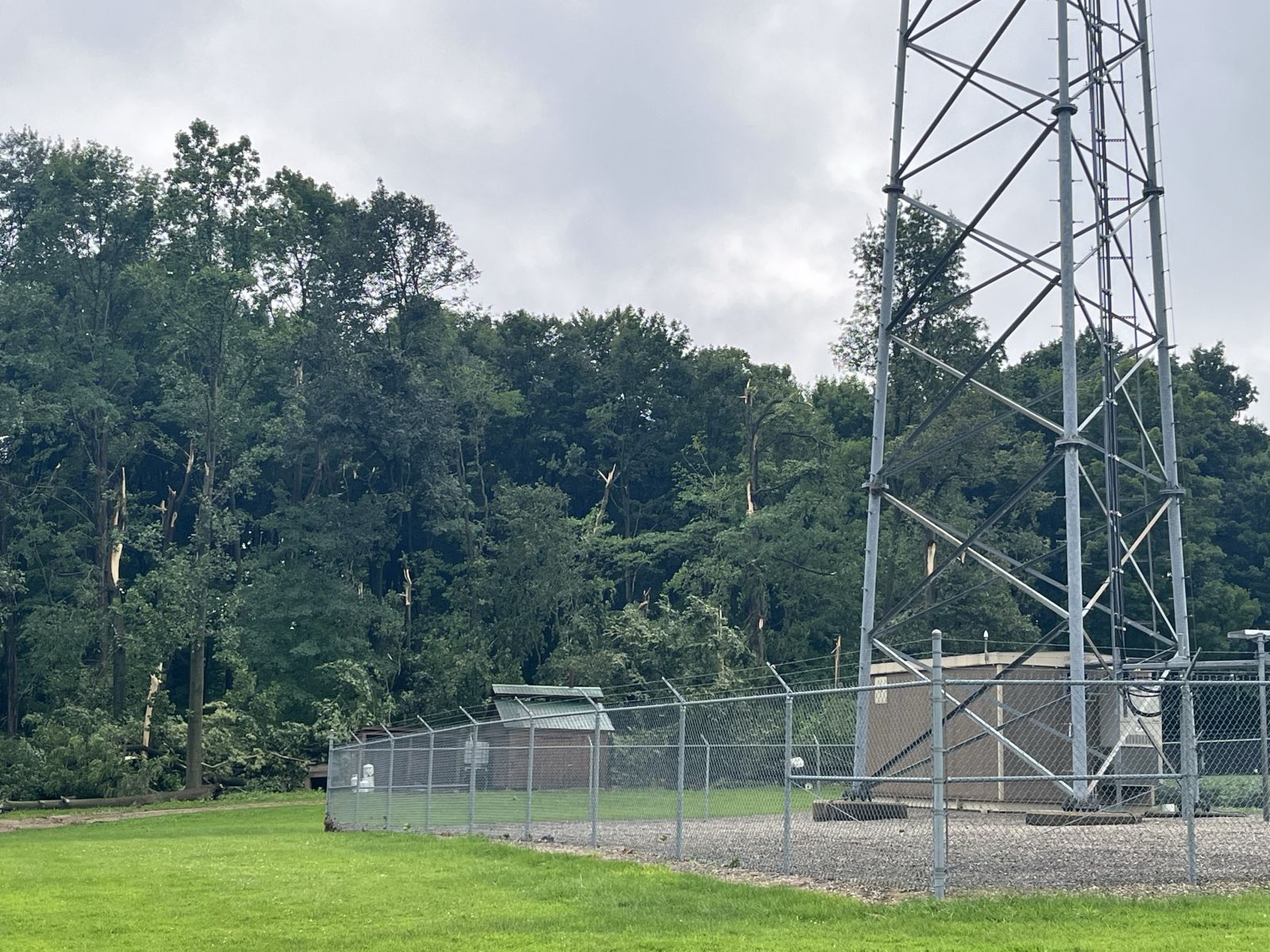
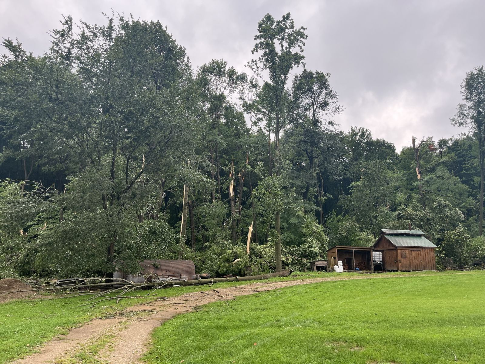
Tree damage north of Lewis Lake in Cass County, MI. (Oliver Moster ABC57) |
 |
 |
 |
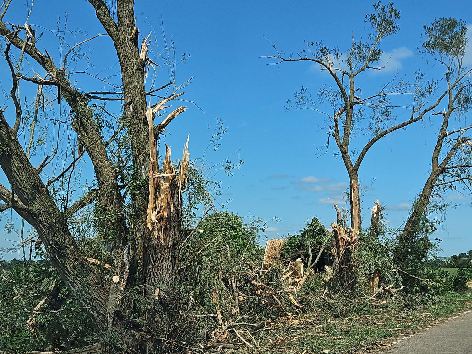 |
| Tree damage north of Lewis Lake in Cass County, MI. (Oliver Moster ABC57) |
The upper story of a barn was lofted by a tornado that moved through St. Joseph County MI. (NWS Survey) |
An entire outbuilding was destroyed by a tornado that moved through St. Joseph County MI. (NWS Survey) |
Significant tree damage was observed along the tornado track that moved through St. Joseph County MI. (NWS Survey) |
Radar
 |
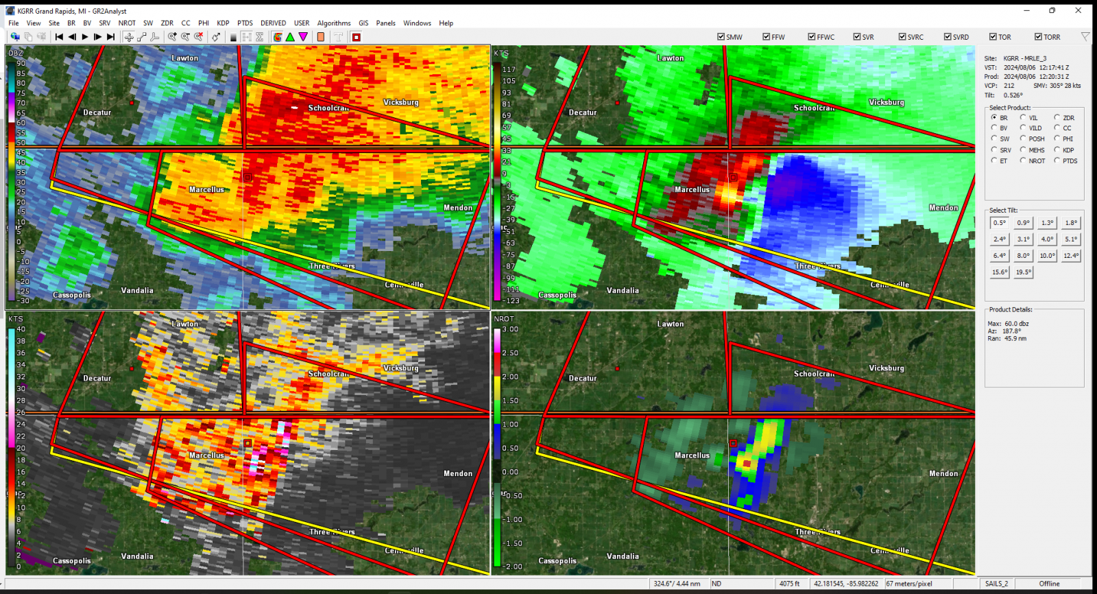 |
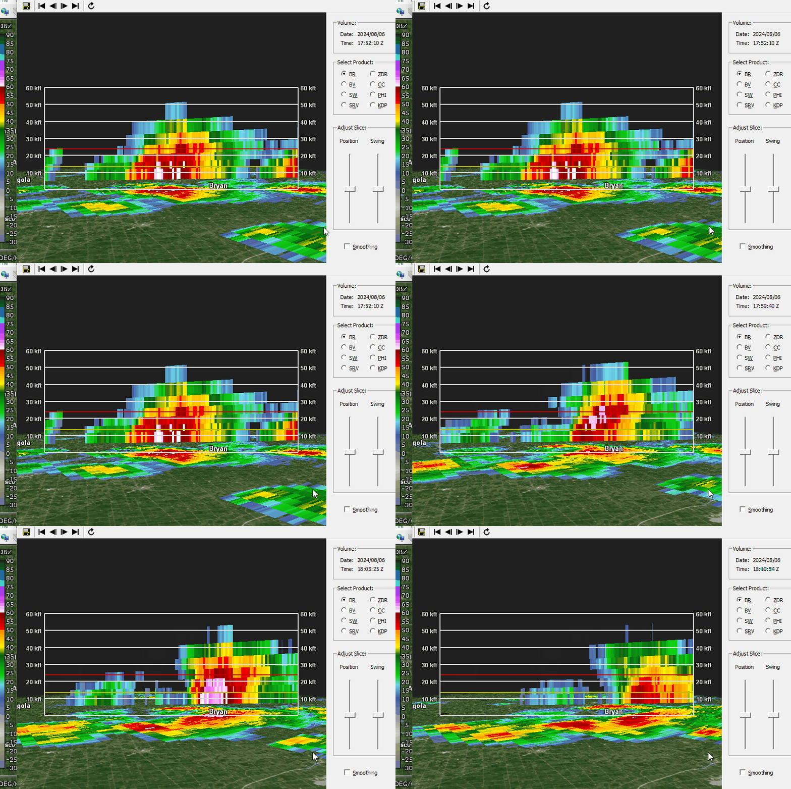
| Gif of the storm near Bryan OH that elicited a severe thunderstorm warning. Notice how 60 dBZ reached the -20C line (red) and then fell to the ground. Often this scenario produces damaging winds and heavy rain, and depending on the environment, can produce large hail. | Radar image the tornado-producing supercell. Upper left panel is reflectivity, upper right panel is storm relative velocity, bottom left is spectrum width and NROT is on the bottom left. |
Storm Reports
Preliminary Local Storm Report...Summary
National Weather Service Northern Indiana
906 PM EDT Tue Aug 6 2024

..TIME...   ...EVENT...      ...CITY LOCATION...     ...LAT.LON...
..DATE...   ....MAG....      ..COUNTY LOCATION..ST.. ...SOURCE....
            ..REMARKS..

1016 AM     Tstm Wnd Dmg     2 SSW Pioneer           41.65N 84.57W
08/06/2024                   Williams           OH   Trained Spotter

            Trees down in the area.

1017 AM     Tstm Wnd Dmg     3 ENE Lake Seneca       41.70N 84.61W
08/06/2024                   Williams           OH   Trained Spotter

            Tree damage near intersection of County Road
            11 and Road S.

0342 PM     Tstm Wnd Dmg     1 N West Leipsic        41.12N 84.00W
08/06/2024                   Putnam             OH   Emergency Mngr

            Several trees and power lines downed across
            eastern portions of Putnam County. 10-13
            power lines down on County Road 7 north of
            US 224. Trees blocking road on County Road
            5.

0250 PM     Tstm Wnd Dmg     3 NW Malinta            41.36N 84.08W
08/06/2024                   Henry              OH   Emergency Mngr

            Large tree limbs down at County Roads 11C
            and N. Time estimated from Radar.

0231 PM     Tstm Wnd Dmg     1 NW Okolona            41.36N 84.23W
08/06/2024                   Defiance           OH   Emergency Mngr

            A 20 foot tree was down in Okolona. Time
            estimated from radar.

0253 PM     Tstm Wnd Gst     3 NW Brunersburg        41.33N 84.43W
08/06/2024  M58 MPH          Defiance           OH   ASOS

            ASOS station KDFI Defiance.

0320 PM     Tstm Wnd Dmg     2 S Ayersville          41.21N 84.29W
08/06/2024                   Defiance           OH   Public

            Power lines downed.

0820 AM     Tstm Wnd Dmg     2 W Howardsville        42.03N 85.76W
08/06/2024                   St. Joseph         MI   Trained Spotter

            Large tree limbs down near Highway 216 and
            Lewis Lake Drive. Time estimated from radar.

0829 AM     Tstm Wnd Dmg     3 SW Moore Park         41.98N 85.66W
08/06/2024                   St. Joseph         MI   Emergency Mngr

            Reports of trees and power lines down in the
            area of Pulver Rd and Null Road. Time
            estimated from radar.

0832 AM     Tstm Wnd Dmg     1 N Three Rivers        41.96N 85.64W
08/06/2024                   St. Joseph         MI   Broadcast Media

            Several large tree limbs down and power pole
            damage near Main Street and Barnard Avenue.

1016 AM     Tstm Wnd Dmg     5 SSW Frontier          41.71N 84.63W
08/06/2024                   Hillsdale          MI   Trained Spotter

            Large tree down near Territorial Road and
            Hillsdale Road. Time estimated from radar.

0941 AM     Funnel Cloud     Kinderhook              41.80N 85.01W
08/06/2024                   Branch             MI   Trained Spotter

            Report of a funnel cloud near the
            intersection of S Angola Rd and E Copeland
            Rd.
Environment
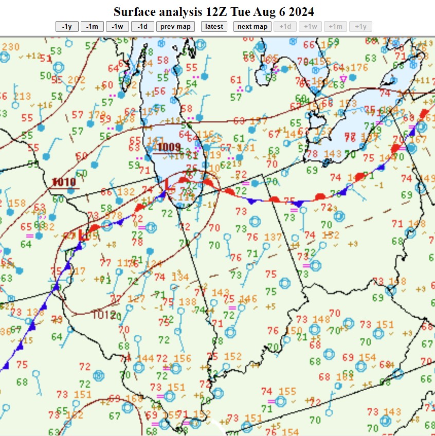
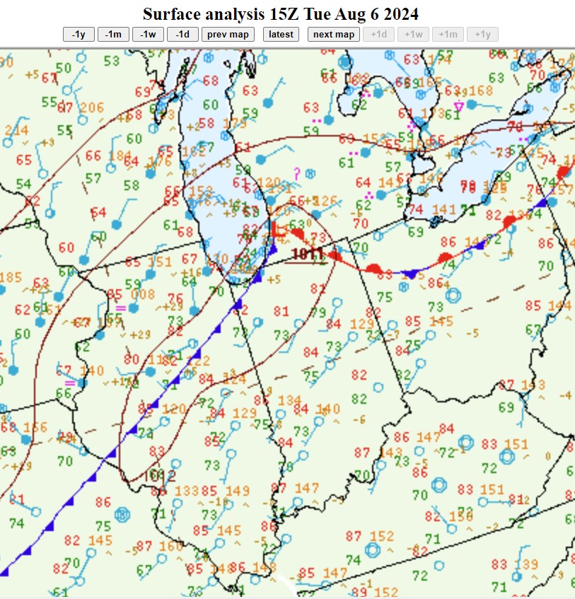
A cold front was moving slowly east-southeast through the day. This the primary forcing mechanism for severe thunderstorms.
 |
 |
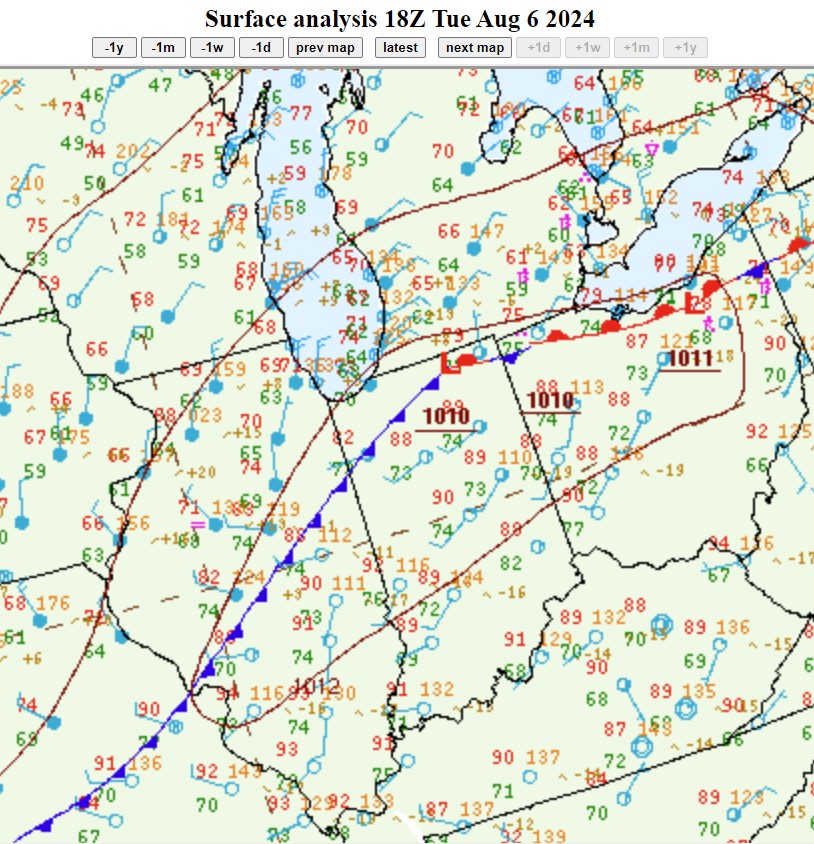 |
| Figure 1: 8am EDT Surface Analysis. The stationary front extending into southwest Michigan added additional vorticity to severe thunderstorms there. | Figure 2: 11am EDT Surface Analysis. The strongest thunderstorms moves along the warm front, analyzed here east of the low pressure center. | Figure 3: 2pm EDT Surface Analysis. Amid a hot and humid environment, this front continued to produce severe thunderstorms, this time in northwest Ohio. |
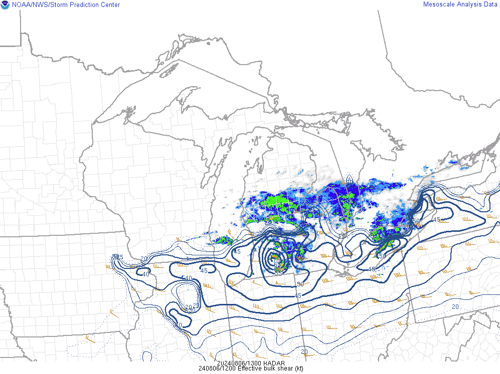
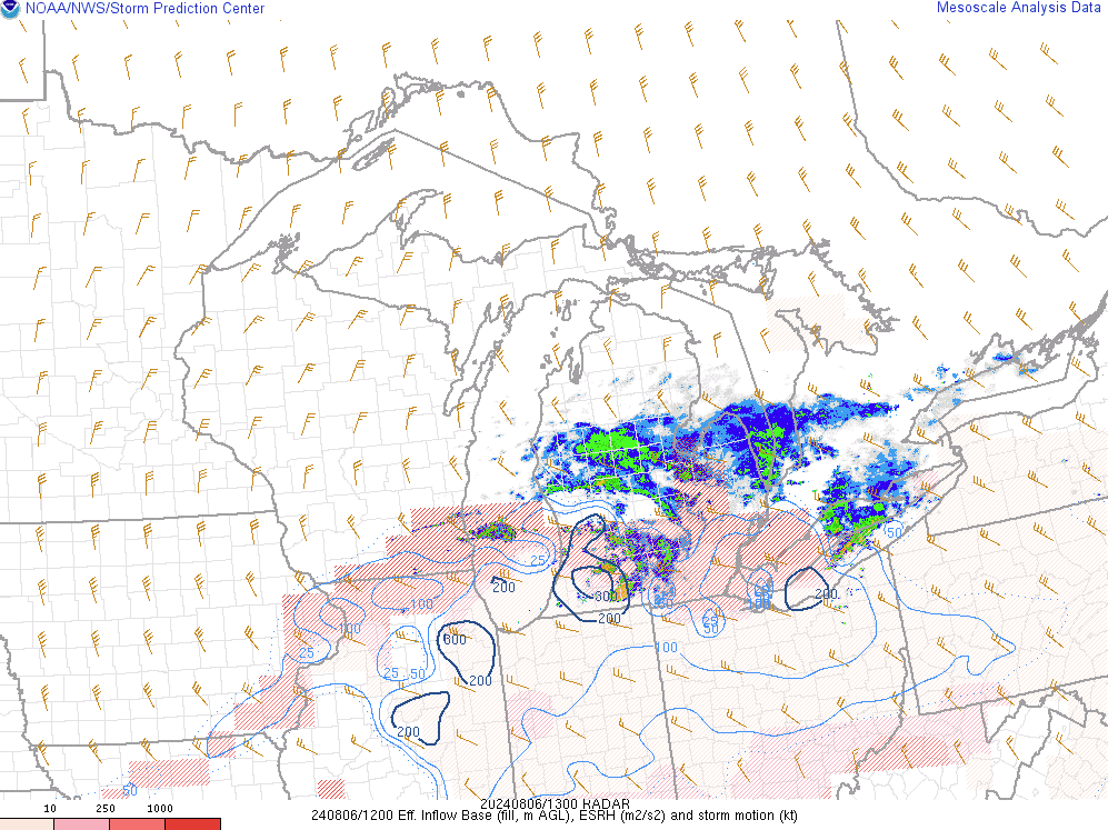
Near-storm environment summary.
 |
 |
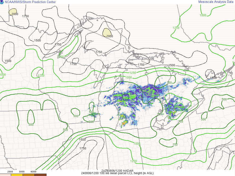 |
| Figure 4: Effective shear at 8am showing how much shear was accessible to storms. We look for 30 kts of effective shear as a starting point usually, but this was more than 2x that in the area of the storm. | Figure 5: Effective helicity at 8am showing how much turning was accessible to storms. We look for around 200 m2/s2 usually. | Figure 6: LCLs indicate how saturated the lowest portion of the column of air was that the storm formed in. |
Additional environmental data.
 |
 |
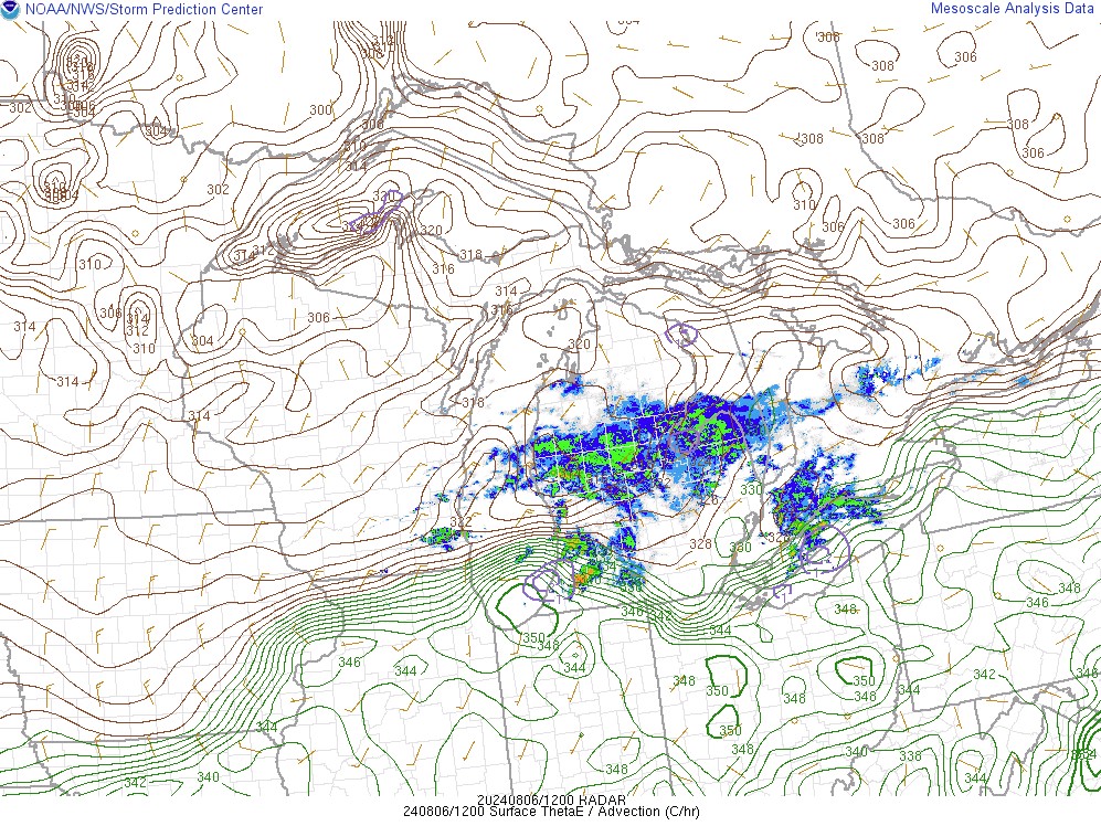 |
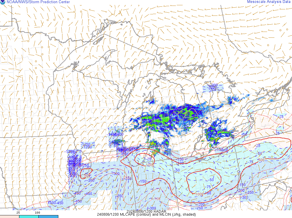
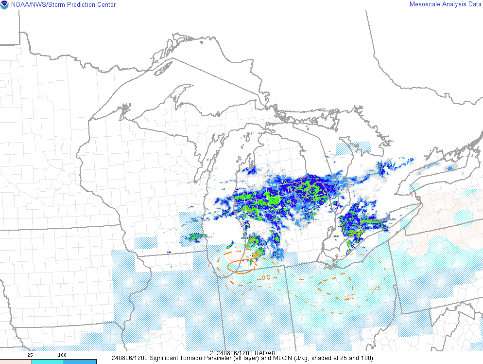
| Figure 7: Given that this occurred in the morning, instability was the limiting factor for this storm. Also note the blue shading indicating mixed layer CIN which often inhibits the growth of thunderstorms. This storm was able to surpass these limiting factors and become severe/tornadic. | Figure 8: Effective Significant Tornado Parameter achieved 1, which is what we normally look for when identifying tornado-capable storms. | Figure 9: Equivalent Potential temperature can be effectively used as a measure of both temperature and moisture. It is a good indicator of boundaries, which can form as a result of a gradient of temperature and/or moisture. Notice how the storm traveled right along the gradient of this parameter. |
 |
Media use of NWS Web News Stories is encouraged! Please acknowledge the NWS as the source of any news information accessed from this site. |
|



 Follow us on X
 Follow us on Facebook
 Follow us on YouTube
 IWX RSS Feed