Overview
Showers and thunderstorms developed across northwest Illinois during the late afternoon and early evening hours on Wednesday June 22nd, and developed southeastward into northern Indiana. Sporadic reports of wind damage were received across northern Indiana as these storms strengthened, with a few reports of tornadoes and significant straight line wind damage. The areas of most prominent damage were noted across southern White county, southern Kosciusko county, and in Huntington county south of Huntington. Many locations received 1 to 2 inches of rain during the course of this storm, with localized amounts in excess of 3 inches with the heavier showers and thunderstorms.
A National Weather Service damage survey team from this office was dispatched Thursday to investigate storm damage across portions of Kosciusko, Huntington, and Wells counties. As of this morning, the team has confirmed 2 tornadoes in Huntington county southeast of Huntington. Sporadic wind damage was noted in an arc from just southeast of Mentone and extending east southeast to south of Claypool with estimated winds of 70 mph. An area of concentrated widespread wind damage was found in the Yellow Creek lake area. An additional isolated area of widespread wind damage was found along SR 25 in the Palestine lake area. An isolated pocket of wind damage was found along and just west of SR 1 south of Bluffton with estimated winds of 70 mph.
A photogrammetric survey analysis was conducted for the Brookston Indiana area of White county where it was determined that a straightline macroburst wind event occurred with estimated 90 mph winds. Extensive and widespread damage to trees occurred in Brookston along with some structural damage to primarily farm buildings outside of Brookston.
This was part of a larger regional outbreak of severe storms with multiple tornadoes occurring over northern Illinois. See this page from WFO Chicago for more information concerning the extensive storm damage that occurred in northern Illinois.
Tornadoes:
|
Tornado 1- 5 Miles S-SE of Huntington
Track Map  
|
||||||||||||||||
|
Tornado 2- 5.2 miles SE of Huntington
|
||||||||||||||||
The Enhanced Fujita (EF) Scale classifies tornadoes into the following categories:
| EF0 Weak 65-85 mph |
EF1 Moderate 86-110 mph |
EF2 Significant 111-135 mph |
EF3 Severe 136-165 mph |
EF4 Extreme 166-200 mph |
EF5 Catastrophic 200+ mph |
 |
|||||
Brookston Macroburst
 |
|
KIND Radar Loop from 12:04 - 12:22 AM EDT Note the line surge taking place through southeast White county as dark blue and brief dark red colors indicate inbound velocities of 90 to 100 knots with widespread and extensive severe wind damage occurring. |
Photos & Video:
Tornado EF1 Damage Pictures (Pictures from NWS Survey)
 |
 |
 |
| Severely damaged maple trees, some structural damage to house | Roof damage | Barn damage |
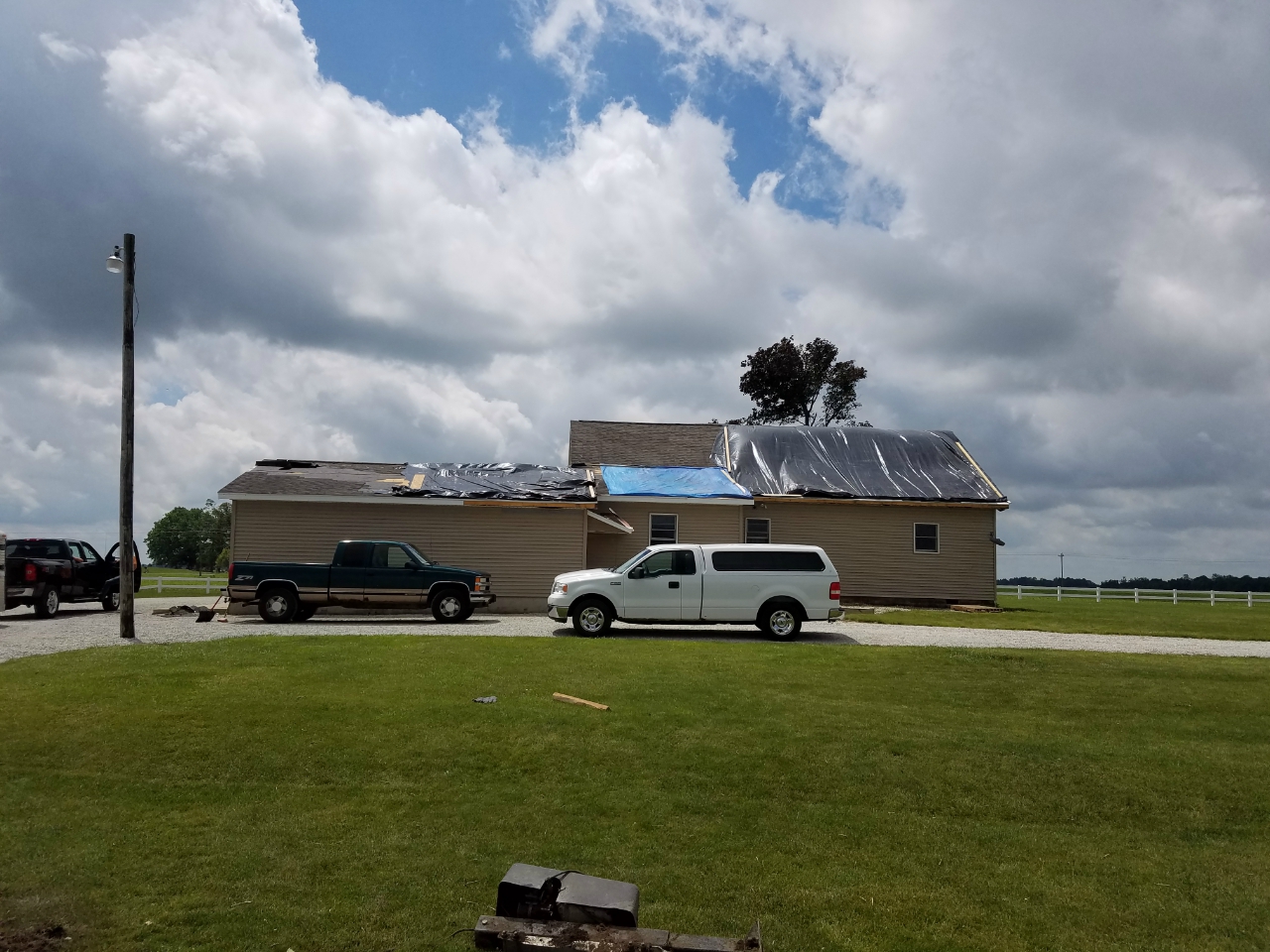
Tornado EF2 Damage Pictures (Pictures from NWS Survey)
 |
 |
 |
| Barns destroyed, ground scour | Trees snapped and uprooted | Barn collapse and overturn |
Video of EF2 Huntington Tornado, credit to Vicky Platt
Radar:
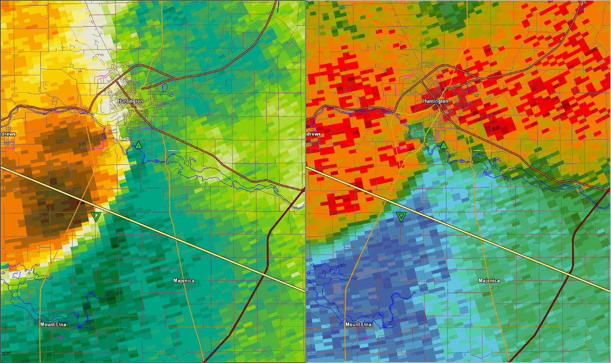
Huntington tornado sequence
 |
|
Radar Image at 1:00 AM EDT Strong rotation southeast of Huntington |
Storm Reports
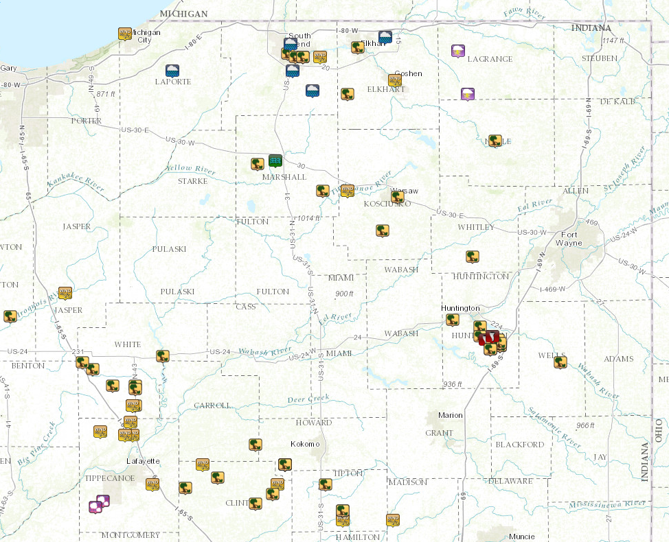 |
| Overview of Storm Reports for June 22-23 |
Environment
A stationary boundary to the southwest of the area began to return northward as a warm front on Wednesday. This front marked a boundary between very unstable conditions across the Mid Mississippi River Valley, and much weaker instability across portions of the southern Great Lakes into the eastern Great Lakes. This transition in instability magnitude often serves as a preferred path for organized thunderstorm complexes. An unseasonably high amount of shear was also present which allowed storms to quickly organize and become strong to severe. Precipitable water values were also quite high, which led to efficient rainfall rates, with a localized reports of rainfall amounts in excess of 2 inches.
 |
 |
 |
| Figure 1: 100 mb Mixed Layer CAPE 700pm June 22 | Figure 2: Effective Shear 700pm June 22 | Figure 3: Precipitable Water 700pm June 22 |
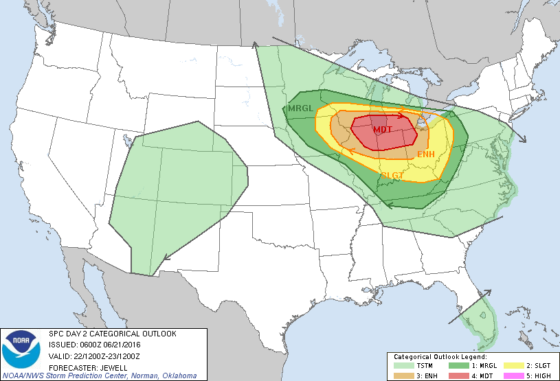
SPC Outlooks
 |
 |
| Figure 7: SPC Day 2 Outlook at 2 am June 21 | Figure 8: SPC Day 1 Outlook at 8 pm June 23 |
 |
Media use of NWS Web News Stories is encouraged! Please acknowledge the NWS as the source of any news information accessed from this site. |
|

