Northern Indiana
Weather Forecast Office
Overview
|
On the evening of Wednesday, March 19th, a broken line of strong to severe thunderstorms moved across northern Indiana. There was a high shear, low CAPE setup during this event, with very strong, ample shear and meager instability. Damaging wind gusts and a few isolated tornadoes were the main hazards, with sporadic pockets of wind damage found throughout northern Indiana. 2 EF-0 tornadoes were confirmed in portions of Cass, Miami and Fulton counties in Indiana. The Public Information Statement for each tornado can be found at this link. Graphical details follow below. Thank you to all of our partners including trained spotters, media, emergency managers, and the public who sent in damage reports to us! |
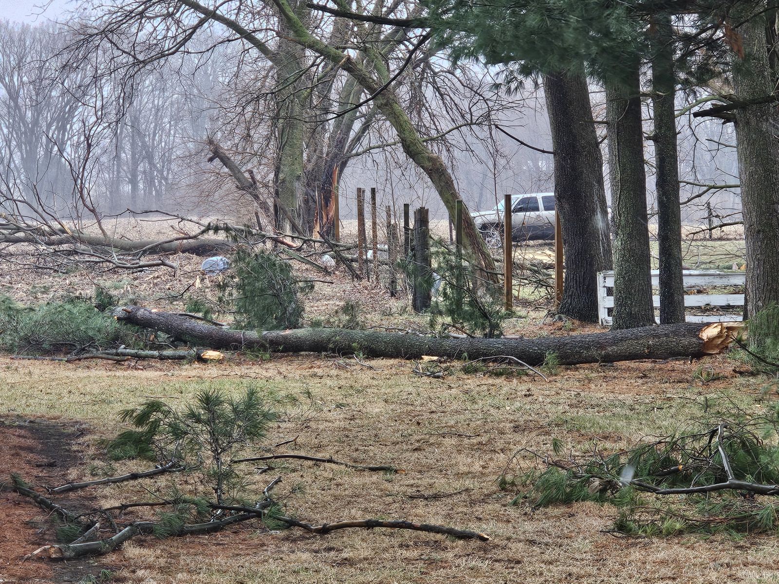
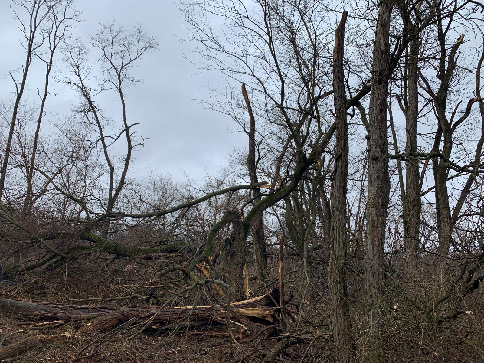 Snapped tree limbs from an EF-0 tornado along E 350 S on the far southwest side of Akron, IN in far southern Fulton County. (photo from NWS IWX Storm Survey) |
Tornadoes
Select a tornado from the table to zoom into the track and view more information. The default table view is limited to 8 tracks, but can be scrolled by a mouse wheel or dynamically expanded. Additionally, the table can fill the entire window by clicking the small circular expanding arrow icon at the very top right of the table and returned to its original size by clicking the button again. The side information panel that opens over the map can be closed using the "X" on the upper right corner of the pop-up. Zoom into the map and click damage points to see detailed information and pictures from the surveys.
|
NOTE: times shown below are local to your device's time zone. |

The Enhanced Fujita (EF) Scale classifies tornadoes into the following categories:
| EF0 Weak 65-85 mph |
EF1 Moderate 86-110 mph |
EF2 Significant 111-135 mph |
EF3 Severe 136-165 mph |
EF4 Extreme 166-200 mph |
EF5 Catastrophic 200+ mph |
 |
|||||
| Tornadoes that fail to impact any ratable structures on the EF-Scale are rated EF-Unknown (EF-U) | |||||
Photos
 |
 |
 |
 |
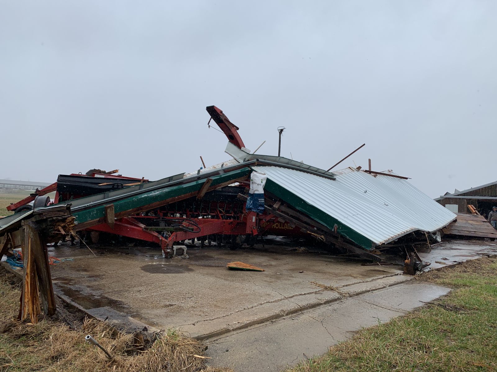
| The outer walls of an outbuilding collapsed near the Fulton/Miami County line with debris thrown as far as 300 yards to the northeast. (NWS IWX Storm Survey) |
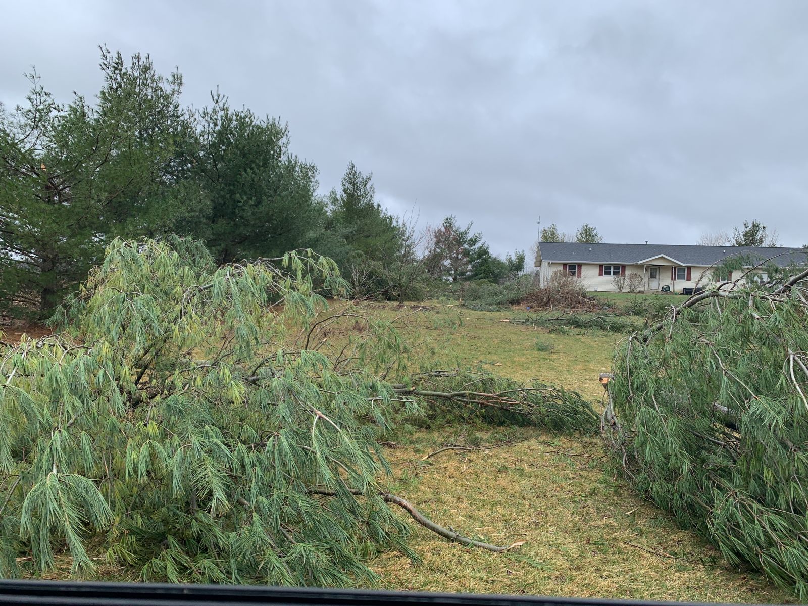
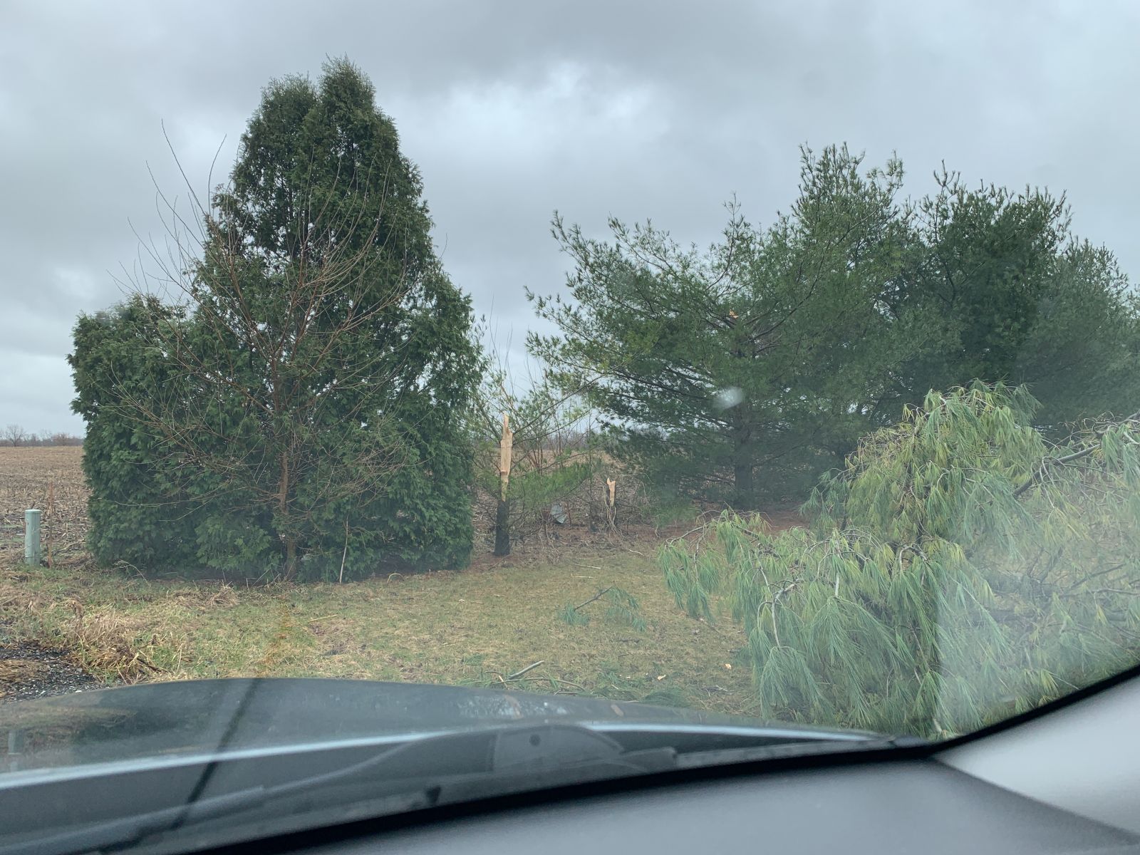
Numerous pine trees snapped in southern Fulton County, IN. (NWS IWX Storm Survey) |
Numerous pine trees snapped in southern Fulton County, IN. (NWS IWX Storm Survey) |
Several sections of a center pivot in northern Miami County, IN were flipped over. (NWS IWX Storm Survey) |
 |
 |
 |
 |
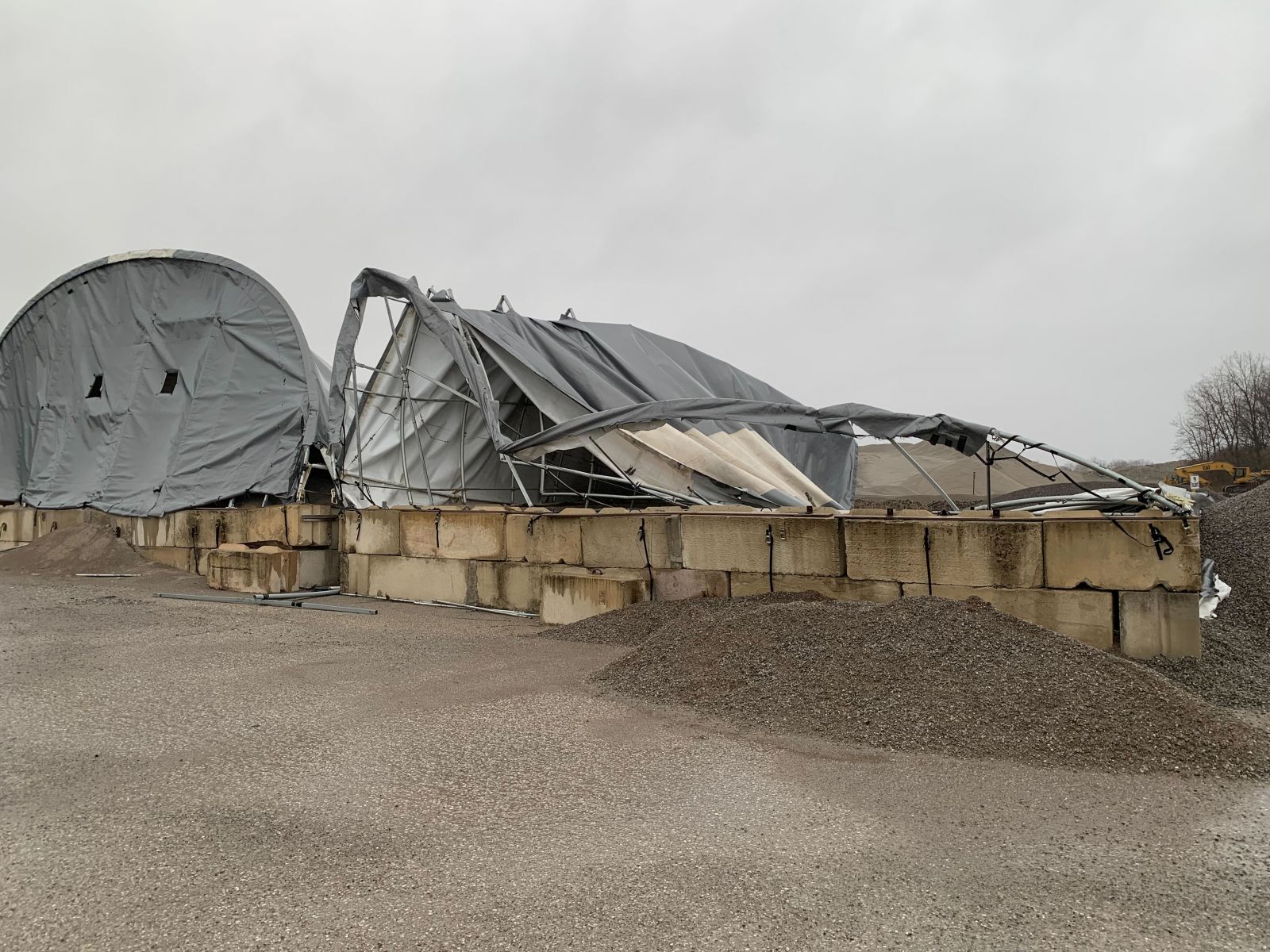
| A large building collapsed at 2413 S County Rd 150 E (Cass County, IN EMA) |
Numerous downed tree limbs at 3401 S County Rd 50 E (Cass County, IN EMA) |
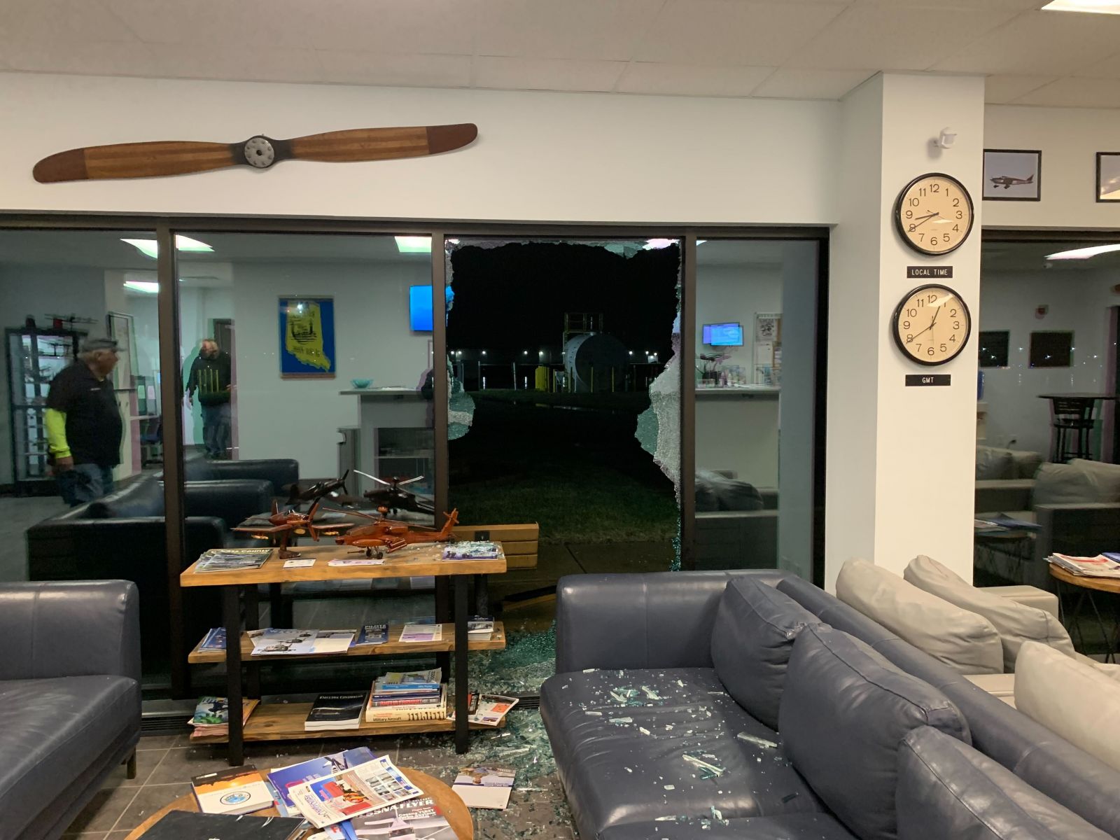
An airport hanger garage door was blown in at the Cass County Airport (Cass County, IN EMA) |
A window was destroyed at the Cass County Airport (Cass County, IN EMA) |
Storm Reports
Preliminary Local Storm Report...Summary
National Weather Service Northern Indiana
510 PM EDT Sun Mar 23 2025
..TIME... ...EVENT... ...CITY LOCATION... ...LAT.LON...
..DATE... ....MAG.... ..COUNTY LOCATION..ST.. ...SOURCE....
..REMARKS..
0727 PM Tstm Wnd Dmg Michigan City 41.71N 86.88W
03/19/2025 La Porte IN Broadcast Media
Corrects time of previous tstm wnd dmg
report from Michigan City. Photos passed
along from media showing several large
downed trees in Michigan City. Time
estimated by radar.
0742 PM Tstm Wnd Dmg Union Pier 41.83N 86.69W
03/19/2025 Berrien MI Public
Media reports large fiberglass outdoor
decorations damaged by wind in Union Pier in
Berrien County Michigan. Time estimated from
radar data.
0749 PM Marine Tstm Wind 1 SW Stevensville 42.01N 86.53W
03/19/2025 M40 MPH Berrien MI Trained Spotter
Trained spotter reported 30-40 mph winds and
pea size hail.
0750 PM Tstm Wnd Dmg 1 ESE Waterford 41.67N 86.83W
03/19/2025 La Porte IN Trained Spotter
Trained spotter reports a tree blown down
into power lines due to strong straight line
winds southeast of Waterford at 675 W 400 N
in La Porte County Indiana.
0752 PM Tstm Wnd Dmg 3 SSW Logansport 40.71N 86.38W
03/19/2025 Cass IN Emergency Mngr
Additional reports from EMA of hanger doors
blown in and windows broken at
Logansport/Cass County Airport. Time
estimated by radar.
0754 PM Tornado 2 S Logansport 40.72N 86.36W
03/19/2025 Cass IN NWS Storm Survey
A survey of ground and aerial data revealed
a weak, very disorganized tornado began
between 2 homes on E CR 300 S where a TV
tower was bent over, minor shingle and fence
damage was noted with the debris suggesting
a weak circulation. This feature moved
northeast into a wooded area where tree
damage was initially very limited, but then
uprooted or snapped roughly 20 shallow
rooted trees with weak convergence noted.
The tornado moved into an open field and
deposited 1 piece of the fence from the
touchdown location as it dissipated before
reaching S CR 150 E.
0802 PM Tstm Wnd Gst 3 WNW South Bend 41.70N 86.32W
03/19/2025 M54 MPH St. Joseph IN ASOS
ASOS station KSBN South Bend International
Airport measured a 54 mph wind gust.
0812 PM Tstm Wnd Gst 1 N Benton Heights 42.13N 86.42W
03/19/2025 M52 MPH Berrien MI ASOS
ASOS station KBEH Benton Harbor measured a
52 mph wind gust.
0814 PM Tstm Wnd Dmg 1 N Watervliet 42.20N 86.26W
03/19/2025 Berrien MI Trained Spotter
tree downed. size unknown.
0815 PM Tstm Wnd Dmg 3 E Paw Paw Lake 42.23N 86.23W
03/19/2025 Berrien MI Trained Spotter
tree downed. size unknown.
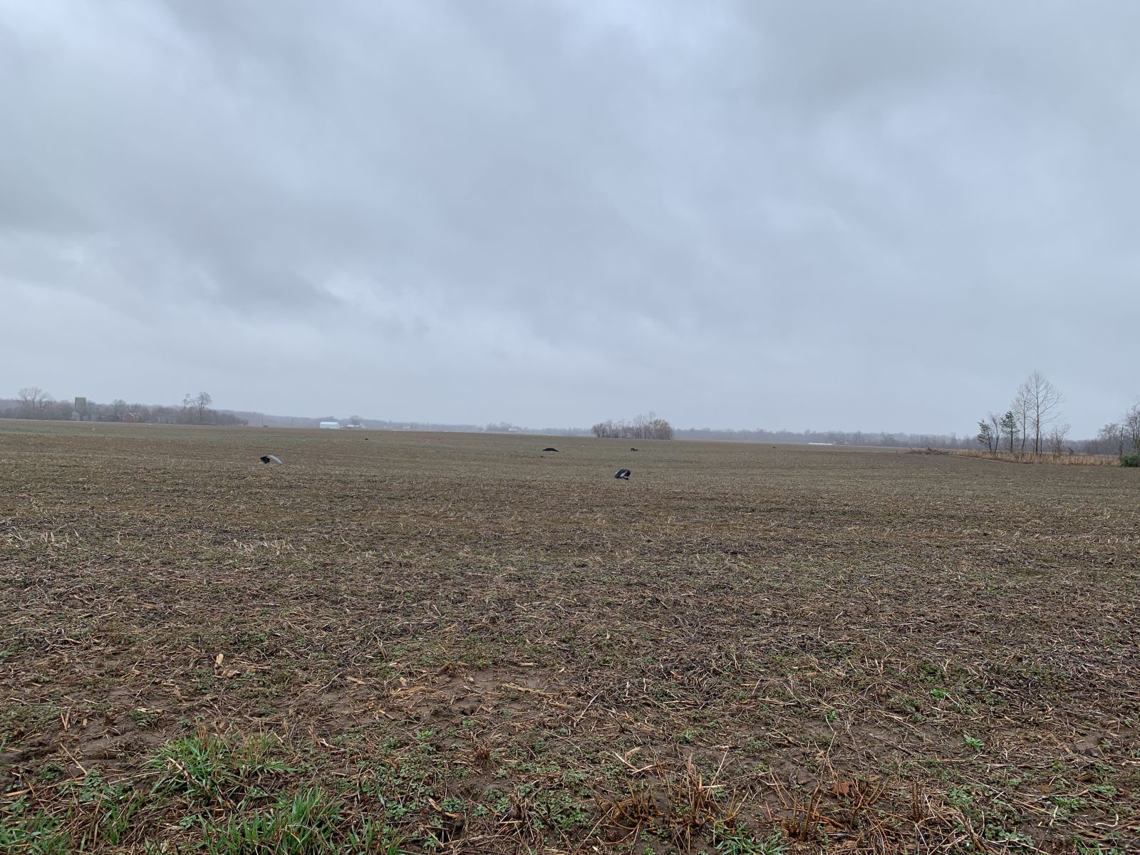
0820 PM Tornado 3 NE Macy 40.99N 86.08W
03/19/2025 Miami IN NWS Storm Survey
A survey of damage confirmed a EF0 tornado
touched down east of CR N 25 W, south of
Pleasant Hill Rd where an outbuilding in a
wooded area was flipped from north to south
against a tree and some debris thrown to the
southwest. The tornado reached peak
intensity at the intersection of Meridian
and Pleasant Hill Rd where one of two older
barns suffered extensive damage. The
majority of the barn remained at the site,
but roof and siding materials were visible
across fields and in trees into Fulton
county. Four of eight center pivot spans
were flipped near the damaged barn. The
tornado crossed S 1000 E, E 350 S and S 1075
E before dissipating with mainly tree damage
observed. Max winds 85 mph, max width 100
yards.
0820 PM Tstm Wnd Dmg 3 SW Akron 41.00N 86.06W
03/19/2025 Fulton IN Emergency Mngr
Emergency management reports large trees
down and sheet metal blown around 3 miles
southwest of Akron in Fulton County Indiana.
Time estimated from radar data.
0822 PM Tstm Wnd Dmg 2 SSW Akron 41.01N 86.04W
03/19/2025 Fulton IN Emergency Mngr
Emergency management reports large trees
down and damage to a dwelling around 2 miles
southwest of Akron in Fulton County Indiana.
Time estimated from radar data.
0825 PM Tstm Wnd Gst 2 SSW Coloma 42.17N 86.33W
03/19/2025 M54 MPH Berrien MI Dept of Highways
DOT station MC161 I94mm0372 measured a 54mph
wind gust.
0848 PM Tstm Wnd Gst 4 SSW Huntington 40.83N 85.53W
03/19/2025 M52 MPH Huntington IN Mesonet
Mesonet station CW9663 Huntington measured a
52 mph wind gust.
0921 PM Tstm Wnd Dmg 2 SW Lake James 41.69N 85.07W
03/19/2025 Steuben IN Law Enforcement
Report relayed by EM that law enforcement
reported tree limbs down on Orland Road east
of CR 400 West. Time estimated via radar.
0922 PM Tstm Wnd Dmg 1 SSE Nevada Mills 41.71N 85.07W
03/19/2025 Steuben IN Emergency Mngr
Report relayed of tree limbs down between
Lane 230 and CR 450 West near Jimmerson
Lake. Time estimated from radar.
0922 PM Tstm Wnd Dmg 3 S Orland 41.69N 85.18W
03/19/2025 Steuben IN Emergency Mngr
Emergency management reported downed
powerlines and a broken utility pole on CR
350 N west of SR 327.
0923 PM Tstm Wnd Dmg 3 NE Nevada Mills 41.76N 85.05W
03/19/2025 Steuben IN Public
Roof peeled off a barn.
0929 PM Tstm Wnd Dmg Auburn 41.36N 85.05W
03/19/2025 De Kalb IN Amateur Radio
HAM radio operator reported a power pole on
fire due to lightning strike along with
downed power lines in Auburn, IN. Time
estimated by radar.
1049 PM Tstm Wnd Gst 2 WNW Westminster 40.71N 84.02W
03/19/2025 M56 MPH Allen OH AWOS
AWOS station KAOH 2 WNW Westminster.
0756 PM Marine Tstm Wind 1 NNW Saint Joseph 42.11N 86.50W
03/19/2025 M46 MPH LMZ043 MI Mesonet
Weatherflow station XSTJ St. Joseph Pier
measured a 46 mph wind gust.
Environment
Synoptic summary.
 |
 |
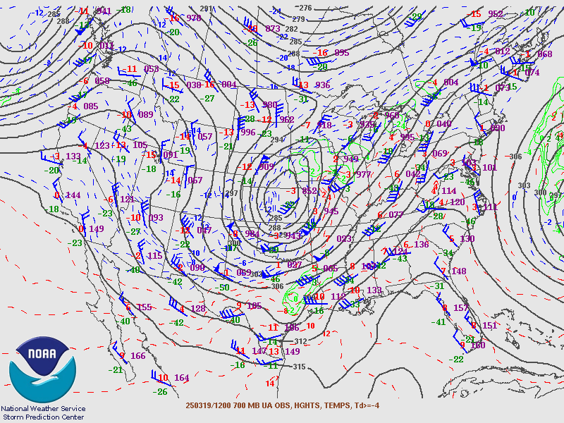 |
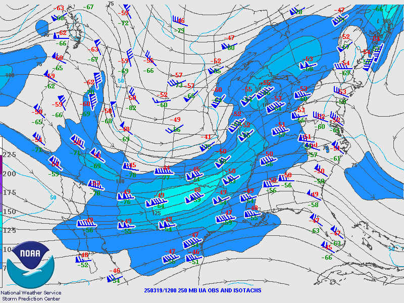
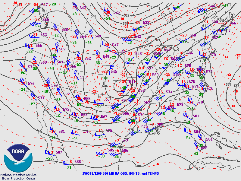
| Figure 1: The 250mb chart from the morning of March 19th shows the presence of the left exit region of a strong jet stream over our forecast area. | Figure 2: The 500mb chart from the morning of March 19th shows a nearly closed upper level low in the Central Plains and it associated negatively tilted trough. | Figure 3: The 700mb chart from the morning of March 19th shows strong southerly flow and WAA. |
Near-storm environment summary.
 |
 |
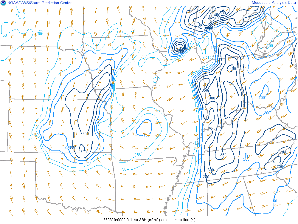 |
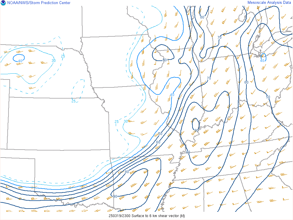
| Figure 4: LCL heights were around 1000m at 00Z March 20, 2025 | Figure 5: There was ample bulk shear from 0-6 km at 00Z March 20, 2025 with ~70 kts across the forecast area | Figure 6: Ample 0-1 km SRH of up to 300-400 m2/s2 was present around 00Z March 20, 2025 |
Additional environmental data.
 |
 |
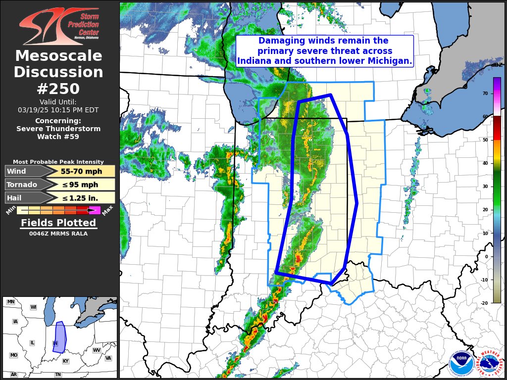 |
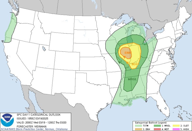
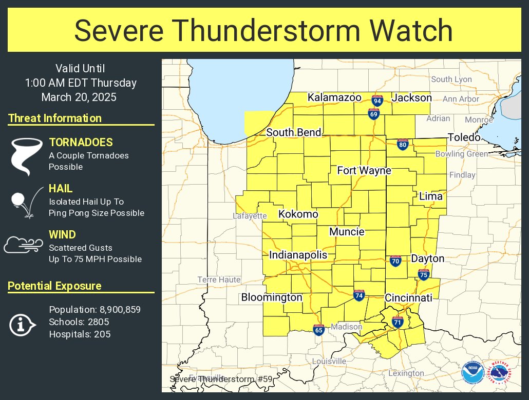
| Figure 7: The 20Z Day 1 Outlook issued by the Storm Prediction Center had a Slight Risk (level 2 of 5) for much of our forecast area. An Enhanced Risk (level 3 of 5) was just off the west in Illinois. | Figure 8: Severe Thunderstorm Watch #59 was issued at 6:55 PM EDT on March 19th, with damaging wind gusts to 75 mph and a few isolated tornadoes identified as the main threats. | Figure 9: A mesoscale discussion was issued by the Storm Prediction Center at 8:48 PM EDT, showing the continuing Severe Thunderstorm Watch and outlining the area where the threat for wind damage was anticipated to persist across central and northern Indiana. |
 |
Media use of NWS Web News Stories is encouraged! Please acknowledge the NWS as the source of any news information accessed from this site. |
|
Hazards
Heat Related
Watch/Warning
Outlook
Storm Prediction Center
Storm Reports
Submit a Report
Outdoor Event Watcher
EM Briefing
Climate
CoCoRaHS
FWA Daily
SBN Daily
FWA Monthly
SBN Monthly
Cliplot
Spring Frost Climatology
Fall Frost Climatology
Severe Climatology
Tornado Climatology
Local Information
Public Information Statement
Probabilistic Snowfall
Storm Data
Skywarn
COOP
Our Office
WSR-88D
Headline Criteria
NOAA Weather Radio
Weather History
Social Media Feeds
Weather Events Page
US Dept of Commerce
National Oceanic and Atmospheric Administration
National Weather Service
Northern Indiana
7506 E 850 N
Syracuse, IN 46567
574-834-1104
Comments? Questions? Please Contact Us.
Thank you for visiting a National Oceanic and Atmospheric Administration (NOAA) website. The link you have selected will take you to a non-U.S. Government website for additional information.
NOAA is not responsible for the content of any linked website not operated by NOAA. This link is provided solely for your information and convenience, and does not imply any endorsement by NOAA or the U.S. Department of Commerce of the linked website or any information, products, or services contained therein.
You will be redirected to:

