Overview
|
A brief landspout tornado occurred between Ottawa, OH and Leipsic, OH in Putnam County. The andspout was only on the ground for 1 minute, but did cause damage to a home on Road H5. The home sustained moderate loss of the roof and siding, and an attached garage also collapsed. Debris was scattered northeast of the property.
Thank you to everyone who sent us photos, videos, and reports to our social media!
Read more about the landspout here in our Public Information Statement |
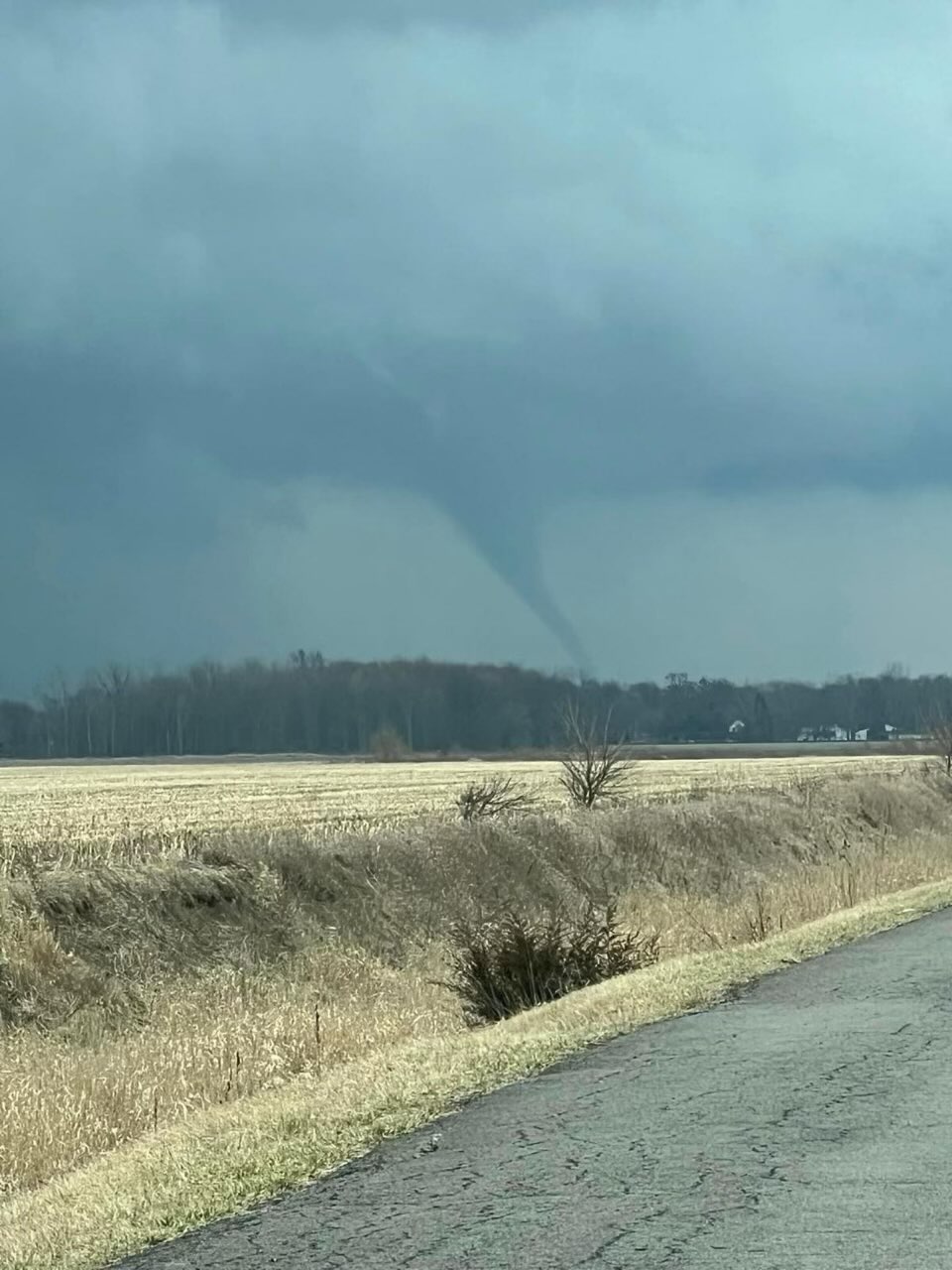 A photo taken of the tornado near State Road 65 and Road H5. Photo taken by Beth Pneuman, relayed by Kaylee Bowers (WTOL) on Facebook |
Landspout:
|
Tornado - 3 SSE Leipsic
Track Map 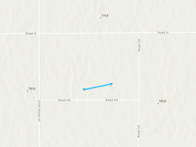 
Downloadable KMZ Fil |
||||||||||||||||
The Enhanced Fujita (EF) Scale classifies tornadoes into the following categories:
| EF0 Weak 65-85 mph |
EF1 Moderate 86-110 mph |
EF2 Significant 111-135 mph |
EF3 Severe 136-165 mph |
EF4 Extreme 166-200 mph |
EF5 Catastrophic 200+ mph |
 |
|||||
Photos
Damage photos taken by the Putnam County EMA office
 |
 |
 |
 |
| Damage to a home near SR65 and Rd H5 south of Leipsic (Putnam County Emergency Management) |
Damage to a home near SR65 and Rd H5 south of Leipsic (Putnam County Emergency Management) |
Damage to a home near SR65 and Rd H5 south of Leipsic (Putnam County Emergency Management) |
Damage to a home near SR65 and Rd H5 south of Leipsic (Putnam County Emergency Management) |
Radar
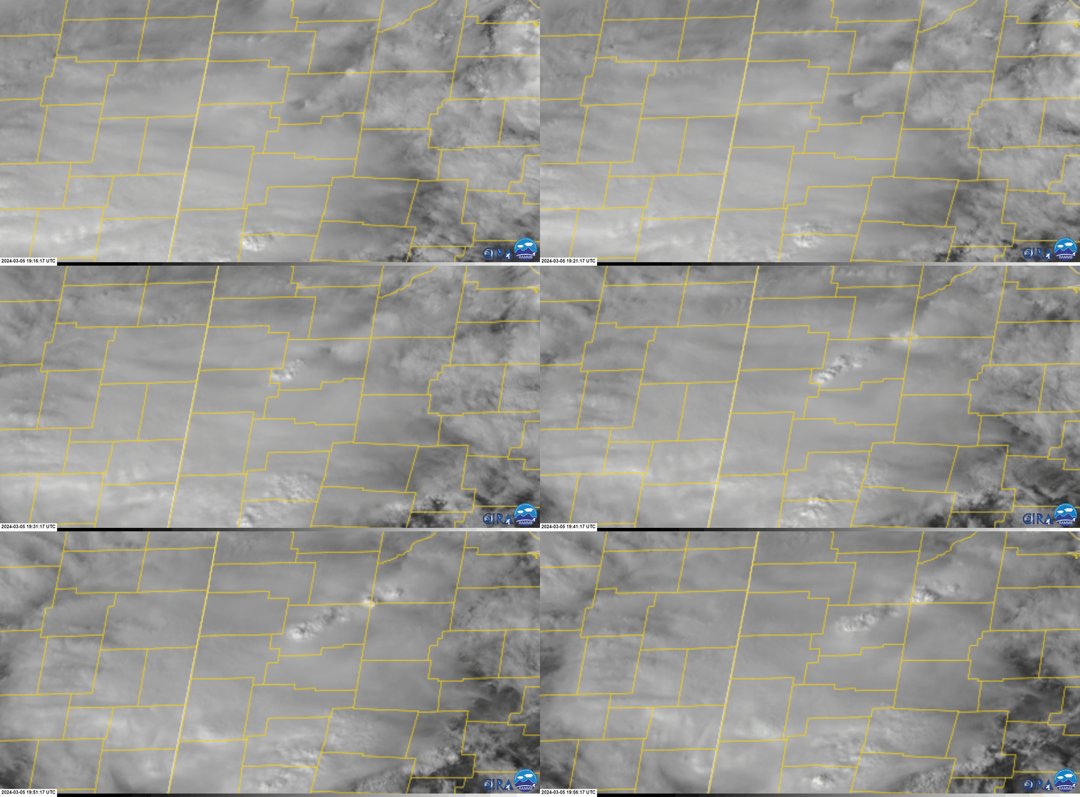
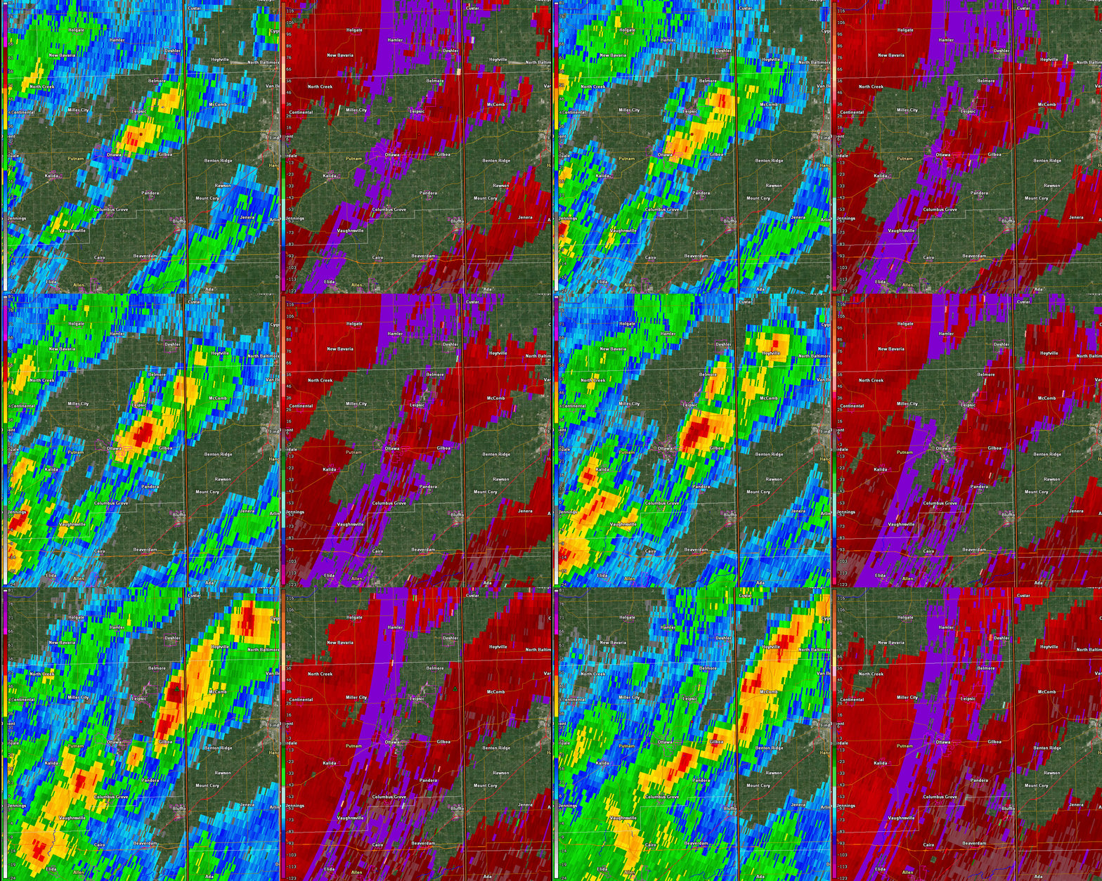
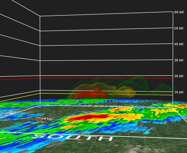
Satellite and Radar Loops from the afternoon of March 5th (landspout occurred at 2:34 PM ET or 19:34Z)
 |
 |
 |
| GOES East visible satellite loop over northwest Ohio 1916-1956Z | KIWX 0.5° reflectivity (left) and velocity (right) 1915-1956Z |
3-D reflectivity (1937Z) |
Storm Reports
0229 PM Landspout 3 S Leipsic 41.06N 83.98W
03/05/2024 Putnam OH Emergency Mngr
A brief EF-0 landspout has been confirmed
near Leipsic, OH. Emergency manager and
trained spotters confirmed tornado. Several
photos and videos of the landspout along
SR65. One home near the intersection of Road
H5 and SR65 sustained damage to the roof and
siding. An attached garage collapsed and
debris was scattered to the northeast of the
property. Time estimated from radar.
Environment
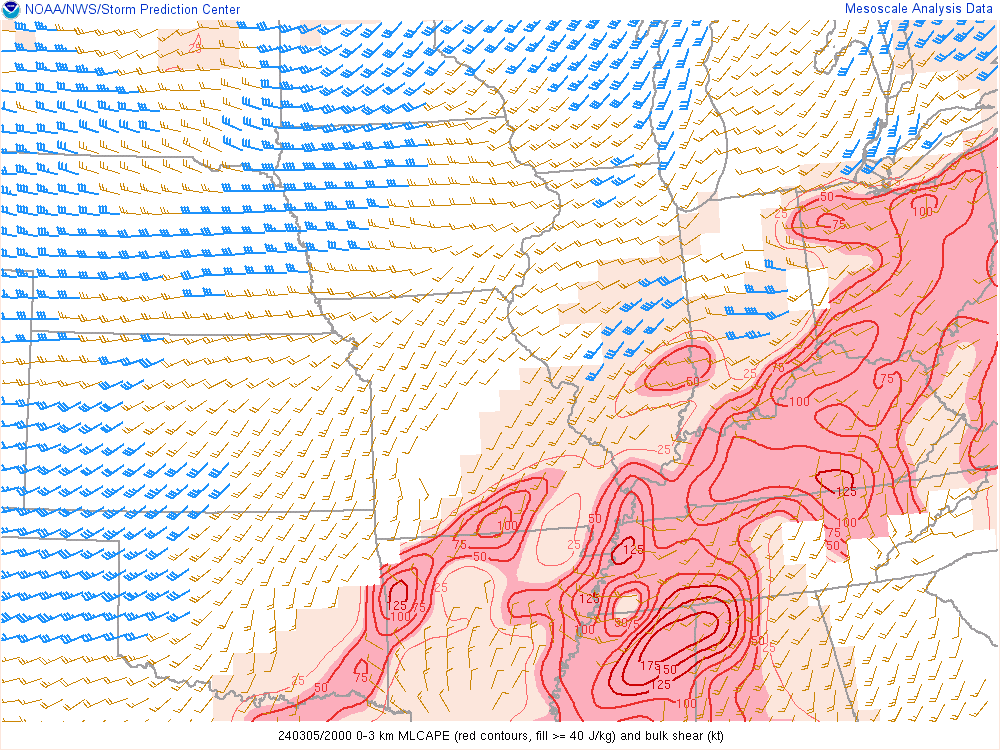
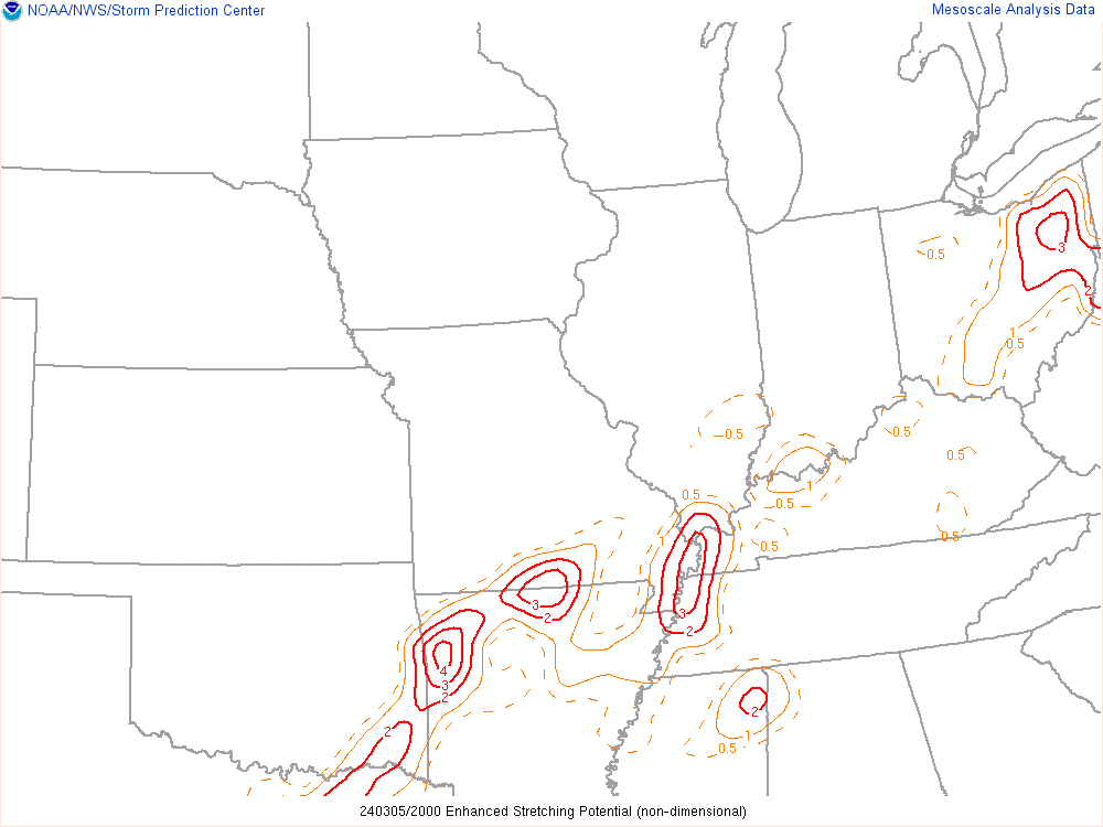
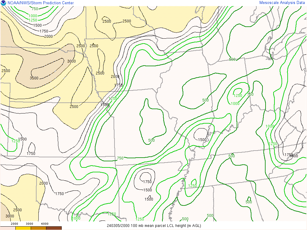
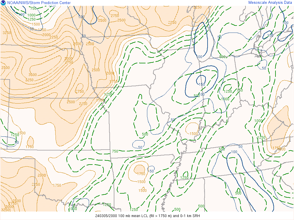
The landspout in Leipsic developed in an minimally favorable environment for landspouts. The non-supercell tornado parameter at 20Z (3PM) was zero. The only two favorable parameters at 20Z were the bulk shear of 40 kts and the low LCL heights between 500-750 meters. The 21Z WPC fronts analysis (figure 3) depicts a quasi-warm front/stationary front draped across the area, which could have also aided in the formation of the landspout.
 |
 |
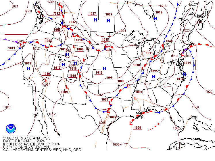 |
| Figure 1: 0-3km MLCAPE at 20Z | Figure 2: 20Z Enhanced Stretching Potential | Figure 3: 21Z Surface Map from WPC showing a quasi-warm front across the IWX CWA |
 |
 |
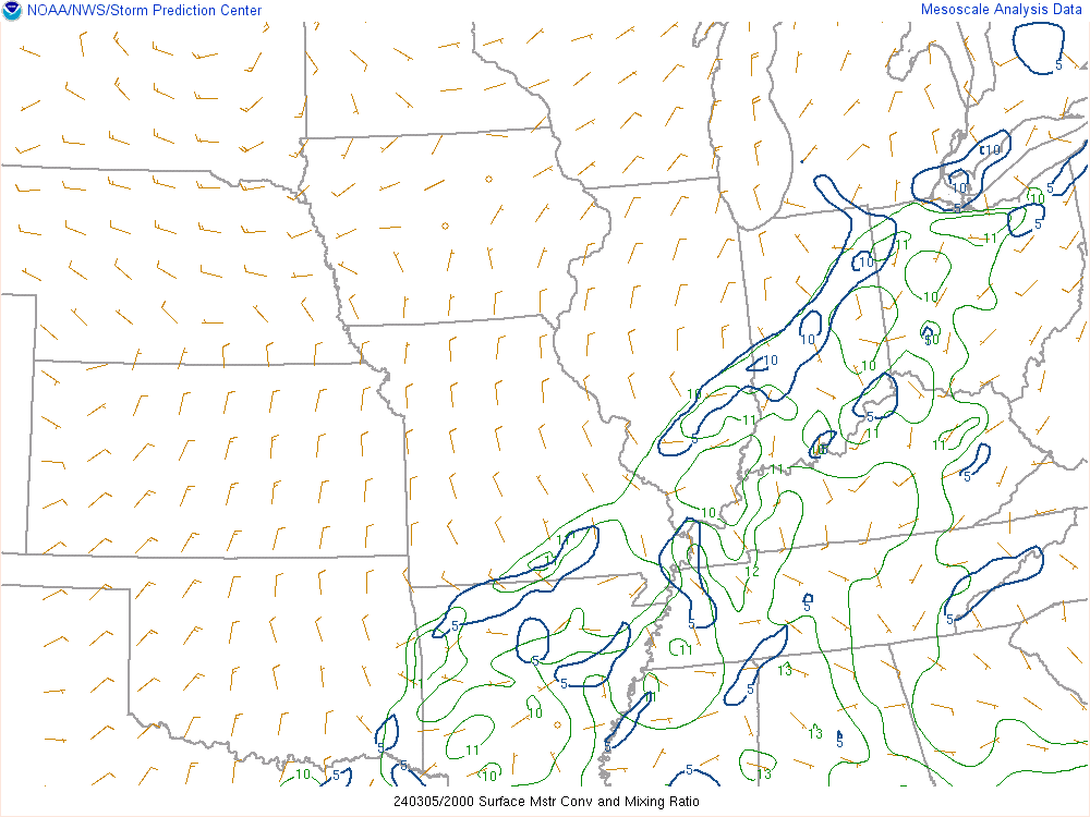 |
| Figure 4: 20Z LCL heights | Figure 5: 20Z mean LCL heights | Figure 6: 20Z Surface Convergence |
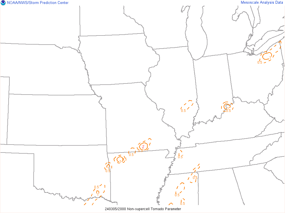 |
| Figure 7: Non-supercell Tornado parameter |
 |
Media use of NWS Web News Stories is encouraged! Please acknowledge the NWS as the source of any news information accessed from this site. |
 |