NWS All NOAA
Northern Indiana
Weather Forecast Office
Last Map Update: Tue, Jul 21, 2026 at 5:34:47 pm EDT


 Weather Story
 Weather Map
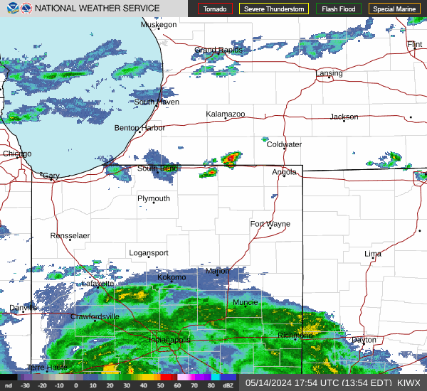 Local Radar