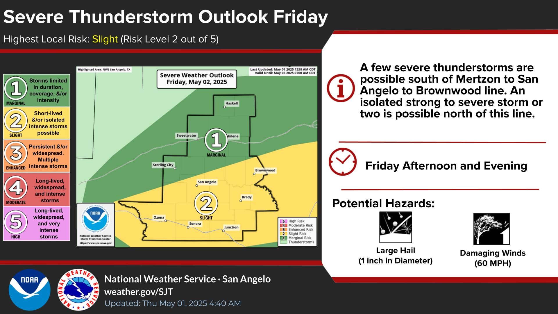
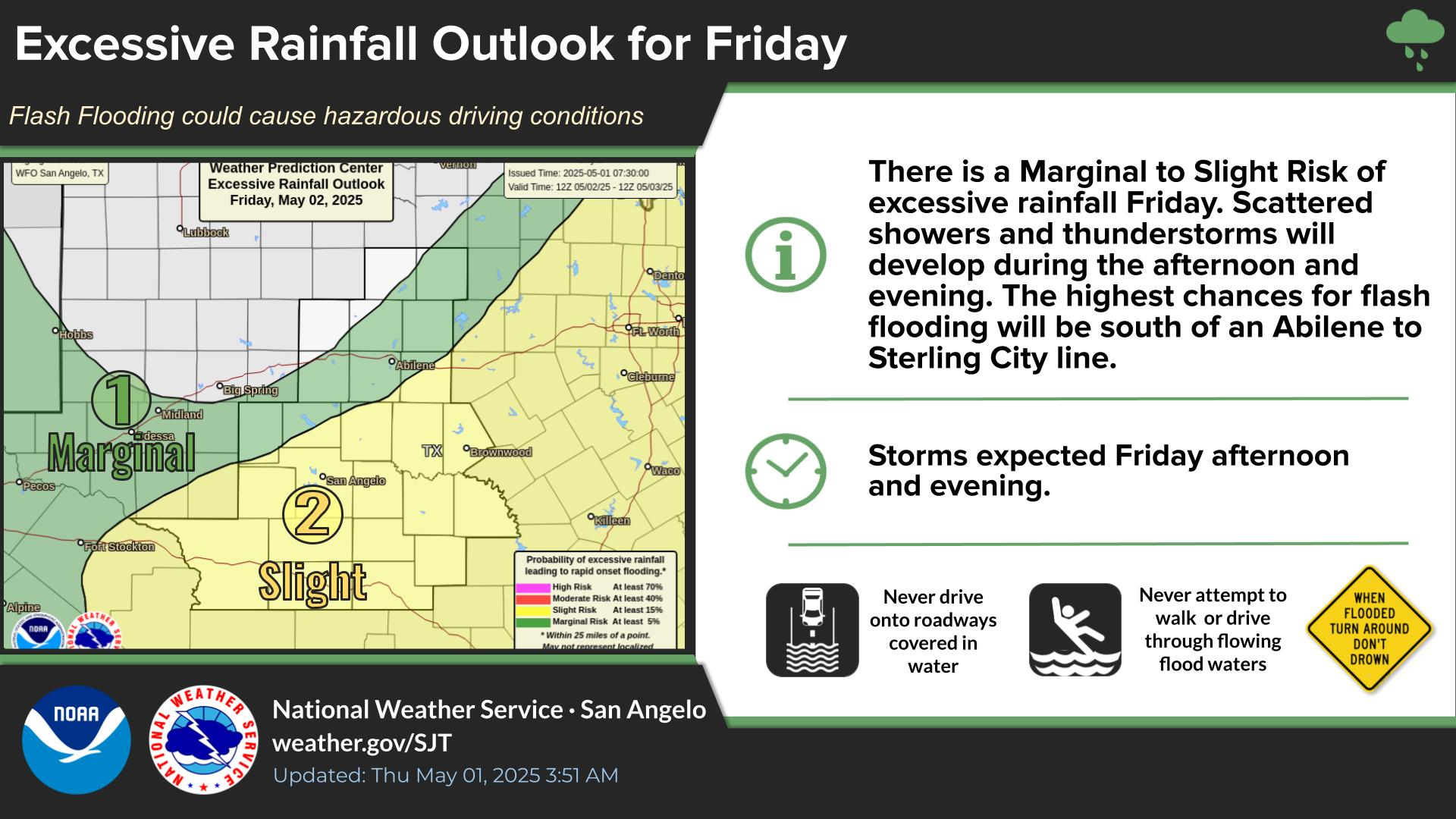
There is a potential for isolated to scattered thunderstorms much of today. Heavy rainfall associated with these storms will pose a risk of flash flooding.
Storm complexes may move southeast into the Big Country early Friday morning, and again late Friday afternoon and night. A isolated severe thunderstorms is possible, mainly north of Roby to Haskell to Throckmorton line. Large hail and damaging winds are the main hazards.


 Virtual Tour
 Current Observations
 Weather Briefing
 Satellite Loops
 Past Weather Reports
 Past Rainfall Maps
 Drought Information
 River & Lake Levels
 Fire Weather
 Aviation Weather
 Additional Resources
 Social Media