
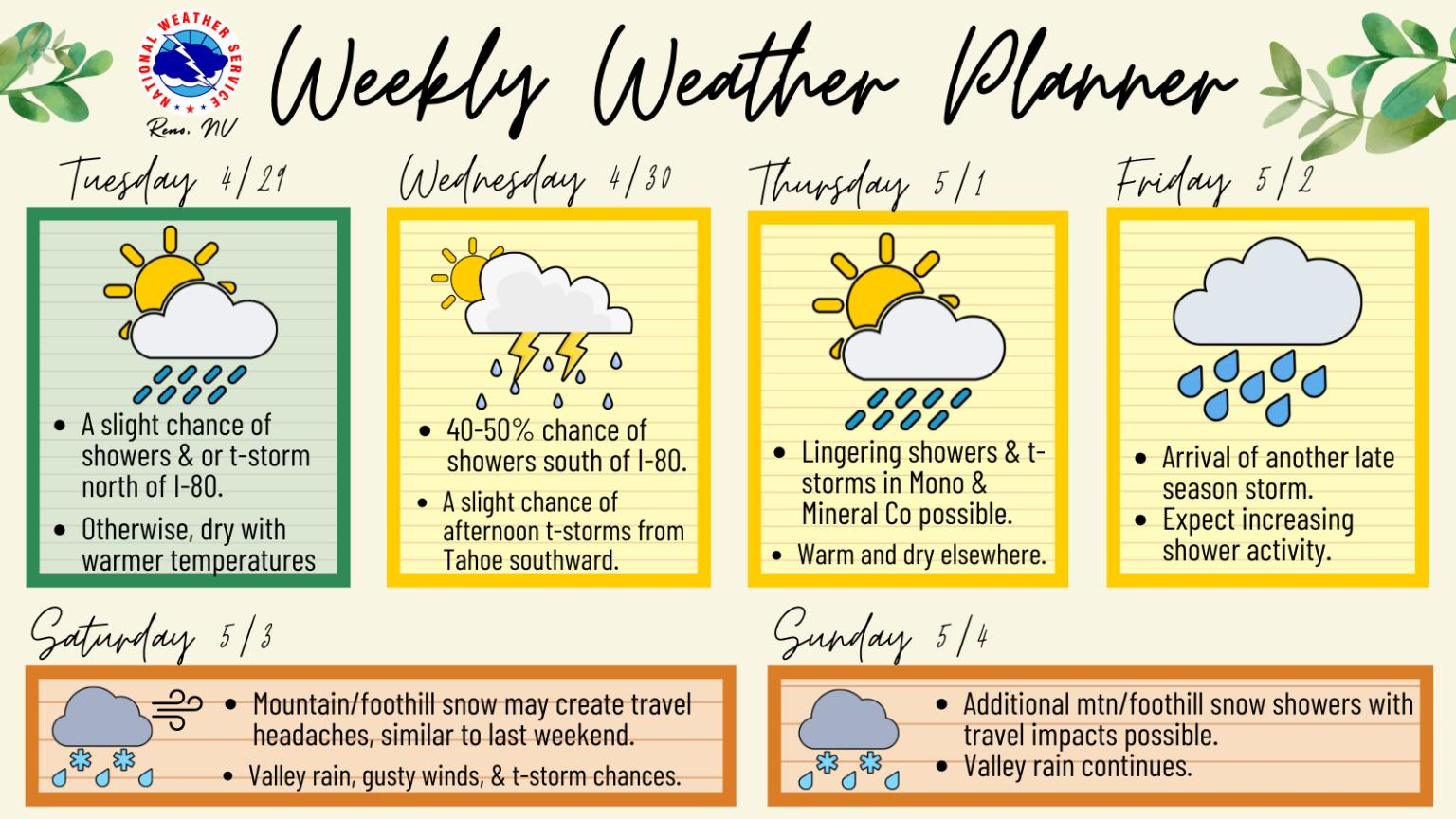
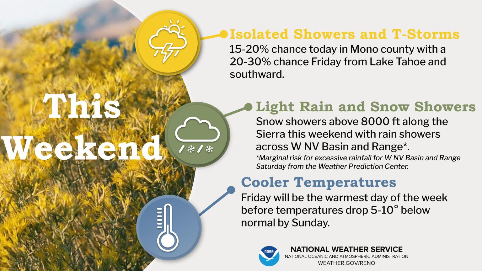
Strong to severe thunderstorms may produce heavy to excessive rainfall over portions of the Central/Southern Plains and Mississippi Valley today. There is a Slight Risk (Level 2 of 4) for Excessive Rainfall and a Slight Risk (Level 2 of 5) for severe thunderstorms today. Elevated fire weather conditions are possible over parts of western Florida today. Read More >
Last Map Update: Thu, Apr 24, 2025 at 4:44:20 pm PDT
|
Text Product Selector (Selected product opens in current window)
|
|


 Radar
Radar Satellite
 Fire Weather
 Lake Forecasts
 Snow & Avalanche
 Recent Temp & Precip
 Mountain Observations & Remote Data
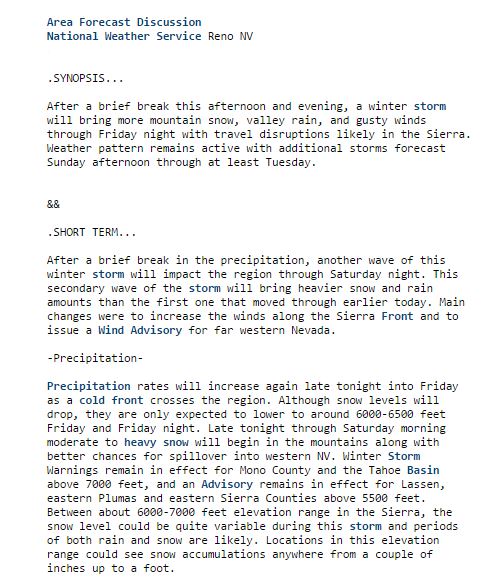 Forecast Discussion
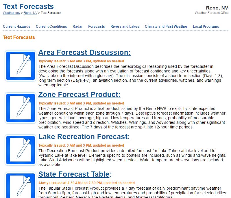 Text Forecasts
 Graphical Forecasts
 Forecast Weather Tables
 Social Media