
A powerful spring storm continues across the country with multiple high impacts in the forecast. Life-threatening, catastrophic, and potentially historic flash flood event continues across the Lower Ohio Valley and Mid-South. A couple rounds of significant severe weather expected from the Mid-South through the Ozarks and ArkLaTex with very large hail and strong tornadoes possible. Read More >
Last Map Update: Fri, Apr 4, 2025 at 9:30:09 am PDT


|
Text Product Selector (Selected product opens in current window)
|
|


 Social Media
 San Francisco Radar
 Sacramento Radar
 Satellite
 Weather Map
 Local Graphical Forecast
 U.S. Graphical Forecasts
 Forecast Weather Tables
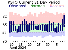 Recent MTR Temperatures
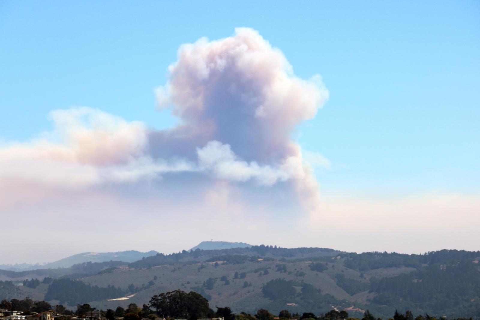 Fire Weather
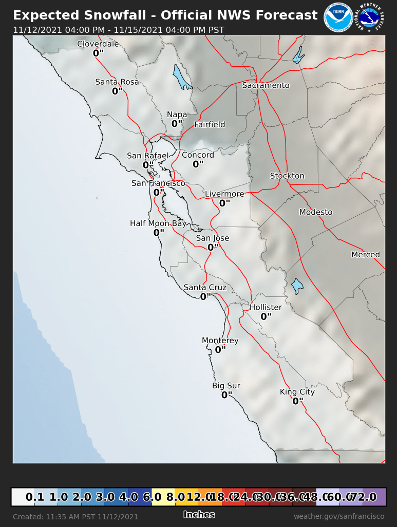 Probabilistic Snowfall Forecasts
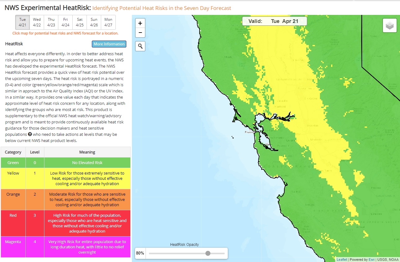 Heat Risk Link