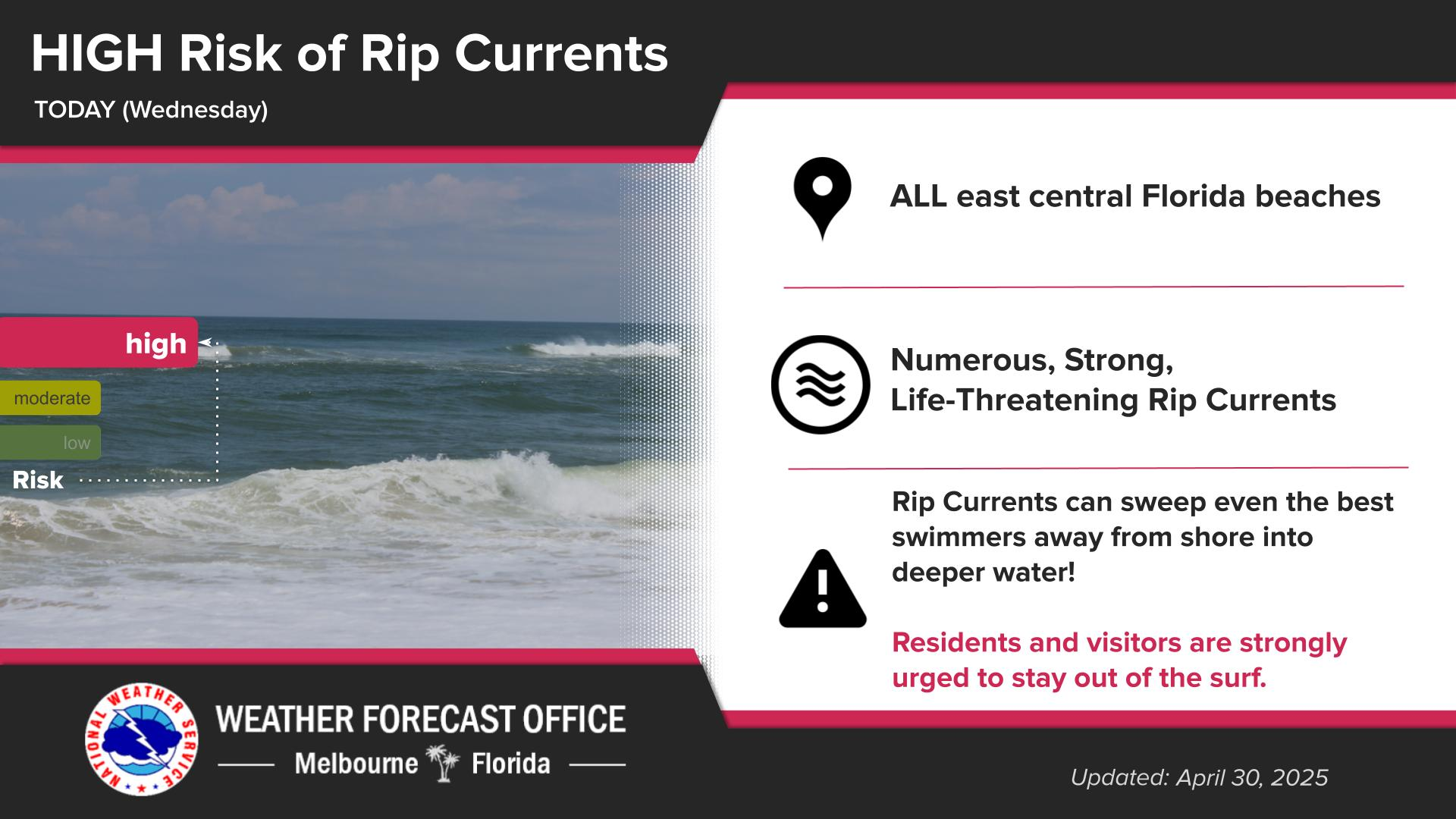
The dry weather persists, with highs reaching the 80s once again this afternoon across the area. A high risk of rip currents continues at local beaches, and entering the surf is not advised.
The latest drought update (April 24, 2025) places portions of Volusia and Lake Counties in Extreme Drought. Elsewhere, abnormally dry or drought conditions continue to expand.
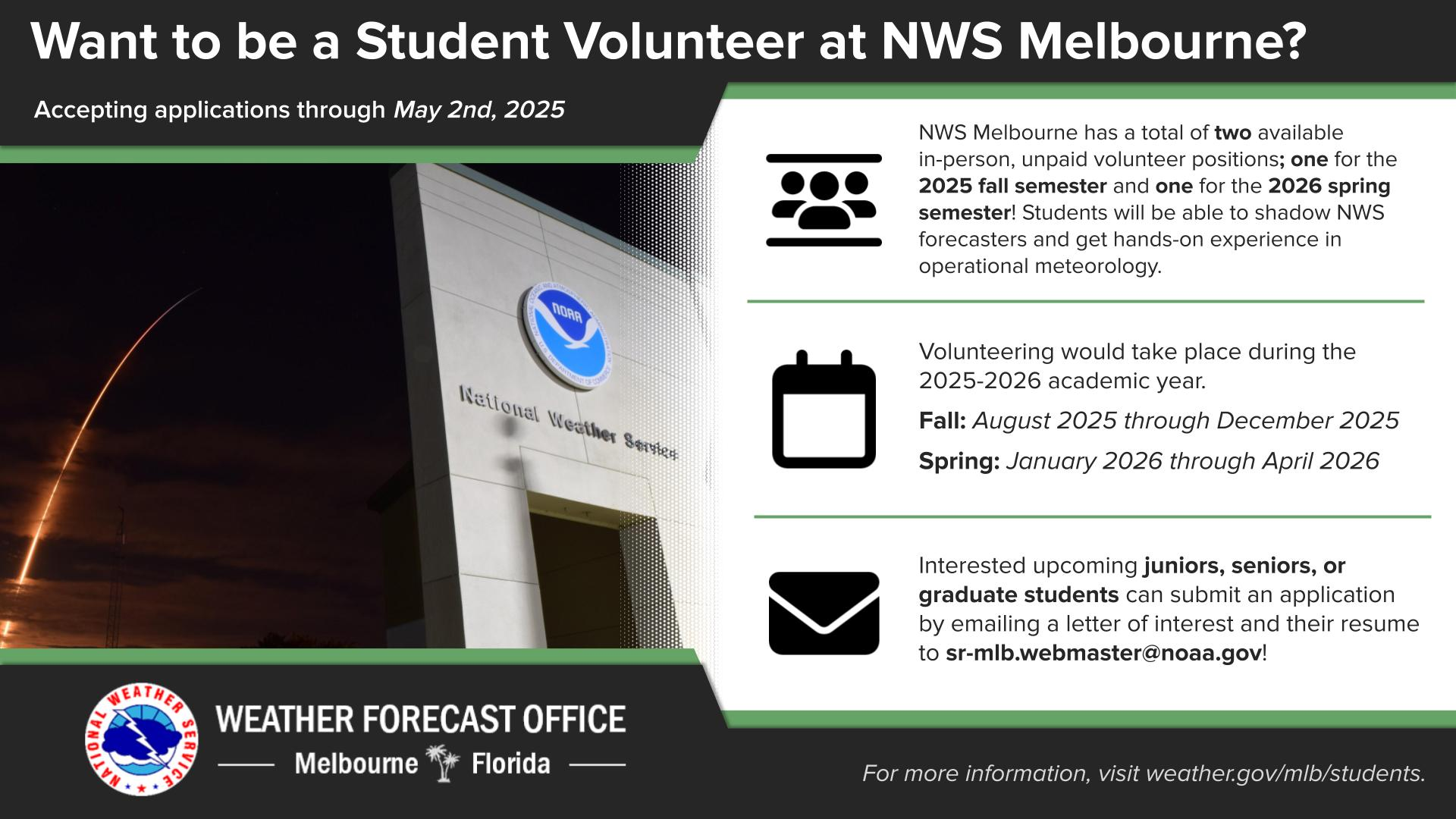
Are you a junior, senior, or graduate student with an interest in operational meteorology? NWS Melbourne has two volunteer positions available for the 2025-2026 academic year, one during the fall semester and one during the spring semester. Additional details are available at weather.gov/mlb/students.


 Interactive Radar
 Regional Satellite
 Severe Weather