| Strong Late-Summer Cold Front 19 August 2015 |
 |
| Regional radar animation valid from 12:38 to 1:48 am on Wednesday, 19 August 2015. |
| A rare strong summer cold front plunged through the southern plains late Tuesday and early Wednesday (18-19 August). This front was sent southward by a potent storm system that moved across the upper Midwest. When the front encountered the heat and moisture in place thunderstorms erupted. Many of these thunderstorms were strong to severe across the Texas Panhandle during the early morning hours of Wednesday. A number of reports of damaging winds and large hail were received including considerable wind damage in and around Canyon and Amarillo. One intense strong storm tracked further south past Tulia, producing a 61 mph wind gust at the West Texas Mesonet site 2 miles northeast of town. This storm gradually weakened, but still dumped heavy rain as it raced eastward. |
 |
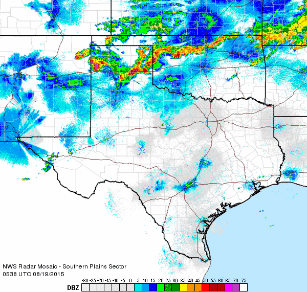
| Regional radar animation valid from 4:28 to 5:38 am on Wednesday, 19 August 2015. |
| Scattered thunderstorms continued to develop along and behind the front as it surged southward through the South Plains and Rolling Plains Wednesday morning. Many of the storms were packed with lightning and created a loud start to the day. The storms also dropped heavy rain, though they generally moved fast enough to preclude producing a significant flooding threat. Even so, where several rounds of storms tracked repeatedly across the same area, a good chunk of the southern Texas Panhandle did record 0.50 to 1.50 inches of rain. Childress officially recorded 1.07 inches which did break a daily record for August 19th, topping the previous record of 0.83 inches set in 1982. |
 |
| Radar-estimated and bias-corrected 24 hour rain totals ending at 6 am on Wednesday, 19 August 2015. A regional view of the same image can be VIEWED HERE. |
| Outflow from the thunderstorms gave the cold front an extra push south, while low clouds filled in within the invading cool and moist air. The mostly cloudy conditions and breezy northeast winds held afternoon temperatures down in the 60s and lower 70s on Wednesday, one day after seeing highs well up into the 90s. If you think these cool readings were out of place for West Texas in August you'd be right. In fact, the afternoon temperatures were below previous record minimum highs for August 19th (the record minimum high in Lubbock for August 19th is 74 degrees). However, the cold front didn't move through until after midnight, so the daily high temperatures for the day were recorded shortly after midnight when readings were still in the middle 70s to lower 80s (Lubbock's official high was 82 degrees, recorded at 1:54 am). Temperatures did tumble into the 50s and lower 60s late Wednesday evening, so both Lubbock and Childress were able secure a record then, breaking and tying their record lows, respectively. Officially Lubbock dropped to 57 degrees before midnight, eclipsing the previous record of 58 degrees (set in 1950), while Childress tied its record of 60 degrees (first set in 1932). Needless to say, the cold front sure brought a nice reprieve from the typical hot August weather. |

