|
Winter Weather Returns to West Texas
2 February 2014 |
|||
 |
|||
| A view of Shallowater on Sunday morning, 2 February 2014. The image is courtesy of KAMC. | |||
|
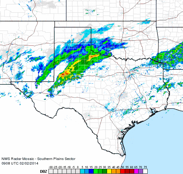
A potent, quick moving upper level storm system moved from the Desert Southwest over West Texas late Saturday night into Sunday (1-2 February 2014). As the winter storm drew closer, a large area of precipitation developed in eastern New Mexico and then spread eastward across the South Plains and Rolling Plains. Initially, pockets of sleet, rain, and freezing rain mixed in early Sunday morning. However, the precipitation quickly transitioned to primarily snow.
|
|||
 |
|||
| Regional radar animation valid from 3:08 to 4:18 am on 2 February 2014. | |||
|
One particularly heavy and slow-moving band of snow setup across the southeast South Plains into the Rolling Plains (see the above radar animation). The sleet and snow in this heavy band was so intense it even possessed considerable amounts of lightning and thunder in the pre-dawn hours of Sunday. Locations including in and around Post, Spur and Paducah saw the brunt of this band, picking up a quick 6 to 10+ inches of snow before the snow diminished and shifted east by midday.
|
|||
 |
|||
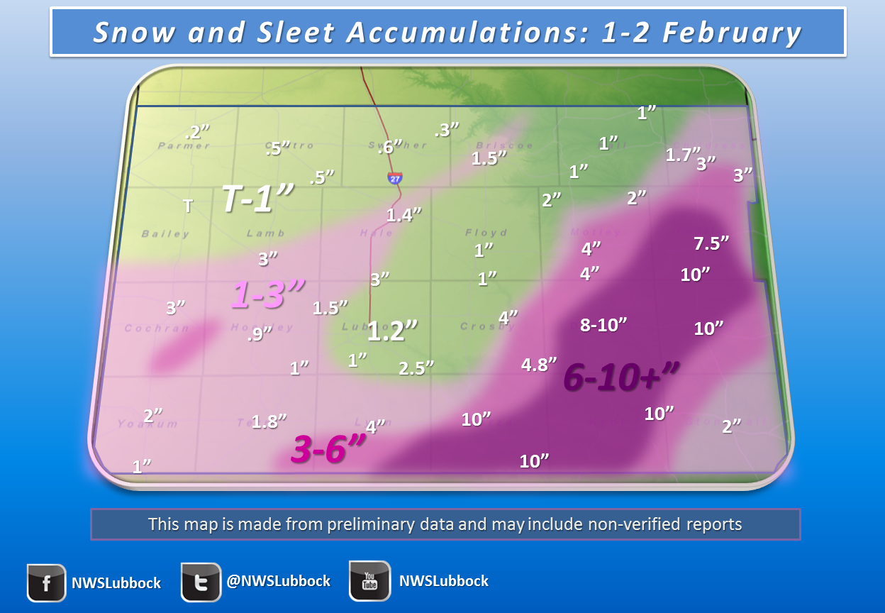
| Snow totals map for 2 February 2014. | |||
|
Further to the west, across much of the Caprock, bands of light to moderate snow dropped 1 to 2 inches at many spots. The sleet and snow did result in slick and snow covered roadways, and made travel nearly impossible where the heaviest snow fell. Although a headache for those wanting to travel about, the snow made for a beautiful wintry Sunday! Additionally, the precipitation brought to an end a dry streak that began in mid-December. Lubbock and Childress both officially tallied 42 consecutive days without measurable precipitation (from December 22nd through February 1st). Below are several images captured from around the area during and after the winter storm: |
|||
|
|||
| Infrared satellite imagery (left) and radar imagery (right) captured around 2 am on Sunday. Also plotted on both images are cloud to ground lightning strikes (small "+" and "-" symbols). Click on the images for larger views. | |||
 |
 |
||
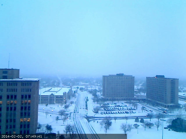
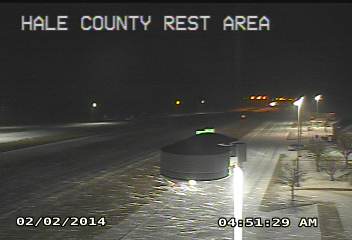
| View from the Texas Tech campus (left) and Hale County Rest Area (right) early Sunday morning. Click on the image for larger views. | |||
 |
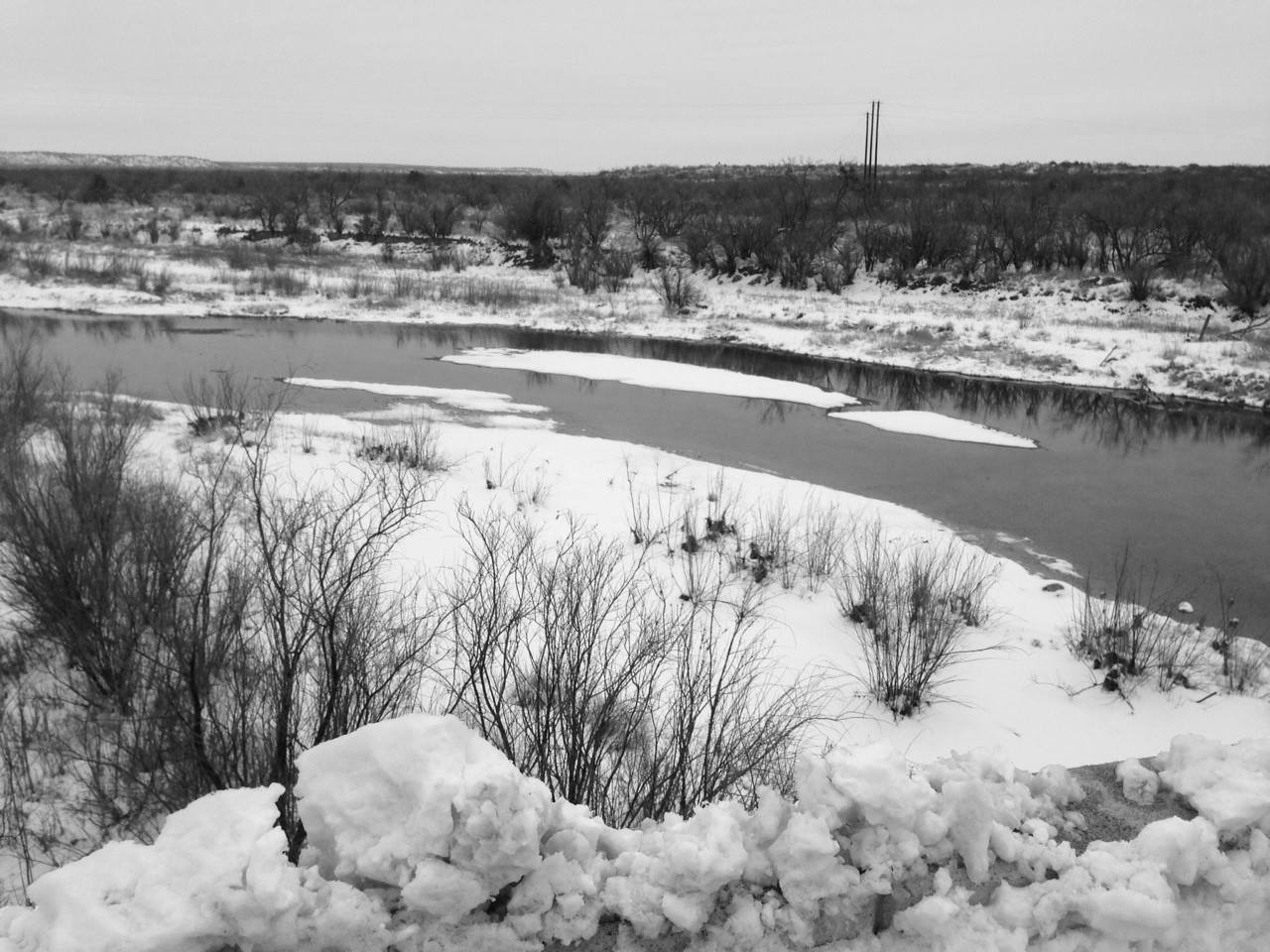 |
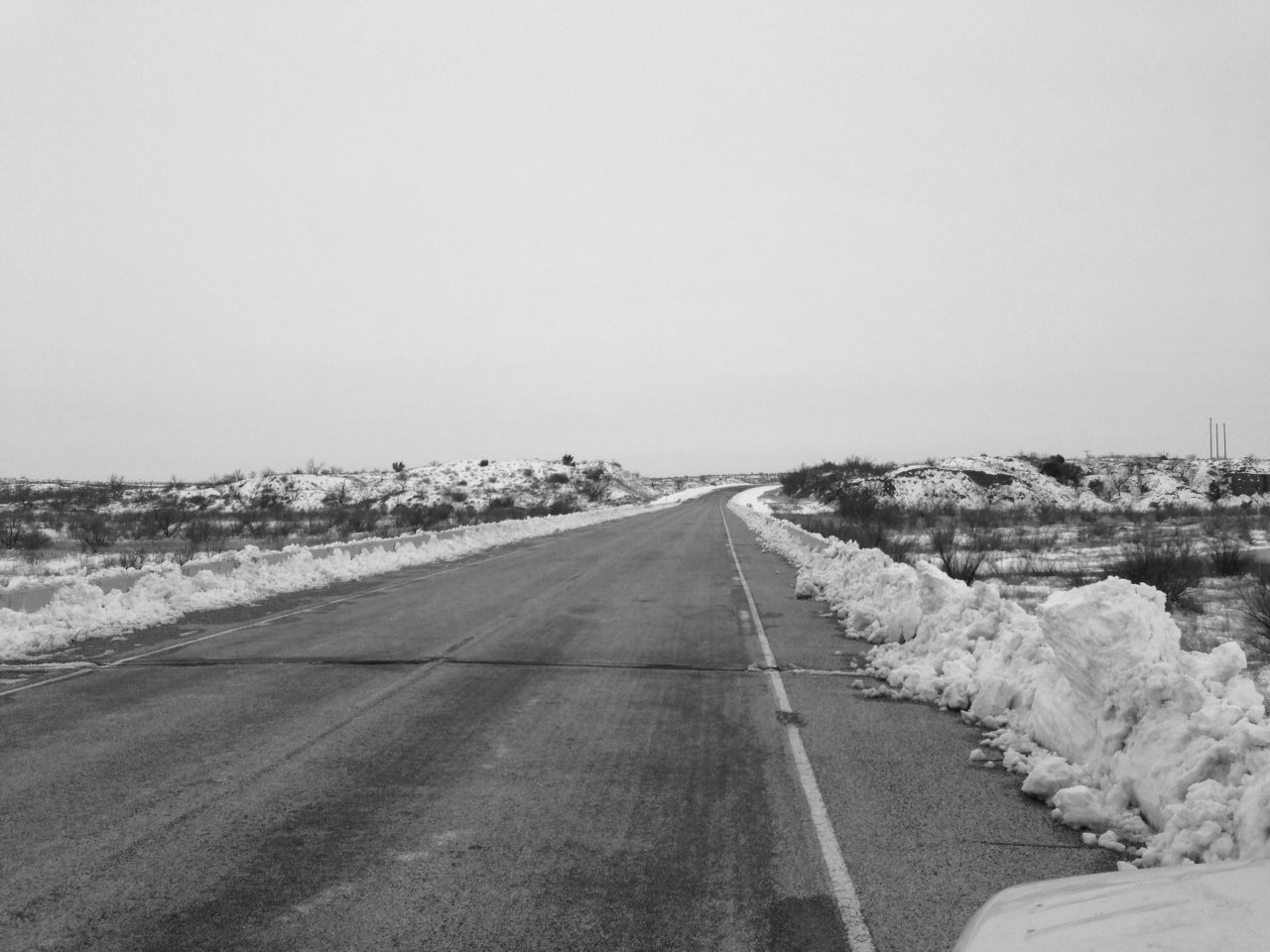
||
| Aftermath of the snow storm near, captured near Jayton on 3 February 2014. The right picture is of the Salt Fork of the Brazos River. Click on the images for a larger view. | |||
 |
|||
| A frozen White River Lake captured on 3 February 2014. | |||
 |
|||
| Another picture captured from near White River Lake on 3 February 2014. | |||


