|
Severe storms: east and northwest |
||
 |
||
| View of the back side of intensifying thunderstorms to the east of Lubbock. The picture was taken at 4:42 pm on May 27th. | ||
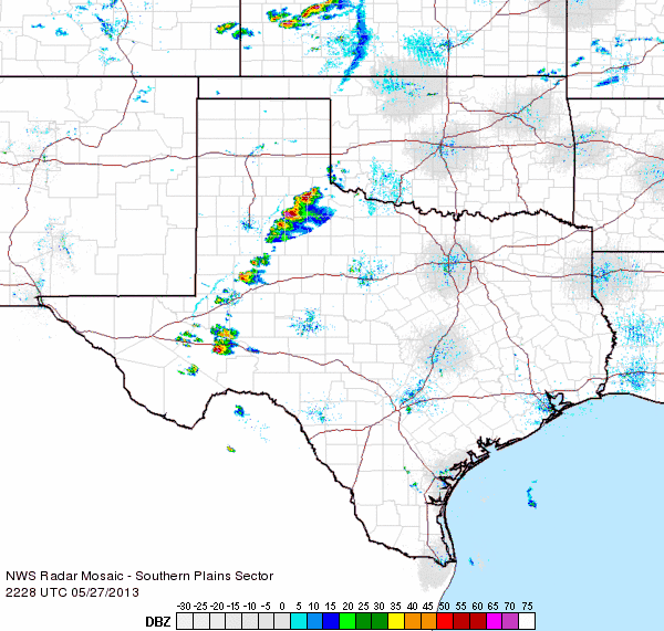
| Hot temperatures, in the 90s and lower triple digits, and the dryline were enough to kick off scattered thunderstorms during the late afternoon and early evening hours on May 27, 2013. Strong instability and modest wind shear allowed a few of these storms to become severe, dropping large hail and localized heavy rains. Hail as large as baseballs was reported in the community of Tell, southwest of Childress, with several other spots receiving golf ball sized hail before the storms faded by mid to late evening. | ||
 |
||
| Regional radar animation valid from 5:28 to 6:38 pm on 27 May 2013. | ||
| The above animation shows how the storms evolved during the early evening hours on Memorial Day. Below are several pictures of the impacts felt as the storms moved through. | ||
|
||
|
||
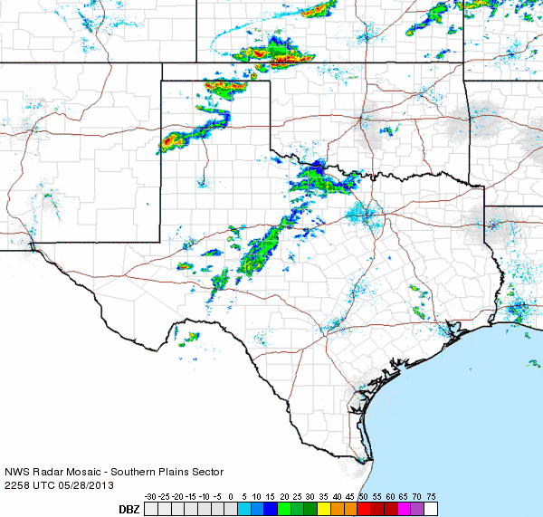
| On May 28th, the dryline retreated to near the TX-NM state line. An isolated supercell thunderstorm developed in western Parmer County. This storm produced large hail and heavy rain as it moves slowly north-northeast. The radar animation below shows the storm's track. | ||
 |
||
| Regional radar animation valid from 5:58 to 7:08 pm on 28 May 2013. | ||
| Preliminary storm reports for the 27th can be found HERE. A plot of the local storm reports from both days and 24-hour rain totals for the 27th can be found below. The rainfall reports are courtesy of the West Texas Mesonet. | ||
|
|
|||
|
Toggle Preliminary Local Storm Reports for May 27, 2013
|
Toggle 24 hours Rainfall Totals (inches) for May 27, 2013
|
Toggle Preliminary Local Storm Reports for May 28, 2013
|
|


