|
Strong Winter Storm Brings Rain, then a Little Snow |
|
|
|
|
| 48-hour precipitation totals valid from 7 pm on 18th (Sunday) through 7 pm on the 20th (Tuesday) of December 2011. Data courtesy of the Texas Tech West Texas Mesonet. Click on the map for a slightly larger view. | |
|
A strong winter storm brought widespread beneficial precipitation to the South Plains region between late on the 18th (Sunday) to early on the 20th (Tuesday) of December 2011. The precipitation fell mainly in the form of showers and thunderstorms, though even a little snow mixed in. The above map shows the total precipitation recorded by the West Texas Mesonet sites over the event. A good quarter to half of an inch of rain fell across the entire region, with localized higher amounts. The Lubbock airport officially recorded 0.58 inches of liquid, while the Childress airport received 0.32 inches. Even with the late year rain, 2011 is on pace to easily be the driest year on record at Lubbock. CLICK HERE to learn more about the record year of 2011. |
|
|
|
|
| Water vapor satellite image captured at 10:15 am on 19 December 2011. The "L" denotes the approximate location of the mid-level storm system with the arrows indicating the flow around the low. Click on the image for a full lower 48 view. | |
|
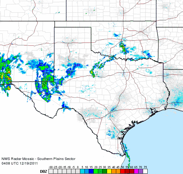
The winter storm initially approached West Texas from the Desert Southwest late Sunday and early Monday (18-19 December 2011). As the system drew closer it pulled abundant amounts of moisture northward from the Gulf of America as well as from the eastern Pacific Ocean, and widespread showers and thunderstorms developed. The below radar image shows precipitation just beginning to blossom across the Trans-Pecos late Sunday evening, well in advance of the upper level storm system. |
|
|
|
|
| Regional radar animation from 10:08 pm to 11:18 pm on 18 December 2011 (Sunday). | |
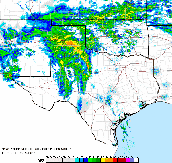
| By Monday morning, a large shield of precipitation developed and quickly spread across the South Plains and Rolling Plains. This was when most of the precipitation fell locally. This is also when the precipitation began changing to snow across southeast Colorado and northeast New Mexico, as colder air was advancing southward behind a strong cold front. | |
|
|
|
| Regional radar animation from 9:08 am to 10:18 am on 19 December 2011 (Monday). | |
| The below images show what the storm system looked like from space as the winter storm was really getting spun up over the area. Much of the South Plains and Rolling Plains actually saw a fair amount of sunshine Monday afternoon as dry air got wrapped in underneath the upper level low. | |
 |
 |
| Visible (left) and infrared (right) satellite image captured at 12:15 pm on 19 December 2011. Click on the pictures for bigger view. | |
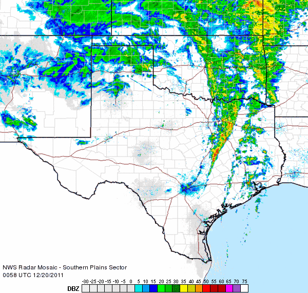
| The upper level storm continued to advance to the northeast across the Texas Panhandle Monday night while at the same time the cold front plunged southward through the South Plains. This allowed the precipitation to change over to snow across the entire Texas Panhandle as well as into the South Plains. However, by this time, the precipitation intensity waned. Still, a few locations including Muleshoe, Friona, Hart and Dimmitt did report anywhere between a half inch and an inch of snow. The below animation shows some light rain and snow showers skirting the southern Texas Panhandle Monday evening. | |
|
|
|
| Regional radar animation from 6:58 pm to 8:08 pm on 19 December 2011 (Monday). | |
|
|
|
| NASA MODIS Satellite imagery from Tuesday, December 20, 2011. It is difficult to distiguish the snow from the clouds, but a swath of snow can be seen stretching from eastern New Mexico southeast into Parmer and Castro Counties. Click on the image to view a larger version. | |


