| August 11th, 2011: Stormy Weather Returns to Parts of the Area |
Portions of the South Plains finally received some wetting rainfall Thursday night, August 11th. For much of Lubbock and the surrounding areas, this was the first significant rainfall since spring, and many locations more than doubled their yearly rainfall totals in this one event! Unfortunately, the rainfall was not widespread - the Lubbock area was "lucky" in that two outflow boundaries collided in the vicinity setting up new thunderstorm development that moved only very slowly to the east.
In addition to the beneficial rainfall, some localized severe weather also occurred. The most signficant damage was found in Dimmitt, where the West Texas Mesonet station two miles northeast of town recorded a peak wind gust of 95 mph during a microburst. Another microburst with wind speeds of around 70 mph caused some damage in Olton. Two to three inches of rain in the southern portions of the city of Lubbock caused widespread street flooding and some home flooding as well. Intense lightning resulting in a large apartment fire and power outages. The map below shows the local storm reports received by our office.
|
|
|
Preliminary storm reports from the event. Click on the weather icons to view the full report.
|
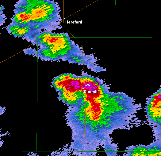 |
| Radar image at 6:30 CDT by the KLBB WSR-88D of the thunderstorm which produced the microburst over Dimmitt. Base reflectivity shown. Move your mouse over the image to view the base velocity data from roughly the same time. |
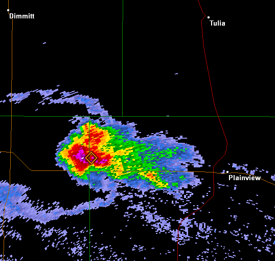 |
| Radar image at 5:13 PM CDT by the KLBB WSR-88D of the thunderstorm which produced the microburst over Olton. Base reflectivity shown. Move your mouse over the image to view the base velocity data from roughly the same time. |
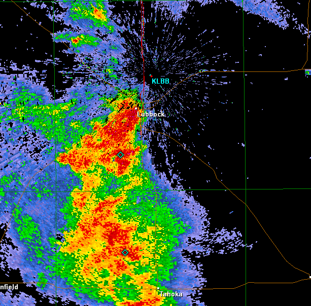 |
| Radar image at 8:45 pm by the KLBB WSR-88D of the thunderstorm complex which produced the heavy rain across much of Lubbock and Lynn Counties. |
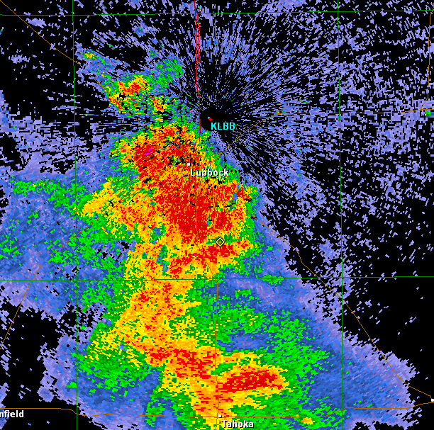 |
| Radar image at 8:45 pm by the KLBB WSR-88D of the thunderstorm complex which produced the heavy rain across much of Lubbock and Lynn Counties. Note the storms have not moved much in a half hour. |
Precipitation Map
 |
| Map of some of the observed precipitation that occurred across the southern Plains on August 11th. Note some of the wide ranging values in the city of Lubbock. The official observing site at the airport only received 0.05" of rain, while the National Weather Service office ten miles to the south at the science spectrum picked up a whopping 2.84"! Click on the map for a larger version! |
To view the West Texas Mesonet summary for the event please click here!

