After several months of very little rain across the South Plains, a complex of thunderstorms moving across the area late on the 10th and early on the 11th brought some much-needed rainfall along with a few reports of severe weather. Late on Tuesday the 10th, the dryline retreated west to the New Mexico border while a strong upper-level storm system approached West Texas from the 4-corners region. Once the lift from the system encountered the deep moisture along and just to the east of the dryline, thunderstorms developed late Tuesday night. Around midnight, several storms raced northeast from the northwest South Plains into the Texas Panhandle, then another complex of storms developed across southeast New Mexico into the southwest South Plains and then moved east-northeast, bringing at least modest rainfall to much of the area. Rainfall totals ranged from just a trace up to about an inch and a half in Denver City. In addition to the rain, hail up to one inch in diameter was reported on the south side of Lubbock, and a severe wind gust of 59 mph was reported near Friona.
To view a complete listing of the preliminary storm reports CLICK HERE.
Below are some images and information from this event.
|
|
|||
|
Preliminary storm reports from the event. Click on the weather icons to view the full report. Rainfall reports are courtesy of the West Texas Mesonet. Hail size and mesocyclone tracks are derived from radar data.
|
|||
|
Toggle Storm Reports
|
Toggle Rainfall Reports
|
Toggle Hail Size
|
Toggle Mesocyclone Tracks
|
The image below shows a satellite image around 3:30 am on the 11th. The thunderstorm complex in the Panhandle can be seen (cool colors indicate cooler temperatures/high cloud tops) along with the developing storms across the southwest South Plains.
 |
| Water Vapor satellite imagery at 3:30 am on 11 May 2011. The dryline is located near the Texas-New Mexico border. Click on the image to view a larger version. |
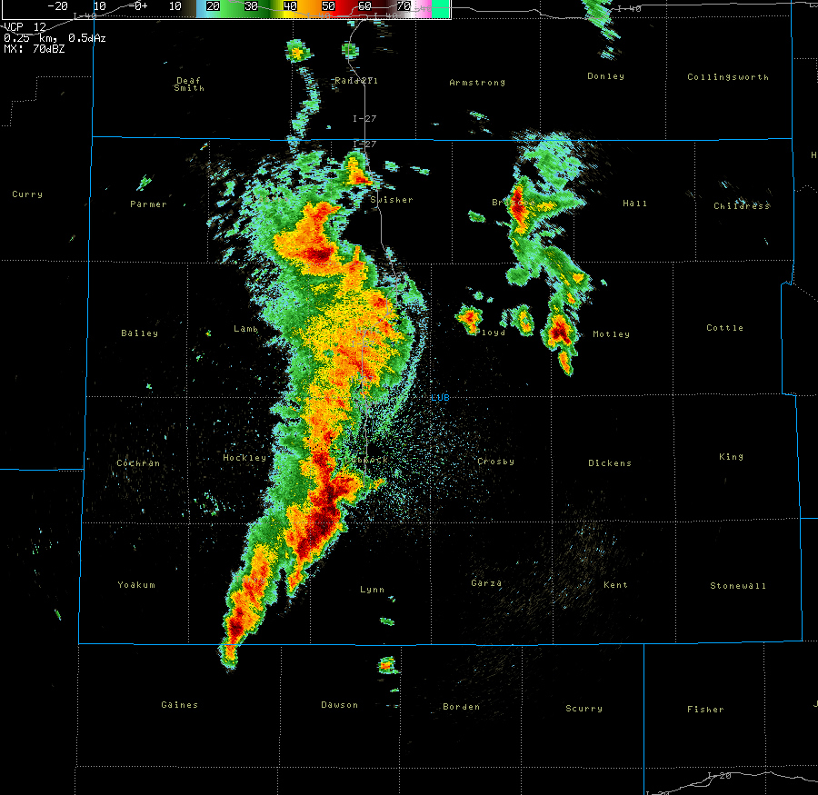
Below is a sequence of images from the Lubbock radar showing the progression of the thunderstorm activity across the area early Wednesday Morning:
 |
 |
 |
 |
| Base (0.5 degrees) reflectivity data from the Lubbock WSR-88D from 4 am to 7 am on 11 May 2011. Clockwise from the upper left. Click on each image to view a larger version. | |

