Feburary 27th, 2011 is a date that many residents of the South Plains will remember for a variety of reasons. Be it the wind, the dust, or the fires, most everyone was exposed to some of the most dangerous weather in West Texas. What's even more important to realize is that the peak of fire weather season is still yet to come. What causes such driving winds? Why were the fires so difficult to handle? At the basic level, it is largely due to the influences of weather. The Texas Forest Service has put together a video in collaboration with the National Weather Service about Texas Firestorms.
The story of February 27th, and the significant fires that occurred on this day goes back further than most people realize. Let's rewind about a year and follow the path.
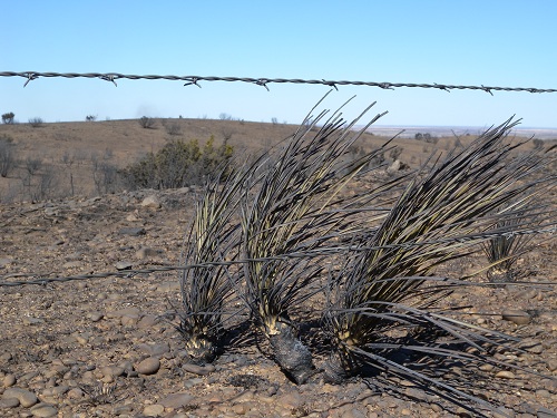
Most residents will remember the winter of 2009-2010 as fairly wet. Certainly there was above average snowfall during the winter months. That winter was influenced, in part, by the El Nino Southern Oscillation (ENSO) which was in the El Nino phase whereby sea surface temperatures are above average in the Eastern Pacific. El Nino is a naturally occurring cycle. It seems subtle that the sea surface temperature may be a couple degrees warmer or cooler than average, but it has effects on the weather that impact different parts of the world. With the El Nino phase, we typically see a wetter and often cooler winter across West Texas. That certainly was the case last winter and spring. The above average precipitation continued into the spring yielding favorable conditions for vegetative growth across the region. Then, in early July 2010, we experienced a very significant rainfall event influenced by the remains of Hurricane Alex. Some parts of the area received as much as 14 inches of rainfall with this event. In addition, there was unusually high humidity during the summer with a protracted period of time with dewpoint values above 70 degrees--a value more customarily experienced in regions a couple hundred miles east of our location. With the abundant rains and plentiful sun, wildland grasses and other vegetation blossomed to historically record levels.
They say that if you don't like the weather in Texas, just wait a while and it will change. Late 2010 into early 2011 was certainly no exception. El Nino weakened as summer approached and transitioned to a La Nina mode whereby the waters are cooler than average. With La Nina conditions, we generally see warmer and drier conditions around the region. It should be noted that contrary to popular belief, El Nino or La Nina phase do not dictate our day to day weather. Rather, it tends to change the larger scale storm track. We can still get wet and cold periods in the La Nina phase just as we can get a dry and hot spell in El Nino. The El Nino Southern Oscillation does not necessarily cause the weather, but instead influences it.
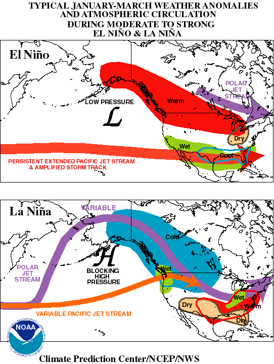
La Nina has the most influence on West Texas weather during the winter months. As we put October in the history books, with 2.61 inches for the month, the next several months were very dry. Less than 3/4" of rain fell November through January. In February, we picked up 0.43 inches with some of that in the form of a very dry powdery snowfall along with some of the coldest temperatures here since the late 80s. After all the growth of the vegetation during the late summer, then drying conditions and a prolonged hard freeze, we ended up with a plentiful tinderbox of very dry, cured fuels.
The National Weather Service in Lubbock recognized the onset of La Nina and the plentiful fuels across our forecast area as did our surrounding offices and inter-office collaboration and research has led to advancements in forecasting the conditions supportive of wildfire outbreaks. After all, the fires of the 2005/2006 winter season were still fresh in our minds. This record season, just a few years ago was the impetus to further study these wildfire outbreaks. There was obviously a connection to the weather, but how do we better forecast these events? Just two years ago, in 2009, areas west of the Interstate 35 corridor suffered an outbreak of wildfire on April 9th. Lessons learned from this event also helped us refine the techniques.
The National Weather Service began working with local fire departments, emergency managers, the Texas Forest Service and the Department of Public Safety last fall highlighting a concern that the abundant fuels and the prognosis for a dry winter would bring the potential for damaging wildfires. The fuel was there, the dryness was forecast, and the West Texas wind is a regular visitor. It seemed as if it was only a matter of time before we saw serious fire outbreaks.
For many years, Fire Weather Watches and Warnings have been issued. These products are meant to highlight conditions whereby the wind speed at the 20 foot height are expected to exceed 20 mph coincident with relative humidity values less than 15% for three hours or more. It was found that while these conditions contribute to the worst outbreaks, there are still instances where large fires occurred. With the dense network of surface observations provided by the West Texas Mesonet, meteorologist started looking at the weather conditions near significant fire starts. Some of the most significant findings are located on our West Texas Electronic Fire Weather Page.
But the work did not stop at the surface. A number of major outbreaks in from 2005 to 2009 were analyzed to come up with a composite view of large scale conditions supportive of wildfire outbreaks. Just as in tornado forecasts, there are a number of parameters that must come together and forecasters in this region are trained to recognize those patterns. As these large scale features are often quite broad, covering areas of many hundreds of miles, one finding that has allowed us to better determine the area most like to experience wildfires in these events is the orientation and location of the 500mb (near 18,000 ft) wind maximum and the 850 mb (near 5,000 ft) thermal ridge where warm air is being transported northward.
Preparations with local and state authorities specifically for the 27th event began on the 22nd of February. Our forecast guidance depicted a strong upper low digging along the California coast which is a fairly common occurrence this time of year. Usually, with this type of pattern, we can expect disturbed weather as the low nears the Four Corners depending on what is anticipated at the surface. If cold enough, lows tracking along I-20 to our south often yield a good chance at significant snowfall. If warmer along with moist conditions, severe weather may be possible. However, the NWS meteorolgist recognized this scenario as being a potential fire weather event with very dry conditions and high winds.
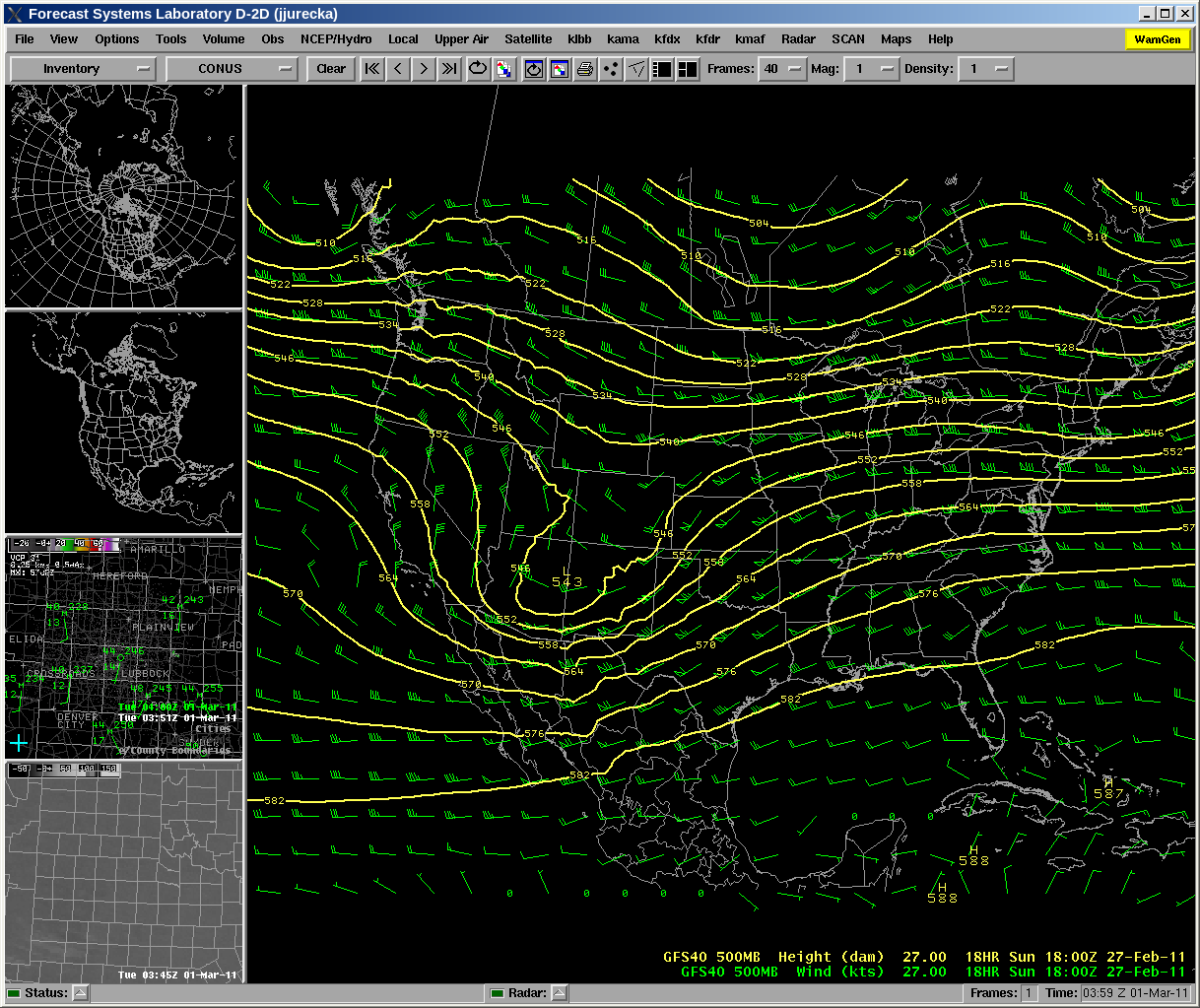
500 millibar chart for 12 pm, Sunday February 27th, 2001
As seen in the above chart, the upper level low increased the gradient from southern Arizona to West Texas (closely spaced lines of equal geopotential heights) which accelerates the wind speeds over our area. When wind speeds at this level start to exceed 100 knots over our region, it highlights concern. On the 27th, the radiosonde (upper air balloon) sounding depicted winds around 110 kts.
The Texas Forest Service and Texas Department of Emergency Management were made aware of the concerns and began efforts to pre-position equipment to better handle the possibility of a wildfire outbreak. In the days that followed, National Weather Service meteorologists continued to refine their forecast and updated local and state authorities via online discussion forums and normal products. The following excerpt was extracted from the Hazardous Weather Outlook for Wednesday, February 23rd.
...ADDITIONAL THREATS OF CRITICAL FIRE WEATHER MAY RETURN BOTH SATURDAY AND SUNDAY AFTERNOON.
On Friday, February 26th, the National Weather Service in Lubbock issued an articulate presentation highlighting the concerns for the outbreak. The forecast and risk areas were continually refined and it became clear that the Texas Panhandle to the Permian Basin were going to be the favored area for wildfires. Conference calls were held each day ahead of the event and all entities put their action plan in place based on the forecasted conditions. Fire engines were mobilized, bulldozers were brought in, and aircraft from as far away as Tennesee were made available to fight any fires which broke out.
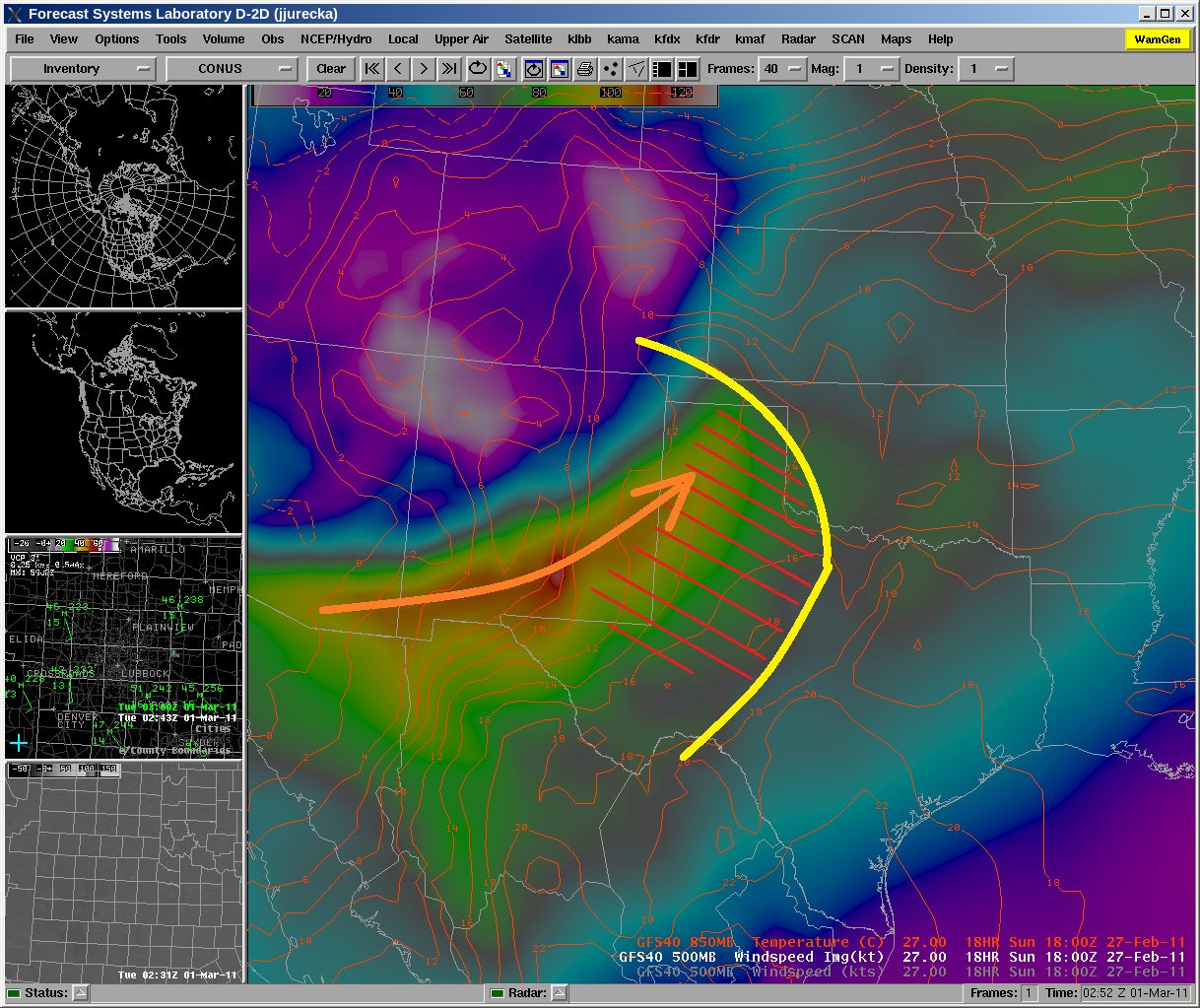
500mb jet maximum (shaded colors/arrow), 850 thermal ridge (yellow line) and resultant area of higest risk (red hatched area) for 12 noon, Sunday 27 Feburary 2011
The figure above is a depiction by one of several numerical models which are used every day by the National Weather Service which are used as guidance for our forecasts. NWS meteorologists analyze many data points from the surface to the tropopause to determine what they believe will occur and issue their forecast. As there was much concern for the fire potential on the 27th, every few hours, the new data coming in was analyzed and any changes to the prognostic outlook were made. It became clear that conditions were going to be most critical in the area outlined by the hatched area in the image above. Daily updates were provided to state and local authorities and their plans were put into action. Additional resources were brought in to help fight any fires. Our forecast began to enhance the wording to convey the threat to our region and at 330AM on Saturday morning, a Red Flag Warning was issued for Sunday after being under a Fire Weather Watch previously.
A MORE DANGEROUS FIRE WEATHER SITUATION WILL DEVELOP ON SUNDAY AS
A STRONG UPPER LEVEL STORM SYSTEM MOVES ACROSS THE TEXAS
PANHANDLE. EXTREMELY STRONG WINDS WILL SPREAD OVER THE REGION ON
SUNDAY ALONG WITH RELATIVE HUMIDITIES DROPPING TO OR BELOW 15
PERCENT.
On Saturday evening, the usual process of checking actual conditions and comparing them with the computerized guidance was performed. In this analysis, it was verified that the relative humidity values Saturday evening were even lower than forecast (quite common, but an important reason why human forecasts are so important.) This dryness further served to cure the already volatile fuels. As the confidence in the forecast increased, the wording in our products became even more emphatic. So that by the early morning hours on Sunday, the following was included in the Red Flag Warning.
A DANGEROUS FIRE WEATHER SITUATION WILL DEVELOP TODAY. WEST TO
SOUTHWEST WINDS WILL INCREASE INTO THE 25 TO 35 MPH RANGE AT 20
FEET AS TEMPERATURES WARM TO ABOVE SEASONAL NORMAL VALUES AND
RELATIVE HUMIDITY DROPS TO BETWEEN 5 TO 15 PERCENT. THIS WEATHER
WILL COMBINE WITH HEAVY AND VERY DRY GRASS LAND FUELS TO RESULT IN
CONDITIONS FAVORABLE FOR DAMAGING AND LIFE THREATENING WILDFIRES.
This was further emphasized in the Area Forecast Discussion
...WILL CONTINUE THE REDFLAG WARNING FOR THE ENTIRE SOUTH
PLAINS...KEEPING IN MIND THAT CENTRAL AND EASTERN LOCALES /WHERE
TEMPS WILL BE IN THE 70S AND 80S/ WILL POSE A HIGH THREAT FOR FIRE
WEATHER DUE TO LOWER PROLONGED RELATIVE HUMIDITIES.
Even in these days of computer automation, the human mind remains the most remarkable tool for analyzing short term weather patterns. The following images are hand analysis charts from Sunday morning at 6am idenfying the setup.
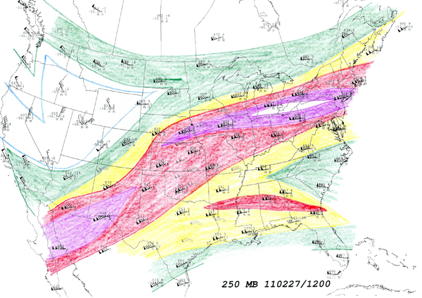
Hand analysis for the 250mb level (near 35,000 feet) with shaded wind speeds
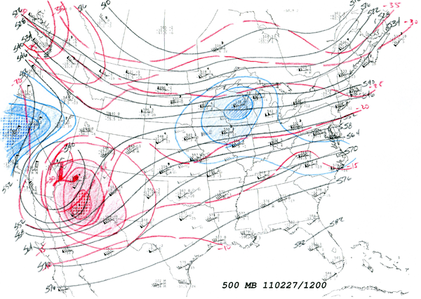
Hand analysis for 500 mb (near 18,000 ft) with shaded areas outlining heigh change contours indicating expected direction movement of the upper low.
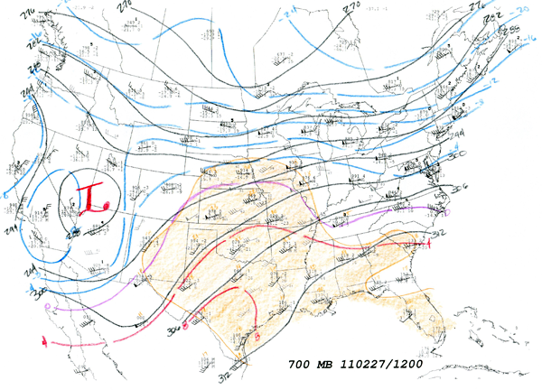
Hand analysis for the 700 mb level (near 10,000 ft) with shaded area depicting the steep mid-level lapse rates.
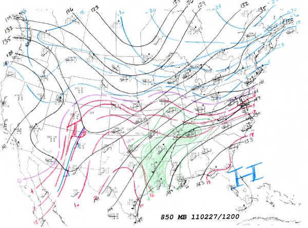
Hand analysis for the 850 mb level (near 5,000 ft) with shaded green depicting areas of high moisture and red lines indicating temperature contours. Notice the location of the thermal ridge from south Texas to the eastern Panhandle.
As the day shift assumed responsibility on Sunday morning, the focus largely shifted from forecasting to monitoring all available data. A portion of our staff was dedicated to, and served on-scene, at the Texas Department of Public Safety command post with further dedicated resources at the Forecast Office. Continuous communication was established providing briefings to public officials in support of monitoring and decision making. It was a team effort with local, state, and federal organizations all contributing.
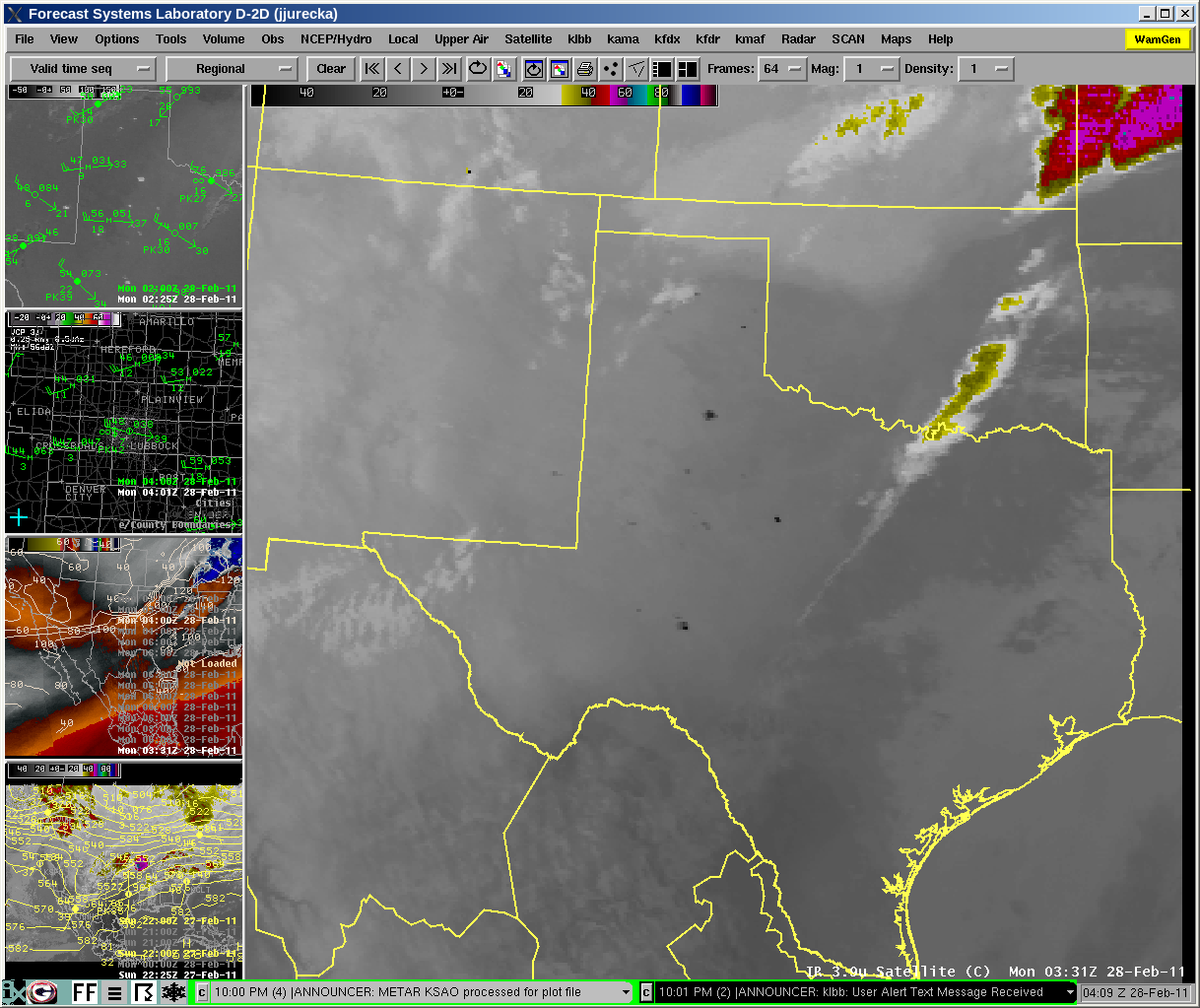
After a brief period of early morning high cloudiness and shallow low level moisture return, the dryline swiftly moved across the area. By late morning, southwesterly winds were begining to pick up across the west. By noon, dust was evident on satellite imagery along with the first indications of fire across eastern New Mexico.
One of the most effective tools to discovering fire starts is the 3.9 um shortwave infrared satellite image available from NOAA's GOES imagers.
330pm CST 3.9 um GOES East Imagery - Dark spots indicate active fires
Using this imagery, the National Weather Service was able to quickly identify fires, often before they were reported and relay this information to the command center. This allowed for a quick response and deployment of fire suppression resources. Each one of the black areas on the image depicts a wildfire in progress with the exception of one data error in southern Colorado.
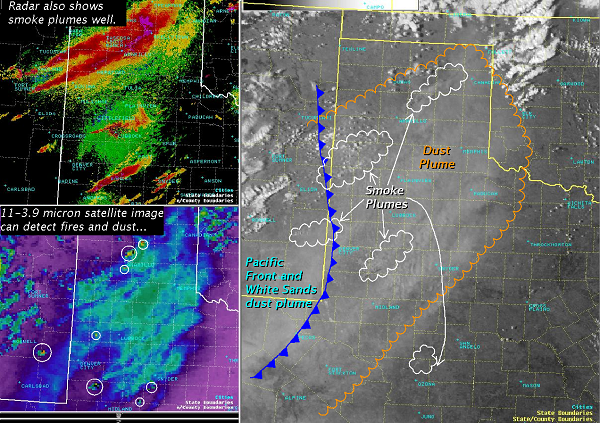
Other NWS products capable of monitoring dust and fires
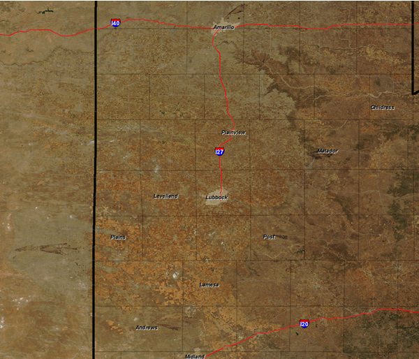
As the fires continued and spread, it became clear that a fire which started on the Floyd/Motley county line along US 62/70 was rapidly approaching the City of Matador. The National Weather Service expressed concern that the fire was moving quickly toward Matador. Because of the collective work of all agencies involved, officials made the determination to evacuate Matador. When the decision was made, the NWS in Lubbock issued its second ever Fire Warning, to alert citizens of the direct threat of a wildfire to their community. While a few homes were damaged in the fire, there were no lost lives in the city. The system worked as intended.
BULLETIN - EAS ACTIVATION REQUESTED
FIRE WARNING
MOTLEY COUNTY JUDGE
RELAYED BY NATIONAL WEATHER SERVICE LUBBOCK TX
410 PM CST SUN FEB 27 2011

THE FOLLOWING MESSAGE IS TRANSMITTED AT THE REQUEST OF THE MOTLEY
COUNTY JUDGE.

RESIDENTS OF THE CITY OF MATADOR SHOULD EVACUATE TO THE MOTLEY
COUNTY SCHOOL. A WILDFIRE IS APPROACHING THE CITY OF MATADOR FROM THE
WEST AND POSES A DANGER TO THE RESIDENTS IN THE CITY. ALSO...U S
HIGHWAY 62 AND 70 HAS BEEN CLOSED WEST OF THE CITY OF MATADOR.

$$
There were several significant fires from the Texas Panhandle to the Permian basin. In our region, fires continued to burn for several days past the initial event.
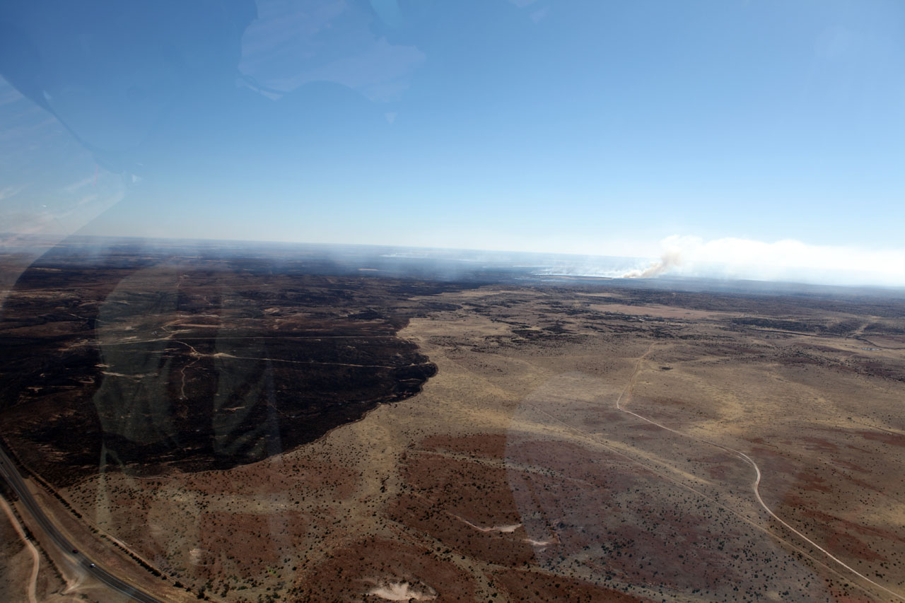
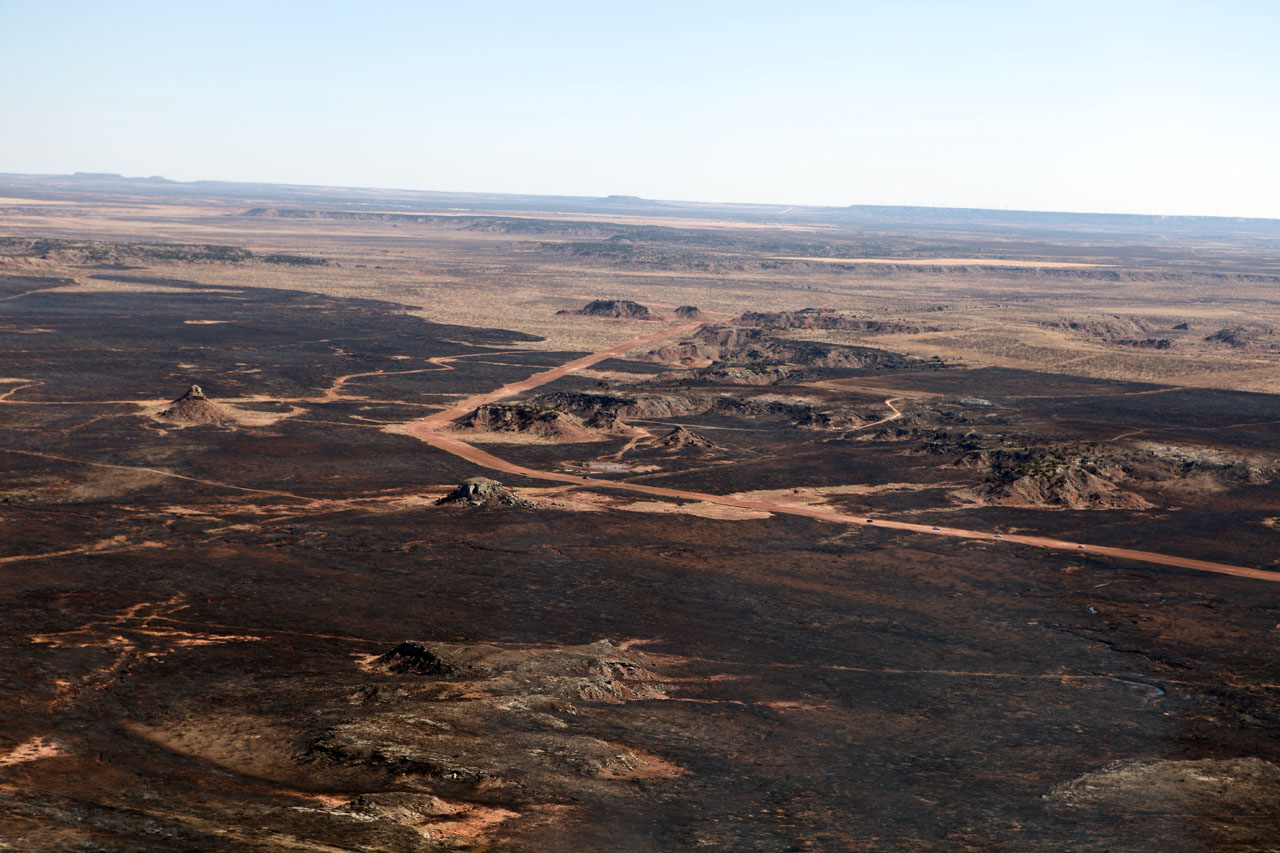
Burn scars showing the leading edge Motley county burn several miles east. This fire is estimated at 45,000 acress.
The front line of the active Motley County fires on Monday, February 28th
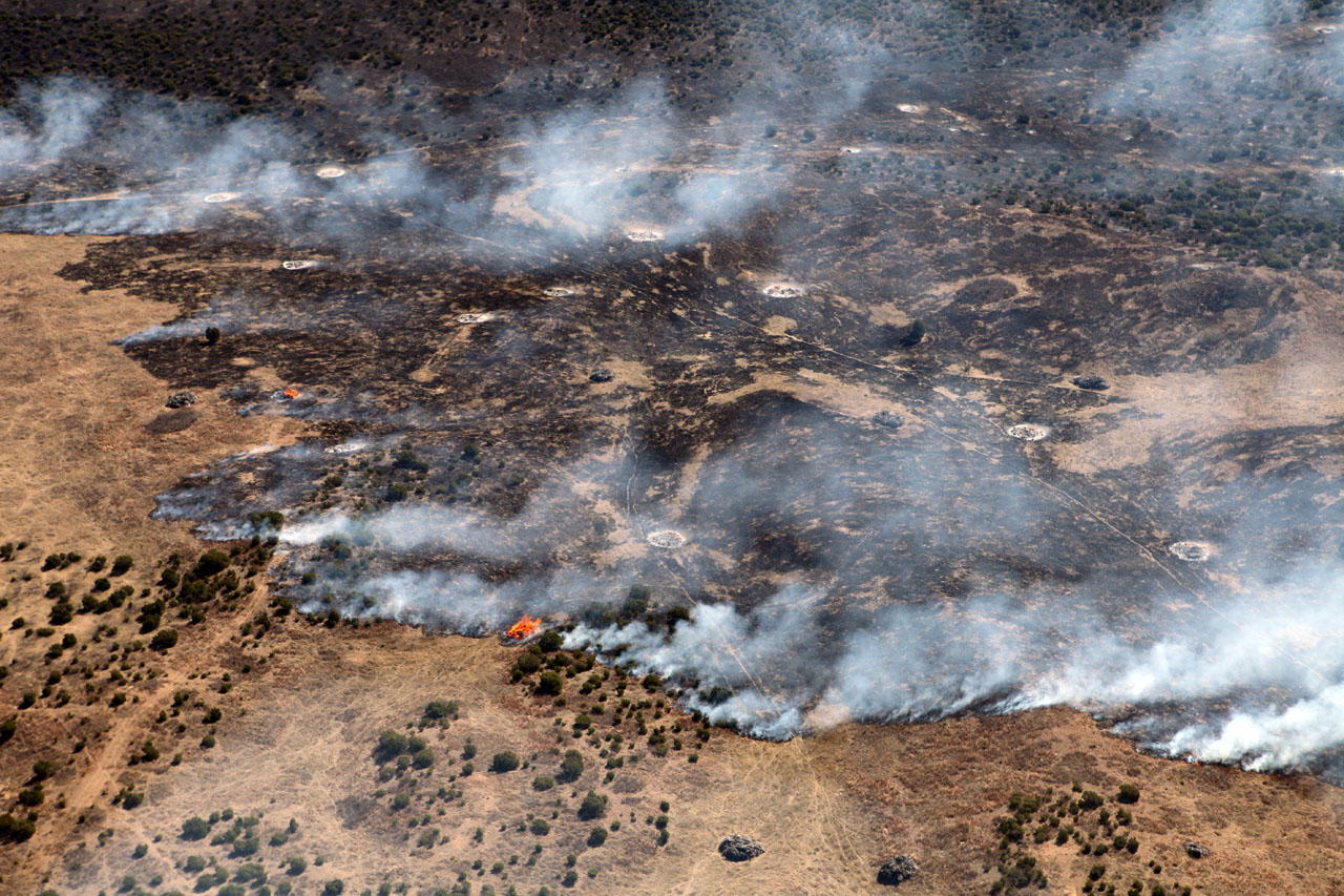
Aerial view of the Garza County complex which burned 9,500 acres
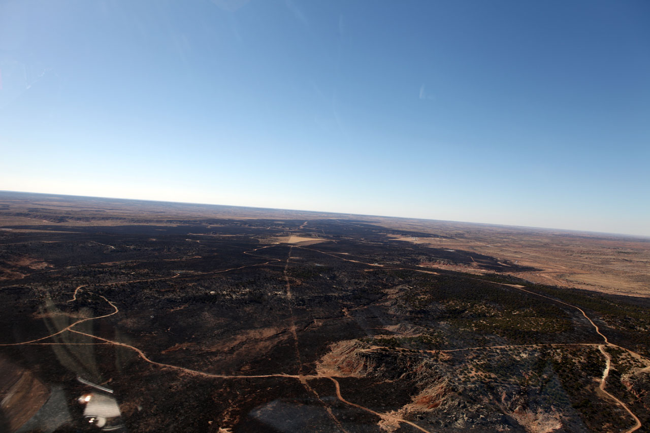
A view looking west from the eastern extent of the Garza County Fire
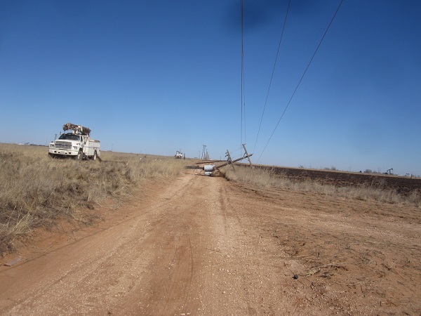
Downed power lines...the culprit behind the 1,500 acre Hockley County Fire
MODIS imagery of burn scars across the eastern South Plains and Rolling Plains
Regional MODIS image of the burn scars across the region
In our county warning area, about half a dozen homes burned as did a commercial building and countless outbuildings in the fires on this day. Further north, dozens of homes were burned due to an accidental start in North Amarillo. To our south, a 5 year old was killed in a traffic accident caused by smoke across Interstate 20. Forecasting fire outbreaks are somewhat akin to tornado outbreaks in that science allows us to identify areas which are at risk. Still, individual fire starts, like tornadoes, are not predictable today and thus we must continue to highten awareness of these potentially deadly weather conditions and then convey this to fire officials and the public in general. The NWS does not forecast fires, but does forecast conditions known to support rapid wildfire growth. In cooperation with the Texas Forest Service, the Department of Public Safety, local fire and public safety officials, and other agencies working together, the risk can be identified and resources moved to the right areas so that suppression efforts can begin as rapidly as possible. It is truly a team effort. This event could have been much worse if prepatory efforts were not taken.

