|
More Snow for the South Plains Area: |
|||||||||
| Another storm system brought widespread snow to the region between the afternoon of the Monday, February 22, and the morning of the 23rd. | |||||||||
|
Heavy snow falling at 82nd and Quaker in Lubbock at 9:45 pm on Monday, February 22, 2010. The image is courtesy of KAMC. Click on the picture for a larger view.
|
|||||||||
|
Snowfall totals between 2 and 4 inches were fairly common with this winter storm. However, much of the snow, especially during the second half of the storm, fell in relatively narrow but heavy bands. This resulted in some localized heavier snow totals in some areas, while other locations missed out. The below map displays some of the snow totals received from around the area. To view the preliminary Local Storm Reports issued by the Lubbock NWS Office CLICK HERE.
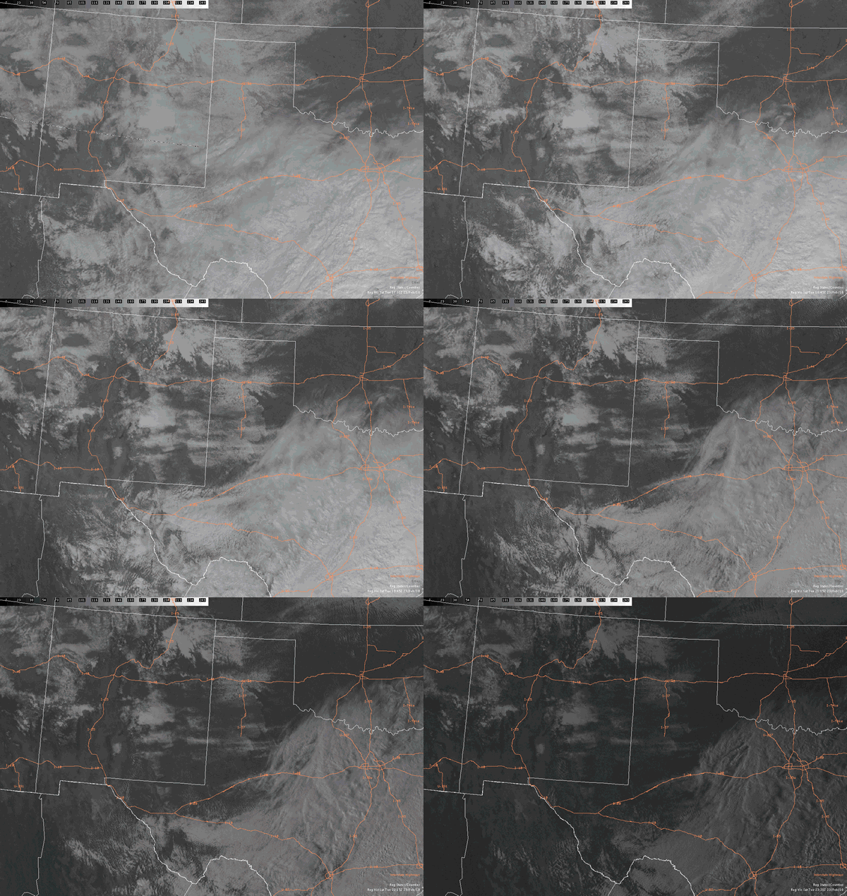
The below graphic shows an animation of the visible satellite view, as taken from space, during the late morning and afternoon hours after the storm system shifts south and east of the South Plains region. A large expanse of snow can be seen extending from eastern New Mexico all the way into western Oklahoma. Much of the snow in western Oklahoma and into the eastern Texas Panhandle and northern Rolling Plains does quickly melt through the day under near full sunshine and temperatures climbing above the freezing mark. |
|||||||||
 |
|||||||||
| Visible satellite loop after the snow event on Tuesday, February 23rd (between 11:01 am and 5:31 pm). Note the clouds shifting southeast exposing the windspread snow (non-moving white areas) across much of eastern New Mexico into the Panhandles and South Plains. | |||||||||
| Visible satellite picture taken at 11:15 am on Tuesday, February 23rd, 2010. Clouds cover much of the Rolling Plains and southern South Plains, roughly south of a Estelline to Abernathy to Lovington line. However, the remainder of white on the image indicates widespread snow covering the ground. Click on the picture for a larger view. | |||||||||
| Above and below are still visible satellite images taken during the late morning (above) and mid-afternoon (below) on the 23rd. Though most of the region saw snow, the later image better indicates where the heavier snow fell. The deeper more widespread snow remains on the ground, even after hours of melting, and shows up as brighter white areas. Numerous heavier snow bands can be noted, including one from near Abernathy to south of Floydada, and a couple from the southern South Plains into the southern Rolling Plains. Additionally, a relative minimum can be noted from near Muleshoe to north of Plainview, where much of the new snow melted by mid-afternoon. | |||||||||
| Visible satellite picture taken at 2:31 pm on Tuesday, February 23rd, 2010. Clouds have shifted eastward, roughly east of a Willow to Paducah to Snyder line. Also, the sun and warming temperatures have already melted a considerable amount of snow. Click on the picture for a larger view. | |||||||||
| Below is a radar animation showing the evolution of snow bands during the late evening hours on the 22nd. As noted above, the radar confirms that the heaviest snow was not widespread, but occurred in distinct batches or bands. | |||||||||
|
|
|||||||||
|
Radar animatation depicting bands of moderate to heavy snow traversing the South Plains and Rolling Plains between 9:18 pm to 10:28 pm on February 22, 2010. To view a radar animation between 6:58 pm and 8:08 pm on the 22nd CLICK HERE or to view a radar animation between 11:38 pm on the 22nd and 12:48 am on the 23rd CLICK HERE.
|
|||||||||
| Below are several pictures taken from around Lubbock during the morning of the 23rd. Bushes, duck, geese, daffodils, and people all had to deal with the snow. Click on any of the images to view a larger version. | |||||||||
|
|||||||||