|
Storms Produce Large Hail and Strong Winds - 2 June 2009 |
||||||
 |
||||||
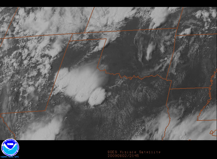
| Visible satellite image taken at 4:45 pm on Tuesday, 2 June 2009. Five distinct thunderstorm cells are present stretching fom the South Plains into the Rolling Plains. | ||||||
| Tuesday (2 June 2009) brought a few rounds of strong to severe thunderstorms to the South Plains region during the afternoon and evening hours. The initial impetus for thunderstorm development was an outflow boundary that moved steadily south and west through the late morning and afternoon hours. This outflow boundary originated from a batch of morning thunderstorms that moved across the eastern Texas Panhandle into western Oklahoma. As the outflow boundary moved southward in encountered increasingly unstable air, and storms erupted along it by early afternoon. The below image clearly depicts the outflow boundary before thunderstorms developed along it, with the above image taken a few hours later after storms developed. | ||||||
|
|
||||||
| Visible satellite image taken at 1:15 pm on Tuesday, 2 June 2009. This picture was taken before thunderstorms developed across the South Plains, but does nicely depict the northwest to southeast oriented outflow boundary (with a line of cumulus clouds along it). Click on the image for a larger view. The image is courtesy of The National Center for Atmospheric Research. | ||||||
|
Given the very unstable atmosphere that was in place, the thunderstorms that developed during the afternoon quickly became strong to severe. The storms were most proficient at producing large hail, but did also generate some localized strong winds and heavy rains. Numerous reports of golf ball sized hail were received, with a couple of reports of baseball sized hail from Clairemont and east of Post. Additionally, one storm produced a wind gust measured by the West Texas Mesonet site 1 mile northwest of Lake Alan Henry to 72 mph. A more complete listing of preliminary storm reports can be found by CLICKING HERE. |
||||||
|
|
||||||
| Radar loop between 3:58 and 5:58 pm on Tuesday, 2 June 2009. | ||||||
| The above radar imagery shows the thunderstorm activity near the height in intensity and areal coverage. This activity eventually waned through the early evening, but an isolated severe thunderstorm did approach the Muleshoe area from eastern New Mexico, bringing gusty winds and hail reported to nickel size in Muleshoe just after 8 pm. The below left radar image displays the strong storm shortly after impacting Muleshoe. | ||||||
|
||||||
The storm that moved across Muleshoe during the evening hours weakened as it pushed farther east. However, additional thunderstorms continued to occur well into the evening hours along a cold front as it slide southward through the Rolling Plains and eastern South Plains. One storm even produced a severe wind gust to 61 mph near Jayton at midnight (around the time of the upper right radar image). This late night activity quickly diminished and shifted southward through the early morning hours Wednesday. |
||||||


